Last week I took a shot at a longer hike in the Sierra Nevada Mountains with the goal of climbing Mt Langley (14,032 feet) and going up Mt Whitney (14,508 feet) again, this time from he west. Unfortunately, I didn’t make it all the way.
All the photos:
https://www.flickr.com/photos/wanderingjim/albums/72157671492134405Just the highlights:
https://www.flickr.com/photos/wanderingjim/albums/72157670679608771Day 1
After camping at Cottonwood Lakes Trailhead in Horseshoe Meadows (10,000 feet), I started out in the morning.
Hiked up Cottonwood Lakes Trail to Muir Lake, then continued to Cottonwood Lake #1, an unnamed lake (don't know why they couldn't name it #6

), #3, #5, and #4.
While I had thought I’d double-back to see lake #2 and go up New Army Pass, upon seeing Old Army Pass and seeing day hikers coming down it, I decided to save an extra mile or so and added elevation climbing.
Not sure why I was originally fixated on going up New Army Pass, since Old Army Pass was pretty straight forward. A little snow to cross, but nothing difficult. Looked more daunting that it turned out to be.
At the top of Old Army Pass I would have had to climb up back towards New Army Pass to camp at the spot I had planned to. Instead, I started up towards Mt Langley, hopping to find a suitable campsite along the way. Hopefully out of the cold wind (despite it being late afternoon) that was blowing over the ridge I was on.
Coming around some rock formations, I found a spot that seemed perfect. Someone had already put up some rocks to act as a wind barrier. So I setup camp and had dinner. Had to tie my tent down pretty well to keep the wind from taking it away.
Before enjoying the sunset to the west, I did some surveying of the east ridge I was on to find a good place to see the sunrise. Ideally, I would be at the summit for sunrise, but that would mean getting up 3-4 hours before sunrise and making my way up Langley in the dark, only having the widely spaced cairns as a guide.
Unfortunately, that night I did’t get a good night’s sleep. I don’t know if it was the cold (but I had more than enough layers and my sleeping bag to keep me warm), the wind buffeting my tent, or me still acclimatizing to the altitude, but it wasn’t a good night.
Day 2
Up well before sunrise, I shed as much weight as possible from my backpack and headed for the ridge I had identified the prior night to see the sunrise over some mountains to the east. I ate breakfast as I enjoyed the show.
Then it was time to start the hike/climb/scramble to the 14,032 foot summit of Mt Langley.
The trail was straight forward to get to the start of the cairns that marked the official route to the summit. But I found that it wasn’t always easy to see the next cairn in the sequence or identify the route to take on the way up to the next one. Several times I followed footprints, only to end up doubling-back or taking a very rough scramble over rocks to get up the trail.
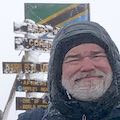
It was a long hard slog up, but I reached the summit mid-morning! It’s remarkable how the soreness and tiredness can vanish when you reach your goal and take in the 360 degree view from the top.
Spectacular.
Of course, I could see Mt Whitney to the north and scouted out the routes I was planning on taking to reach my next goal for this trip.
It was interesting that from the top of Mt Langley, it was VERY clear that Mt Whitney was the tallest peak in the area. Mt Whitney is surrounded by so many other peaks and ridges, that it doesn’t always look like the tallest peak in the continental US.
After soaking in the summit for a while, I started down the mountain. I found it a lot easier to follow the cairns on the way down.
After having the mountain to myself that morning, i passed a half dozen or so day hikers heading up to the summit on my way down.
I also checked out the two possible routes down towards Crabtree Pass. The route north of The Major General and the route down to Solider Lakes both looked a little daunting, so was planning on following the Army Pass Trail down to Solider Lakes as I originally planned.
This is where my body started to protest what I was doing to it. Still don’t know exactly what it was: That I didn’t spend enough time acclimatizing (one night sleeping at 8,000 feet and a afternoon and sleeping at 10,000 feet at Horseshoe Meadows), that I was just tired from the long slog up Mt Langley, that the lack of sleep was getting to me, that the 12,300-14,032 altitude I was at that day was affecting me, or just had a bug or something.
I decided to try a short nap back at camp to see if that would help. Didn’t really seem to.
I felt so bad I thought about aborting and returning to Horseshoe Meadows. Not wanting to give up at that point, I decided to break camp and head down to Solider Lakes via the Army Pass Trial. Pretty much downhill and I could camp at 10,800 feet to see if I felt better in the morning.
Day 3
I did feel a little better in the morning, but still seemed to have some trouble getting a full nights sleep. Enjoyed the sunrise and a full hot breakfast. And then weighed my condition and ability to continue towards Crabtree Pass and Mt Whitney. I broke camp started up from Soldier Lakes, but soon found myself unable to continue climbing.
I rested a bit, but then determined that I couldn’t continue up this path.
I did have the option of heading west and going up towards Crabtree Pass via Rock Creek or even going the long way around via the Pacific Crest Trail and the John Muir Trail. But after considering my condition and that if I continued in any of the three routes available to me at that point it would be a 2 day abort if I couldn’t continue, I reluctantly decided to head back to Horseshoe Meadows via Cottonwood Pass Trail. About 600 feet elevation gain and 11 miles, but I made it back safely.
Maybe since i had already conquered Mt Whitney last year, I didn’t have the deep urge to climb it again and played it safe.
In retrospect, I probably could have continued since I was feeling fairly good that afternoon and the next day after a night at a hotel.
Even considered heading back and trying to go up Whitney from the portal or even climbing up White Mountain Peak (12,000 feet to 14,252 feet). In the end, I congratulated myself for getting my second Fourteener under my belt and headed home to the Bay Area.
So not exactly the hike I was planning to do, but still a great hike and saw a new part of the Sierra Nevada Mountains.
This does complicate my plans for next year. I was thinking of Mt Williamson, but would still like to get up Mt Whitney again.
Is there a way between the top of Mt Williamson and Mt Whitney?
Not sure I can try doing Whitney again this year (I'll be in Japan hiking the Japan Alps and Mt Fuji for most of August).