Mt Whitney Webcam
Mt Williamson Webcam
Who's Online Now
0 members (), 57 guests, and 13 robots.
Key: Admin, Global Mod, Mod
Previous Thread
Next Thread
Print Thread
Mt Langley question
#53802 07/06/18 07:42 PM
Joined: Jul 2012
Posts: 219
nyker Offline OP
OP Offline
Joined: Jul 2012
Posts: 219
Hi all, does anyone know the difference in distance/miles between going up New Army Pass vs Old Army Pass to summit Langley? (Assume the standard start from Cottonwood Lakes TH).

Re: Mt Langley question
nyker #53820 07/09/18 12:11 PM
Joined: Sep 2009
Posts: 8,509
Likes: 103
S
Offline
S
Joined: Sep 2009
Posts: 8,509
Likes: 103
New Army Pass is about the same distance -- the difference is negligible. "Old" Army Pass tops out about 300' lower elevation, so that is the main advantage.

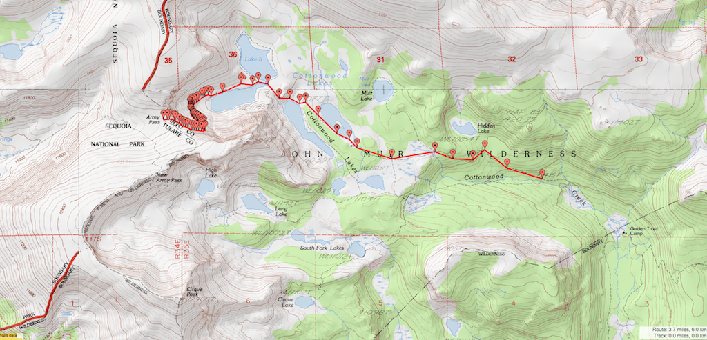
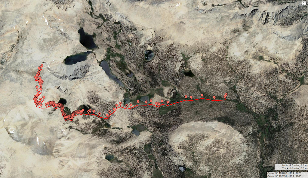
Since it looks like you're planning a Langley trip, let me encourage you to take the no-longer-maintained South Fork trail. I think it saves a little distance compared to the CW Lakes trail. I took it 2 years ago, and missed the junction, and got off-route only one other place (approx here).

The junction off the main trail is here, 50 yards after it crosses the creek. It is little used but easy to follow. Here's where it re-joins the maintained trail by the South Fork Lakes.

If you would like more gps markers, let me know. ...You could make a loop hike -- south fork trail and New Army on the way in, old Army and the main trail on the way out.

Re: Mt Langley question
Steve C #53828 07/09/18 07:14 PM
Joined: Jul 2012
Posts: 219
nyker Offline OP
OP Offline
Joined: Jul 2012
Posts: 219
Thanks Steve, for some reason I remember a ranger telling me the Langley trail was longer but 1500ft less elevation gain

Re: Mt Langley question
nyker #53833 07/10/18 12:07 PM
Joined: Apr 2012
Posts: 579
Likes: 3
Offline
Joined: Apr 2012
Posts: 579
Likes: 3
Originally Posted By: nyker
Hi all, does anyone know the difference in distance/miles between going up New Army Pass vs Old Army Pass to summit Langley? (Assume the standard start from Cottonwood Lakes TH).


I did the "Old Army/New Army" loop a few years ago, and thought the "Old Army" was shorter. I just went to Gmap4, and measured the distances, and found Old Army to be 3.7 miles (one way) vs New Army to be 4.7 miles. These distances were measured from the forks where the routes intersect. Sorry, one is Satellite and the other is Topo. See images below:

Old Army


New Army


Link Copied to Clipboard
Powered by UBB.threads™ PHP Forum Software 7.7.4
(Release build 20200307)
Responsive Width:

PHP: 7.4.33 Page Time: 0.023s Queries: 22 (0.012s) Memory: 0.5867 MB (Peak: 0.6395 MB) Data Comp: Off Server Time: 2024-04-19 15:15:36 UTC
Valid HTML 5 and Valid CSS