Mt Whitney Zone
Posted By: wagga Snow Sentinel - 03/12/17 07:22 AM


While Whitney, swathed in her white winter coat, is unmolested by all but the most intrepid adventurers, some light reading.

Extra points for identifying the terrain.
Posted By: dbd Re: Snow Sentinel - 03/12/17 07:51 AM
Looks like Tioga Pass Road with the Dana Plateau under the wheel.

Dale B. Dalrymple
Posted By: Snacking Bear Re: Snow Sentinel - 03/13/17 04:21 PM
That was a really interesting read. Thanks for sharing!
Posted By: + @ti2d Re: Snow Sentinel - 03/13/17 08:08 PM
I can see Aspen Grove...great fishing spot!
Posted By: Steve C Re: Snow Sentinel - 03/14/17 04:39 AM

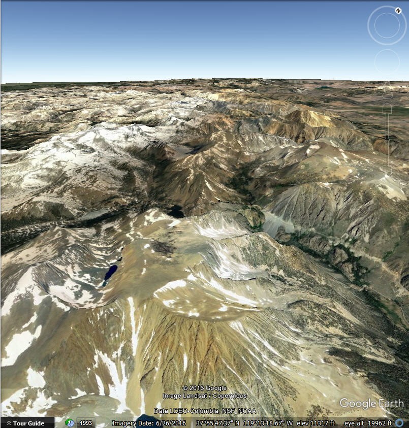
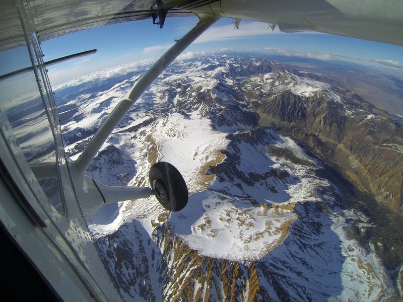
Given the curved horizon, I think the camera used for the original picture had a wide angle lens.

Thanks to DBD and GoogleEarth, the picture below is a good match.
In the picture above: Ellery Lk and Tioga Lk are snow-covered lakes above the wheel. Tioga Pass entrance is behind the wing strut. Tioga Pass entrance on Tioga Pass are in the "V" formed by the wing strut and the vertical window. Mt Dana is hidden by the plane's body, left of the wheel.


© WhitneyZone Message Board