Mt Whitney Zone
Posted By: RenoFrank Mountaineers Route 8-5-14 - 08/07/14 07:21 AM
I day-hiked up the MR two weeks ago to make sure I could find my way. That day we stopped at Upper Boy Scout Lake for lunch and came back down to the Portal. The plan for this trip was to hike up to Iceberg Lake on Tuesday, summit and return to the Portal via the MR on Wednesday. As on my previous trip I had a very useful discussion with Doug at the Portal Store about finding my way. I learned that there was snow up the chute above Iceberg Lake and ice and snow on the Final 400. My wife and I agreed we did not want to go up there in those conditions but did want to find our way to Iceberg Lake and camp there one night.

We found camping at the Portal convenient for both trips. Both times we were able to park very close to our walk-in camp sites which were conveniently very close to many bear-proof food storage lockers and trash cans.

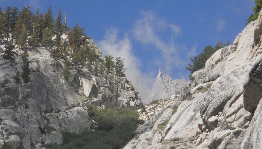
We hit the trail around 7:30 AM Tuesday 8-5 and proceeded without incident - crossing Lone Pine Creek twice, traversing the Ebersbacher Ledges, then heading up to Lower Boyscout Lake.


Here we are taking a break at Lower Boy Scout Lake


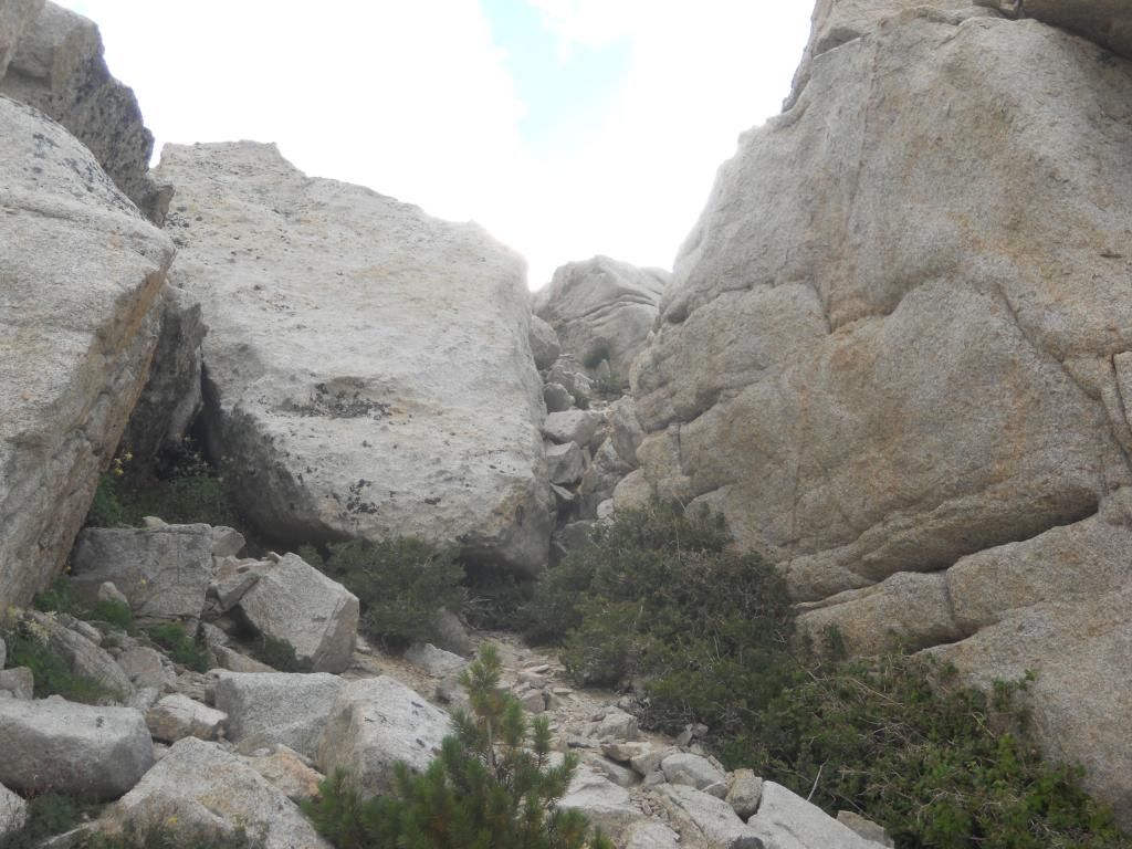
Doug had advised me to stay just south of the vegetation around LBSL warning me that many people mistakenly take too high of a route up to those big boulders. Two weeks previously I had taken that high route but my wife somehow found the correct route upward.

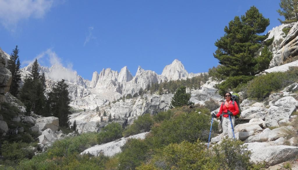
Soon we went by the "pyramid shaped rock" that I learned about fron Steve's very helpful videos.


And we made it up and through Clyde Meadows and discovered that that clump of about a dozen trees right above CM is an excellent spot for lunch.


We arrived at our lunch spot at 12:30 and left towards Iceberg Lake at 1:00 PM.

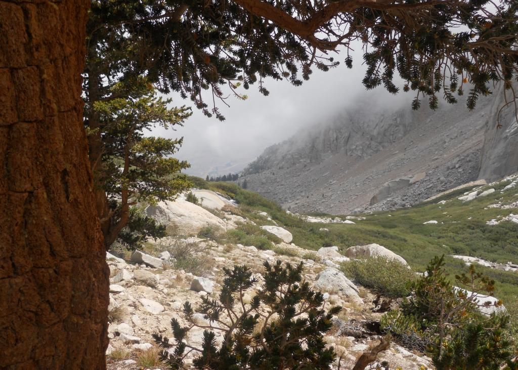
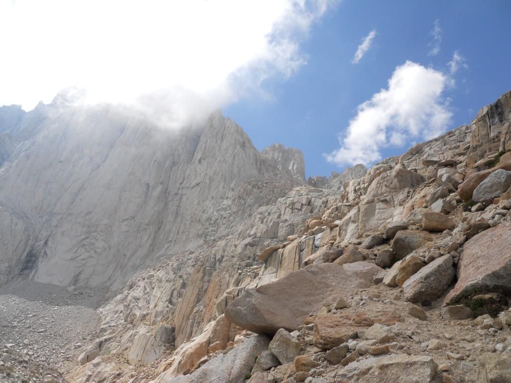
We soon discovered that we had taken a slight wrong turn and scrambled up this little chute

My wife told me several times "That wasn't the right way to go and I am not going down that way."

Meanwhile I was becoming more exhausted as we continued and my pack was feeling heavier and heavier. Since we didn't expect to climb above Iceberg Lake, my wife Bea ditched her pack and we decided we would hike down to Upper Boy Scout Lake after reaching Iceberg Lake and camp there for the night. About an hour after Bea ditched her pack I started experiencing cramps in my legs and we agreed it would be best to turn around rather than getting farther and farther away from our intended camp site. It was 3:00 PM, two hours above our lunch spot. This is where we reversed course. I think it was just before the first seep, can anyone tell how far we were from Iceberg lake?


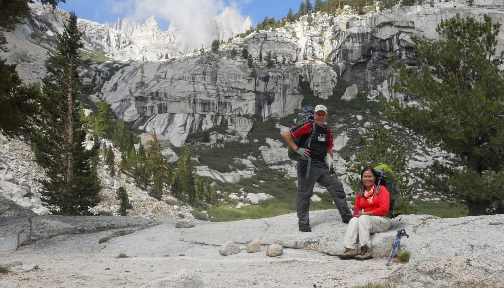
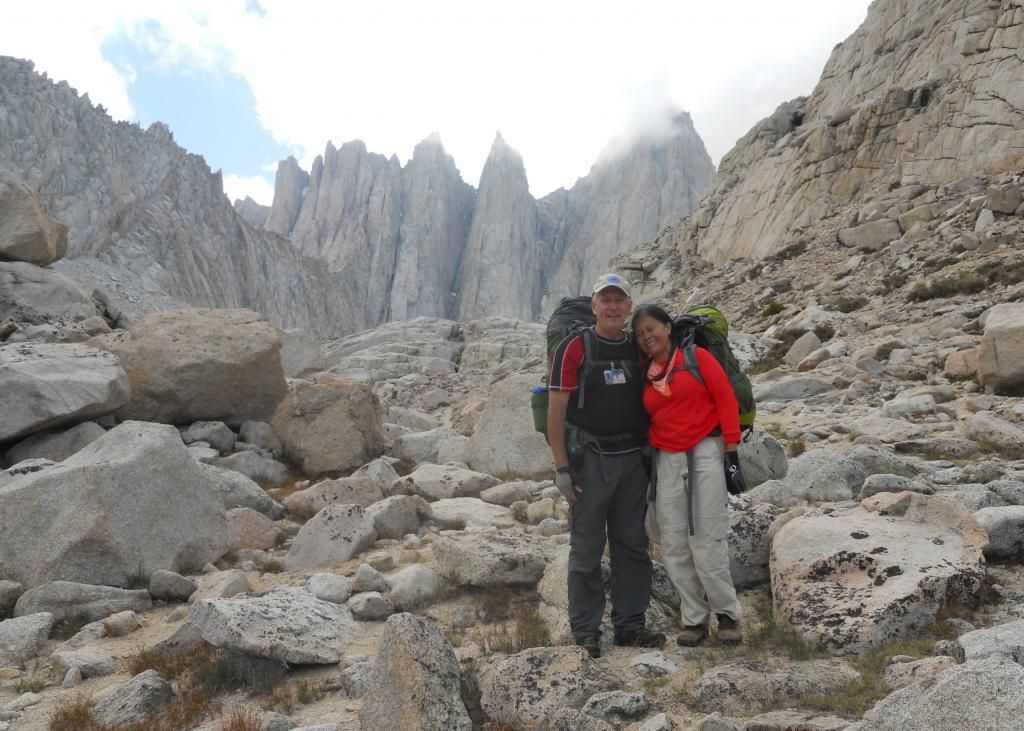
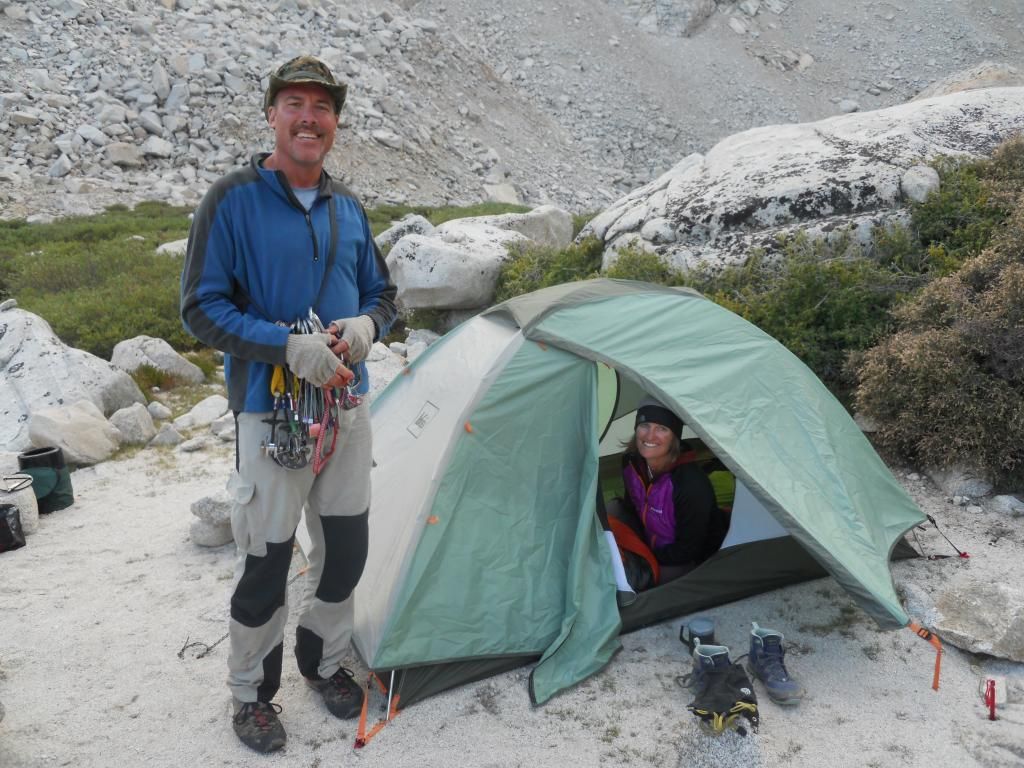
We met a solo hiker after Bea had retrieved her pack and he was kind enough to take this picture.


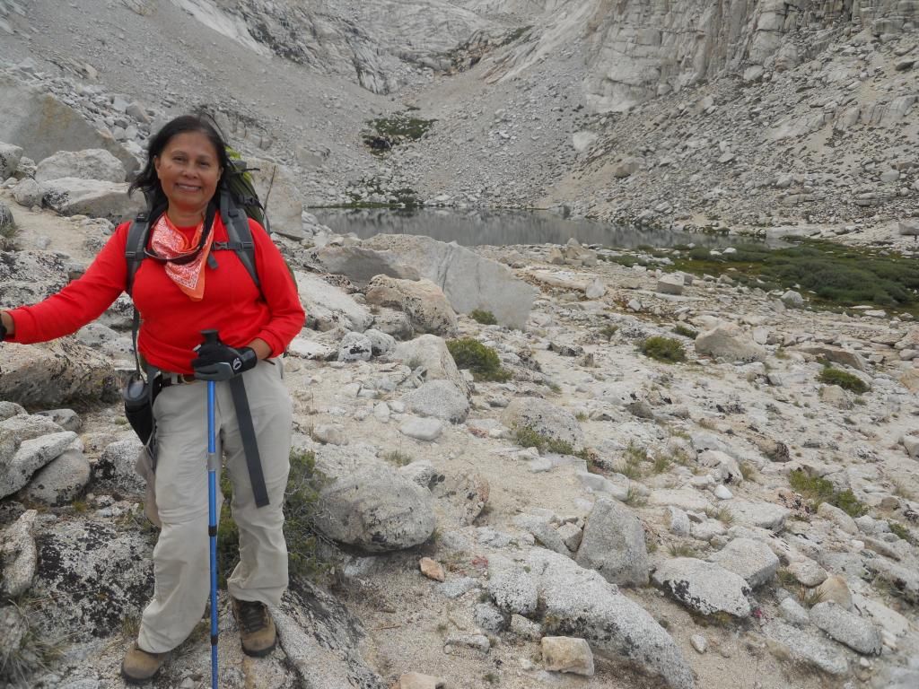
This time we found the correct route and were soon just above UBSL.


We set up camp and soon met the only other people there - a very nice couple - Kent and Norma.


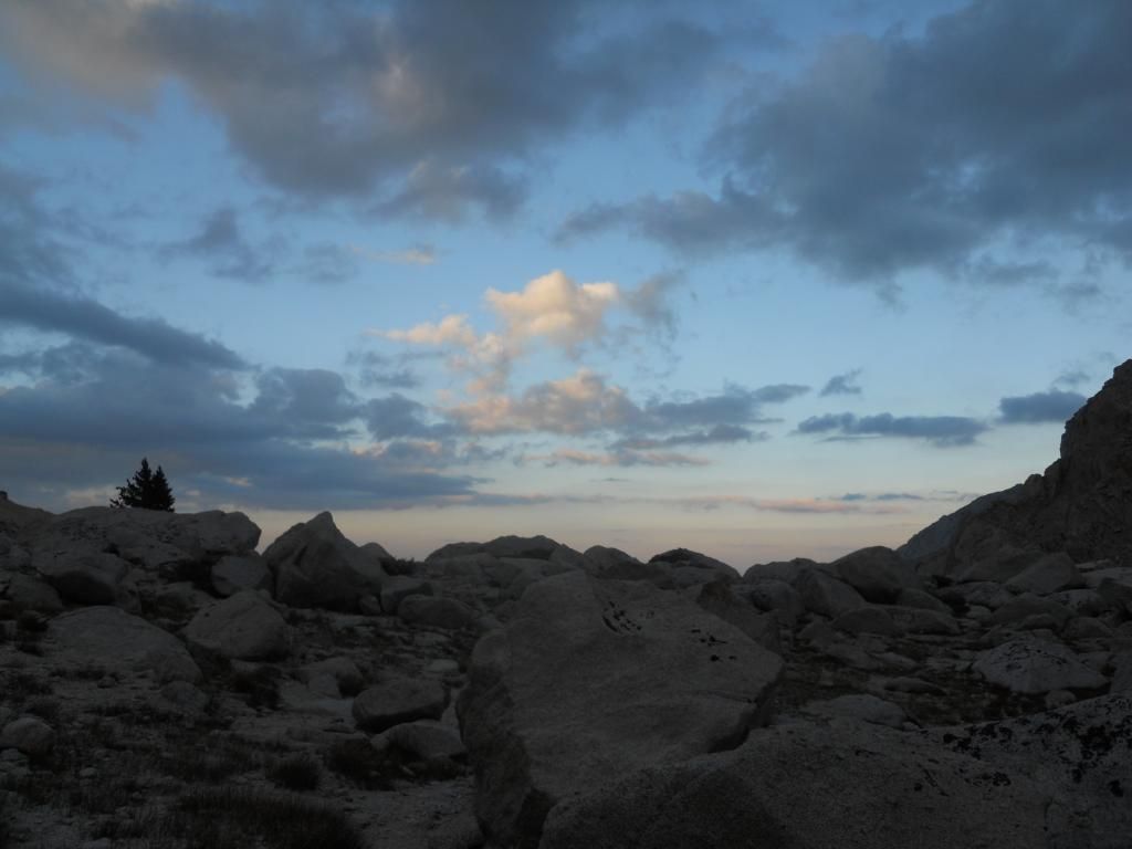
We enjoyed a beautiful sunset as we had dinner.


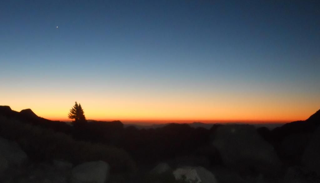
And awoke for a nice sunrise and alpenglow


We left camp around 7:15 and arrived back at the Portal about 10:45.
Posted By: John Sims Re: Mountaineers Route 8-5-14 - 08/07/14 03:24 PM
"It was 3:00 PM, two hours above our lunch spot. This is where we reversed course. I think it was just before the first seep, can anyone tell how far we were from Iceberg lake?"
>>>>>>>>>>>>>>>>>

Hi Reno,

Not really sure, but it looks to me as though you might have passed the "normal" route up to iceberg lake. I think if you had just climbed up 30' or 40' you would be there.

John
See below for my guess as to your location


Posted By: Steve C Re: Mountaineers Route 8-5-14 - 08/07/14 03:37 PM
Well, I am thinking he wasn't quite at the spot to climb up. In the lower left corner of his picture, there is a big boulder with one (or is it two) vertical black mark. I think the climb up starts about there.

If he hadn't passed the seeps, he wasn't far enough.

And like everyone else, quite possibly too high. Staying lower in that area is the best, I think.

Frank, were the really skinny and tall cairns there this year? You WERE almost there, though. Maybe 15 minutes.
Posted By: RenoFrank Re: Mountaineers Route 8-5-14 - 08/07/14 04:24 PM
A few more comments:

1. Just above LBSL about 11:00 AM we met three guys coming down. They had started a "day hike" the day before about 1:30 PM. They said they reached The Notch at 1:00 AM going on snow all the way up along side The Chute. One of the three was half way up The Final 400 (which he described as snowy and icy) when he realized his two friends were not going above The Notch so they all descended to Iceberg Lake. They were cold, wet, and unprepared to be out overnight. One said he had socks on his hands for gloves but they were wet and freezing. Luckily there were people camped at Iceberg Lake who helped them make it through the night. I'm guessing that could have ended badly.

2. In the middle of the night while camping at UBSL my wife told me she could hear a marmot chewing on our tent. I assured her they would not come in the tent and to try not to worry. In the morning my wife found this hole on her side of the tent. Our campground friend Kent suggested that it was made by a mouse.

Any advice on what kind of a patch I need to repair it? An air mattress patch? nylon tent patch? It's a Big Agnes Flycreek 3. I believe it's ripstop nylon. And are there any precautions I can take to prevent this?

3. Between LBSL and the E-Ledges on the way down I slipped and fell on my butt. I was able to scoot on my butt to a safe spot to stand up. I had just shot a video of my wife going over an interesting spot on the trail and I'm afraid I was careless as I tried to catch up to her.
Posted By: RenoFrank Re: Mountaineers Route 8-5-14 - 08/07/14 04:34 PM
Originally Posted By: Steve C


If he hadn't passed the seeps, he wasn't far enough.

And like everyone else, quite possibly too high. Staying lower in that area is the best, I think.

Frank, were the really skinny and tall cairns there this year? You WERE almost there, though. Maybe 15 minutes.


I did not see any tall and skinny cairns. I did see one in your video and also was aware that you warned about being too high on that section. I too could see a use trail down below me but we continued on our path as long as we still were on a "trail". I'm thinking I would have known if I did pass a seep and I think I could see the first up ahead of me. And I wasn't certain where I would be turning up towards the lake but it seemed far away. If I was close to Iceberg Lake that makes me feel a little better about my failed attempt to reach it.
Posted By: RenoFrank Re: Mountaineers Route 8-5-14 - 08/07/14 06:04 PM
Originally Posted By: John Sims


Not really sure, but it looks to me as though you might have passed the "normal" route up to iceberg lake. I think if you had just climbed up 30' or 40' you would be there.


You may be right, John. When I look at this picture I was looking ahead at that big flat spot of scree in the lower left hand corner, thinking that's where I would be turning up to the lake.


However, when I look at this picture I think I see that same flat field of scree at the base of Mt Whitney and it seems quite a long way past the ascent to Iceberg Lake according to the red line path.


How could I have passed the seep(s) and missed the place to turn up to the lake? I was advised that I would clearly see many footprints in the sand going up there.
Posted By: John Sims Re: Mountaineers Route 8-5-14 - 08/07/14 08:52 PM
Hi Frank,

I was looking at the slope of the base of Whitney (from your picture) when I made my earlier comment, and still "guess" that the comment was accurate. Of course if you were using a "long" lens it can really distort one's perception of distance. Iceberg lake is a bit back from the incline, and it just looked to me as though the slope would continue down for a bit, suggesting that Iceberg lake was directly above you. Then again, Steve has been up there many more times than I, so his opinion should count for more:-)

>>>>>>>>>
"How could I have passed the seep(s) and missed the place to turn up to the lake? I was advised that I would clearly see many footprints in the sand going up there."
>>>>>>>>>

I know from my own experience I often see things on second, third, forth, etc... visits that I never noticed on earlier visits (to any higher altitude destination). Something about lack of oxygen, and exhaustion:-)Perhaps you just did not notice.

Regardless, you were very close.

See the pic below for the "slope" of the base of Whitney I was referring to.


Posted By: Steve C Re: Mountaineers Route 8-5-14 - 08/07/14 10:16 PM
Here are a couple of images. Click on the for the full size, or use the link to get to the source view

Gmap4 view (Gmap4 link)


Google Earth view G.E. Link


Frank, I think you were in the "multiple use-trails area". You cannot miss the seeps. There is a lot of green vegetation, and on the first one, the granite is either wet, or streaked with black from being wet.

To give you an idea of the scale, while I was adding the lines, I measured the distance/scale of the view. The area covering the seeps covers about 200 meters. Based on that, I'm guessing you were half a mile yet from Iceberg Lake, and about 300' below its elevation.
Posted By: RenoFrank Re: Mountaineers Route 8-5-14 - 08/08/14 06:12 AM
I think I found two pictures that help pinpoint my location.


I may have been even further past this little "lake". I can clearly see this water and the distinguishing triangular rock in the center on your Gmap4 and Google Earth Views. The pictures I took appear to be taken from about the fifth broken line segment from the left denoting the "multiple use-trails area". And as I said, I may have hiked further than that point.
Posted By: Steve C Re: Mountaineers Route 8-5-14 - 08/08/14 06:48 AM
Well that pretty well nails your location!

All you needed to do was follow that v-shaped trough (with the newer gray moraine material on the left and the older more tan-colored rock on the right) until you got past all the green areas. The spot to climb would have been clear.

You were doing well staying low like that.
Posted By: RenoFrank Re: Mountaineers Route 8-5-14 - 08/09/14 06:50 AM
I hate to beat this to death, but I was so looking forward to this hike and disappointed that I missed Iceberg Lake. I zoomed in a little on this picture taken where I stopped and turned back. It looks like water flowing down the rock in the middle of the picture. Could this be the first seep, just past the point where i stopped?
Posted By: John Sims Re: Mountaineers Route 8-5-14 - 08/09/14 04:25 PM
HI Frank,,
One thing you might want to consider for future hikes is using either a GPS or smart phone to record your .gpx track. I use an iPhone app called "gps4cam" that will sync with my photos, and encode the lat/lon/alt info into the photo exif file. Then, you can see where the photo was taken on a map. Many applications support this (I use flickr).

What you see in your picture is not one of the "seeps". They are very obvious when you see them.

Regardless of your "exact" final position, you were very close to Iceberg Lake. By my measurement from the pool to Iceberg Lake was only 600 meters. You just have to go back:-)

Posted By: RenoFrank Re: Mountaineers Route 8-5-14 - 08/10/14 03:24 AM
Thanks John and Steve for the information and the encouragement. I do hope to return.
Posted By: Steve C Re: Mountaineers Route 8-5-14 - 08/10/14 06:34 AM
Frank, if you get a chance to go again, you could plan on spending the night at Upper Boy Scout, and then the hike above that would be easier with only "snacks and a jacket".
Posted By: RenoFrank Re: Mountaineers Route 8-5-14 - 08/10/14 07:21 AM
Att: Steve and John

Steve, I have considered staying at UBSL when I return.

Please look at these short videos. I started editing some video i shot during my hike. In the first one you can see we were about even with that tiny "lake". And as I pan to my wife Bea I think maybe you can see a "seep"

19 from Frank Bursick on Vimeo.


In the second I can see more vegetation and it appears we may have gone past a seep.

20 from Frank Bursick on Vimeo.


And in the third it is clear that we have walked quite a ways past that "lake" and it seems there is a seep directly behing Bea.

21 from Frank Bursick on Vimeo.


Now I feel really stupid. Maybe the altitude was affecting me. Maybe I never looked upward from the track I was walking. Maybe I didn't know what i was looking for. Judging from these videos, now how far were we from Iceberg Lake?
Posted By: Mtns_Goat Re: Mountaineers Route 8-5-14 - 08/11/14 03:47 PM
How did you get this picture AND with the Red line to mark the route? I am looking for this in the normal hiking route that beginners take up to Mt.Whitney. I am going to attempt to summit next weekend. Can you help me out here? thanks

Michael
Posted By: John Sims Re: Mountaineers Route 8-5-14 - 08/11/14 04:52 PM
"Now I feel really stupid. Maybe the altitude was affecting me. Maybe I never looked upward from the track I was walking. Maybe I didn't know what i was looking for. Judging from these videos, now how far were we from Iceberg Lake?"
>>>>>>>>>

Hi Reno,

No reason to feel stupid. I have no idea the actual statistic, but I "guess" that at least 50% of "first attempts" of difficut hikes going "a bit off trail" fail. Weather can play a role. Getting better "beta" about the route can play a role, etc.... Certainly the Mountaineers route meets this criteria. Not really a "trail", and certainly difficult with the altitude and incline. No way to tell exactly how close you were to reaching the plateau at Iceberg Lake, but most likely less than 300 yards. No doubt if you had known how close you were you would have reached it.

As said earlier, you just have to go back smile

You have worked hard to get into shape. Perhaps now is the time. Weather forecast is finally starting to improve, so time to "pull the trigger"?
Posted By: Steve C Re: Mountaineers Route 8-5-14 - 08/12/14 05:09 AM
Frank, your last video shows you were at the point where you climb up, I think. SO close!

Here is my Mountaineers Route set, starting with a picture with the first seep in view. There are over a dozen pictures showing where I climbed. Actually the set is from two separate years. The first one, we climbed the seep. The second, we climbed the rocky "ramp-like" area that goes up and to the right, and tops out right at Iceberg Lk.

Read the captions on the pictures. I think that will help.
Posted By: John Sims Re: Mountaineers Route 8-5-14 - 08/13/14 12:45 AM
Originally Posted By: Mtns_Goat
How did you get this picture AND with the Red line to mark the route? I am looking for this in the normal hiking route that beginners take up to Mt.Whitney. I am going to attempt to summit next weekend. Can you help me out here? thanks

Michael


Hi Michael,

You can get maps, gpx routes, google earth files, etc... from:
https://sites.google.com/site/mtwhitneytrailinfo/MtWhitneyTrail/waypoints

The following is a "screen shot" from Google Earth using the .kmz file found on this page

Posted By: RenoFrank Re: Mountaineers Route 8-5-14 - 08/16/14 07:18 AM
Here's my video of this trip. Warning: 18 minutes kinda boring. The creek is running a little high

Mountaineers Route - Mt Whitney from Frank Bursick on Vimeo.

Posted By: John Sims Re: Mountaineers Route 8-5-14 - 08/16/14 06:38 PM
Bea exhibits great route finding skills. All you had to do was follow:-)
Posted By: RenoFrank Re: Mountaineers Route 8-5-14 - 06/26/15 10:54 PM
Originally Posted By: John Sims


Regardless of your "exact" final position, you were very close to Iceberg Lake. By my measurement from the pool to Iceberg Lake was only 600 meters. You just have to go back:-)


John, I went back yesterday and we found our way to Iceberg Lake. My plan was to gain confidence getting there and return for an overnight summit hike as Steve suggested. After yesterday's hike some in my group have opted out of a return trip. I don't think I want to carry an overnight pack up there again ( my wife and I did that on the trip described earlier in this post). Maybe we're just too old and worn out. I do have a 6 day hiking trip to Mammoth Lakes coming up and permits to backpack rim to rim in the Grand Canyon in October. PS - We had trouble route finding getting up to Iceberg Lake from the last seep both going up and down.
Posted By: John Sims Re: Mountaineers Route 8-5-14 - 06/26/15 11:41 PM
Originally Posted By: RenoFrank


I don't think I want to carry an overnight pack up there again ( my wife and I did that on the trip described earlier in this post).


Hey Reno,

I'm 100% with you on this. I have only ever done one day hikes. I just prefer the comfort of hot and cold running water, clean sheets, cooked meals, etc..... I've no doubt that I do miss some of the "experience", but one long day, versus two (or three) sorta long days, hauling an extra 20 lbs of camping gear, seems a good trade off to me. How long did it take you to get to Iceberg Lake? If you were there in ~5 hours you could most likely get to the top in another 3 to 4 hours, and then 5 hours down the main trail, and "shazam", you're done. Total time less than 15 hours. Of course this is a long day cry

6 days in Mammoth is also lovely. I just spent 4 days there, and will go back in July, Aug., and Sept. I want to see if I can get to Lake Ediza via the Minaret Lake/creek trail (starts from Devils Postpile Info center). Of course many other options, so I fully understand this as an option over the MR.

Congrats on getting to Iceberg! That is a journey in and of itself.

John
Posted By: RenoFrank Re: Mountaineers Route 8-5-14 - 06/27/15 05:04 AM
Originally Posted By: John Sims
How long did it take you to get to Iceberg Lake? If you were there in ~5 hours you could most likely get to the top in another 3 to 4 hours, and then 5 hours down the main trail, and "shazam", you're done. Total time less than 15 hours. Of course this is a long day

6 days in Mammoth is also lovely. I just spent 4 days there, and will go back in July, Aug., and Sept.


John, it was a very long tiring day just to get to Iceberg. We started at 7am finished back at Portal at 9pm. My wife and I surely could have been faster, but a niece hiked with us. She arrived at our camp at the Portal at 2:30am after working all day, slept a few hours, hiked, and then drove 5 hours back to Reno to work the next day. She is not what I would call an experienced hiker.

My group of 10 will be in a vacation home in Mammoth Lakes for 5 nights starting Tues, Aug 11. If you're in the area maybe you can stop by in the evening.

Posted By: Steve C Re: Mountaineers Route 8-5-14 - 06/27/15 05:20 AM
Frank, congratulations finally getting up to Iceberg!

I can understand John's only dayhiking. It sure is simpler, and I like the warm shower and soft bed, too.
Posted By: John Sims Re: Mountaineers Route 8-5-14 - 06/27/15 05:41 PM
Originally Posted By: RenoFrank


She arrived at our camp at the Portal at 2:30am after working all day, slept a few hours, hiked, and then drove 5 hours back to Reno to work the next day. She is not what I would call an experienced hiker.

My group of 10 will be in a vacation home in Mammoth Lakes for 5 nights starting Tues, Aug 11. If you're in the area maybe you can stop by in the evening.


Hey Frank,

Your niece may not be an experienced hiker, but you cannot deny her strength. Wow, with only 4 hours sleep, 14 hours at altitude on the trail, and then a 5 hour drive, getting back to Reno ~ 2:00 AM the next day. Not someone to be trifled with :

My July dates are the 20th to the 23rd so will not be able to stop by. Wish I could. I'm sure I would enjoy a visit, and perhaps a brew.

Let us know which trails you hike. Always interested in new destinations.
Posted By: John Sims Re: Mountaineers Route 8-5-14 - 06/27/15 05:42 PM
Originally Posted By: Steve C
Frank, congratulations finally getting up to Iceberg!

I can understand John's only dayhiking. It sure is simpler, and I like the warm shower and soft bed, too.


Oh my, is there a convert in the house?
Posted By: Steve C Re: Mountaineers Route 8-5-14 - 06/27/15 07:40 PM
> Oh my, is there a convert in the house?

No no, just coming out and admitting it. smile I haven't given up backpacking yet -- in fact I am trying to decide which Zpack to buy (my 3rd) to replace the last worn out one.)

After several days on a backpack, I find my mind wandering, thinking how nice the bed at home is. I'm trying to figure out how to get to that mental state like Rogue Photonic has where he's just as comfortable in the woods as at home.
Posted By: John Sims Re: Mountaineers Route 8-5-14 - 06/27/15 09:54 PM

> I'm trying to figure out how to get to that mental state like Rogue Photonic has where he's just as comfortable in the woods as at home.

You just need to start our on a 3+ month trip, with several hundred miles of trails planned. No way to start thinking about your bed at home for the first 12 weeks:-)
Posted By: SanGorgonioHiker Re: Mountaineers Route 8-5-14 - 06/27/15 11:39 PM
I've heard it said by many experts, that you need at least 2 weeks of backpacking to feel almost all comfortable ... and after 3 weeks the; woods are as good as home.
Posted By: RenoFrank Re: Mountaineers Route 8-5-14 - 06/28/15 03:21 PM
Originally Posted By: RenoFrank


I don't think I want to carry an overnight pack up there again


I just cancelled my permits for a party of 4 overnight up the North Fork of Lone Pine Creek (Mountaineers Route) entering on Tuesday July 14.
Posted By: RenoFrank Re: Mountaineers Route 8-5-14 - 06/30/15 02:33 PM
Here's my latest video

Iceberg Lake from Frank Bursick on Vimeo.

Posted By: Bulldog34 Re: Mountaineers Route 8-5-14 - 06/30/15 10:47 PM
Great job on both vids, Frank. Good music selection as well.

You'll be back. Swearing off a route hardly ever holds . . .
Posted By: Steve C Re: Mountaineers Route 8-5-14 - 07/01/15 12:33 AM
Nice! The Ebersbacher Ledges video (3:30-8:30) sure makes it look treacherous! smile
Posted By: John Sims Re: Mountaineers Route 8-5-14 - 07/01/15 04:30 AM
Originally Posted By: Bulldog34
Great job on both vids, Frank. Good music selection as well.

You'll be back. Swearing off a route hardly ever holds . . .


Hey Reno,

Bulldog says it all. You'll be back. You just need the right circumstances to occur at the right time.
© WhitneyZone Message Board