Trail & Snow Conditions: Mt. Baden-Powell, Dec 13 2015 - 12/14/15 07:15 PM
We hiked Mt. Baden-Powell from Vincent Gap:
-We got started later than expected. Both navigation apps on my phone gave us bad directions. Since SR 2 shows up as ‘closed during the winter,’ they were routing us to Forest Service Road 4N56.
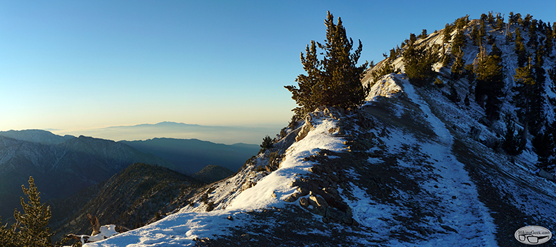
-The trail was apparent and easy to follow. We did see tracks (from when the snow was deeper) where hikers had gone off trail. I’d like to go back when there’s deep snow and re-do the hike with snowshoes and/or crampons. I need to find info on the winter route.
-Most of the trail was covered with snow. With the cool temperatures, the snow hadn’t yet melted and refroze, so microspikes weren’t necessary. It was supposed to hit the 40s later in the day, so I suspect micros could be useful later this week.
-It got extremely cold & windy as we approached the summit. The wind had blown most of the snow off of the summit.
I've posted some photo and info about the gear I used on my blog. Here are some highlights:
Trail & Snow Conditions: Mt. Baden-Powell, Dec 13 2015
-We got started later than expected. Both navigation apps on my phone gave us bad directions. Since SR 2 shows up as ‘closed during the winter,’ they were routing us to Forest Service Road 4N56.
-The trail was apparent and easy to follow. We did see tracks (from when the snow was deeper) where hikers had gone off trail. I’d like to go back when there’s deep snow and re-do the hike with snowshoes and/or crampons. I need to find info on the winter route.
-Most of the trail was covered with snow. With the cool temperatures, the snow hadn’t yet melted and refroze, so microspikes weren’t necessary. It was supposed to hit the 40s later in the day, so I suspect micros could be useful later this week.
-It got extremely cold & windy as we approached the summit. The wind had blown most of the snow off of the summit.
I've posted some photo and info about the gear I used on my blog. Here are some highlights:
Trail & Snow Conditions: Mt. Baden-Powell, Dec 13 2015