Full Picture Album:
Full Crow Pass 2013 Picture Album Crow Pass is a roughly 26 mile trek through the Chugach Mountains beginning in Girdwood and finishing at the Eagle River Nature Center. The hike begins with a 2,100 ft. elevation climb in the first few miles and mostly descends through valley of mountain peaks, glaciers, waterfalls, and a river crossing at the halfway point.
My partner for this hike is Ross, who is a Joshua Tree area climbing instructor and had a summer job in Denali National Park washing the “school” buses all summer. He was laid off from the summer job a few days early—because the pipes to the water hoses froze and burst as they washed buses.
The week before the hike brought a big snow dump in the mountains and even trace amounts of snow in Anchorage. Glen Alps, only a few miles from my house, had 8 inches of snow. The Rangers at the Crow Pass Ranger Station reported that there were 3 foot snow drifts at the Crow Pass Cabin. This made Ross and I discuss items such as snow shoes! As the week progressed it warmed up—as high as mid-50’s, and rained frequently. The termination dust across the mountains that line up with the Anchorage city skyline disappeared. So this led me to believe the snow in the Pass would likely be gone also. Keep in mind, our peak elevation would be 3,500 feet.
Thursday night Ross and I had the one hour drive to Eagle River Nature Center in rain, fog, and very poor visibility to drop our car that would wait for us until Saturday night. I believe that drive was the most dangerous part of the trip! As Friday morning came the excitement had built even though it was raining heavily. I planned on a full day’s work Friday early morning before leaving for the 45 minute drive to the Trailhead at about noon. As the sun rose, the views out my office windows barely displayed any sign that there was a mountain range somewhere in the dark gray and rainy clouds. My wife graciously agreed to drive the 1 hour trip to Girdwood and we started the hike at about 1:30 pm Friday afternoon in rainy, dark skies.
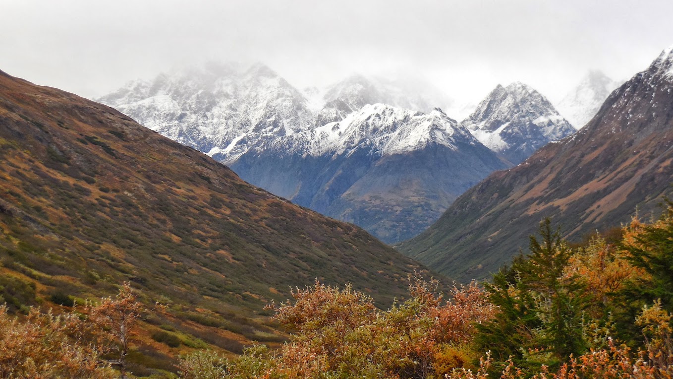
Looking down to the Trailhead after a quick climb:
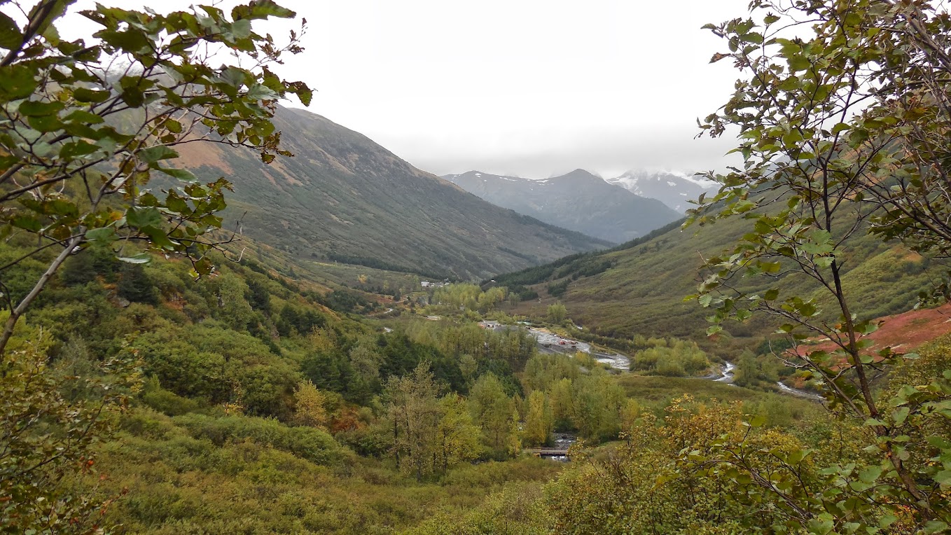
We never quite reached the snow level seen in the picture. Also note the gold mining equipment in the lower right of the picture.
Ross quickly shed layers as we began the steep ascent to Crow Pass in the rain (carrying what we later weighed as 40 pound packs). I was prepared for this climb and started with only a shirt and Rain Jacket layer but thermals at the ready in case it was cold and windy at the top of the pass—which was fully expected. We barely touched snow on the trail to the top and the wind picked up as we climbed. It seemed like it would be a cloudy, rainy hike. Upon reaching the cabin we found the lake partially surrounded by snow but the wind began to dissipate. I was still worried about visibility to Raven Glacier since the Cloud level was so low. My worries were soon set aside as we rounded the corner to see the Crow Pass sign at Raven Glacier in the background.
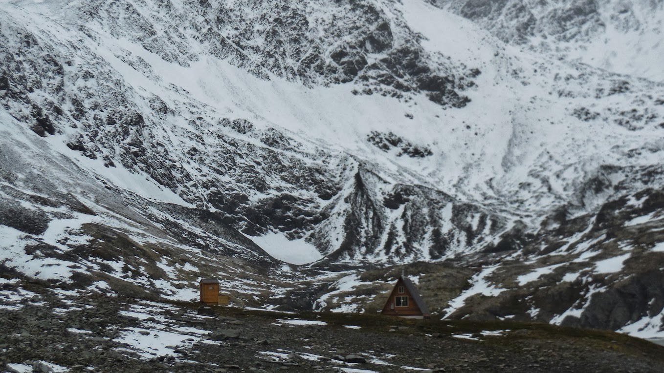
Crow Pass Cabin (reservable for 6 people for $35)
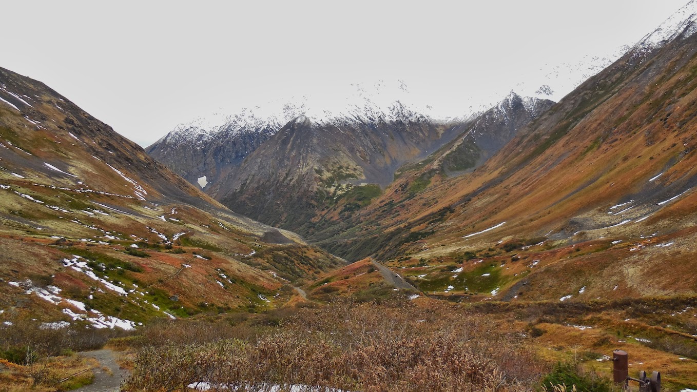
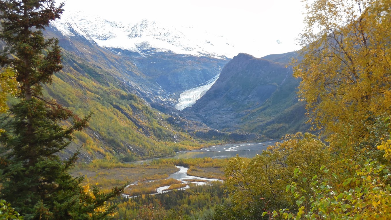
Crow Pass:
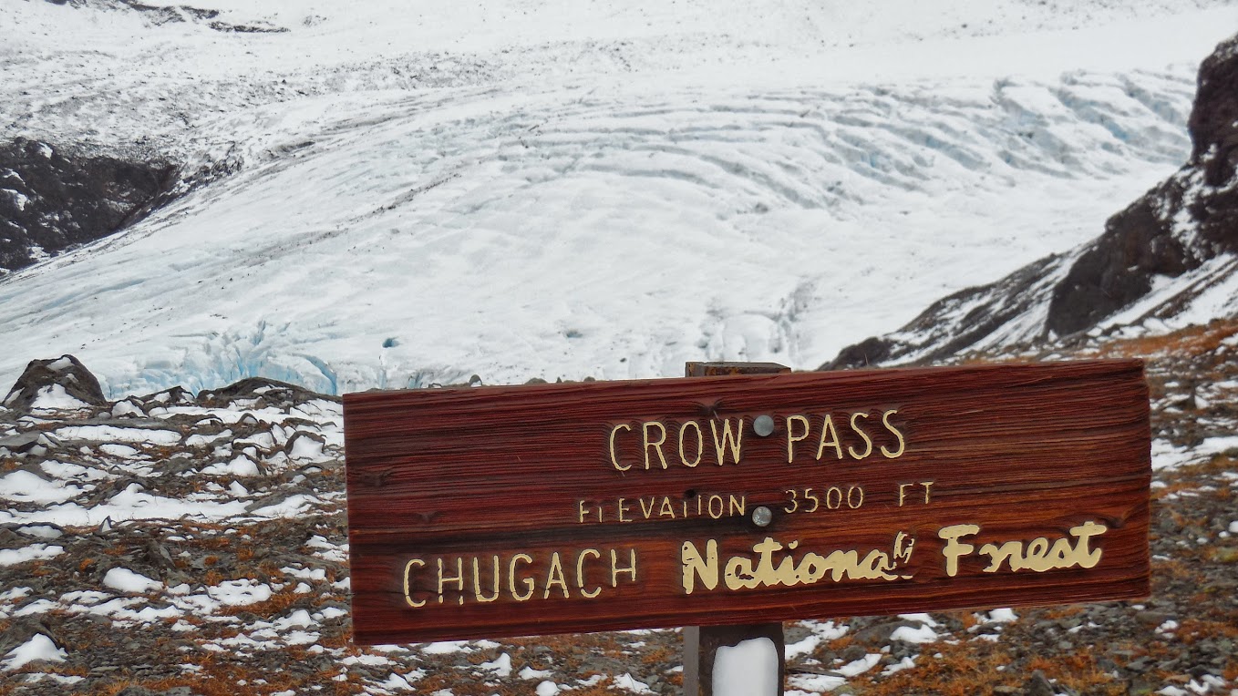
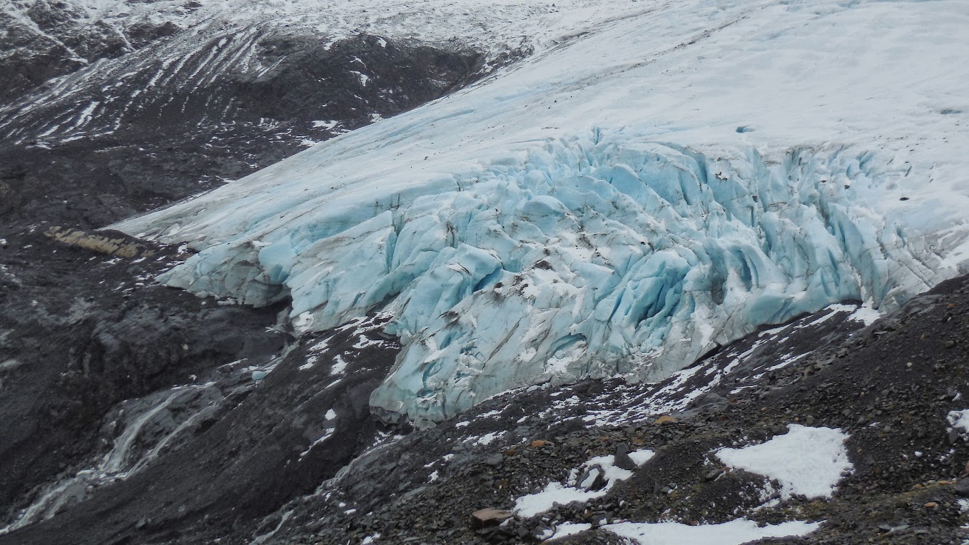
Raven Glacier (note the 3 “rivers” flowing out of the glacier)
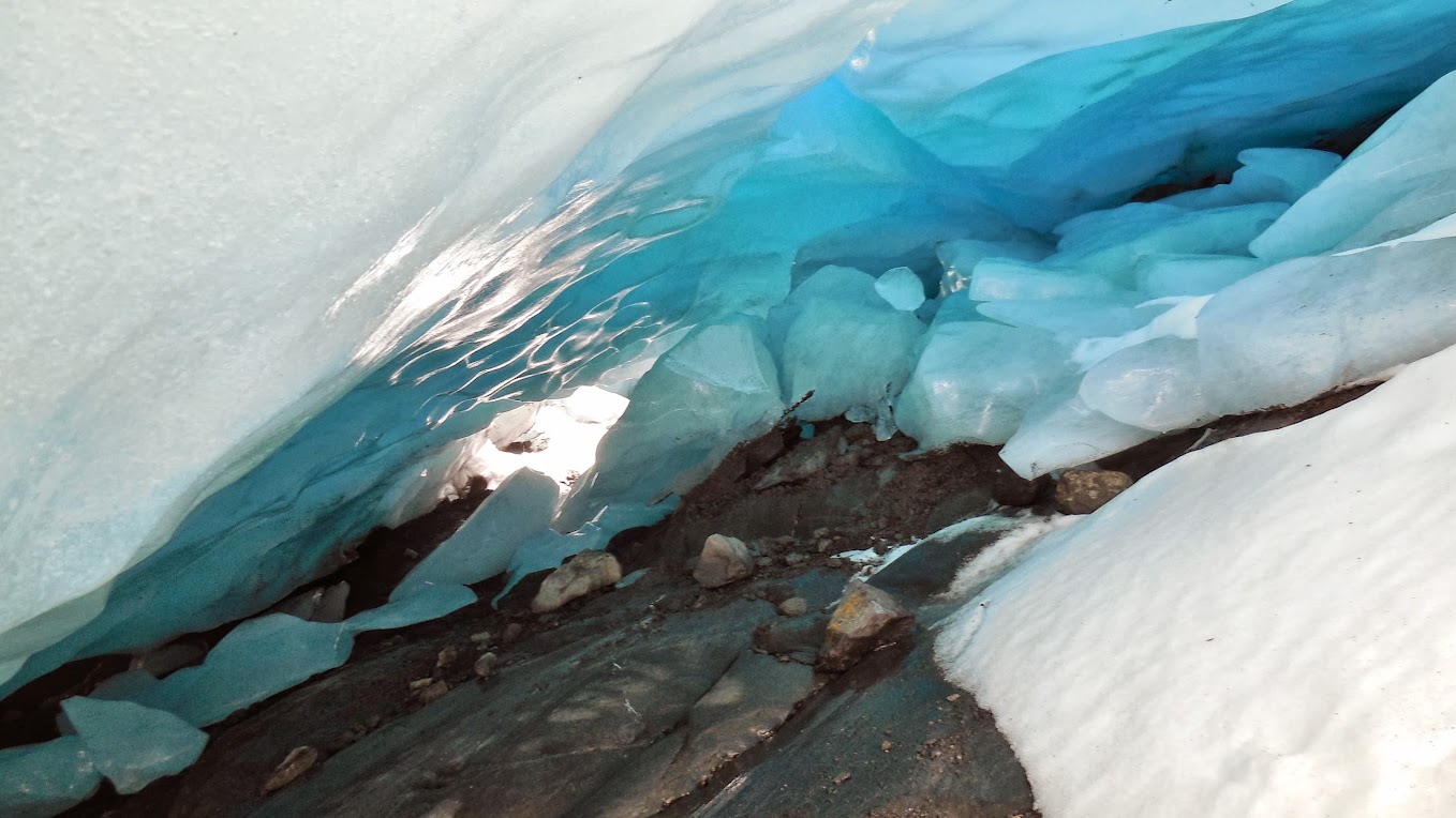
After covering the hardest part of this day’s hike we had plenty of time to explore before dark so my plan was to get to that Glacier! It was a much harder hike down the glacier than expected across a steep scree field that was often covered in deep but post-holey snow along with running creeks of water across slick rock. The payoff was amazing. Ross had never been to a glacier before and was awestruck at the colors and magnificence. We found a “cave” and hiked 30 yards or so into the glacier, were able to look up and out of the glacier through crevasses, and found one of the running rivers inside the glacier.
Glacier Cave
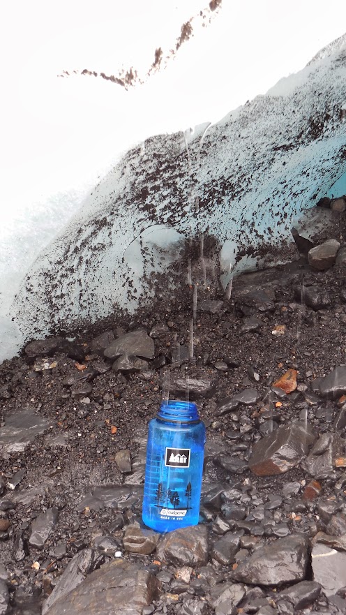
PERFECT Water Refill—NO Filtering Necessary!
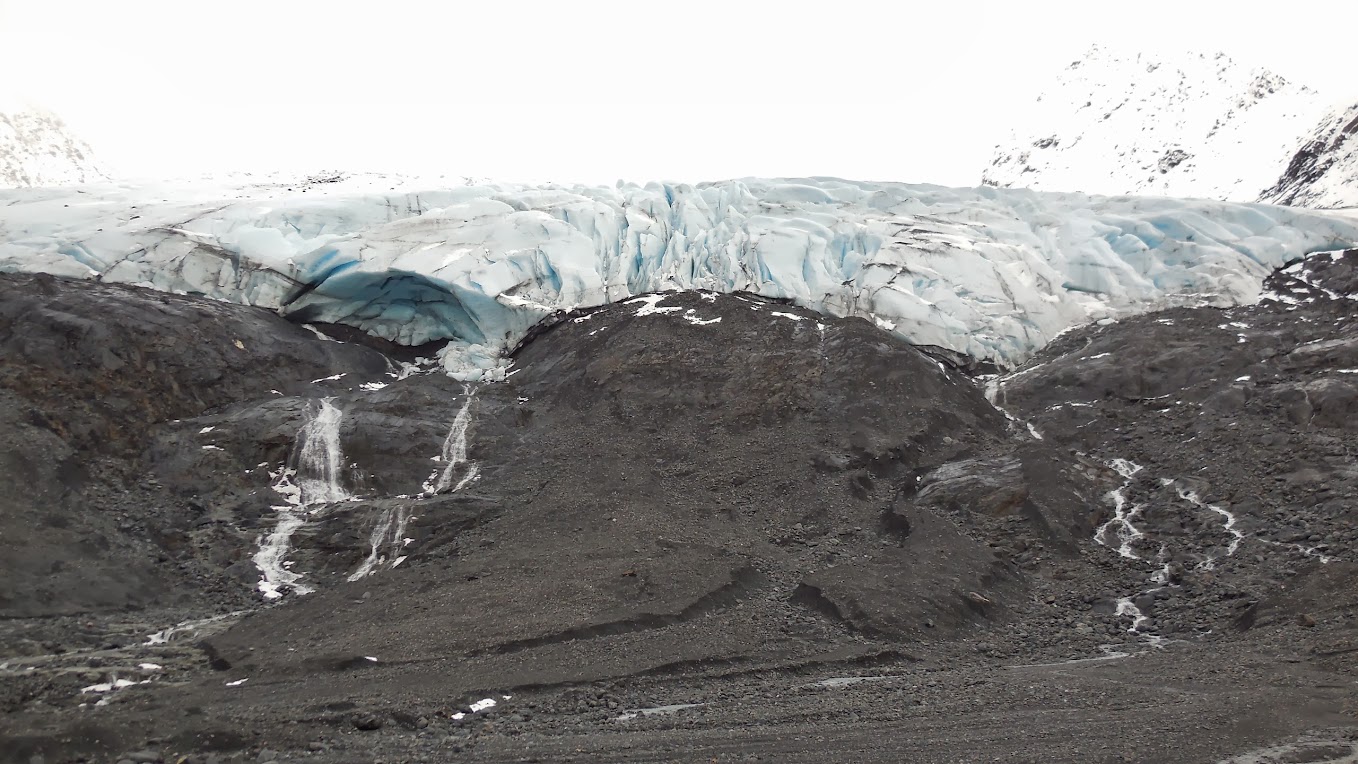
Raven Glacier (sorry for the washed out exposure at top of picture but it goes on forever)
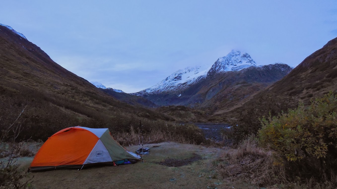
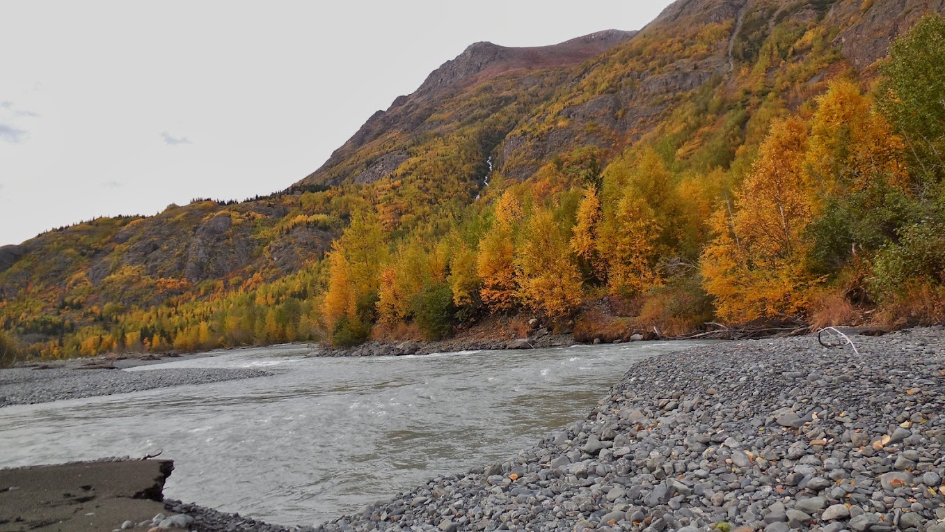
By the time we left the glacier the sun had come out and it would not rain the rest of the trip! We covered 5 more miles before setting up camp right at dark. The next day would be a long one and include the river crossing. That made it 8 miles for the day leaving about 18 miles for Day 2.
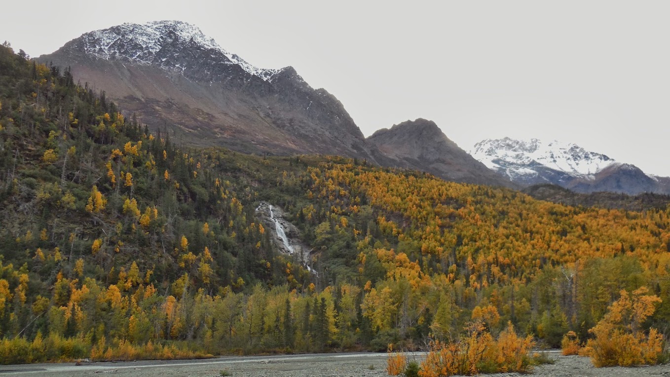
I’m told the hike goes through 5/6 totally different ecosystems. Here are fall colors in front of Snow-Topped Mountains:
Campsite
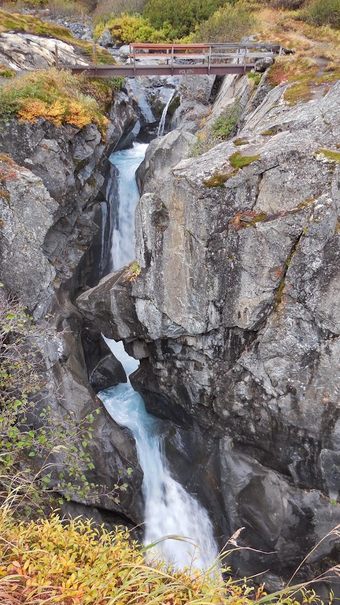
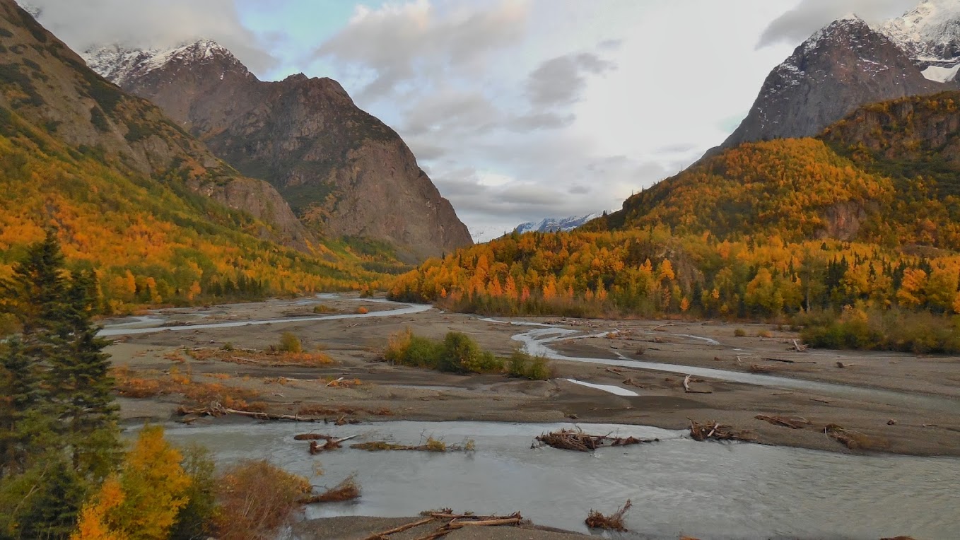
Ross above River Gorge:
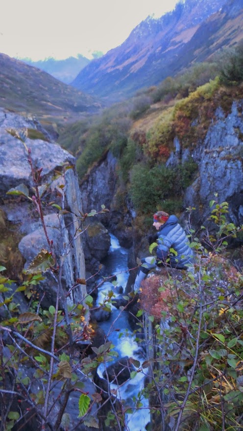
Looking back at River Gorge:
Breaking camp by 9:15am after brushing condensation ice off the rain fly, the next morning would bring quite a bit of excitement before the eagerly anticipated Eagle River Crossing in 5 miles. We encountered lots of fresh bear and moose tracks on the rough and muddy trail. However it wasn’t until the forestry descent just before the river that the alarm went off. Ross and I properly had been making noise and loud conversation through the entire hike. Brush is sometimes very high and it is easy to surprise a bear if you are not making noise. Ross and I even had a spirited conversation on our plan of escape if the entry to the Glacier Cave would have collapsed. We settled on two not so good options. 1. Climb out the icy walls with NO equipment. 2. Jump in the river and hope to be washed out without major injury in the river washout seen on the right of the picture up above. If escape were impossible, we noted that there may have been no way for searchers to ever find any trace of us at all. Searchers recently found a military airplane crash from the World War II area on a local glacier. As we discussed this mortality tale, we suddenly heard a HUGE ROAR/GROWL. Unmistakably a Bear! Both of us pulled our readily accessible bear spray cans and began to make lots of noise. We never saw the bear. But we sure made him angry and it sure got our blood pumping!
Bear Tracks:

Ross ready to Fight Bear:

After narrowly escaping the jaws of death from the bear we traveled on and turned a corner to find this view of Eagle Glacier and Eagle River:
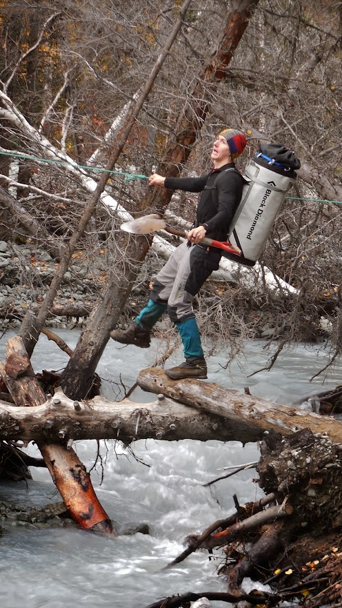
Normally a hiker can expect knee to waist deep water. Notice the calm and still water to the right of the picture. Suspicious, I threw a rock only to hear a kerplunk with no sound of rock hitting bottom. Importantly the white stakes are set up at a wide portion of the river avoiding narrower sections of deeper and swifter rapids. With fresh snow melt and sunny skies melting the glacier, I expected a tough and painfully cold crossing. Somewhat anti-climatically the crossing was still very painfully cold—but only calf/halfway to our knees depth. Ross even found a shovel in the middle of the river, and as a true LNTer, I now have that shovel as a souvenir of the hike in my home thanks to Ross lugging it! With the most “dangerous” parts of the hike behind us, we now only needed to cover 13 rugged miles through bear/moose infested muddy uneven trails! Thankfully two other crossing which had turned dangerous early in the season after the logs washed out were mostly fixed.

Note: Shovel in Hand
We were blessed with beautiful waterfalls and wildlife on this part of the trail. Ross noted that when he first arrived in Anchorage I took him out for a quick drive before his train trip to Denali. I tried, and inexplicably failed, to find him a moose. As they began the beautiful glass-topped train ride to Denali, Ross expressed a hypothesis that moose did not really exist and it was a hoax similar to Big Foot. Others on the train, fed the theory and Ross was convinced moose were just made up—when suddenly from the train all spotted a moose. Similarly I have yet to seen a black bear since I moved to Alaska. Doubt is creeping in that black bears do indeed exist. At this point in our conversation, I spotted far across the river bed what was definitely a black bear!
Black Bear?
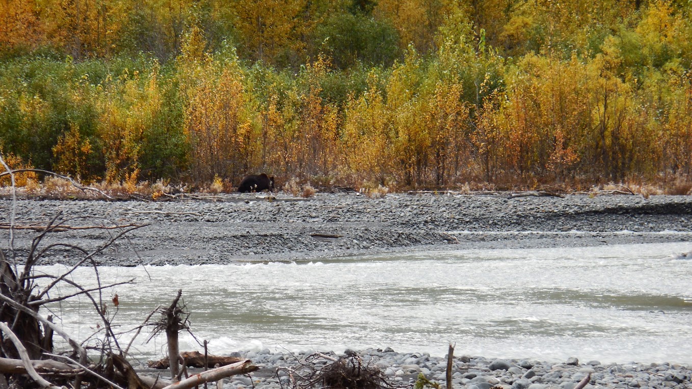
Clearly on my camera viewfinder the dark black coat resonated as he was in view for only a short while before disappearing in the trees. Alas, upon reviewing my pictures loaded on my computer, I note a brown tint and a definitive distinction shoulder/neck hump. Indeed this was a brown bear/grizzly bear and I still have yet to see a black bear in Alaska.
Later we spotted a pool of spawning salmon in the river—some already bright red!

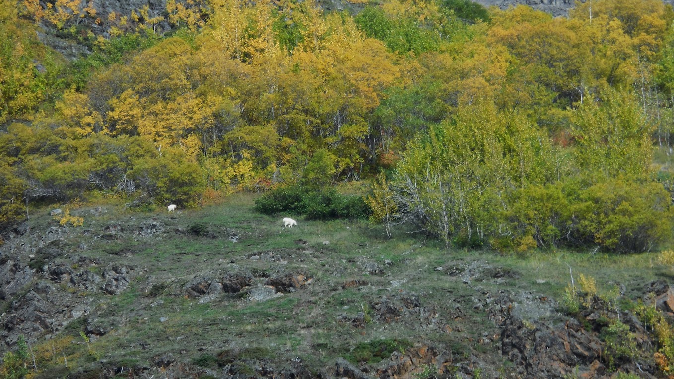
And finally, way up on the hillside we spotted two polar bears!
Tough and Rugged Trail (and supposedly downhill!):

Covering 18 miles with 40 pound packs on this type of trail was indeed difficult and we realized we were not going to make it before it turned dark at about 8:30pm. With headlamps out we completed the hike at about 9:15pm after 12 hours of hiking. We were so thankful we caught the break in weather. We really were expecting a rain filled hike with a low cloud ceiling curtailing the views. Most of my clothes went unused---never did use the thermals! We saw NO ONE until near the end of the trail two hunters had hiked in from the other direction to spot dall sheep and goats. I’ve concluded that I believe a dayhike is actually easier as far as body soreness and effort. Earlier in the summer it is easy to do it at an enjoyable pace with plenty of daylight.


