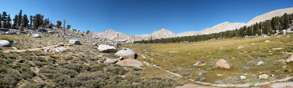
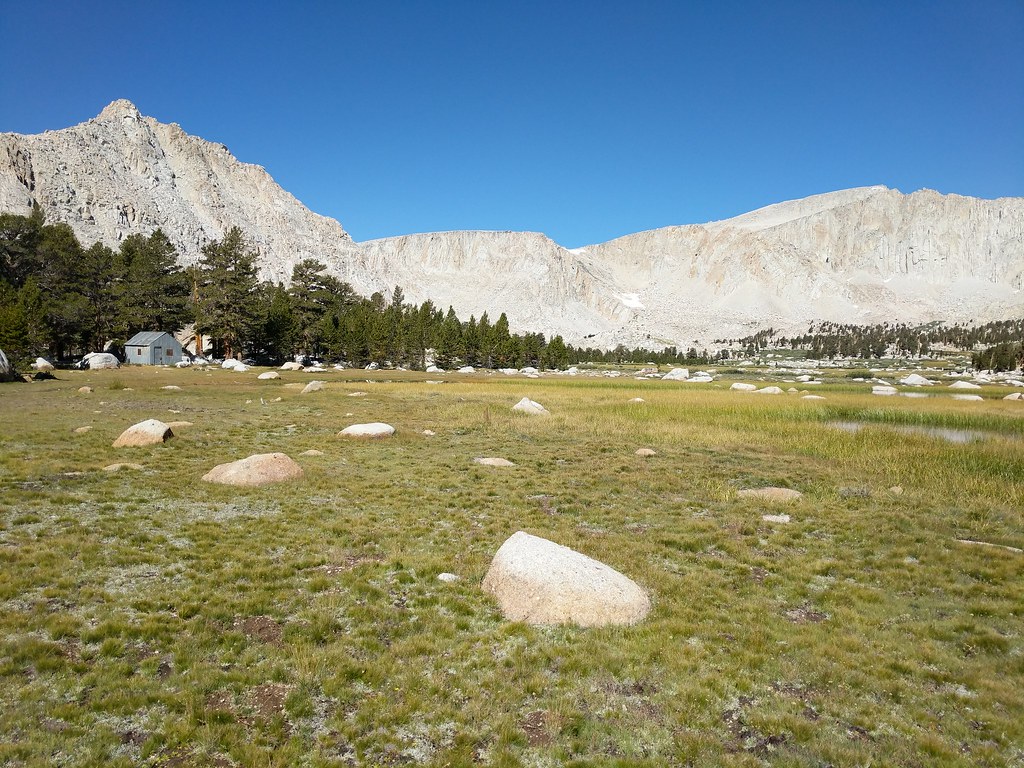
On Friday the 15th we woke up to a brisk morning. We lazily made coffee, ate some breakfast and proceeded to pack up our stuff and got ready to hit the trail. With a quick stop to stow any unnecessary items in my truck and use the facilities we were on our way up the trail towards Cottonwood Lakes at 8:00. The section of trail between Horseshoe Meadows and the beginning of Cottonwood Lakes went surprisingly quick. We were greeted with the expanse of Cottonwood Lakes, Mount Langley and Cirque Peak as we crested the hill. We took a breather here and ate some snacks and took some photos before we began again. We made a beeline through the basin towards lakes 3, 4, and 5 passing the familiar sight of the tin cladded cabin on the edge of the unnamed tarn before lake 3. The section of trail between there and our next objective passed quickly and we soon found ourselves at the beginning of the climb to Old Army Pass.
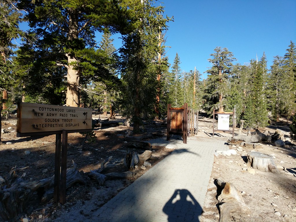
Cottonwood Lakes Trailhead
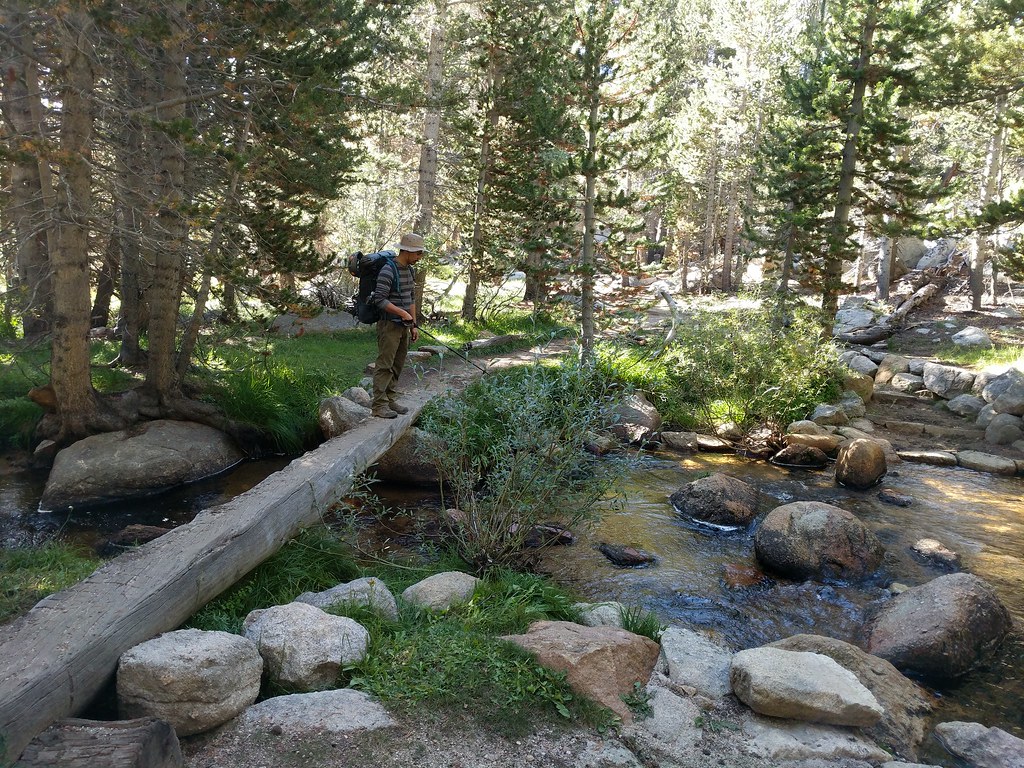
Jose crossing the stream just after the John Muir Wilderness boundary
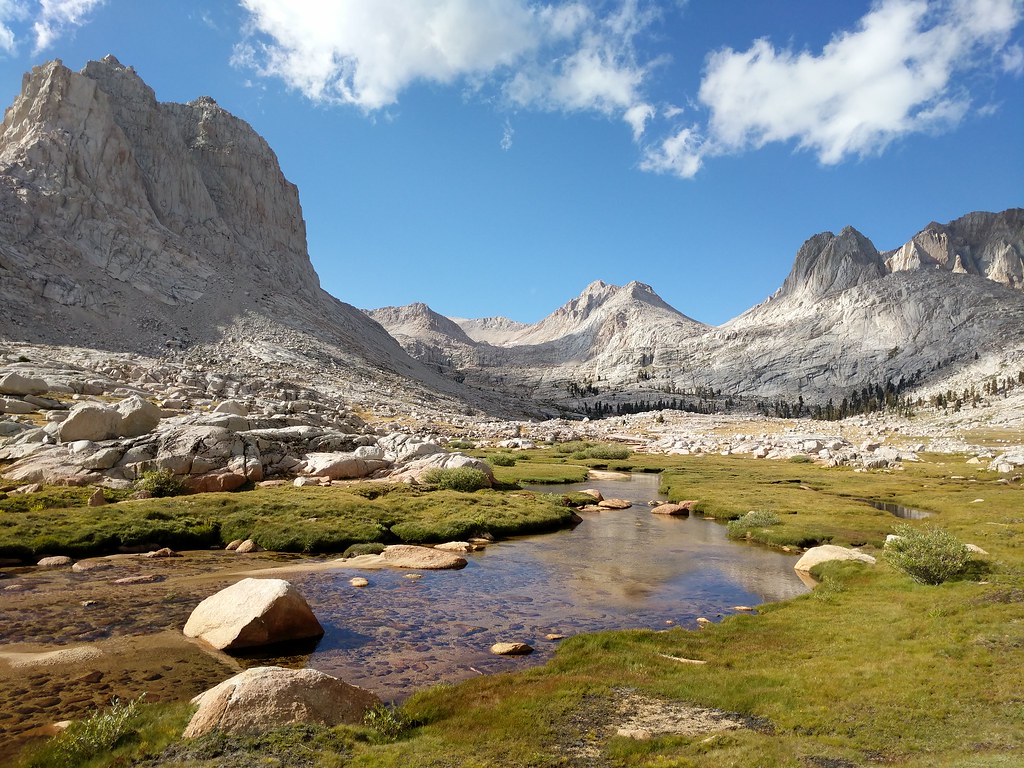
Pano from the start of the Cottonwood Lakes Basin
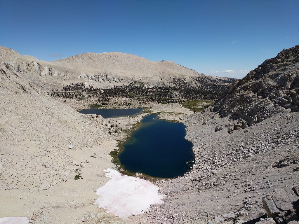
Cabin next to the tarn with Langley looming in the distance
Looking up to Old Army Pass from the far end of Lake 4

Old Army Pass was in great shape with only a small patch of snow to cross early in the climb. We were both surprised how quickly that we made the trek to the top of the pass. We both agreed that we must be in better shape than the last time we each had individually climbed Old Army Pass as it only took us 45 minutes to make it to the top. From the top of Old Army Pass we saw quite a few day hikers heading up to summit Mount Langley. We both had summited Langley in the past so it wasn't on the radar for this trip. We quickly headed downhill on the trail, passing the junction that leads up to New Army Pass and descending towards Rock Creek and Lower Soldier Lake. Just before the turnoff to Lower Soldier Lake we found a nice flat area to stop for lunch. By this time it was 1:00 and we were making good progress towards our final goal for the day. After lunch we hiked the short distance to the junction for Lower Soldier Lake and headed north. The original plan was to head around the east side of the lake, then up the notch, and down to Rock Creek. When we arrived at the east side of the lake we were confronted with a wet, marshy bushwhack of a trail through the brush on the side of the lake. After going a short way in we decided to circle around the lake and hit the use trail at the northwest corner of the lake that would lead us up the hill and the the ridgeline to the east of Rock Creek. We made the scramble to the top of the hill in a scant 10 minutes and proceeded to travel cross country and stay level on the ridgeline until we could see the use trail that made it's way up along the banks of Rock Creek. When we finally spotted the use trail below we slowly dropped down the ridge and stopped for a quick break on top of some boulders to take pics of the awesome view of the miter basin laid out before us.
Looking back down to Cottonwood Lakes from the top of Old Army Pass:
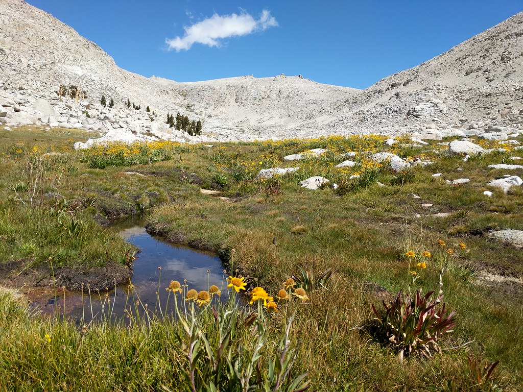
Wildflowers along the stream as we descended from the Army Passes
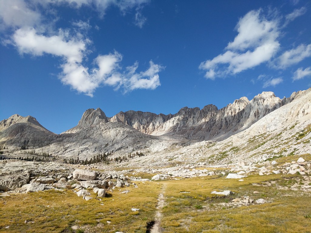
Almost to our lunch stop
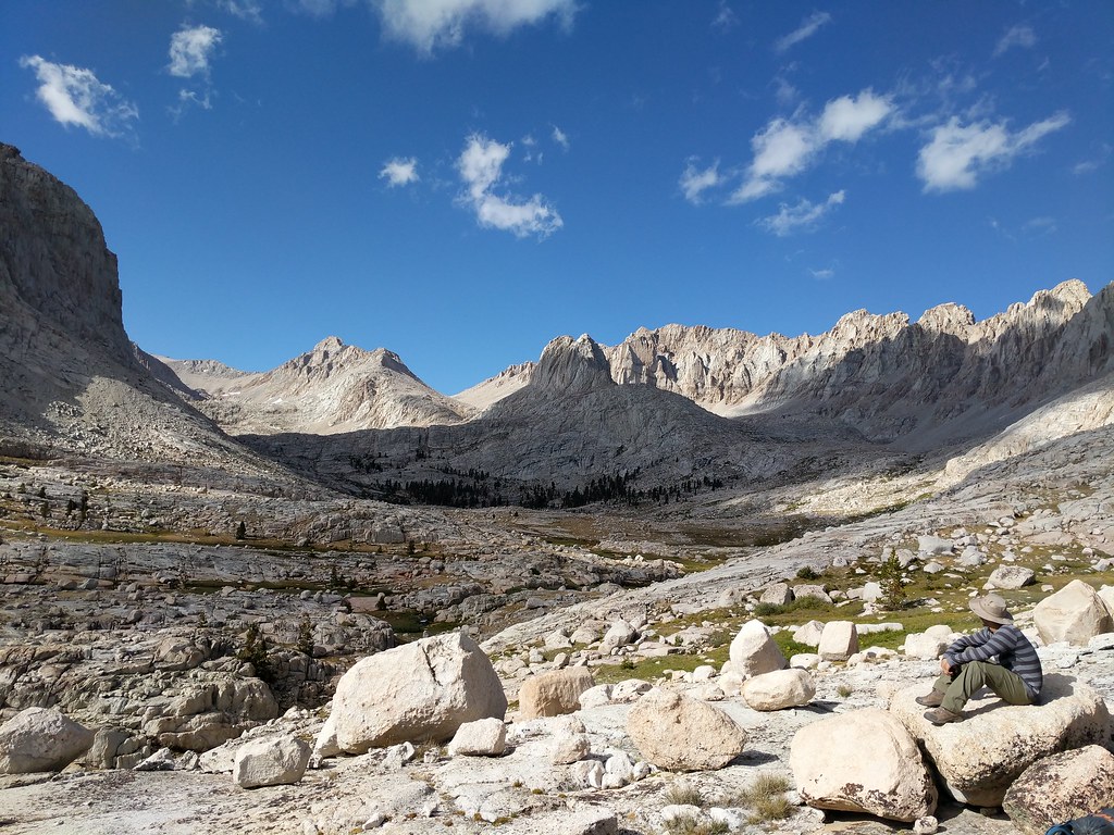
Taking in the vistas as moody clouds draped the landscape in shadows and sun
After killing some time taking pics we re-shouldered our packs and made our way to the use trail that winds its way through the basin, with the trail dropping in and out as it snaked it's way along the edge of Rock Creek. We shortly found ourselves facing the last bit of uphill between us and our objective for the day, Sky Blue Lake. We followed the path of least resistance along the slabs and waterfalls that guard the entrance to Sky Blue Lake and found ourselves staring at a wonderful alpine lake nestled amongst stark granite cliffs. A short walk later around the south side of the lake and we found a good spot far enough away from the water that was level and offered some protection from the wind that was blowing over Crabtree Pass and into the basin. It was now 4:30 and the light seemed to be fading quickly so we made quick work of setting up camp and filtering water for dinner. After the camp chores were done we both wandered around and took more pics of the surrounding environs. We had both wanted to explore this area and so far we were really glad we had put forth the effort to make it there. The lake was pretty quiet, with only one other group camped on the opposite side of the lake from us. This was surprising as we had passed no fewer than four other groups on our way there who said that Sky Blue Lake was there final destination for the day.
Miter Basin from along Rock Creek
Making our way through the basin to Sky Blue Lake along the spotty use trail
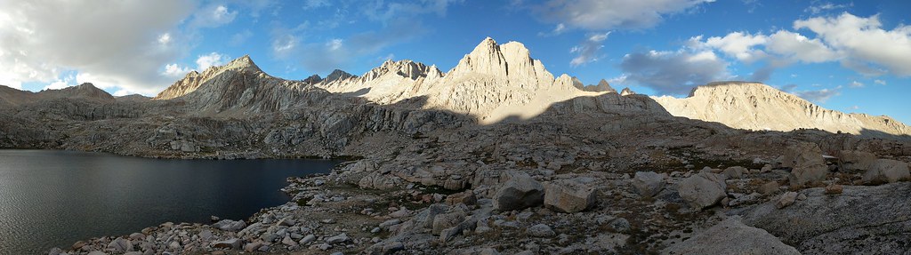
Pano on the shore of Sky Blue Lake from Crabtree Pass in the west to Langley in the east
After many photos were taken we ate dinner and watched the skies darken and the entire basin get plunged into shadow, with the final light of the day illuminating some lingering clouds with dark reds and oranges. With the day drawing to a close and darkness encroaching Jose decided to retire to his tent. As I had only brought my bivy along on this trip I wasn't quite ready to go-to sleep as of yet so I wandered up on the cliff above where were camped to look at the stars in their grandeur. A little while later finally sufficiently wound down after our 14 mile hike in I went back to where we were camped to retire for the evening. While getting situated for bed I glanced up at the cliff and saw a big rock perched right above my head. At this point I decided to walk back up the cliff above and check out this bit of impending doom and make a judgement as to it's stability. After a quick inspection I judged it's stability to be of a questionable nature and descended to relocate my bivy out of the path of this silent lurking threat. With things safely relocated out of harm's way I crawled into my bivy, cinching my sleeping bag around my head and drifting off to sleep with the stars illuminating the sky above.
Last light of the day on the shoulder of Mt. McAdie
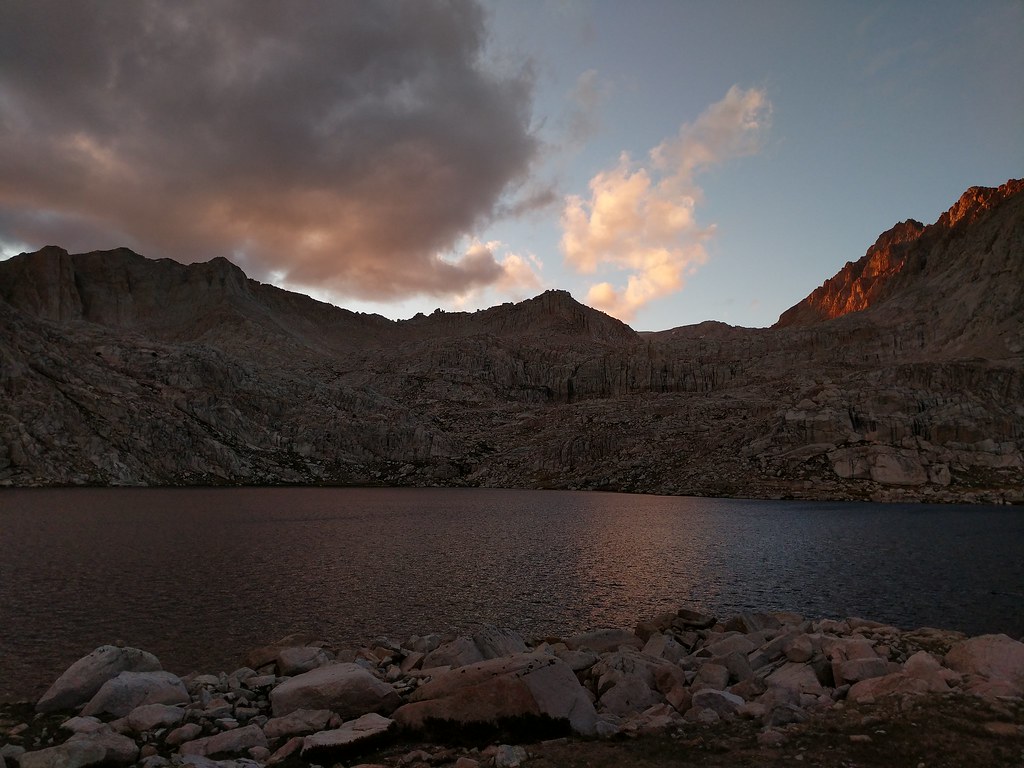
Firey glow in the clouds over Mt. Newcomb


