Here's a link to a section of "A Climber's Guide to the High Sierra", published in 1954, edited by Hervey H. Voge.
The Whitney Region: Kearsarge Pass to Army and Franklin Passes
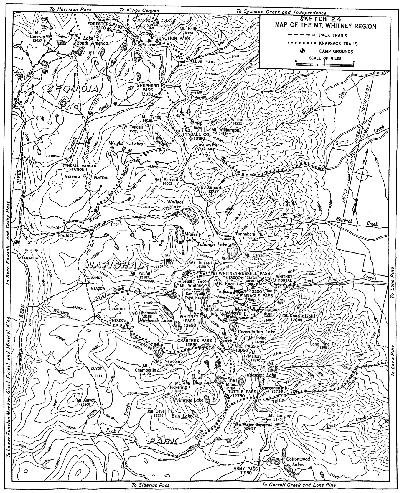
THE WHITNEY REGION, that portion of the crest of the Sierra Nevada lying between Shepherd Pass and Army Pass, is a spectacular display of mountain sculpture. Rising west of Lone Pine, in Owens Valley, and following the northeast border of Sequoia National Park, this jagged thirteen-mile escarpment includes seven of California's fourteen peaks exceeding 14,000 feet in elevation: Mounts Tyndall, Barnard, Williamson, Russell, Muir, Langley, and the culminating summit, 14,495-foot Mount Whitney, highest peak in the United States excluding Alaska.
The web page is here:
The Whitney RegionAnd the "sketch" map of the area. Note the straight road up to Whitney Portal. (Click on the map for full-size, you may need to click 2x.)