Mt Whitney Webcam
Mt Williamson Webcam
Who's Online Now
0 members (), 61 guests, and 9 robots.
Key: Admin, Global Mod, Mod
Previous Thread
Next Thread
Print Thread
Page 1 of 3 1 2 3
111 Days In The Sierra
#29217 11/21/12 02:58 PM
Joined: Dec 2009
Posts: 558
OP Offline
Joined: Dec 2009
Posts: 558
This year it was difficult for me to write anything at all. I just had the feeling that nothing was interesting enough to be worth reading for anyone. I struggled to think of anyway to write this story down but I decided instead of doing each day and posts of 20 days at a time like last year I will do a story of each week and keep it a bit more basic. I don't know when or how much time will pass between each updated week but here is the first.


June 1st 2012, a number, a designation for a calendar, just another year down the cosmic lengths of the 4th dimension. Flowing down the filthy freeway of highway 99 in the oppressive summer heat zipping by countless people with their own stories I stared at the range of mountains rising from the valley floor. That is of course what I could see of them through the disgusting muck of what is called human "progress". It had only been 8 months since I had returned from my last big journey in the great hills rising before me yet my soul felt heavily fatigued. 8 months was more then enough to continue the degradation that was occurring within me. I had spent the last 8 months back in a life that offered me nothing but took everything. Even the ambitions only a year before that had the potential to spark new life within me no longer held any drive. The only thing that made sense to me any more was to continue one desire that held within my heart which was further exploration of the Sierra Nevada Mountains.

Since the summer of 2009 I had spent more then 200 days roaming the great range and it had done little to satisfy my need to see more so I had spent the last many months working out logistics of a hike that for most people would be the ultimate life journey. For me on the other hand it was just a continuation of what no longer seemed to be anything other then what I could call my real life. The mountains where the only real home I knew and I soon would be back within their warm embrace.

WEEK 1

MAP

Winding and bouncing up the old Mineral King road the temperature slowly dropped while we climbed away from the valley below. If all went well I would not be dropping below 7,000 feet more then a few times in the next 140 days of Sierra travel. It wasn't until the sight of Oak trees were replaced with beautiful healthy species of Pine that I was able to have any real emotions about what was about to transpire. Like my other trips of this nature the over all scope of what lay before me was so immense that my mind could not take it in. I could not feel excited until I stepped out of the Jeep as cool fresh air and the sweet smell of pine hit my nose. The sound of fresh running water and the long happy call of the Douglas Squirrel sounded near by. It was then that I knew I was home.

I had never reserved a permit before and like every other year it was time to go pick it up. I was afraid it would be a very long process since I was starting within Sequoia National Park. The Mineral King Ranger Station turned out to be far more primitive and they did not have a computer system. When I informed the Ranger of my 140 day plan he gave me a piece of paper to write every day down. This clearly was going to take some time only made worse by the fact that many lakes I was going to camp at had no name. I had only got about 5 locations into it when I decided on a better solution. I had my entire itinerary printed out in my pack. I got that and the Ranger was able to photo copy it making the process painless. As for any reaction to my huge trip he seemed largely complacent.

I got a site at the Cold Springs Campground and my ride headed on home. I got set up and relaxed. Almost every item I had this year had been replaced and I had at least one item I had never carried before in the back country and that was a Samsung Galaxy 5. As I sat and considered this it suddenly hit me hard that I had forgotten the USB cord to charge the damn thing. I also had a separate small MP3 player that I had forgot the cord also. I hadn't even hit the trail yet and I was already planning for things to be brought to me. Not such a good start.

Strapping on my pack for the first time was a heavy burden with 14 days worth of food which was more then I had ever carried. I had on the other hand got my base weight down to about 20 pounds so it was not the heaviest pack I had carried. I began up the road to the trail head that was about a mile away. Before too long I was breathing quite heavily as the sweat came on. I was a heavy 245 pounds and had done even less this year around to train which was a common theme for me. Since I have never driven before I didn't have the luxury of driving to a near by trail or general good hill to climb and simply walking out the door and going for a walk is far less appealing. The end result is weeks of really hard work before I get back into decent shape.

Making my way up the steep road and into Mineral King Valley I was in an extremely good mood to be back in the Sierra. What could possibly lay ahead was anyones guess. My first point of interest was Franklin Creek. I was anxious to see what it was going to throw at me. Last year I had crossed it on July 5th and it was the most dangerous crossing of my 2011 trip. Reaching it I was delighted to see that it was an easy ford or even not one at all as while I put my shoes back on two other hikers came along and hoped across without getting wet. I just didn't take the time to even look close enough to see it could be done. I then began leap frogging with these two hikers as we both had trouble tackling the constant up hill battle. The Mineral King Valley was not the lush green paradise it had been the year before. The winters death grip was still clinging to the area. A Bald Eagle soared over head as I slowly made my way up the hill. By the time I was closing in on Franklin Lakes I was beat. I normally never wear sun glasses in the Sierra unless I am on snow and it seemed unusually bright outside. Oppressed by blinding light and completely depleted of energy I got my first good look at the lakes. I had already been given advise as to where better camping is on Franklin so I pushed beyond the dam area to mid lake. The down side of this was that there were no bear boxes. For some reason they had been located below the dam in a viewless campsite. So I had a whole crap load of food that was not in my bear barrel and no where to store it. I began to set up my tent and to my dismay I had left my tent stakes in the campground below. I now had no tent for the next two weeks until I could have some more brought to me with my cords. A large population of Marmots was patrolling the area but I did not think anything of it yet. I had spent some time talking to other hikers when I went back to my camp to notice one of my new water shoes I had left on the ground like I always do was completely gone. OH YOU LITTLE BASTARDS! I exclaimed! I began the hunt and finally saw my shoe under a huge rock. I crawled underneath it and got my shoe back to find it was chewed up. For the next many hours I was under constant assault. I had to guard every piece of gear I had. I felt completely helpless laying out in the open with no protection from the Marmots. Finally I pulled out my garlic salt and dumped a great deal of it on the ground which the Marmots happily fought over leaving most of my stuff alone. One of the other hikers had the Marmots chewing up his sleeping bag while he was in it trying to sleep! This year I made an attempt to cut weight in allot of ways. One of them was to replace my 6 gallon kitchen sink system that weighed 11 ounces with a 10 liter bucket that was 2.8 ounces. My first trip down to the water which left me out of breath when I set the bucket down at camp it immediately dumped over. This just isn't going to work I thought so another piece of gear put on the list of things I need to replace. The night was frigid and I was not able to stay warm very well.

Waking up the next morning I was covered in a good layer of condensation. I began the now new again routine of the daily pack up. One of the other hikers I had talked to came over and offered his tent stakes to me so I wouldn't be completely exposed out here which I later would be quite grateful for! I began up Franklin Pass and picked apart the trail in typical trail worker fashion. Closing in on the top I was already beat. The last couple of years I had not gone straight to high altitude and I could certainly feel the lack of oxygen. Once I had puffed my way to the top I had my first sections of snow to cross for the year. Nothing challenging though and before I knew it I was making my way down admiring the aesthetic rock formations littering the sandy slopes. A cold breeze was blowing which little did I know would be the theme for this entire hike. Maybe it was my own jinx as they call it since after my previous years hike I thought how I hardly had had any wind at all in 2010 and 2011 which I thought was odd considering it was the mountains. This year looking back I cannot recall a day that I did not have wind. Although the distance from Franklin Lakes to Forester Lake was only 5 miles by the time I was climbing the last gentle slopes to the lake I was completely out of energy. At this point I was glad I had played it smart and only planned 5 miles a day to begin this hike. Reaching the lake I found a couple wonderful camp sites in wide open forest areas. An orange hue had long covered the sky from a fire raging in the direction of Golden Trout Wilderness. Little flakes of ashes rained down as I got set up in the quiet solitude. I had left the people behind at Franklin Lakes and I would not see another human again for 6 days. I stripped down and actually jumped all the way into the lake which to my delight was quite warm in Sierra lakes standards. Generally I am a cold water wimp and getting all the way into the water happens perhaps twice in a 3 month period on the trail. Doing so on day two left me hoping that this may be a theme for the year. Looking back... ha ha! yeah right...

Leaving the area it was a quick hop over the hill and down to Little Claire Lake. This lake had me a bit intrigued because the regulation page attached to my permit said no camping within a 100 feet of Little Claire Lake. But wait? Your not allowed to camp within 100 feet of any body of water if the terrain allows for it. No closer then 25 feet period. As I stood at the lake it was clear that the terrain was not an issue. I suppose the violations were just so bad that a special notation needed to be added...

Dropping down the first switchback I began to leave the trail. I was on my way to Amphitheater Lake and I thought I would do a bit of a lake tour by moving West to Lake 10,569 and then North East past a smaller lake and on up to Amphitheater. However I didn't get very far before a mix of cliffs stood in my way offering fine views of the canyon. I scanned carefully but trees obscured any solid promises of a doable route. I was so green on this 3rd day of hiking that I did not feel like meandering around these cliffs looking for a route so I went back to the trail and on down. Before I had switched to the bottom I bailed off and began up Soda Creek. Navigating up this canyon was a major mix of terrain ranging from difficult creek hoping to slightly bush whacking to steep tiring hills. Plenty of beautiful cascades kept things interesting as I pushed on up. The closer I got the more snow that was scattered on the ground making things a bit more difficult as I climbed through the nasty half dead black stained willows that as you rub on them they leave you covered in crap. I was in bit of a pessimistic mood being so worn out by the time I reached a level area that was strikingly beautiful in it's simplicity. It served to rejuvenate me for the final steep push for Amphitheater. As I climbed clouds began swarming in at high rates. In about 20 minutes blue skies gave way to grey cloud cover. I reached the lake to find it almost completely frozen over. Freezing winds were blowing as I began looking for a place to set up. There were very few locations but I managed to find a flat spot. I sat for some time staring at my next goal which was Crystal Pass. It did not look good. I used my monocular to carefully study every piece of it. I could not see a single approach that would not put me on very steep snow slopes intermixed with steep smooth slabs. Before long I could no longer consider it though when the clouds completely engulfed the area. It was freezing so I got in my tent and tried to stay warm. The winds picked up more and more and before I knew it snow began ripping down. It was becoming a full blown blizzard out as I laughed to myself about losing my tent stakes. Without the ones that nice hiker had given me I would of only had the choice to pull out my tent and climb in it like a bivy. For the next many hours the storm showed no signs of letting up as the winds ripped around 40mph. I only had a 32 degree bag and tonight was supposed to be about 19F without counting wind chill factor. It clearly was a matter of survival mode at this point as I put on every shirt I had and wrapped the rest of my clothes around my feet. All night long the winds never let up. Several times my trekking pole fell down and the tent collapsed. After 3 or 4 times I gave up and thought it was probably better for the sake of my tents survival to leave it down. Other then my sleeping bag being 32 degrees it also was too small. At one point I tried to zip it up but after an hour or so I realized that the lack of loft from my body smashing into it was worse then just using it quilt style. But even quilt style it was not large enough to completely close off over my head so I always had a draft. Any rolling over also required me to adjust it behind my back.

After a long cold night the sun rose but the winds were still ripping. I climbed out of my tent into absolutely freezing winds and examined the scene around me. A good layer of new snow was on all the surrounding peaks and my camp. Every single creek that had been flowing down from the surrounding peaks was now frozen in time. My water bottles and the lake were also frozen solid. I needed water bad so I went down with my ice axe and beat through the ice which had frozen over about an inch thick. Looking again at Crystal Pass I decided it was too dangerous to proceed. My only choice at this point would be to cut foot holds in solid ice as I made my way up. I briefly considered climbing the Eastern ridge of Sawtooth Peak but I decided turning around and going back down Soda Creek and around on the trail was the better choice. I very slowly packed up my gear as things were slowing down with the onset of hypothermia. Once I got off of this plateau the winds weren't a problem as I made my way down Soda Creek and back to the trail. It was a rather uneventful hike down canyon in the cold air. Seeing all the iron filled spring ponds I knew now why it was called Soda Creek. After passing a difficult downed tree and nearing the junction I set up in a basic camp and considered my route ahead. Once I had finished this jaunt around Mineral King I would be heading out to Kaweah Basin and I knew all the lakes were still going to be frozen. After the episode at Amphitheater and considering I am a person that likes to do laundry and bathe every other day the thought of frozen lakes for days on end was not appealing at all. So ultimately I decided the best thing would be to burn my extra food right now and then proceed with my next section early and then do a trip to Kaweah Basin. So even though I had lugged it for the last 4 days 6 days of food was thrown on top of my camp fire.

Other then down trees these trails were uneventful. Passing Lost Canyon Creek I checked the bear box. Hmm, Fuel, Camelback, food, crap. Nothing unusual there. Up over and down the hill I went as I got my first glance at Red Kaweah from this prospective. What an awesome peak to be on I thought. After passing the lowest Big Five Lakes I took lunch as the icy wind blew on me. Cold...always cold. Cold at night, cold all day. Just a cold world around me.

Passing the second lake and then to the largest the trail took me straight into a camp site. I considered it heavily but decided that there was just no good location to set up my tent so I began making my way around the Northern shore. Nothing... Then it was back onto what was left of the trail and on to the upper lake. I was certainly not going any further then this lake so I began major scan mode for any place at all to set up a tent. Nothing... I went up and then back down as I made my way around the lake. Not a single F**king place to set up I exclaimed. Not even a place to just lay your body with no tent! Finally I found a flat enough spot with over grown grass buds that I began hacking out with my ice axe. Sometimes you simply have to make your own camp. As the sun set I sat on a rock and thought heavily about what these regulations mean. I always thought that Sequoia like Kings Canyon had a blanket 10,000 fire elevation rule but that wasn't true. The paper said that Kern River drainage areas were 10,400 feet. Was this one of them? This whole area does drain into the Kern. But wait it says that Big arroyo areas are 10,000. This does drain into the Big Arroyo before the Kern... I sat and tried to understand the wording of the regulations and debated on making a fire since I was at 10,240 and it was cold. I went back and forth until I finally decided to have one.

I left directly out of my camp and began up the slope of what I am calling 5 Lakes Pass. The slope was highly intermixed with small shelves, talus fields and grass ramps. After lots of heavy breathing I was on top. The over all view was fantastic. I went left off the top into a choke point that was a single class 3 move and delivered me out on easy snow slopes to the bottom . I went between the 2 upper lakes so I could see the Kaweahs from the South Western shore. I then instead of picking up the trail followed the shore line almost to the outlet and went out on the Eastern slopes to get a view down which was well worth the effort. Once I had taken the trail down to the lower lake I went around to the Ranger hut hoping to say hello but it was too early in the year for a Ranger. After making my way back I went past the last lake of the area and on down to where it was time to leave the trail again. Making my way up this nameless creek was at first easy as I picked up a decent use trail but before long I lost it and continued up the creek which led me into a narrow choke point and forced me higher up the rock faces. After a few difficult creek crossings I was closing in on my destination of Lake 10,410. Now before getting here I debated on making a fire. That damn 10 feet was killing me. 10 feet! But 10 feet below the lake was a sign marking no fires above this point. This was both a let down and a nice thing to see as this meant that the fire I made the night before was not illegal and this area was indeed 10,400 feet.

Since the outlet of the lake would have to be forded and I was on the South Side I made my way around that side of the lake. My initial surprise was that I had been told this lake was completely boring and not worth visiting. I however thought it was easily the nicest out of the Little Five Lakes. Despite enjoying the views once again I could not locate a place to camp. I climbed way up the South Eastern slopes of the lake to find nothing. I kept going around the lake without luck until I was almost on it's western shore where I began dangerous post holing through SUV size rocks. The only positive side was that this shore offered nice views of the Kaweahs. Once on the West side I was back in the trees yet still nothing. I did find an illegal fire ring but there was not a single place to lay your body around it! About half way around the Northern shore I found lots of nice camping after over an hour of searching. While sitting in the cold I stared up at Red Kaweah as it completely called to me. I needed to summit! I had the fever and I was going to add it to the list while heading for Kaweah Basin. I went for a waist deep dip in the lake which was cold on an industrial scale.

Re: 111 Days In The Sierra
RoguePhotonic #29247 11/27/12 10:39 AM
Joined: Jul 2012
Posts: 37
R
Offline
R
Joined: Jul 2012
Posts: 37
Awesome week 1 report. I enjoy your trip reports as they are always well articulated. I cant wait to read about the rest of the trip.

Re: 111 Days In The Sierra
RoguePhotonic #29301 12/03/12 08:44 PM
Joined: Jul 2011
Posts: 69
C
Offline
C
Joined: Jul 2011
Posts: 69
Thanks for sharing, Rogue. I'm looking forward to reading more about the adventure this year!

Re: 111 Days In The Sierra
RoguePhotonic #29646 01/20/13 03:06 PM
Joined: Dec 2009
Posts: 558
OP Offline
Joined: Dec 2009
Posts: 558
Sorry that I have taken so long to put any work into this story but I have been really busy. I'll try to accelerate the process significantly.

WEEK 2

MAP

Leaving Lake 10,410 was an easy task while following the Northern shore this time around. I wanted to avoid following back down the outlet through the pinch point of the cliffs so I hooked wider between two tarn lakes and down some grassy slopes to where the use trail could be picked up. Over all it was extremely smooth and what I would consider the proper way to get to and from this lake.

It was another quiet morning grinding down the rough trail containing damage from the winter. 6 days had passed since I had seen another person traveling new terrain for me. I wondered just how long I would have gone without seeing a person if I had been heading for Kaweah Basin. As I hit the bottom I had to ford the Big Arroyo which was not difficult but so cold that I was in severe pain by the time I reached the other shore. After passing the old Ranger cabin and hooking up with the High Sierra Trail I was back on familiar terrain . The grind up canyon was slow and uneventful as I kept an eye out for some typical compositions I like to photograph. Stopping at the large cascade before the switch backs I took a photo and then realized a person was getting water from the river. I paused as this odd scene was laid before me. It's not every day you see a human after all...

Although I find myself eager to speak with the first person I see I typically find you never have the opportunity which was the case here. The allusive specimen went back to it's mate far from the trail corridor and I continued on my way.

Tackling the partially covered switch backs was not too difficult as I admired the typical sights of 9 Lakes Basin . Topping out and starting down the area was flooded making the travel a bit messy but beautiful. I couldn't make good progress because I was snapping so many photos. Precipice Lake was mostly frozen and I took a couple notes on camp sites in case I wanted to stay up here as I returned in a few days. Although it was time to drop down endless switch backs the amazing beauty of this mountain side was still one of my favorite and it kept me in good spirits. Rounding a corner I caught sight of two guys sitting on a rock. I thought maybe I would be able to speak to them but they were off trail facing away from me so on I went without a word. Down, down, down I went through the tunnel and into the humidity. The vegetation of the Southern slope was putting out a very oppressive amount of heat. But again the views did not let up as I hit the bottom and wandered into a camp to relax. After awhile three guys came down the hill which were the ones I had passed. One of them said to me "glad we are meeting under better circumstances". I had no idea what he meant... Turns out he had been taking a crap in the snow (and using the snow to wipe his butt) when I came around the corner. I guess I looked right over his head because I never saw him. Probably for the best considering such a major contamination of the water supply in progress.

Waking up in the morning I found a nice buck waiting for me. It watched me intently as it was highly trained in humans habits. I walked out to the forest to drain the bladder as the buck followed me the whole way. It stood about 10 feet away from me and licked it's lips in anticipation of the delicious bounty which it attacked the second I walked away. Back at camp I found my trekking pole had been dragged 20 feet away and was all slobbered up.

I began the long trek to Lodgepole. My paper written plan was to go to Merhten Creek for the night but I would just see how it went. I had hiked this section of trail about 7 times so I knew it all well. Down past Lower Hamilton, past the falls, up the hill, down the hill, cross the bridge, climb to Bear Paw Meadow where they were starting to set up for the season. Reaching Buck Creek I took lunch under the bridge which is one of my favorite break spots. Unfortunately I ripped my pants on a piece of rebar so this time it didn't treat me so well. I never did patch that hole...

As I went up, down, left and right I knew I would make it to Lodgepole which helped me along thinking about a cheeseburger. By the time I was closing in however I was beat. The major heat had taken it's toll on me and I had to put it crude yet comically a major case of the red ass. Throw in some chafing and raw blisters on my heals and I was not a happy camper. I hobbled to the bus stop with only one major thing on my mind and that was I wouldn't be able to take a shower since they closed at 5pm "I thought they did".

Reaching these resorts and resupplies often is a funny experience because everyone thinks your done. Or they might ask "are you coming or going?" I'm coming and going was always a nice reality on the trail. I have to admit it was always a bit odd feeling turning into some sort of celebrity as soon as you answer how long you are out for. The whole crowd begins intently listening to what you have to say and everyone has a question which never bothered me to answer no matter how many times I was asked.

I wasn't all that happy to be climbing on the bus that was completely packed shoulder to shoulder since I am a more courteous person and I don't like smelling like an ape for their sakes. Once in the camp ground I did the typical routine of standing in a line of cars on foot. I originally had not planned to stay an extra day at Lodgepole at all but since I had cut out my layover day at Lake 10,410 and I got in a day early I decided to stay for two nights. To my delight the showers were open until 8pm at this time of year. I spent some time talking to a couple while I ate and they invited me back to their camp so I spent the rest of the night chatting with them.

I spent all of the next day just relaxing and stuffing my face. I called my grandmother and aunt which are the two who most enjoy meeting up with me whether it's to bring me my cords or give me a ride so I scheduled that for the following day. When they arrived we had lunch and I got all the items I needed. I also took the opportunity to send home my ice axe. That evening as I sat in my camp studying a map a backpacker was crossing the road. He saw my tent and came over to chat. His name was Blake and turns out he was a PCT thru-hiker that had never spent any time in the high Sierra. What are you doing over here I asked and he told me how he was in a small group and one of his friends needed to get back to Visalia so while at Cottonwood Pass and not knowing the area they decided to hike the 50 miles back to Kennedy Meadows and then hitched around the Sierra. Really!? I said. You know you could have hiked about 4 miles down to the horseshoe Meadows trail head and hitched down from there? Well they didn't and he sure was going to let his friends know when he got back! He currently was wondering about how he could get back to the trail as quickly as possible. I gave him allot of insight into the different trails and how quick it is and also how scenic they are. Ultimately he decided to hike with me on the High Sierra Trail.

The following morning we got a late start and began on our way. It was already hot and I had let Blake lead at first but his pace blew me away so he ended up letting me lead which had the effect of pushing myself harder in an effort to maintain a good pace making the hike more difficult for me while I was still getting in shape out here. Meeting Blake was one of those things you wonder if the universe meant for us to cross paths. I just happened to be the guide he needed for the area and he currently was in the thick of a major disaster in his life. The sort of thing that leaves you at a cross road where the following weeks will determine the course of your life. I could relate to allot of his problems and being a person with such personal turmoil I was all too happy to be an ear for his pains and fears and offer what wisdom I could. We arrived at Bear Paw Meadow at last light closing our first day on the trail.

The whole Kaweah Gap area from just beyond Bear Paw Meadow over the pass is what I consider the highlight of the High Sierra Trail. This could be considered a bad thing since you reach it early on a thru-hike of it. No matter how many times I hike it the views never get old. This time around it was especially fun bringing someone along that had never seen these sorts of views.

We began up towards Hamilton Lake in the oppressive late morning heat. I was once again struggling to maintain a fast pace with a hiker that had already been on the trail for over a month behind me. By the time we were grinding the final steps to Hamilton I was hurting. The heat was terrible but luckily it was about lunch so we took a dip in the lake and sat on the shore in the shade as Blake marveled at Hamilton telling me it was one of the nicest places he had ever been. We were joined by a family as we sat for the better part of 2 hours on lunch. My goal for the day had been to actually cross the Kaweah Gap or at the least stay at Precipice Lake but my schedule was flexible enough that when we debated on staying at Hamilton for the night it was no big deal to me.

We took up camp next to 3 young guys that were doing the High Sierra Trail. Most of them had little to no experience backpacking. Their most notable piece of gear was a full hookah setup complete with replacement glass bowls just in case. Although I had a great time hanging out with all of them well into the night they had a few habits that were less then satisfactory with backpacking. One was that they would leave their bear barrels and bear box open while they went off for long periods of time. Complete with food scattered all about. The second and worse to me is they had dumped a massive amount of rice out into the lake. All down the granite shore line that everyone enjoys was a streak of rice for about 50 feet. This couldn't have been a worse place to dump such a thing because it was on granite so no going into the mud and there was no moving water meaning that rice was going to stay there until a poor Ranger wades out knee deep scooping it up. I told them that a Ranger would probably fine you on the spot for doing that but as I will note later it had no effect.

The grind up the Kaweah Gap was once again extremely laboring trying to not stop with Blake hot on my heels. We leap frogged a bit with another guy we met at Hamilton by the name of Riley. The three of us topped out on the gap together and then split up on our way down. From here the smooth grind down this canyon was a breeze. Once again the camping plans changed. I had planned to go to Moraine Lake but since I was going to the Kern Hotspring next we said why bother pushing on and stopped at the Big Arroyo junction which Riley was also camping at. It was pretty early so we had lots of relaxing to do. I had introduced Blake to wild onion so we spent some time foraging for and cleaning a pile of them to eat with dinner. The first rain drops of this trip began to fall but luckily only last for a minute or two.

Re: 111 Days In The Sierra
RoguePhotonic #29658 01/22/13 01:03 AM
Joined: Sep 2009
Posts: 8,509
Likes: 103
S
Offline
S
Joined: Sep 2009
Posts: 8,509
Likes: 103
Nice reporting Rogue P. Pretty amazing that you hiked out the High Sierra Trail, and then back in.

Here are two pictures you took that I missed last Sept. when I hiked the trail.

Looking west toward Valhalla, with Hamilton Lake on the right. You can see three legs of the HST before it reaches Hamilton Lake, and then again far beyond and below as it crosses the granite on its way to Bearpaw.

Full size


The fuzzy-antler buck is a treat, too.


Re: 111 Days In The Sierra
RoguePhotonic #29659 01/22/13 09:26 AM
Joined: Dec 2009
Posts: 558
OP Offline
Joined: Dec 2009
Posts: 558
Yeah there weren't many options for going to Lodegpole. I planned hiking the High Sierra Trail again because a friend wanted to come along that had never done it but then he dropped out. That is why I shifted the plans from climbing Whitney to climbing Mt. Russell.

Lodgepole is a good resupply location but I am running out of new places to see around it. I might need to wander through Crowly and Box Canyons.

Another year or two at this and I will be planning almost entire hikes going back to the best places. I suppose that might be an interesting route to see when all is said and done.

I also never mentioned in the trip report that the deer I reported on was still there waiting for me as I got out of my tent in the morning on the return trip. He is keeping the wilderness clean of urine. :grin:

Last edited by RoguePhotonic; 01/22/13 09:30 AM.
Re: 111 Days In The Sierra
RoguePhotonic #29705 01/24/13 10:39 PM
Joined: Sep 2009
Posts: 8,509
Likes: 103
S
Offline
S
Joined: Sep 2009
Posts: 8,509
Likes: 103
How did you like that Hexamid Solo tent from Zpacks? Did it hold up for the whole trip?


Sounds like the storm the first week was pretty crazy, too. Is the tent noisy in the wind?

Second question: What mapping software are you using to create the nice maps of your route?

Re: 111 Days In The Sierra
RoguePhotonic #29707 01/25/13 11:09 AM
Joined: Dec 2009
Posts: 558
OP Offline
Joined: Dec 2009
Posts: 558
I was happy with the solo plus all around. The only down side is it's not free standing. As for wear and tear the zippers failed at about the 2 month mark like they always do. In the high wind storm my trekking pole poked a hole through the bottom pad it stands on but that isn't a big deal.

The worst bit of wear is the fabric has certain points where a line runs through it but it's not a seam. Many locations began to fray apart at those lines. I'm not sure why but I am going to repair it with some cuben tape and hope it will last another major hike.

The noise is probably about the same as any other tent to me.

The mapping software is Mapsource with the 24K West maps. It's kind of a pain to make those maps as I take about 8 screen shots of the map zoomed in and then crop the edges off from the computer. Then I take the images and stitch them together with Microsoft ICE. Then I used paint to hand draw the route taken.

Last edited by RoguePhotonic; 01/25/13 11:10 AM.
Re: 111 Days In The Sierra
RoguePhotonic #29744 01/30/13 02:26 PM
Joined: Dec 2009
Posts: 558
OP Offline
Joined: Dec 2009
Posts: 558
WEEK 3

MAP

Packing up in the morning Riley took to the trail long before Blake and I. As we ground up the long hill side leaving the Big Arroyo I felt heavily fatigued. I just didn't seem to have much energy and Blake shared the same sentiments. I think both of us were in a poor mood also. After we had topped out on this hill we took a break over about an hour and half having deep and relatively negative conversations. I suppose it's nice to have another head to input into the deeper philosophies of life. Reaching the junction that takes you either past Moraine Lake or directly to the junction beyond Sky Parlor Meadow I gave Blake the option of going either way. I told him I could meet him at the junction if he wanted to hike past Moraine Lake. Since I had never taken the Eastern route I wanted to and he ended up joining me. This ultimately was a mistake as this route was completely boring, hot and dry as we climbed over down trees in a small burn zone. I thought this route would at least give you some views of Sky Parlor Meadow but it does not. I certainly will never take that way again!

Beginning down I was zoned out when I suddenly heard a rattle to my left as a fairly large rattlesnake let me know he did not like me. Startled I jumped back and admired it since it was the first rattlesnake of this trip. Being just over 9000 feet it also was the highest I had seen a rattlesnake.

In 2010 a trail crew had told me this section of trail was getting a reroute to avoid the burn zone but I could not see any evidence of it. The grind down this long hot trail was everything I had remembered. By the time we hit the bottom of the Kern Canyon I was beat. Approaching the drift fence we met another rattlesnake in the middle of the trail marking the 2 rattlesnakes I would see for this entire trip. We arrive at the Kern Hotspring with Riley setting up camp. We joined him once again and were the only 3 people at the spring.

This was my first trail layover day. Riley went on his way and Blake hung around awhile thinking he was going to head out today but ultimately he stayed for another night. In another odd twist we were joined by another man that happened to be a counselor in the field of issues that Blake was having so we sort of had a back country private session.

Come morning Blake had wanted to get going earlier then I wanted to so he took off ahead on his way to Whitney and his own destiny. He would be the final person to hike with me for any length of time on this hike.

As for me I was still on a casual hike so my goal for the day was only to hike the 7 miles to Junction Meadow which I arrived at in only about 3 hours.

Leaving Junction I was a bit worried that I would not be able to reach Wales Lake because of it being about 3700 feet up and I still didn't seem to be getting into shape but I was able to make it well up Wallace Creek to where the use trail crosses a meadow outlet by lunch. This area was infested with mosquitoes which was one of the first locations for this to be true so far in the trip. I continued along easily until I had scaled the final granite slabs to Wales Lake. The sand showed no one had been to the lake yet this year and was a decent place to set up camp. The wind was ripping though which made the epically cold dip in the lake that much worse.

Heading out to climb Mt. Russell I had picked what looked like a small ledge that could take me to the more level terrain towards Tulainyo Lake. When I reached it however it turned out to be a wide ramp that made getting past the steeper slopes a breeze.

Slogging along and slowly up I finally reached the harsh terrain of Tulainyo Lake. The area did not seem to support camping of any kind. Perhaps if your lucky you might find a rock big enough to fit your body. Hooking towards Russell / Carillon Pass I had to cross a single large snow field that was extremely cupped. This early in the day it was mostly solid so I made good time across it. Arriving at the base of the pass the way up seemed fairly straight forward. I began hoping up the rocks very quickly sometimes making using of all fours like a monkey. The talus was beautifully stable and the right size to have fun running up it. Nearing the top some class 3 had to be climbed with some loose rock but without trouble I was standing on top. I had been speaking to myself out loud about the beautiful views when a head popped up near by. I was slightly disturbed suddenly since I had been so in my own world and I never expected to see someone. I set out up the ridge with the couple not far behind. I tried to set a good pace which was a mistake because while climbing a large rock I slipped bashing my knee and scratching a wrist. After a few moments of major pain I kept going up. Slowly I made my way up the ridge with many difficult maneuvers with decent exposure. Closing in on the false summit the climb had become much steeper. By the time I had huffed my way onto the summit I was greatly disappointed to see the real summit. My GPS showed more then 14,000 feet for this point. After the last ridge traverse I was finally on top around lunch time enjoying a fine views on this clear day. The couple that had been following me up finally topped out and took my photo. They quickly went back down as I sat and relaxed. Finally it was time for me to go so I retraced my steps back. While climbing along a slim rock dislodged and fell bashing me in the ankle leaving a bloody scrape cut. After I was done groaning I made my way back to the pass and down to the lake. The snow field was more difficult later in the day but I still made ok time on it. As I made my way down the nice class 1 terrain the wind was ripping with a fury. Suddenly I stumbled. Stumbles occur so often while hiking that they become second nature. You stumble, correct your near fall and keep walking like nothing happened. Due to this I was half way to the ground before I realized I did not correct myself. I smashed hard onto my left arm bashing the crap out of it and scratching my wrist up. For the third time I fought off the pain picked myself up, dusted myself off and went on my way although I considered myself lucky that I did not break my arm. Arriving back in camp with with 2 scraped wrists, 1 bashed knee, 1 bashed arm and one bashed and scraped ankle I couldn't be happier, besides my solar charger had brought my media player back to 100% power while I was gone!

I made quick work getting back down to the High Sierra trail. As I reached Wright Creek I ran into the 3 Hookah carrying guys from Hamilton Lake. We had a nice chat and I gathered they had stayed at Junction Meadow the night before which was my destination for the night. Again I was in camp at this location early. I held my hand over the fire pit and plenty of heat was coming out of it. Down at the creek a large amount of couscous was dumped into the water along the shore. Yep I found their camp! Still not changing their habits. Later a couple set up near by and I had a chat with the guy and he was a man I had met before known around Lodgepole by the name "Yogi". The two of them had been out since around the 22nd of May and were planning to do 120 days in the Sierra so I wasn't alone out here. He also gave me some ideas of a way he liked to cross the Whaleback which I would use later.

After fording the Kern I began up the Kern-Kaweah River trail. Once again I did not have much energy and the heat was oppressive. Most of this trail was irksome at best and I did not enjoy myself at all. A nice view or two did show themselves and while trekking along I was slightly startled by a large bearded face smiling at me. The Gallats Lake area didn't impress me like I had hoped but it was certainly a welcome place to be after the miserable climb up to it. Finally it was time to leave the trail again and I picked a random location to start up canyon. The easy cross country travel through this meadow ridden valley was great but the mosquitoes were pretty thick when ever the wind would let up. Here and there were bits of a use trail but they never lasted long. Reaching the slope leading to Lake 11,400 the terrain shifted from smooth valley meadows to harsh loose rock that was much slower to navigate. Reaching the lake it turned out to be much nicer then I had expected. That is the scenery was. The camping situation on the other hand was non existent. I checked all about and finally settled on a small spot that was just big enough for my body. A cold breeze blew most of the night ending my third week in the Sierra.

Re: 111 Days In The Sierra
RoguePhotonic #29937 02/20/13 06:11 PM
Joined: Dec 2009
Posts: 558
OP Offline
Joined: Dec 2009
Posts: 558
WEEK 4

MAP

After a chilly night I began out towards Pants Pass. I had long decided to take the Southern ridge saddle and not hike up the East Col. which looked like a steep lose scree mess. The area had about 70% snow cover and the initial progress was easy on harder packed snow. Unfortunately I ran into many sections of knee deep post holing that slowed my progress significantly. After allot of huffing, puffing and cursing I finally reached the end of the snow line and made my way up to the ridge which offered beautiful views down on the Kaweah Gap. From here it was an easy 100 yards or so to dump onto the actual saddle of Pants Pass. Looking down the East slope of this pass and considering how easy the South Ridge is I couldn't imagine why anyone would go this way other than to say you had done it.

Beginning down the lose mess was immediately proving to be allot of fun. It was the type of scree that you can just mash your foot in hard pushing into a nice step. The only danger to this was keeping an eye out for areas that might have a rock just under the surface that will cause you to slip. After a couple hundred feet down riding the scree happily suddenly the whole hill side began to go on me. I looked up to see that besides all the scree this section was filled with large boulders and they were also riding in the slide. I quickly began to run across the slope while riding the avalanche. Thankfully I got out of the path of the slide and it stopped after another 20 feet. After a few good chuckles I continued down. At one point another slide took off on me but not as dramatic as the first. As the slope curved left and then back right I fell onto my butt and I was in another mini slide which I did everything I could to stop because my trekking pole was lodged in the rock above me. Finally the scree mess gave way to more manageable slopes and I made my way over to the small lake below the two Lion Rock Passes. From here both looked like an easy climb. I hooked directly left and began angling up the slope. This pass was nothing more then picking your way up a mix of grass ramps, small talus fields and large glacier polished slabs. I made it on top of Lion Rock 2 Pass in time to sit and eat lunch. As I began down the snow cover was about 90%. The snow cupping made it no good for a nice slide to the bottom. Instead I began sliding down being beat up as I went. By the time I was far enough down to continue on foot my hand was bleeding from the ice crystals on the surface of the snow.

I made quick work down the rest of the pass and began to angle to the right following the drainage. When it ended at a steep cliff side I looked down it but could not see far enough to judge if this class 3 route could be taken. Not wanting to have to climb back up I hooked left and began down the slope on the South shore of Lion Lake. This route took allot of micro route finding down small shelves that were littered with smaller lose rock. Without any real difficulty I was strolling along the shores of Lion Lake. I crossed the outlet and found a nice large rock to lay out on for the night. A local Marmot eyed me with great suspicion but decided I could stay for the night. I took a miserably cold dip in the lake and began down the outlet towards Tamarack Lake in an effort to find some vistas. I did find a camp site but nothing that great for views. Closing the night a cold wind was blowing hard. Maybe it had always been blowing since the wind never seemed to stop for this trip. My Western Mountaineering Summerlite was a bit smaller then my Versalite and nights like this I was reminded of it as I could never fully close off the draft and as I would roll and adjust a couple times the wind blew my bag off me completely. ARRRGGG!!! stupid wind!!!

As I set out around the Northern side of the lake I began angling up towards Lion Lake Pass before I was below it which worked out well enough. Yet again this was an easy pass on it's South side following small glacier carved sections of rocks lined with grass. By the time I had reached it's top however the icy wind was ripping over the ridge. I hunkered down and took a break before tackling the slope below. Once again it was about 95% snow coverage but this time much steeper. The early morning snow was hard packed and I could barely maintain any footing. I was outside my comfort zone at this point and wished I had my ice axe. This was the only time on this trip I would feel this way. I slipped once and had to use my trekking poles to self arrest. Once again my hand was bleeding this time due to digging my finger nail into my skin. I could barely stand back up so I began a system of lowing myself down by stabbing my trekking poles into the snow at about my knee level and then lowering my body down some. When I had made it far enough to resume on foot I began angling across the head wall of Cloud Canyon. What at times was a pleasant scenic climb turned into a miserable nightmare of post holing. First it was unstable snow where you never knew if you were going to hold or fall in slightly. Then knee deep snow which was extremely difficult to move forward in. Then the snow gave way to thigh deep post holing and I could no longer walk. Cursing, kicking and fighting in despair I was forced to crawl on all four using my trekking poles in front of me in an effort for solid ground. Inch by inch I made my way up the slope until I was swearing I would never ever EVER!! come back onto this head wall with snow! RAWWWRRRRRRRR!!!! The last 50 feet of progress probably took me 30 minutes. Finally like a ship wrecked refugee I staggered onto the lose rock and stumbled up to the ridge line offering wonderful views. As I made my way up the ridge the icy wind continued to rip with a fury. 50 yards or so before being below Peak 12,345 I found the old mining trail and followed it along then bailing off to make the summit. Despite all the hardship the views did not disappoint. Checking the register I was the first to sign it for the season and I began down to the West. Not very far down the ridge line I spotted a mine adit near by so I climbed out to it on some difficult scree slopes. It was a shallow opening with snow and ice inside but had some interesting mine relics inside. I climbed out the rear opening but it did not lead anywhere interesting.

Back on the ridge the trail was easy to follow and I made my way down admiring Deadman Canyon once again. Moving down the North side was a slushy and muddy mess but was not difficult. I passed by another mess of relics where any other evidence of the mining was covered in snow.

I began angling across the head wall but it proved more difficult then I would have thought from all the times I have seen it. It was a mess of soft snow fields, micro cliffs and slick water covered granite. After longer than I would have liked I crossed over the trail here and began up towards Horn Col.

Climbing this pass was easy as proverbial pie especially compared to last year when it had been all snow. After plenty of huffing I made my way on top of the 3rd pass for the day. The year before I had climbed along the talus on the North Ridge but this time I dropped slightly down onto the granite slabs and made my way along the talus here. It took a bit more caution as the talus was sitting directly on top of smooth granite slabs and could be easily knocked down hill. After the last slopes down I was back at Lonely Lake again. I set up in the same camp as the year before and closed a difficult yet rewarding day.

Leaving camp I was a bit torn on the best way to Pterodactyl Pass. I considered hooking out around the bowl in front of me to avoid loosing altitude but after more detailed surveying of the terrain I decided that dropping directly down and crossing was the best way to go. After a few steep granite slabs and crossing by some mosquito encouraging tarns I was on my way up. This past couldn't be much easier. Zig zagging along granite avoiding all talus and with little effort I was on top. From the pass I hooked right moving North West in a wide arch avoiding more intermixed terrain littered with some tarns. The area had more nasty mosquito pits and for one of the first times on this trip I was mounting my head net. The Tablelands are an unusual place to travel. A wide expanse of barren landscape offering some vistas but generally is dull to travel. Easy yet irksome at times. I would mostly regard it as a connector zone that is best traveled quickly. After zig zagging and going over the small ups and downs I reached the edge looking down on Table Meadows. As I made my way down this steeper bit of terrain I saw a man below making his way up. I figured our paths would cross but he seemed to make a point to stay away from me so I continued on my way down the valley.

Traveling down the Marble Fork of the Kaweah River proved to be a bit more difficult then I might have expected. The terrain was so mixed with granite micro cliffs and brush that I followed the creek through several more difficult areas which would not have been possible in higher water. Finally after an uneventful stretch I hooked left and over a small hump to get my first look at Pear Lake. I began left across this granite area until I was walking on some steep slabs. I wondered what I must look like from a distance. Arriving at the lake however I found it to be abandoned. I had noted the poor Ranger cabin that for some reason and been placed far below the lake. I wanted to go down and say hello but I was too lazy. I got set up and wandered around taking pictures as a few more people began showing up. I quickly learned this area was a repeat of Franklin Lakes as the Marmots began assaulting my camp so I could have no rest. I attempted to teach a Marmot not to chew on my solar panel by stopping it every time it tried to do it. After the 15th time the Marmot wandered off to terrorize someone else's camp.

As I made my way out of the area I heard that familiar deep sounding call. As I came around the corned I finally caught my first view of the culprit. I was completely amazed to find that it was a Grouse! A STUPID GROUSE! For the last four years I had been hearing that call and never knew what it was. I had been asked by countless people what it was and I had asked countless people and no one had an answer. It was nothing more then the mating call of a Grouse... I marched along quite happy that such a long running mystery had been solved.

As I reached the creek that runs between Emerald & Aster Lake I spotted a Deer and her two babies. I watched them for a bit as they happily grazed. Then suddenly one of the fawns plopped down into the grass. I chuckled to myself that the poor little thing was so small it could not get it's head above the grass but time passed and it did not come out. I stood and watched as the curious mother searched the ground where her baby had fallen. She was upset and began digging at the ground. This went on for about 10 minutes when I realized that I was going to have to do something so I took my pack off and approached the mom slowly talking to her softly. The baby was crying and she clearly did not want to leave as by the time I got to where it had fallen she was about 6 feet away from me. I looked down to see that a deep cut water channel was running through the grass. The fawn was up to it's neck in water and was caught under some roots. I could tell it's struggle was futile and it would never make it out alive. I reached in and with a scream from both the baby and the mother I picked the poor thing out and set it into the grass. The mother had backed off 15 feet and just stood and stared at me cold. The fawn stayed collapsed in the grass shaking both from fear and the freezing water it had spent the last 10 minutes in. I stood and waited as the mother made no move towards her baby and only stared at me like I had killed it. Finally after about a minute the fawn slowly got to it's feet and the mother immediately was excited to see that her baby was ok. They went to each other and she began cleaning her baby up. The mother and I exchanged one last glance and I got my pack back on and resumed the trail. I was so moved by the experience I could hardly express myself. It became one of the best experiences I have ever had hiking the Sierra.

As I neared the junction that goes to The Watch Tower I was confused to find a rough trail leading off into the forest. I thought it was the junction I wanted although it was not marked. The trail did how ever have cut logs on it. I followed it for about a hundred yards and lost it completely. Maybe this was a reroute or some trail used by trail crews I thought so I back tracked and found the proper way. As I reached the Watch Tower I climbed the steeper sides of it from the trail and got some views from the top. From here it was all down hill to Lodgepole. Before I got there however I ran into a mother, her daughter and niece. They chatted me up a bit and were amazed with my hike. They offered to feed me dinner and gave me their camp site number.

Reaching Lodgepole I again considered the idea of how long I would stay. And for what ever reason I decided to do two layover days. That night I joined the 3 girls at camp for a nice dinner and exchanged stories.

The following day I kept running into them again everywhere I went like we were stalking each other. They fed me dinner again and we did a hike to Tokopah Falls which was one of the only hikes I had not done in this area.

When all was said and done it was time to get moving again. I took the trail towards Silliman Pass and ran into a couple that where headed the same way but were much slower than me. As I had learned in 2010 this trail was uneventful as I went past Twin Lakes and over Silliman Pass. When I reached Ranger Lake I began looking for a site with a Bear Box since I had heard there was one here. I couldn't find it though and settled with an ok camp on the Northern side of the Lake. I had long taken a dip in the lake, ate my dinner by the fire and retreated to my tent to escape the mosquitoes as the last light of the day was coming to an end when the couple I had run into earlier came stumbling into camp. I offered them my camp which they accepted. By about 1am we finally went to bed.

Re: 111 Days In The Sierra
RoguePhotonic #29952 02/21/13 06:27 PM
Joined: Dec 2009
Posts: 213
W
Offline
W
Joined: Dec 2009
Posts: 213
Your experience with the deer is one of the most inspiring things I've ever read. THAT is a SPECIAL moment, for sure.

Only ONE incident like that any 20 or 30 years is ENOUGH to make life good.

(Only thing that could have improved the experience might have been a cold IPA after it?!)

Re: 111 Days In The Sierra
RoguePhotonic #29953 02/21/13 07:24 PM
Joined: Dec 2009
Posts: 558
OP Offline
Joined: Dec 2009
Posts: 558
Yeah that was a good day. Talk about being in the right place at the right time to do something good.

Re: 111 Days In The Sierra
RoguePhotonic #30012 02/26/13 07:56 PM
Joined: Feb 2013
Posts: 6
R
Offline
R
Joined: Feb 2013
Posts: 6
Hey Rogue- thanks much for the posts. I'm really enjoying your week-by-week installments about your solo Sierra adventure. Really nice pics as well. But I'm intrigued. I'm fortunate if I can get away for a long weekend let alone 4 months in the mountains. How do you pull it off? I recognize that question may be too probing for a public forum, and if that is the case, feel free to tell me to mind my own business and I'll just continue to live vicariously through you.

Regards,
Rico

Re: 111 Days In The Sierra
RoguePhotonic #30014 02/26/13 08:50 PM
Joined: Dec 2009
Posts: 558
OP Offline
Joined: Dec 2009
Posts: 558
Lol I have never understood why people are so private about their financial situation. Or get upset about being asked anything. You can ask me literally anything you want and I don't care. If I am uncomfortable answering then I will just say so with no harm done. ;)

Basically the way it has been possible for me is I have continued to live with family to alleviate the need to pay a mortgage or rent for a place that I am not even occupying while I am gone. If I did not do this then I would probably only be able to do one of these hikes every 2 years so that I could save enough money to pay everything in advance. Then I work in construction doing acoustical ceilings and my uncle owns the business I work for. This has allowed me to take off for however long I want and still be welcomed back without any change. Then of course I have no wife/kids/girlfriend or anyone that makes wandering the mountains for months a problem.

Re: 111 Days In The Sierra
RoguePhotonic #30022 02/27/13 06:11 PM
Joined: Dec 2009
Posts: 558
OP Offline
Joined: Dec 2009
Posts: 558
WEEK 5

MAP

The three of us after a late night parted ways late from camp. As I made my way through Sugarloaf Valley I was reminded how horrible of a trail it is. Just sandy and hot with almost no views. At least I was not choking on smoke like I had been in 2010 when wild fires were raging near by. Slowly I slogged along taking note of all the bear tracks in the sand and by the time I reached the Roaring River Ranger Station I was beat. I was happy to learn from other Rangers that Cindy was supposed to be arriving on this day but when I got there the cabin was still shut down for the season.

She never did make it as I made my way up Cloud Canyon the following morning. Like I had remembered the hike through Cloud is mostly uneventful. It's major beauty is isolated into primary locations such as Big Wet Meadow. I was just glad that the mosquitoes were not bad and I could enjoy myself more as I had to make a couple typical ford locations. When I was getting closer to where I planned to leave the trail I was keeping an eye out for Shorty's Cabin. My GPS map showed a waypoint for it but it was not accurate. Ultimately I never did see it and just went on my way. As I began off trail it wasn't so easy right away. I had to find my way through some wet marshes and then climb through some mild brush mixed with talus. Although my goal had been to try and reach Glacier Lake I knew it was futile. My energy had fizzled out and I was ready to stop for the night. I found a giant flat rock that was about 7 feet above the ground and only had one access point to get on it which was a small rock bridge. I decided this would be a good place to lay out for the night. Ever since I had left Wales Lake my filters seal was broken where the pump handle was. I had left it out in the sun while I climbed Mt. Russell. I decided to try and use my lighter to heat the glue in an effort to seal it again since every time I pumped water it would shoot water 15 feet. This back fired on me though and the whole area warped and the filter was dead ending any further water treatment for the rest of the hike.

That night I decided to make a fire on the rock since it was unlikely that any black stain on it's top would be seen by any other hiker going through here. I danced around on the rock under the stars listening to music wondering about my physical condition. It was day 30 on the trail and I did not seem to be getting into shape like other years. Maybe I am just getting old I thought but after this day it was like a switch was flipped and I found my energy. An energy that would continue to grow for the rest of this hike.

The rest of the way up Cloud Canyon was easy and scenic. As I reached an old mining area I began searching around for mine relics. Drums, glass jars, a bed frame and a strong piece of aluminum that I first though was foil but it was hard to bend. It had letters on it but all I could make out for sure was OWD. When I had seen all I wanted to see I started making my way up hill towards a low point on the Whaleback. It had a brown mess of rocks on it which was what Yogi at Junction Meadow had told me about. I assumed this was his location for crossing so I began up. The views of Cloud Canyon where wonderful from this prospective. As I reached the brown rocks it was a nearly vertical section of class 3. The rocks where loose and demanded allot of caution because there was plenty enough exposure to kill you. After a couple difficult moves I reached the last ramp to the top.

Beginning down there was a bit of nearly vertical class 3 but it was all solid rock this time which made things allot easier. After lunch on the hill side I made my way down to the basin below and on down to the small lakes. When I reached the area where the terrain gets much steeper I began angling to my right in an effort to not lose too much altitude while I pick up the trail again. This was not the easiest task as I walked across steep faces of granite slabs. At one point I made a difficult jump around a corner and my pack hit the rock face nearly throwing me down to my demise.

When I picked up the trail I immediately ran into 4 people which startled me. I had an odd exchange with them since they didn't seem to understand what I was doing out here. I made quick work the rest of the way to Colby Lake and did some fishing for the first time on this trip. I had picked up a roll of line and a couple lures at Lodgepole and was doing some bootleg fishing using my trekking pole. It was a bit difficult to get the hang of this type of fishing but it worked just as well.

Moving North it was a fairly easy task to cut around into the drainage of Talus Lake. Although plenty rocky the travel continued to be easy as I passed a small unnamed lake and then on up to Talus Lake. I continued around the Northern shore and up the talus to near the pass. After passing by the the small tarn I sat on the pass looking at the terrain below. From way up here I spotted what looked like a nice camp site so I pulled out my monocular to examine it and other locations more closely. Continuing down this pass was a bit more challenging in terms of planning your way. A great deal of slabs had to be navigated and zig zagging down narrow grass slopes proved to be the key. Once I had reached the bottom I found the campsite I had seen from above and it seemed like a nice place to stay for the night so I got set up and went for a swim in the beautiful tiny lake near by. I then began exploring down along the larger meadow some. The North side was a particularly wonderful place to be and the familiar feeling of being in a place you belong came over me. If anywhere in the Sierra was worth coming back to Table Creek was certainly one of them.

The following morning I began making my way up towards Thunder Ridge Pass admiring all the beauty around me. This was another easy stretch of terrain to travel. As I got closer to the pass a small cut trench was on my left and I made the mistake of not entering it. Instead I stayed higher up and got stuck on a plateau of micro cliffs. Fortunately as I was almost to Thunder Ridge Pass I was able to drop down and begin up the pass. Although the pass itself was easy grass ramps the rest of the area was an aggressive looking mess of moraine. I had on my mind the fact that somewhere in this general area a WW2 fighter plane had never been found. Where are you hiding yourself I thought as I jumped up over the pass and began down the other side. Looking down I was happy that although this pass was solid talus you have the advantage that no route find is necessary but after only 15 feet down a rock rolled on me and sent me smashing down bashing and cutting my knee. I also took some cuts to my wrists and slightly sprained my ankle. I sat down to fight off the pain and gathered myself again. The more I continued down the more I realized how bad this pass really is. The talus was hauntingly unstable/stable. I touched a 3000 pound boulder and it took violently off smashing down the hill in a thunderous crash. Every step down I never knew which rocks were going to hold and which ones would take me out.

When I reached the level talus field below I saw a familiar sight again. A pile of animal droppings that looked like Horse. I had seen this so many times in these crazy locations. What the hell and how is a horse wandering around up here? Later I would finally come to the conclusion that this is bear scat. Their early season diet of mostly vegetation produces scat that looks allot like a horse. Even so it was an odd place for a bear to be wandering.

As I approached the cliff sides looking down on the 3 lakes below I hooked hard right and picked up a talus slope that took me down to the shore line. After I made it across the first lake I found a large rock to hide half my body under and eat lunch. As I laid here the Marmots were letting out their scared chirps. After about a minute I realized that they sounded too upset to just be scared of me. I began looking around until I spotted the culprit. I coyote was making it's way along the lake and up the hill to where ever it was going.

As I dropped to the final lake I had a hard time getting through a large talus field over grown with willows but finally I was down and rounded the lake to enjoy the final look at these three beautiful unnamed lakes.

Crossing plenty of small talus over to Cunningham Creek what did I find? Well what else but more beauty? Now it was time for the final push so hooking up grass and granite slabs I closed in on South Guard Lake passing more horse looking bear scat. When I arrived I first began searched the South West shore for a place to camp but had no luck so I moved over to the East shore. Here I found a few spots that didn't offer much for me. I decided it was time to bring one of these patches up to a livable standard so I started clearing all the rocks out of a dirt patch until it was big enough to set up my tent.

I set out to do some fishing but had no luck at all and concluded that this lake had no fish. A few drops of rain fell marking the first rain since the Big Arroyo 19 days ago.

Even though my ankle still hurt from the day before I set out to climb Mt. Brewer. I went around the South East shore and came to a snow field running into the lake. I joked that I bet this damn thing is hard as a rock. I stuck my foot out and pressed on it. My foot immediately slipped out and I almost fell to the ground. Not only was it hard but it was solid ice! I was forced up hill on some difficult rock faces but after some trouble I made it past it and continued up some drainage ways to the East. Up top I began moving more towards Brewer but hard packed snow made it difficult. Once I had topped off my water at the tarns below Brewer I began scrambling up the talus like a monkey using all four limbs. I enjoyed being so nimble and feeling so good as I made quick work up to the ridge. At one point I found myself in front of a nasty bit of rock that required a vertical class 4 climb. When I had finally reached the top it was difficult to pick out which block was the summit. The one a bit more to the East looked higher so I began working out across this difficult ridge. I dropped onto the North side of the slope and had to shimmy slightly inverted along a cliff face. When I reached the furthest East side of the ridge I found orange peels all over and searched for any sort of summit marker or register without luck. I decided to give this summit block a try so I set up my camera to record a video and climbed on top of it. The rock was only a few inches wide and I thought about standing up on top of it but decided it was probably best not to so I just sat on it. From here I still could not tell if this was the high point so I made my way back across to the high spot on the West side of the ridge. Once I had climbed on top of it I could tell for sure the other block was the summit. Climbing back down this rock however was intense since the hand holds were almost non existent and my boots did not help me much.

Finally it was time to go so I began angling down the South East slope towards Brewer Pass. When I had reached one notch that I thought might be the pass it was a class 5 chimney climb so I figured the real pass was further South. The rest of the way down the sand slopes was easy enough and on back to the tarns while talus hoping. This time I decided to go around the North shore of South Guard Lake so I passed the small lake below Cinder Col and on down. This idea proved to be a bit more difficult though since I immediately was faced with steep granite slabs that were not that easy to cross. Then when I reached the West shore a large snow field in front of a cliff face blocked my way so I was forced way up the hill and back down again. Finally I crossed the outlet and wandered back into my camp victories over another peak.

Leaving South Guard Lake I angled out towards Longely Pass in an effort to not lose much altitude which put more obstacles in my way yet worked out well enough. The initial climb was a steep slope of rock and sand which was tiring but once you fight your way beyond this you have an easy stroll to the top. When I got there I looked up at South Guard and debated climbing it. I wanted to bag the peak and it was an easy climb to the top but in the end I was simply too lazy. The top of the pass had a cornice all the way across. The North side extended all the way to the cliff faces and the snow looked too steep if it was very hard packed. I made my way to the Southern end and was able to climb down below it. I began traversing across the pass under the cornice which was mostly easy but could have been uncomfortable for others due to the fact that some of the slopes were loose sand and were close to vertical cliffs. If you fell you would mostly likely go over the cliff to your death.

Once I had gotten to the North side I began down the sand slopes which were a breeze to just ride down to the bottom. After passing by the small lake below I reached some slopes that could be taken down to the primary lake. I debated on them but from here I could not see the North shore of the lake and I had no idea if it could be taken so I decided to stay up higher until I was about half way around the lake where I found some grass ramps down to the shore line. After admiring this beautiful lake I began making my way to the outlet. Before I got there however I reached a slot of terrain that headed down which I decided to take. This proved to be a pleasant way to go as I picked up a couple areas that seemed to have constructed switchbacks. Most of the way down was easy although I made use of hoping along the creek to avoid some snow and major talus which would not have been possible in higher water levels. After plenty of micro route finding choices and small bush whacking I found myself standing on the shore of Lake Reflection. As I stood there for some reason I felt so incredibly peaceful and found the lake so beautiful. A wonderful feeling breeze was hitting me and the sound of the waves splashed on the shore. I felt like just laying down and soaking up the sun without a care in the world but I had a camp to find. Moving along the North shore it had plenty of cairns to follow which was a bit pointless in my opinion because the choices were few where one could climb along the granite faces. When I reached the outlet there was one camp with no one home. I got set up near by as a couple came walking across the log jam. Talking to them a bit they were out for a two weeks and already had climbed every single peak in the whole area including further South to Midway Mountain. Apparently they also had a second camp set up at East Lake to climb peaks down there. Certainly they had way more stamina than I ever will!

I spent the rest of the night fishing but could not catch any fish worth eating.

WEEK 6

MAP

After taking one last look at Lake Reflection I began out on the log jam that the other two hikers had crossed the day before. I did not make it far though before I said "the hell with this!" It was just a bit too sketchy for my liking so I began down and around the outlet lake where the crossing was much easier. I continued down the valley making an attempt to follow the use trail that was here but I ended up losing it. A bit further down I must have made some wrong choices because before I knew it I was climbing through thick willows. And man do I mean thick! They were over my head and I began getting pissed as I fought my way through with a horrible amount of effort. At times I could not tell if I was even on the ground but finally I punched out and continued on easier terrain. After one or two large talus fields I finally picked up a decent enough trail that took me to East Lake. Another delightful lake to enjoy but now it was time to trudge down to Bubbs Creek. About half a mile before the river crossing I spotted a decent size black bear across the creek. It did not see me as it wandered along. I wanted to test how wild it was so I called out to it "hello Mr. Bear!". It looked up at me without a care in the world and just went on with scratching it's neck and rubbing it's butt on a tree. Clearly a bear used to seeing allot of people.

After dropping down the last bit to the crossing I got there just as a man was getting his shoes back on. We sat and talked for 30 minutes and he told me how this was his first time in the Sierra and that when he began to cross the creek, not knowing what to do he tossed his shoes across to the other side and one bounced back into the water. When I told him that I just tie my laces together and sling the shoes over me he could only say - "I didn't think of that". Resuming the trail it was time for the long slog down canyon as the temperature got much hotter. Before I got there however a man came hiking up the trail. "Don't I know you I asked?" After a brief moment we remembered. "Oh yeah! your the man that gave me your tent stakes at Franklin Lakes!" 36 days later and they were still serving me well.

After the 14 mile trek I came wandering out at Roads End. Although I would have loved to get a ride to Cedar Grove for the night I decided to bootleg camp in the same location I had the year before.

Come morning I made the 5 mile walk to the resort. To my dismay the bridge was still out! What!? Still!? Damn! I had one advantage though and that was that the river was low enough already that fords could be made easily. Sadly when I asked about using the electrical outlets under the counter they said nope I cannot use it. After a couple bad dealings with some people the manager decided to get rid of all liability and not allow anyone to charge anymore. I knew that I could use the visitor center in the Sentinel campground but again because of that magic word of liability the Rangers will not allow you to leave your stuff over night.

After doing laundry and getting a shower it was time to call my family. Like the year before my uncle owed me plenty of money before I left so it worked out again to have them bring me a resupply and the money. I was going to make the call when I was informed that all communications in the valley were down and since it was Friday they would not be back up until Monday. So I was just stuck! I spent the next couple of days hanging out with the Rangers and just reading while spending way more money then I wanted to. Finally on Monday the phones came up and when I picked up the phone about 12 dollars of change came pouring out of it from all the people who wasted their money trying to call. I ended up giving it all to a young girl who said she had 5 dollars to last her the rest of the week. After arranging the package for the next day I could only keep waiting.

After getting my package my aunt said how my dad wanted me to call him and that he wanted to do a hike. We had already discussed the fact that since he only has the weekend off that it would be impossible for him to do much with me and she could offer no more relevant information so with dread I made the call. My dad always had a tendency to ramble on about nothing at all with no regard to the fact that I am feeding change into the phone and need to communicate information quickly. This is exactly what happened as any time I would try to tell him about anything interesting that had happened out here he would cut me off on some random bit and after less than 10 minutes I ran out of change listening to him going on about how he is way better than me in any kind of route finding or wilderness travel. We never did manage to get much information communicated about him wanting to hike other then he has the weekend which of course I already knew. It may have been less than 10 minutes of communication but the exchange left me irritated every time I thought about it for the next month on the trail. That would be the last non business phone call home on this trip...

Come Wednesday it was time to get away from this place and all the chaos. So with the largest load I had carried of 15 days I set out back up the trail to Roads End. While there I took a break and went to the Ranger booth. Remember me? I said to the cute young girl working the station. "Yes... If you keep at this your not going to have anywhere left to explore!" she said. We talked for an hour or more and then it was time for me to get going again.

By the time I reached the bridge crossing the South Fork it was burning hot out so I jumped into the river to soak myself for climbing the switch backs which worked beautifully. Some where close to Charlotte Creek I set up for the night.

The next morning I began up the West side of Charlotte. I didn't get far as I saw a couple on the other side going up also. I yelled over to them "I didn't think I would see anyone else going up here!" After I was able to make them hear me it turned out they had no desire to go up Charlotte Creek but were Rae Lake Loop hikers that had just seen me hiking and followed me like sheep.

Right away the steepness of the slope was kicking my butt. The high heat was also killing me. Further up the slopes were so steep and mixed with light vegetation I could barely stay on the side of the slope. Then the walls began to close and I found myself back in the middle of a nightmare bushwhack! I fought through getting more angry and slowly losing my sanity. I was out of water and although the creek was not that far below me it was impossible to reach. Finally after more misery then I care to remember I got to the creek and was able to get water again. Good times ahead right? WRONG! The slope from here was so steep and so over grown that I had to use the branches to pull myself up the hill while trying to get myself through the nightmare. WHY DO WE DO IT!!!! WHY!!!! I yelled. CAN ANYONE HEAR ME!!! NOPE!!! Because no one is stupid enough to come up this damn creek but me!!! ARRRRRGGGGGG!!!!!!!!!

By the time I got through a 30 foot section leaving the creek I was all cut up and the scab on me knee was ripped open. Looking over at the East side of the creek it looked like it had better options for getting through but not much. I began angling higher up the hill in an effort to get away from the brush which slowly worked and the slope gave way to annoying yet manageable Manzanita. After crossing the creek coming down from below Gardiner Pass I popped my head over the steep banks to see a tarp stretched out. Once again the sight of people caught me off guard. As I was making the last steep push I heard a loud rumbling sound and I thought it was thunder finally since I had not heard any yet but it did not stop. I looked over across the valley to see dust clouds all the way down a slope from a good sized landslide. When this area leveled out I found a nice camp site to the end day as a mild rain washed over the area.

Re: 111 Days In The Sierra
RoguePhotonic #31315 05/09/13 09:03 PM
Joined: Dec 2009
Posts: 558
OP Offline
Joined: Dec 2009
Posts: 558
I have been working 7 days a week for like 2 months. And at this point I know I will never finish this before I go back into the Sierra.

Week 7

MAP

Continuing up Gardiner Pass was proving to be an easy task as the slopes were not very steep. Suddenly I came out on a massive avalanche area that was staggering. It easily was one of the largest I have seen in the Sierra but luckily for me the primary bulk of debris was further down the hill so traveling through it proved to be easy. After I had crossed over it and entered the forest I picked up what was left of this old trail that could be taken to the top . From here I had the choice to hook wide around some large rocks to my right or enter a steep small chute with a metal box smashed at it's top. I took the chute and after about 15 feet it met up with the switchbacks that took me most of the way to the lower lakes. From here the trail was so faint that I saw no reason to even look for it anymore.

After skirting around the small lakes I began meandering down anyway I could. Because of other things that had been on my mind I was startled to see a pile of rocks sealing off a large rock. I thought it might have been someone's tomb but the other side was open. More like some kind of extreme shelter.

As I made my way down the final hill to Lake 9,530 I almost tripped on a big stretch of barbed wire. It was wrapped very oddly around the area in a manor I could not make any real sense of. Nothing more than a hazard now! After skirting around the lake close to the outlet I found an okay camp and went for a dip in the lake but was displeased to find a couple fresh water leaches on my ankles or at least that's what I thought they were. The whole area had allot of trash for being more or less a cross country location. While at the outlet a thin strip of silver was showing itself under a narrow water channel on the rock. It turned out to be a large knife that probably had been sitting there for many years. A bit too heavy for me to pack out I thought so I left it at my camp. For the first time on this trip I caught some fish and cooked them but my cooking method was not so great and I felt it was hardly worth all the effort.

What was left of the trail was close to my camp and began down the steep hill. Even though there were some switchbacks left it was steep enough to have a hard time not slipping. I doubted that this was once a trail but a use trail that developed after the actual trail could no longer be found.

Once I had hit the bottom and passed through a mess of talus I lost the trail and went straight out across the creek and began up some steep hill sides. After this initial climb though the grade stopped it's aggressive nature and made for nice easy up hill travel. Although at times I picked up a trail and cairns it was better to just make your own way. In good time I passed the lowest lake of the basin, the outlet lake and onto my destination of Lake 10,544 by lunch. The rest of the day was spent relaxing, reading and some fishing without luck. For some reason the fish in this lake showed no interest in my lures at all.

My next destination was Kings Col so I I back tracked past the outlet lake towards the Western slopes of the approach. Getting there first involved some navigating along granite shelves mixed with tree growth. Then across a cut water channel to where easy slopes begin up giving nice views of 
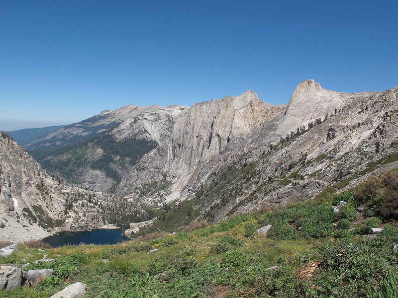
Mt. Gardiner . As I got closer I noticed that the class 3 rocks of this slope could be avoided but I did not bother. I climbed straight up their face until I reached the water channels coming down these slopes displaying some of the last flower beds this area would see for the season.

Like Longely Pass the initial steep climb is then replaced by a casual stroll to the top but before I got there I thought I would walk over to the top of King Col Option 1. When I got there though it did not offer much for views below or a view that could give me an opinion on how difficult it might be so I resumed my trek to the top . When I got there I took note of a single set of foot prints that led into the Col. All I could think was "oh crap". The snow had retreated enough to not be a problem but it was so damn steep looking that I thought maybe this will be my last pass!

As I began down I just couldn't get any solid footing. The dirt was hard packed with small rocks to slip on. Then what larger bits of rock were sticking out of the dirt were crumbly lined with further sand. I did not make it far before the tracks that had gone into the Col. disappeared. That person was smart enough to turn back but I wasn't.

I slowly made my way to the rocks on my left in an effort to use hand holds to help lower myself down. This helped a bit but not much as I very nervously made my way down step by step. Kind of the way a cat moves when it wants to get out of a fight with another cat.

After what could only be called a horrible experience I reached the solid yet slick rocks below and put that pass on the list of "I will never do again".

Making my way down to the lakes below the talus field I crossed was a bit weird in the way it looked like it had a couple constructed switch backs. I could have been wrong and it was just a natural formation but it sure didn't seem like it to me. Finally at the lake the fat lady had sung and I sat to take lunch and gather myself again.

I then crossed around the Eastern shore of the first lake and then for what ever reason crossed the Western shore of the second lake . From here it was time to make the long drop to the bottom. As I started making my way down plumes of smoke began coming up out of the valley. Crap! I thought hoping that there was not a fire in my way since there was not a chance in hell I was going back the way I came!

The lower I got the more smoke blew over making for some interesting views of Castle Rocks . Choppers flew low over head and I wondered if they had caught sight of me coming down out of this area. Finally I could see the flames burning high up the hill side a mile or two down valley.

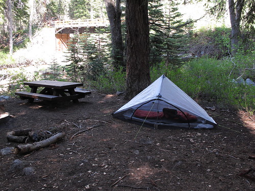
Once finally down I made an easy ford at the first location on Woods Creek I came to which sure felt nice on my tired feet. From here it was the last bit up valley to the suspension bridge crossing for the night. To my surprise no one was here but later two guys came out of one of the more secluded camp sites in the forest and offered me the use of their fire since they were having a trash burning party. I spent the rest of the night chatting with them ending another day.

When morning came it was a horrible sight to see. The smoke was so thick you could not see far and I was just choking on the stuff as I climbed up the trail out of this area. When I neared the Window Peak drainage creek I began searching for the best way to start up. Before I did however I ran into a group of men and had a brief chat with them. As soon as one of them learned that I was going cross country alone with no safety net he called me a total fool and had no interest in talking to me anymore so I went on my way.

Although the first initial bits of rock to climb here needed a bit of of route finding the rest of the drainage proved to be quite easy to travel. Slowly I made my way out of the thick smoke but still could not escape it completely. I passed what in high water would be beautiful cascades but were now only a gentle flow . The first small lake I came to was also displaying the lack of water for the season. From here it was a short climb up to the primary lake of this drainage which displayed nice glacial carved walls. When I left this lake I debated on climbing straight up the inlet but I decided to hook right and go up some easy dry slopes instead. Although this upper portion of the drainage has an aggressive rocky profile it's actually quite easy to travel. For me it was even easier due to the low water levels. I made my way up some small drainages until I came out at my destination lake . I first began looking for a camp site on the Eastern shore but I didn't go far before turning back and heading for the Western lake . This lake was another desolate place to be offering almost no camping. Finally I found a patch of rock I could lay my body on and fought off the high winds for the rest of the day.

Leaving the lake I began up the hill to the East until I was able to pick up a water channel of grassy slopes. I followed this until I could get out of it on my right. I took note of Explorer Pass thinking it looks quite steep from here and made the last gentle climb to White Fork Saddle . This pass did not offer much in the way of views so I quickly began angling left across some talus on my way to the ridge coming down from Peak 12,064. After getting past the initial rocky sections it was quite easy to make this traverse losing a minimum of altitude. Once I had reached the ridge I dropped my pack and admired the view. I looked at Mt. Ickes which I was supposed to be climbing today. Although nothing about it looked difficult the sheer distance of the approach from White Fork Pass was rather unappealing. We'll see I thought as I began the scramble up Peak 12,064. This ridge was quite rocks and sharp. It reminded me allot of climbing along Copper Mine Pass made out of rocks heavy with iron that were rusted. The peak offered nice views of the whole White Fork Drainage. I examined a small cairn on top and found the register. It was interesting to read showing that I was the 5th group to the top and the 9th person at all unless of course anyone else did not sign the register. This sort of interesting history instantly peaked my interest in climbing more remote unnamed peaks.

When all was said and done I retrieved me pack and made the rocky traverse to White Fork Pass. Like many passes from a distance it looked like a very steep scree nightmare but only the final slopes offered any trouble and I was on top for lunch. As I sat on this rocky ridge making the last consideration of climbing Mt. Ickes I decided at last that I would not. The climb from here looked like a several hour event and it did not interest me enough. Beginning down this pass I was faced with one of the types of terrain I like the least. Rocks too big to be called scree and too small to be called talus. The sort of rocks that offer no good footing and are too mixed between stable and unstable to let you relax and you make each monotonous step down .

Finally I was strolling along the desolate shore line below nicely lined with mixed types of rocks adding character to an otherwise dull landscape. I made my way over to the small tarns near by looking for any interesting compositions to photograph. I moved North to the other little lake on this bench and then further North up a small hill until I started angling down a bit through mixed trees and rock. I didn't really know the best way to Bench Lake but I kept moving in a NW pattern until I came out on some cliff sides offering wonderful views of Bench Lake . I was very happy that I had ended up here rather then going straight down the hill through the trees.

I had allot of trouble pulling myself away from this view point but finally I began searching closer for a way down. A couple steep chutes here seemed to offer a way. I settled on one with a strange pink soil surface that I had never really seen before. This may not have been the best idea as before I knew it I was in a very nasty class 3 chute that was reaching outside my comfort zone. Step by step I slowly made my way down meticulously picking my way through this technical descent until it dumped me out on an extremely unstable talus slope.

After all the trouble I finally found myself on the shore of Bench Lake which was as wonderful to see up close as it was from higher up. I set out around the Northern shore looking for camp sites as I went without luck. Half way across the lake I found a spot that had evidence of many illegal camp fires broken up. Still not satisfied and wanting to see the Ranger anyway I kept hiking on the trail until I was near the outlet and a man across on the other side called out to me and we had a chat. I asked him where the Ranger station was and he said that he could not find it. He said it was not marked and that his GPS had a marker for it but when it said he was 50 feet from it and still could not see it then he gave up. So considering this and the fact that I was at the end of the lake I turned around and went back to the spot with ash everywhere. I then took note of how my National Geographic map did not show a Ranger station for Bench Lake so I gave up on the idea of going to look for it myself.

While finding a place to put my solar panel I found a great deal of camp sites up the hill which were all unappealing and trashed. I may have enjoyed the beauty but camping at this lake offered me no enjoyment.

After snapping the reflection shot of the morning I took off North straight out of my camp. At first the hill began angling down amongst the trees and was easy walking but I quickly came to large granite slabs that I could not go down. Staring at the beautiful view kept me from getting frustrated and I started moving West along the slabs until I found a large run out of talus. Getting into it I had to get down some easy micro cliffs and then it was a stable talus hop nearly all the way down. At one point I ended up on some micro cliffs that was more in the lines of a class 4 climbing move but certainly could be gone around if you tried.

Reaching the South Fork it was a ford but just barely. The water was amazingly low for still being on the early side of July. When on the other side I began seeing relics that always fascinate me from older times in the Sierra. The typical tin, a tea cup and I found a tree that had markings on it from 18??. I thought it said 1886? but that seemed a bit old. I began towards the slope and was lucky that I came across the river right about where the trail begins switch backing up. What was left of this old trail began to tackle the slope with a fury and it was quite a labor to get up . At one point I lost it for a hundred feet or so of climbing but managed to pick it up again long before reaching the lakes above. Once there I sat and ate lunch looking at all the little unnamed peaks I would like to climb just to see what I might find on top.

After following the trail around the East shore I lost it as I began up the grassy slopes. At times I picked it up but made no effort to follow it since there was no reason to. Once near the small lake below the pass I was able to pick up the trail again and follow it all the way to the pass. I had an urge to climb Mt. Ruskin but I fought it off and began up towards Peak 12,176. In about 20 minutes I was on top . The register hadn't been signed in 4 years and there was at least one name in it that meant something to me.

The peak offered a nice set of views all around and once I had taken it in enough I went back down to my pack and started down into Lake Basin. Although a girl I met on the slope above the South Fork said there were a couple sketchy bits on this pass I generally did not find it to be of any trouble. I made use of the old trail until I dumped out at the bottom and began around the West shore of the lakes below. I had made this decision based mostly the time of day and the layout of the basin. It was getting later and if I had taken the East shore I would be taking photos into a setting sun so that was no good!

I made my way through the basin passing one murky lake at a time until I reached the L shape lake that was quite beautiful. From here I followed the outlet down which was a mixed way to go. In order to avoid very large talus I stayed on the North side of the creek which had me making my way down some small cliffs that were difficult but I managed to get down in one piece. Everything was great until I entered the trees and began getting assaulted by mosquitoes like a horde of angry bees! I marched down the creek not daring to stop until I reached Marion Lake . I made my way over to the Eastern shore and decided to stay in the same camp I had the year before. It was illegal since it was too close to water but the other sites near the outlet were not appealing. The next day I would learn that up the hill from this spot are a couple good locations.

Although I was happy to be back here it seemed just wrong that the mosquitoes were worse here then any place I had camped at yet and would camp at for the rest of the hike! What sort of treat is that from your favorite lake! That night it rained at 1am breaking the cycle once again.

The next day was my first backcountry layover day since the Kern Hotspring. I set out around the West shore taking photos and wondering why the lake was not half as blue as it was the year before. While exploring the area I was looking for something very specific. I had planned to look for it since before I began this hike and was delighted that I found what I was looking for. This however I cannot say what it was.

Continuing to explore I made my way over and up the inlet coming into the lake from the West. This dumped me out to where people have to choose which chute to take down to Marion . I decided I wanted to try and find the way into the proper chute furthest North that almost everyone misses but the only way I found to get into it involved one difficult down climb. After that it was an easy stroll down and back to camp.

While relaxing in camp I spotted 3 people just making their way down to the lake. I could tell even from the other side of the lake that it was 1 man and 2 woman. I went over and had a talk with them. The 3 of them were from Germany and had no idea at all that they were following the Sierra High Route. They had just wanted to explore some remote basins and saw the ridges that looked crossable on the map and ended up following exactly on the SHR.

A couple hours later 2 more people came down and I had a chat with them and finally near sunset 2 more guys set up camp at the lake and I sat and ate dinner with them. I certainly was not expecting to see 7 people on the same day here but it was a good way to end week 7.

Re: 111 Days In The Sierra
RoguePhotonic #41104 11/30/14 05:08 PM
Joined: Dec 2009
Posts: 558
OP Offline
Joined: Dec 2009
Posts: 558
I know this is certainly a long time coming but people have been bugging me to actually resume these things.

WEEK 8

MAP

As I left Marion Lake I took the same path I had taken the year before. Up to the two small tarns and over a small saddle and then between the two lower lakes of Lake Basin. Climbing up the hill and nearing the small lake on it I ran into two guys making their way up. We chatted for a bit and started hiking together from here. This year there wasn't much snow to be crossed which meant a whole lot more talus hoping to the bottom. When we reached the shore line we began out around the South Western shore. When we reached a wall with what to me was an easy class 3 move one of the guys said he was not going to do it. He promised his wife he wouldn't! So ultimately he resorted to wading through the lake. When we were close to the outlet we stopped and ate lunch for quite a long time. I was supposed to be crossing what I call Observation Peak Pass today but after so much time I decided to stay and camp with the guys here at Dumbbell Lakes. We located a site on the Northern shore and I was amazed to see an illegal fire pit here considering there was hardly a stick to burn.

The next morning we just couldn't break away from chatting. By the time we finally got moving it was about 2PM. These two were heading down into Cartridge Creek from here. I would later learn that one of them had a nasty fall and punctured a 1x2 inch hole in his ankle all the way to the bone. It would then take him 3 days to get out of the wild.

After all the lagging it would required me to cut out the extra day I had planned for climbing Mt. Sill. I dropped down to the lower basin and made my way over to the longer lake here that had a nice NE shore line. Since I had no real information on this saddle I was going on visual navigation only. I made my way towards a cut in the rock lined with some willows. Getting there it was mostly easy yet the slope also had some Rose bushes to climb through which are always the worst. After one more difficult pitch the slope levels out by a small tarn lake. From here it was an easy stable talus climb to the top. I had never planned to climb Observation Peak but since I was here I figured why not.

I began scrambling up the West slope which had plenty of class 3 rocks to get over but mostly proved to be easy. In about 30 minutes I was on top. The view was certainly worth the climb and I took note of a few names in the register I recognized. Once I had soaked up all the views I made my way back to my pack and started down this unknown pass to me. It started as a mess of smaller loose rock but quickly turned to larger slabs of multi colored rock. Most of the way was really easy and when nearing the lake I began down a grass ramp to my left and it ended at some sketchy cliff sides. I knew there was a nice grass hill side the other way but I felt too lazy to walk the small distance back up the hill so I began looking at the cliffs more and decided I can do this. Big mistake! What started as a vertical class 3 climb quickly put me onto class 5 slabs. I had to retreat from a couple different faces I tried to cross and then to my dismay my water bottle fell out and went crashing down and off into the unknown. Damn it! I yelled! WTF am I doing out here on this damn cliff face when a nice grass ramp is right over there!!! It's right there!!! RaaRRww. Finally I had to resort to lowering my pack down by rope. When it came to a rest I paused for a minute to make sure it was stable. Yep it's good... As soon as I threw the rope down the pack tumbled over violently smashing down another 10 feet. I was a tea kettle starting to whistle! I got onto the slab slope that had no hand or foot holds of any kind and maintained a friction climb as long as possible before I could only slip and fall to the bottom. I retrieved my pack which was damaged slightly but my bear barrel was okay. After some searching I was able to locate my bottle and finish the descent to the lake. This was a beautiful area and a glacier smoothed slope across the lake really caught my eye. I had never really seen anything like it before. I took note of a very large pile of bear scat and found a wonderful smooth rock to lay out on for the night.

When I awoke I noticed the lake was putting on a nice reflection shot so I grabbed my camera and took a photo while still in my sleeping bag. One of the things I noticed about this lake was how completely pristine it was. Not a single sign of humans could be found around the area. Not even a balloon! I made my way around the Western shore until a small hump went into a tarn. I was told that this was a better way to get around to the outlet but this little tarn proved to be a bit difficult to get around since both sides of it had either micro cliffs or smooth granite slabs. Once I had gotten around it I began down the hill and quickly realized I was going the wrong way and hooked hard right up over a hill and down to the outlet area. From here it was pretty easy to move North over to the next small lake which was full of water fleas. Near this area I dropped my pack and started off to climb Peak 11,255. My driving force on this peak had been solely based on it's location on the map. It looks like it might be a great view point. The first challenge was moving North up a small hill to what I now call Adventurer Pass.

I started down the unstable talus to a point where I could cross along the slopes to my left. Unfortunately these slopes were very loose and difficult to travel. As soon as I could I began making my way up but the slope was so steep it was very difficult. I began making my way through a mess of mixed terrain with lots of small cliffs. I approached a V notch in a vertical wall and thought it looked like a 5.11+ but that I might be able to get up it. I began up but the holds were only the size of my finger tips at best and they were not squared off but smooth bumps facing downward. I only made it about 6 feet off the ground and decided this was no good so I retreated back to find another way.

After large talus fields, incredibly steep hill sides and more unstable rock I rounded a bend and was on a more casual hill side mostly covered in granite slabs. From here it was a much easier hike until I finally reached the base of the peak. I primarily stayed on it's Northern ridge as I zig zagged through sparse trees and loose sandy slopes.

When I reached the summit I was surprised to see a cloud of insects flying around on top. They looked like little wasps but they did not sting as I quickly found them climbing all over me. There was a strange smell coming out of a rock that they were most heavily concentrated around. There was a small cairn on top but no register. I left a small pill bottle with some paper in it but I had nothing to put into it to write with. Although the peak offered wonderful views it was not quite as good as I thought the view up Leconte Canyon might be. When it was time to go I began down the East slope this time and back tracked to the nasty steep slopes near Adventurer Pass. This time around I really wanted to avoid the loose steep slopes so I decided to try and stay higher up and make my way as close to the pass as I could get. This still proved to be very difficult and I finally ended up along a mess of cliffs. I picked a vertical land slide chute that was filled with loose dirt from recent slides. This had the effect of blasting me in the face with dust as I tried to make my way. The slopes around me looked like they could go at any moment but without incident I was down and went back to my pack. I sat and ate lunch as the weather began turning on me. I hadn't even finished eating before rain began to fall and thunder sounded right over my head. Luckily the main wave of the storm did not stay over me for long and moved on staying away from me for the rest of the day.

I began up the outlet to the East coming from an unnamed lake. One section involved some class 3 talus work as the rain came and went. The lake itself was a nice isolated spot that was humbling. The lake had a beautiful blue in it's depths. I went around the Northern shore and began straight up when I was about half way across the lake. When I topped out The views displayed all the fury of the storm raging in locations all around. I looked up at Mt. Shakespeare and knew I could not make the climb in this weather.

My next goal was figuring out how to get to the lake below. A large chute was leading down to it that looked doable but I could see from up here that the Western shore of the lake could not be crossed and since I could not see the Eastern shore I did not want to take the risk of climbing all the way down and not having a way around so I moved NE along a mass of granite shelves. Navigating this was not the easiest task but I found my way and finally picked up the slopes that would take me down to the shore line.

While making my way down I stepped on a rock with a bit of dead black moss on it. My foot slipped out from under me and in a unison moment I went falling to the ground while bellowing no! as my trekking pole went flying over the cliff side. After recovering I climbed down the cliffs to try and find my trekking pole. I could only see the tip of it stuck on a rock outcrop above so I had to drop my pack and climb up for it. When all was technically well again I began making my way down but doing so was difficult among all these small cliffs. Too many of the surfaces were wet with black moss on it making for dangerous trekking.

While climbing down this difficult rock face my trekking poles were causing problems. I could tell a patch of the slope below was mud so I went to stab my trekking pole into the mud and it hit a rock and bounced my hand into the rock face cutting it up some. Finally after the long battle I was down at the shore line. Looking at the lake it turns out the Eastern shore was also impassable so I made the right choice to avoid the chute.

I made my way to the outlet and then hooked hard right onto the slopes and began moving NE on mixed terrain towards a small saddle. Looking back at Peak 11,255 the slopes looked steep and nasty from this distance. Once I had crossed the small saddle it was time for the long tedious slog to the bottom. A seemingly endless mess of my least favorite type of terrain. After I passed all that mess I then had to push through small pine trees that were soaking wet leaving me wet also. Then the last bit of fun was moving through a mix of micro cliffs in a burn zone littered with downed trees. Finally I reached Palisade Creek and made the ford and pushed on looking for a camp. After a few poor choices I found a decent enough place and got set up just as the last of the useable light faded. It was perhaps the only time I can recall doing laundry in the dark.

The next morning I had not been on the trail long before it opened up and began to pour! It was around 9am which was pretty early for such a display. This made climbing the Golden Stair Case a bit more difficult since wearing a rain shell was so hot. By the time I had reached the top and was ready to begin up Cirque Pass the rain had broken long enough for me to eat an early lunch and get moving again.

There was nothing difficult about climbing Cirque. It's just a slight maze of zig zaggin along the terrain finding the easiest way to go. The rain continued to come and go offering stormy views of the Palisade Lakes. Once I had topped out I began down the slope a bit too directly. The proper way is to move East a bit before dropping down although I didn't know it at the time. This led to a few difficult class 3 shelves to down climb but before long I was at Lake 11,676 From up high I had seen nice DG pools near the outlet where I got set up, enjoyed the views and hid from the rain the rest of the night.

Come morning my next goal was Potluck Pass. What I read had told me to go to the left up some sandy slopes. These looked horrible to me. I did not know at the time that there was a nice use trail leading up them. Instead a small grass ramp was going up the middle of the pass and I decided to take that instead. There was only on difficult section class 3-4 but I made the top easily enough.

From here it's smooth terrain to the Barrett Lakes where I took lunch and then hiked around to the West side of the lake to get a view across at North Palisade. Moving on I began up Thunderbolt Pass which once again was easy enough. Grass ramps to granite ramps with some talus hoping but not much. The North side is a different story. First you are confronted with some car sized boulders which can be difficult to get through but then the rest of the medium to small talus is quite stable and an easy stroll. Then down a mix of shelves and you find yourself at the upper lake in Dusy Basin.

After another night sleeping on a rock I got up in the brisk morning air much earlier than normal Since the prospect of food was calling me. I made the trek over Bishop Pass and down to Parchers where I picked up 2 cans of chili 8 ounces of cheese, 2 bags of chips and two sodas and hiked down to Willow Campground where I managed to get a site since it was still so early. I ate all my food leaving me in a food coma. That night I enjoyed good company with other hikers who bought me dinner at Bishop Creek lodge. I spent the next day doing my typical layover routines ending week 8 and preparing to head into even rougher cross country.

Re: 111 Days In The Sierra
RoguePhotonic #41106 12/01/14 05:37 AM
Joined: Nov 2009
Posts: 1,037
Likes: 6
H
Offline
H
Joined: Nov 2009
Posts: 1,037
Likes: 6
Originally Posted By: RoguePhotonic
I know this is certainly a long time coming but people have been bugging me to actually resume these things.

well worth the wait. Many thanks for doing this.

Re: 111 Days In The Sierra
RoguePhotonic #41108 12/01/14 07:50 PM
Joined: Apr 2012
Posts: 579
Likes: 3
Offline
Joined: Apr 2012
Posts: 579
Likes: 3
Hi Rogue,
Sounds like a bit of a rough week.

Love your trip reports, and photos. Have you considered an album of "just peaks", with gps data, so it could be seen on a map? Most impressive I would imagine. Many peaks up and down the Sierras.

John

Re: 111 Days In The Sierra
RoguePhotonic #41109 12/02/14 01:51 AM
Joined: Sep 2009
Posts: 8,509
Likes: 103
S
Offline
S
Joined: Sep 2009
Posts: 8,509
Likes: 103
I just love following your route on the map, seeing places where you crossed trails and routes I once walked. But your route is so incredibly rugged -- just heading cross-country getting from point A to point B.

If there is a trail part of the way, fine. Otherwise, you just go. cool If only I had lots more time, I would do a trip like yours.

Re: 111 Days In The Sierra
RoguePhotonic #41110 12/02/14 07:00 AM
Joined: Dec 2009
Posts: 558
OP Offline
Joined: Dec 2009
Posts: 558
I've done plenty of peaks in the Sierra but I don't think my list is all that impressive compared to so many others. I have only done like 80 peaks in the high Sierra. I've always thought it would be good to have a website on the Sierra broken down with images of every place. Maybe even a system where if a lake is listed but has no photos people can upload their own.

The funny thing is that route from week 8 is such easy terrain to me now. I went back to allot of that area this past summer and it was such a huge relief to be on such easy cross country terrain.

Last summer I left the trail in Goddard Canyon and went up North Goddard Creek past Davis Lake, crossed Wanda Pass into Ionian, climbed on top of the Ragged Spur and traversed it to the small lake way out on it. Went back across it to Chasm Lake, down the Enchanted Gorge to Goddard Creek and then up over Rambaud Pass and down to Leconte Canyon. It was 11 days with no trail on the worst terrain possible with horrible misery day after day! The guy that was foolish enough to follow along with me kissed the trail when we reached it.

Last edited by RoguePhotonic; 12/02/14 07:04 AM.
Re: 111 Days In The Sierra
RoguePhotonic #41111 12/02/14 02:40 PM
Joined: Sep 2009
Posts: 8,509
Likes: 103
S
Offline
S
Joined: Sep 2009
Posts: 8,509
Likes: 103
> The guy that was foolish enough to follow along with me kissed the trail when we reached it.
grin grin

> I've always thought it would be good to have a website on the Sierra broken down with images of every place
I think Google Maps has the capability to upload pictures linked to a location, but then it covers the entire world, so I'm not sure I would use it.

The above report is from 2012, right? Did you do any major hiking this past summer?

Re: 111 Days In The Sierra
RoguePhotonic #41112 12/02/14 05:57 PM
Joined: Dec 2009
Posts: 558
OP Offline
Joined: Dec 2009
Posts: 558
Yeah I did 130 days in 2013 and this last summer shorter at 86 days. This coming summer I probably will not do more than 75 days or so. Already have most of it planned though.

Re: 111 Days In The Sierra
RoguePhotonic #42301 04/23/15 08:58 PM
Joined: Dec 2009
Posts: 558
OP Offline
Joined: Dec 2009
Posts: 558
Week 9

MAP

Every time I leave Parchers I have a bad habit of eating way too much due to their all you can eat buffet breakfast and then socializing with people inside that leaves me hitting the road quite late feeling so full I wish I hadn't ate so much. So by about 10PM I literally hit the road and began walking the mile or so to the trail head. Like any resupply of 14 days the pack weighed me down as I began back in for a section of rugged cross country. The Bishop Pass trail is well graded and the 7 miles to the top of the pass is generally easy and filled with beautiful views. Once over though the miles begin to set in as the pounding down hill through Dusy Basin always leaves me extremely worn out. My goal had been to reach the junction at the Muir Trail but by the time I dropped to the camp below the 10,000 fire line sign I had had enough and set up camp.

Resuming the next day my route took me through the Ranger stations location. I knew George Durkee was supposed to be there and I had wanted to meet him. When I reached the junction there was a prominent sign detailing that the new cabin was being built and not to bother them unless it's an emergency that was under lined 3 times. I thought about giving George crap about getting too old to deal with all these JMT tourists asking the same questions for 30 years but I decided to pass on by the cabin with just a wave. I thought maybe they wondered where the hell I was going as I took one of their use trails to a place that clearly one of them camps out. Luckily this lead me right to a downed tree that took me across the Middle Fork.

The initial hill side was extremely steep and fatiguing yet was a clear open forest. This generally continued until the grade began to lessen and I made my way up the creek to a flat meadow area . I took a break and enjoyed the views of the triple drainage coming down marked by two water falls. I began up into the drainage that was fairly straight forward until you get into the steeper narrows of the chute. The water levels were low so I did not get wet but I took note that if this route was taken early season you likely would be fighting your way up water falls. As I climbed my final pitch up a cliff side and reached the top I suddenly became aware that I was surfing! The rock I had climbed on was going over the cliff with me on it! I quickly leaped off as it went crashing over the edge and roaring down the chute below.

From here it was mostly smooth sailing as you talus hop along to the smooth slabs heading up to Hester Lake. When I reached it I admired the beautiful blue water in what can mostly be considered a rather dull and desolate lake . Other than the spectacular views looking back at the Palisades that is!

I began looking for evidence of the plane but could find nothing at the moment other than a human crafted piece of wood near the outlet and what looked like battered clothing in the water. A bit of an ominous reminder of people dying here.

The lake offers little camping but I found a nice rock to lay out on and staked my claim for the next two nights.

Come morning I began moving along the NE shore on my way towards Langille Peak. I quickly began seeing pieces of aluminum scattered along the shore line. Mostly small pieces with some glass, wiring, netting and general small pieces scattered around the area. A year later I would learn there is a register at this crash site but I never located it.

Once I was satisfied here I began angling towards the low saddle on the West ridge of Langille. Although a bit tedious at times it was fairly easy to reach the ridge line. From here it was a different matter though. Once I had crossed the hump on the ridge it turned into a rather technical class 3 traverse that slowed me down quite a bit but in a reasonable time frame I reached the summit . An old rusty can held a register left from a Leconte Ranger. I checked the entries to find one a month old and then wait what!? After not being signed for a month someone had signed it today! A single person noting they climbed the East face. So they came up signed it and left before I made it up. I spent some time soaking up the awesome views and began making a better route back. I dropped down the SW face on mixed talus and sand and hooked back to camp.

Leaving Hester I went to the lake just South and began making my way through the large talus field between lakes. While out in the middle of a huge mess of talus I found a random cairn. The type of cairn the just makes me wonder since it marks absolutely nothing other than another person has passed by this exact spot.

I made decent time passing the rugged yet scenic lake below what I call Ladder Pass. The North side of the pass itself proved very easy aside from a few loose sections of rock. I slowly made my way down the South side until I reached a more level section below. From here your presented with two route options. Head straight towards the lake or go right and follow down the drainage. I decided on the straight shot. All through this option I saw cairns marking all sorts of needless paths.

Finally I made my way down the last talus filled slope into the trees on the North shore . I took lunch and scouted camp sites without luck. I passed around to the South shore taking note of the fact that this lake was beautiful from all shore lines. On the South side was a number of camp sites but they did not appeal to me. I wanted to have a view perhaps after being spoiled of my view from camp at Hester Lake. So I climbed out on a large outcrop over looking the lake and found a mostly flat rock to just lay out on. It was so early I seriously thought about just climbing the Citadel today but I never mind just laying around camp soaking in all the beauty so instead I decided to go for a dip. I went down to the shore and began to strip when suddenly I heard voices. I look up to see two people coming down the hillside towards the lake. What? Really!? I thought. I never thought I'd see anyone up here but here they came. When they reached camp I went and said hello. One of them was Elizabeth Wenk author of a JMT guide book and a completer of the SPS list so I had plenty to talk to her about. The two of them set off to climb the Citadel as I went for my swim.

The next morning I made my climb up the Citadel which proved extremely easy with some fun class 3 just before the summit. It had taken me about an hour and a half so I just sat on top and enjoyed the views for awhile. On my way back to camp I found the typical Sierra balloon .

Leaving Ladder Lake I decided to take the drainage route which was easier than the way I had taken. In fairly decent time I climbed my way back up Ladder Pass and rounded the shore of the lake below. I began up the slope I call Black Divide Crossing which in the beginning was easy enough on small to medium talus. The closer you get to the top the larger and more technical the rocks become. I was still sporting 9 days of food so my pack wasn't exactly light. After plenty of technical class 3 I topped out on the ridge offering great views and an extremely satisfied feeling of conquering a route that I had absolutely no information on. I was simply going on topo maps and visual confirmation. For all I knew I was the first to climb this ridge so I couldn't have been happier that I hadn't been shut down horribly. Dropping down the West side of this route is tedious at best. Rock too large to be scree and too small to me talus. Perfectly stable and unstable at the same time yet without issue I found myself at the bottom and then making the climb up the 3rd pass of the day which I call Ionian Pass. Luckily this time around it was class 1 to the top. Dropping down was just more tedious all the way to Lake 11,828 .

Getting there I found some sites that were not good enough to effectively set up my tent. To my despair the weather had begun to turn and the rain began to fall. I had tried and failed to set up my tent free standing. I then decided to climb in and just lay in the downed tent but it did not take long before I decided this was not going to work so I kept messing with it until I got a half assed tent set up long enough to weather the storm and then I broke it back down and slept on top of it.

Setting out for Charybdis I really had no information on climbing it other than to take the North ridge to the summit. This starting simple enough on the easy slopes . I just kept climbing the North ridge looking up at what I thought was the summit.

When I got to the top of this scramble I certainly was not on the summit yet. A high point of rock had to be passed and I decided to go left. Doing this involved a rather strange move with allot of exposure. When I had passed this obstacle I kind of laughed that a cairn was marking to take the other way. Next I had to round another high point on the ridge. This time I went right onto some tiny ledges. These went left then right as I had to make use of hand holds that were far above my head and shimmy inverted a bit with allot of exposure below me. Once beyond this I found myself at a cliff face that dropped down about 10 feet. At first I could not find a way down and knew that I had taken the wrong way in general to maintain the class 3 rating of this climb. I climbed out onto the face of this wall and began down what I can only describe as the most difficult down climb I had ever done. From here it was an easy class 3 climb to the top .

The summit itself was an aggressive mess of rocks that offered no comfortable place to sit. The views all around were wonderful to see. It was so early I had nothing better to do for awhile then sit and enjoy the view.

I decided to hike to the Eastern most bit of the summit in order to get an unobstructed shot looking East. When I got there my camera while still in it's padded case slipped from my hand and smashed down on a rock. When I took the camera out it had impacted directly on the corner of the LCD screen and broke it completely. I could see nothing more than colored lines! This was horrible to say the least since I could no longer see any data when taking a picture or even knowing if they were being taken at all. I switched to auto mode and made use of the horrible eye glass piece.

Leaving the summit I made my way off the NE face and then cut across to the North ridge which although had plenty of class 3 remained as such.

Back at camp I sat and felt such despair at this turn of events of breaking my camera. Taking pictures out here was so important to me and things had been going so well in this rugged section. The last thing I wanted to do was head out but it had to be done. I would re plan the rest of this section and tomorrow I will begin making my way out to Florence Lake to deal with this problem.

Last edited by RoguePhotonic; 04/23/15 09:20 PM.
Re: 111 Days In The Sierra
RoguePhotonic #42400 05/02/15 07:16 PM
Joined: Dec 2009
Posts: 558
OP Offline
Joined: Dec 2009
Posts: 558
Week 10

MAP

After hatching a plan to get a new camera I set out across the rugged landscape of Ionian Basin heading for Goddard Creek Pass. Other than the tedious drop down from Lake 11,828 it was an easy trek past a small lake then after passing Chasm Lake my route was slowed down a bit by taking the route directly in the creek up to Lake 11,582. This involves allot of class 3 boulder hoping that is stable but slow going. After doing this a second time in 2014 I finally realize that climbing the Western slope of this drainage offers a far easier way. Once at the lake thankfully it was much easier to pass around Lake 11,582 and on up to Lake 11,837 both showing off the pure desolation and harsh geology of the area. This lake however is much more tedious to get around with a number of class 3 moves and a horrendous population of shore flies that threaten to give you some extra protein for the day.

After passing the particularly annoying sections on the South Western shore I topped the saddle here and passed another nameless body of water . At this point I was rather annoyed that the conditions for the day were providing for excellent photography and at the time I had no idea of knowing whether my camera was even still take pictures or not.

As I dropped down to Lake 11,818 with Goddard looming before me I once again cursed that I was on my way out rather than climbing up that beast! I'll be back for you yet!

Reaching Lake 11,951 from it's outlet I once again was pushing around a tedious shoreline of perhaps one of the most desolate locations in all of the Sierra. Hardly a blade of grass can be located as you tramp along a forgotten land. One final push to the pass remains and thankfully it was an easy one as I neared the top admiring a shore line in which I will never traverse.

As I began down the easy West slopes of the pass I made use of a faint use trail. Dropping to the lake below I was debating on which shore line to take. A potential cliff which I would have to climb around or a nasty snow slope offering disastrous consequences if one should fall. I chose the former and was not disappointed.

This choke point of the route is the most obvious yet tedious on sharp rocks. It's not until the final drop to Martha Lake that you have to make a decision about how to drop down past a small mess of cliff bands. While on my way down the rain finally began to fall and I caught site of a lone man hiking quickly along Martha Lake. From this distance he looks like Aragorn from Lord of the Rings since he had a large cape like rain coat on as he moved quickly along.

As quickly as the rain came it went as I hiked along Martha Lake. I came across a nice pair of trekking poles leaning against a rock. I thought perhaps Aragorn was camped near by and they belonged to him so I left them.

I made my way down the San Joaquin to the same campsite below the fire line I had used the year before. Before getting there however I caught up to Strider who had returned to camp and his wife. Chatting it up with them they asked me if I had seen some trekking poles and they weren't too happy about hiking miles back to the lake to get them in the morning.

The next day was far less eventful as I figured making my way all the way out to Florence was not practical in regards to getting anywhere on the road so I just hiked down to the Blayney Hot springs. In the evening I put a change of clothes on a rock outside my tent and set out for the springs. When I got out in the river I looked up to see the sky had clouded over completely again. That is not good I thought...Maybe I should return to put my clothes away but decided to keep going. While in the hot spring by myself all hell broke loose! Rain and hail began pouring down. Lightning bolts were flying right over head! What an awesome place to watch the storm I thought as a massive bolt struck the hill side in front of me and the whole area around it glowed for a second. I couldn't have been happier until I returned to my camp in the dark to find my clean clothes soaking wet.

The next morning I made my way out to the Ferry landing and tried to radio for a pickup but there was no response. Over the next couple of hours a group formed and I secured a ride with them at least to the junction heading for Vermillion. Once there I took to the road. Although plenty of cars drove past me in which I would step off the road since their was no room I made no effort to signal for a ride. Once I had passed the junction to Mono Hot springs a car came pulling up with a familiar face in it. The young girl asks me "are you Chris Ryerson?". It took me a moment to remember Marie from VVR the year before. Her and Brian gave me a ride the rest of the way getting me there by lunch time.

Since it was Saturday other than the food logistically it was not ideal. I decided to order a Canon G1X and use over night mail. When ordering a 40 dollar spare battery it cost 50 dollars to ship over night! This still meant that it would not ship until Monday, arrive at my house Tuesday and my grandmother brought it up Wednesday. When she arrived she exclaimed that if she had known the road was that horrible to get here she would never have came. I got her a trailer to stay and tomorrow I would return to my route with a fresh new and better camera and 1600 dollars less in funds.

On her way out she gave me a ride to Florence Lake and I caught the Ferry across. Sky Crane helicopters were battling a fire burning near by from the lightning the night I was in the hot springs. Due to how all the mileage worked out I only made my way back to the Blayney Hot springs and ended another week in the Sierra.

Re: 111 Days In The Sierra
RoguePhotonic #42403 05/03/15 12:52 AM
Joined: Sep 2009
Posts: 8,509
Likes: 103
S
Offline
S
Joined: Sep 2009
Posts: 8,509
Likes: 103
Nice, Chris.

I made it back to Mt Goddard one time years ago. So long that my friend had his first cell phone, and we were able to make a call from the summit -- analog days. I doubt the digital service these days could punch out that far. I remember thinking the fishing in Martha Lake should be good.

Funny about your grandmother and the camera. That road up to VVR is so long and torturous, especially if she came from Bakersfield! Poor woman!

Re: 111 Days In The Sierra
Steve C #42404 05/03/15 04:30 AM
Joined: Oct 2009
Posts: 2,251
Likes: 1
Offline
Joined: Oct 2009
Posts: 2,251
Likes: 1
I remember being driven over that road... Driver stopped the vehicle & treated us all to a technicolor yawn. Very unusual for the driver to succumb to motion sickness.


Verum audaces non gerunt indusia alba. - Ipsi dixit MCMLXXII
Re: 111 Days In The Sierra
wagga #42421 05/05/15 07:10 AM
Joined: Jan 2010
Posts: 1,034
Offline
Joined: Jan 2010
Posts: 1,034
The road up to VVR it is my favorite road in this country - at least for entertainment value, and the destination is well worth it. Don't complain about it being tight until you've driven in places like Corsica, where the locals drive like they have no strong desire to continue living, while you are dodging their speeding Citroens all puckered up, hoping not to drop over the edge of a cliff while avoiding these maniac Sebastian Loeb wanna-bes. sick

The guy who delivers fuel to the generators up at Florence and VVR really impressed me one year when I had to follow him for the final part after Kaiser Pass. He is driving this big old tanker truck that appears far too large for the road. In many places he sits hanging over the abyss as he makes turns with the truck's front wheels turning behind where he is sitting in the cab, barely on the road. His dog is always riding shotgun smile

Re: 111 Days In The Sierra
RoguePhotonic #42799 05/31/15 08:36 PM
Joined: Dec 2009
Posts: 558
OP Offline
Joined: Dec 2009
Posts: 558
Week 11

MAP

Once again I find myself on this stretch of trail. Hot, dusty and crowded with people. How many times have I hiked this? How many more times will I? Too many I think as I trudge along past the bridges and on up canyon . It's not until you pass the junction heading for Evolution Valley that you can enjoy any sort of solitude and will begin climbing back out of the heat of the lower levels of the range. I made my way back up to the same camp below the fire line just before a small shower came and went.

Retracing my steps determined to resume what I had began I went up canyon back to Martha Lake and on up Goddard Creek Pass. This time when I had reached the small lake below the top of the pass I took the left option.

When I reached Lake 12,280 I saw a single location to camp. It did not look big enough for my tent and it was so mixed into the rocks I did not think I could even set it up anyway so I kept going around the Southern shore looking for a place without luck. Once I had reached the East shore I managed to find a single rock that was just big enough to lay my body on. I thought this would have to do and hopefully it wont rain but that notion lasted about 2 minutes as the rain began with large drops. I quickly took out my tent and laid it over the rock and stuffed all my gear into it to protect it. Before I knew it the rain was ripping down and lightning was sounding with ear deafening cracks over head. I was completely exposed up here so I just hunkered down as close to the ground as I could get and sat in the rain getting soaked. I had my rain shell on but my pants were not even water resistant. At one point I was just laying on my back on a flat granite rock staring into the raging abyss above me. I was cold and miserable as the storm raged around me for the next 2 hours while I helplessly lay out in it. When the madness finally stopped I checked my gear which had got quite wet from condensation inside the tent due to rocks warmed by the sun earlier. I decided to hell with this and packed up my stuff again and went back around the lake to that crappy little spot I had seen. When I got set up there however it proved to be quite nice and I actually was able to drive almost all my stakes into the ground. If I had just set up here in the first place I would have avoided all this trouble! But then again I would have missed all that fun!

Next to this spot there was a few rocks tied together with a rope. When I looked at them closer I found a small medicine bottle under it with some paper inside. It was the first lake register I had found before.

When I tried to get water from the lake I could not get any that was clean. The water fleas were out in the millions! As far as I could see out into the water was clouds of large water fleas. Closer to the shore they were too small to see until after they were in your bottle. The Red Copeopods were also out in force. I tried everything I could to not get any in my bottle. I even tried to run water through my shirt but it would not work. I finally gave in an drank the damn fleas.

When it was getting closer to sunset I decided to hike over to a small hill looking out on the basin. Looking South towards the Middle Fork of the Kings earlier the storm that was raging was so black it was like an abyss of destruction. "My god, who ever is over there is getting fucked up!" is all I could think as lightning bolts sprung from the darkness left and right. The sunset came and I ended this chaotic day.

Come morning I set out to climb Mt. Goddard. The entire way around the shore and beginning up the East slope of Goddard can only be described as tedious. It's small sharp rock plenty loose but technically easy. Far off I could hear talking. It was not until I had topped the ridge and was on my final push that I spotted a large group of people on the ridge line described by some guides as a way to climb Goddard from Wanda Pass. Ludacris is all I could think when I looked at the route from many different viewing angles.

On top the view was certainly all encompassing as I had heard. Unfortunately for me most of the view was washed out by the early morning light and plenty of haze. I sat on top for as long as I dared while the storm clouds steadily grew. I retreated back to camp and made it before all hell broke loose once again. Hail, lightning and plenty of rain for about 3 hours but thankfully this time I was dry.

Leaving this lake I took the route down the outlet and on to 11,951 . I decided to go straight through a hump in the terrain which led directly to 11,818 . The only difficult part was the steep chutes here you had to take down to the lake. I was supposed to be heading to the lake below Scylla in order to climb it but the weather was turning fast once again. I knew I would not be able to climb it today as planned and the thought crossed my mind whether I would find camping or not at the lake and to my surprise this lake offered beautiful sandy places to camp. There were actually a couple trees clinging to life. Not only are they the only trees I have seen anywhere in Ionian but after four trips this clearly is the best camping in all of Ionian also so I set up camp before lunch and stayed dry.

Climbing around the shore that evening I was fascinated by the nature of the geology. I examined every bit of the terrain and enjoyed the setting sun. I floated along in some sort of strange Dr. Seuss induced state making a rhyme story as I glided seamlessly along the harsh terrain. " Ms. Grouse she was near, I said do not fear I am going to the view that is near over here! - She seemed upset but did not fret as I went to the left over the cliff in which she sat". And on it went as I hopped along increasing my pace as the alpine glow was going to peak soon. I reached a nice vista looking out on the White Divide and Goddard Creek. I stared into the marvelous scene in front of me only I could hardly say I was me anymore. I was lost in the moment so completely until I snapped out of it and realized I need to return since I had no flashlight on me. Suddenly I found the terrain more difficult to travel now that I was not possessed. I stumbled back into camp at the last bit of useable light and closed another day.

I crossed the isthmus of the lake which lead to a nice easy slope up to the lake below Scylla. I debated heavily on climbing it but the weather was turning again and I had along ways to go. I was a bit burnt at leaving the last named peak of the basin unclimbed but I would see it's summit in 2013.

After I had traversed it's harsh shores I topped out on the small saddle that connects the two lakes together which offers a beautiful view of Scylla and the Three Sirens. Once down the tedious slopes and back at Lake 11,837 I rounded to it's outlet and begin up the slope in an effort to avoid dropping down any and doing a continuous traverse to Wanda Pass. Other than some large class 3 rocks before the summit this plan worked out quite well.

As I dropped down the primary chute of Wanda Pass I stepping onto a rock which gave out beneath me like I had stepped into air. I fell about 4 feet down and landed perfectly on my feet. Yikes I thought that certainly could have been much worse! I had a brief chat with a couple on their way up the pass. I would run into them again in about 4 days and run into the girl again in Leconte Canyon in 2013. Just one more of the many people I have encountered multiple times over the years.

Once off the pass I climbed up to the saddle known as Davis Lakes Pass. From here it began to rain and thunder boomed over Mt. Darwin. Before long the slopes of Mt. Haeckel were covered in hail . I had intended on climbing the small peak at about 12,220 but the weather once again stopped me. Instead I traversed along it's Eastern slope and down to the small unnamed lake here. The rest of the way to McGee Lake was easy going but by the time I had found a nice camp on the Isthmus of the lake it had started raining hard and I had to throw up my tent in a hurry and just throw everything inside. By sunset all was calm and I was treated to one of the rare sunset lake reflections .

Rounding McGee Lake it was nice to be back onto typical Sierra terrain rather than the harsh nature of Ionian. This made for easy travel as I dropped down through the dip of McGee Canyon and back up to an unnamed Lake that offers beautiful views of The Hermit, Mt. Darwin and Mendel. I was curious if this lake had any decent fish but I could see nothing in the water until I walked over a rock and a large fat trout went swimming off fast. After toping the next small hill I got my first look at what I now call Emerald Pass. Piece of cake I thought and made quick work getting to the top . I stopped here and stared up at the small unnamed Peak 11,751 which is incorrectly listed as Peak 10,751 on National Geographic maps. I faced my typical laziness dilemma. I wanted to climb it but the thought of just going down hill was strong. Luckily this time the call of the peak won and I set out for the summit. Other than a couple class 3 moves and some annoying trees in the way it was a simple task getting to the top.

The peak offers a fantastic view of Evolution Valley and Emerald Peak but I was disappointed by the hopes of finding a register or any evidence of a previous ascent at all. Once back down at the pass I began down the West side which was far less straight forward. A tight mess of shelves, chutes and tedious loose rock. I could not identify a class 2 route.

Lake 10,918 turned out to be a nice little hidden gem that I doubt large amounts of people ever climb up to see. After the easy class 1 drop down to Lake 10,554 I was not disappointed by the beauty of this lake either. But the time came to leave all the amazing lakes I had hiked by today and bail off into Evolution Valley. Before the plunge I found some snow markers and there were a large number of felled trees in the area but I could not locate the log cabin most likely present in the area.

Although not technically difficult the drop into Evolution was very steep and taxing. By the time I got to the bottom and had to ford the river it was a welcome dunk into cold water. More than once I have come off the mountain side onto the JMT and I start getting asked questions about the trail ahead. I always enjoy saying I don't know I came from up there and point.

I ended the day in solitude at the horse camp of Evolution Meadow.

My final day of the week ended where I began as I made my way back down to the Muir Trail Ranch and the Blayney hotsprings where I camped with some cool people and got my resupply. Ready to push further North into the range and conquer the rest of my planned route. Or so I thought...

Re: 111 Days In The Sierra
RoguePhotonic #45639 04/02/16 07:47 PM
Joined: Dec 2009
Posts: 558
OP Offline
Joined: Dec 2009
Posts: 558
Some day this trip report will be over!

WEEK 12

MAP

PHOTOS

After a late morning discussing gear with fellow hikers I found myself on this stretch of trail yet again. Up past the bridge but this time not entering the park again but heading up Piute Creek. The seemingly continuous storm was rearing it's ugly head once again. This however provided some shade from an other wise very hot and exposed section of trail.

Along the many cascades I tested out my cameras built in ND feature. But among the pleasant hiking and playing with photos the rain came once again and thunder was sounding over head. When I reached Hutchinson Meadow a group of guys were enjoying a block of cheese and offered me some. We then leap frogged most of the way up the uneventful climb into Humphreys Basin. By this time the storm had broke and everything was calm and peaceful.

When I reached the creek that drains the Desolation Lakes I began cross country. I came across an area that was littered with trash and had a fire pit in between some rocks with melted up pieces of metal in it. The worst trash was some sort of tarp and poles.

When I reached Lower Desolation Lake I was once again treated to the rare calm evening with beautiful reflection shots.

After the easy stroll up to Desolation Lake it was time to find a camp after this long day of climbing but the lake surprising had little in established camp sites on the West shore so I picked a random spot and got set up but I was unable to spend much time handling business when there were so many beautiful photos to take!

After an amazing sunset I finally took to cooking in the last light where I was startled by a rabbit that snuck up behind me wishing to share dinner. Having returned to Humphreys Basin two more times since this first visit I can say that it has the most abundant population of rabbits I have ever seen in the Sierra and also the largest!

The next day was my layover and gladly so since the weather turned bad early and rained on and off nearly all day and into the evening so I did very little beyond laying in my tent.

The journey from Desolation Lake to the top of Puppet Pass is an easy class 1 stroll. The nice views were only marred by the threatening clouds the once again showed their ugly face. After nearly two weeks of rain it was just getting old.

I made the easy talus hop to the bottom and did a small lake tour by going around Paris and down to Alsace Lake before moving down to the NE.

I had yet to reach the valley floor before the rain had caught up with me. For whatever reasons I decided to not push on further than about where you begin up to Merriam Lake. But on this stretch of canyon I had a hard time finding a place to camp. Every 50 yards I would find a fire pit with absolutely no place to set up a tent until I finally located a nice campsite which had a few Rangers hiding under trees. After a nice chat with them I asked if they were staying at this site. They were not but they said it was illegal due to how close to water it was and that they planned to destroy the site. Great I thought so they directed me to a less than ideal yet adequate location.

After hours of rain I set out to collect what wood I could to build a fire. Not an easy task after two weeks of rain but I got a nice blaze going and two girls camping near by who clearly did not want to deal with all the trouble I went through came over and joined me for the rest of the night by the fire.

One more day down and I set off up the hill towards Merriam Lake where I picked up a nice use trail that took me into the flats of this idyllic cirque. Reaching Merriam I found it to be a very beautiful lake with unnamed peaks just begging to be climbed.

Pushing on past one lake after another up to Feather Pass the terrain was a beautiful and easy stretch of Sierra landscape that show cased some of the best the range has to offer. Reaching the top I toyed with the thought of climbing Feather Peak but the intimidating looking class 3 ridge was more than I wanted from an unscheduled run to the top.

Feather Pass proved to be fairly easy with only a small section of shelves to navigate down before reaching the typical talus hop and onto pleasant terrain again passing Bear Paw and Ursa where I took a gully up to the SW side of Black Bear Lake. Only here did I have slight trouble getting down to shore level where I met two guys fishing on a day hike.

Black Bear Lake thankfully had fabulous camping on it's NW shore and I went for a dip in the small tarn lake next to it.

Climbing White Bear Pass wasn't much more than a hump to climb although the top had me into some easy class 3 rocks because of the way I went. Before crossing it however I went to the West shore of White Bear Lake to get a view lower into the basin.

White Bear Pass was a bit like Feather in navigating a section of shelves before getting to easier terrain. I made the mistake of staying too far left and had to take plenty of class 3 but none of it was a problem and before I knew it I was trolling along the shores of Brown Bear Lake with Mt. Hillgard looming in the background.

The terrain throughout this area was an idyllic class 1 stroll out to the Hilgard Branch past beautiful small cascades and up to Italy Lake which is rimmed by large and beautiful peaks. I continued the class 1 stroll with the occasional small field of talus to hop until I strolled into a camp at Toe Lake for lunch. This was supposed to be my destination for the day but it was so early and I felt fine along with it being a class 1 walk up to Gabbot Pass I decided to just push on up.

The North side involves much more talus work yet is still a beautiful journey while you pass the drainage displaying glacier flower colors. Once I had reached the view point looking into the Second Recess it was a glorious sight. I had to pry myself away from the view with each step as I made my way down to Upper Mills Creek Lake. A place fit for a king where I thought about just staying here due to how awesome it was but I decided to go ahead and push further down canyon.

I decided the zig zag down the slabs to Lower Mills Creek Lake which also proved to be an amazing place. Although there was a nice place to set up my tent close by I felt like laying out on the granite and enjoy the beautiful view and the night sky. I should be safe I thought as there was not a cloud in the sky by the time night fell and it had not rained in two days. I woke up at 1am to small drops starting to hit me. You have to be fucking kidding I thought! Flashes of lightning were coming in the direction of Lake Edison. I jumped up and ran over to the flat spot and quickly set up my tent and got all my gear inside. Before long a full blown thunderstorm was under way in the middle of the night! I ignored it and tried to sleep.

Making my way down the Second Recess wasn't very difficult but also not completely straight forward. At times I found a use trail until I steadily followed it down the steep section of canyon by large cascades offering nice views. Once in the forest below I found the proper maintained trail and began making good time. A group of older ladies gave me some nice candies and I steadily made my way down canyon. Once I had grinded my way all the way down to Edison I decided to try walking around the lake. At first it was great strolling along on solid ground but as the lake rounded a corner I was cliffed out and was forced up. I ended up friction climbing some class 5 slabs cursing that I had gone this way until I finally got back onto the trail and made the final grind out where I ended the week at the best rest stop in the Sierra. Vermillion Valley Resort.

Last edited by RoguePhotonic; 04/02/16 08:09 PM.
Re: 111 Days In The Sierra
RoguePhotonic #45641 04/03/16 10:49 PM
Joined: Sep 2009
Posts: 8,509
Likes: 103
S
Offline
S
Joined: Sep 2009
Posts: 8,509
Likes: 103
Rogue, thanks for another installment! The pictures are awesome!

I am sure puzzled about this one: "I took a gully up to the SW side of Black Bear Lake. Only here did I have slight trouble getting down to shore level where I met two guys fishing on a day hike.."

Where in the world would someone hike in from to get that deep into the Sierra in one day?

Re: 111 Days In The Sierra
RoguePhotonic #45647 04/04/16 05:00 PM
Joined: Dec 2009
Posts: 558
OP Offline
Joined: Dec 2009
Posts: 558
Hah well I didn't clarify day hike as in they were camped lower in Bear Lakes Basin and they were just hiking around and fishing the lakes for the day.

Re: 111 Days In The Sierra
RoguePhotonic #45649 04/04/16 05:31 PM
Joined: Sep 2009
Posts: 8,509
Likes: 103
S
Offline
S
Joined: Sep 2009
Posts: 8,509
Likes: 103
Ah, thanks! That's what I sort of assumed.

Re: 111 Days In The Sierra
RoguePhotonic #45669 04/05/16 09:02 PM
Joined: Dec 2009
Posts: 558
OP Offline
Joined: Dec 2009
Posts: 558
Week 13

MAP

After having my belly well fueled up I set out on the hike around the lake once again on what was turning into a very pleasant day. On my way back up Mono Creek I decided to make a short cut and avoid climbing up and then down into it as the trail does and cut directly around on Mono Creek. Although it turned into a nice little hike past nice granite pools the nature of the terrain really didn't save me any time or effort.

I camped at a random location on Mono Creek where I enjoyed a VVR burrito and some Korean hot noodles for dinner. Come early morning the alarm clock of hot Korean noodles had me up and ready to go much earlier than normal.

After the hike up canyon this time I entered the Third Recess and followed the trail until it ended at a nice little meadow. I strolled into camp at Third Recess Lake at a decent hour and decided I was tired of my beard so I used scissors to chop it off the best I could.

My next goal was Third-Forth Crossing which other than a section of small loose and tedious talus before the top it was a very easy pass to get up. My planned route was to make an unknown crossing North of Mt. Mills and drop down the other side. I examined the wall ahead and decided it was passable but it looked quite tedious so the thought of going over Mono was quite appealing because I had never entered the Fourth Recess before and decided exploring it was just as worth wild to me.

I strolled down past the desolate yet beautiful Snow Lakes with their milky glacier flower water and kept on down the easy terrain trying not to step on any yellow legged frogs along the way. Finally I reached the wall looking down at Forth Recess Lake. Hmm I thought how to get down now? The terrain to my left looked passable but a bit long and tedious. Close by on my right was a deep cut couloir. I stared off into it and thought hell I can get down this way so I make a mostly vertical down climb into it on loose nasty rock. I carefully pick my way down trying not to cause any landslides until I reach a large chockstone embedded in the chute. I think ah i'll be able to get down this so I tie my pack onto my rope and lower it over the rock. However the slope below was so steep that it took nearly all 48 feet of my rope for my pack to come to a stop. I decide it's not smart to tie the rope to me as if the pack goes it could pull me off the rock so I toss it down.

I carefully climbed out onto the face of this rock trying carefully not to dislodge a massive pile of loose rock directly above me and haul myself out onto it's face. I try everything I can but holy crap this is not working I think. I climb back up in defeat and stare down and decide to give it another go. While on the face I begin shaking a bit and actually feel scared which is a way I only feel when something is extremely bad. I finally decide that without rappelling that this down climb cannot be done by me anyway.

Looking below at my pack I was more than dismayed. Oh good god what have I done? I climb back up and out of this col and move further to the east where a larger more open col showed itself. I made my way down here which was a loose and difficult descent with many tense moments.

Finally I reach the bottom and round a corner to enter back up into my dreaded col to retrieve my pack.

It was so steep and lose that I could barely climb up. I grabbed onto a 300 pound boulder and it came lose and I was able to stagger back just in time for it to miss landing on my foot but then it kept coming so I had to leap out of the way as it missed me by inches. Then I got to another vertical section that was almost impossible to climb with every hand and foot hold covered in a layer of sand which blasted me in the face and eyes from the wind funneling up the chute. Over all just climbing up without a pack on was extremely difficult to almost impossible and now I had to make my way down with a heavy pack? For the first time I was completely confident I was going to die in this couloir. I pulled out my camera and did a final entry to a video journal noting that I was probably going to die and stating that I have no regrets. As I picked up my gear that poem from the movie The Grey came to mind and I spoke out loud as I buckled my pack on saying "Once more into the fray... Into the last good fight I will ever know... Live and die on this day... Live and die on this day..."

The slopes were loose and steep enough that as I would step down sideways I would rotate my body back into the slope to make use of my hands as well. At times I considered doing some technical climbing up the walls to try and escape this Col. but I just kept going down one horrible step at a time. Finally I reached the vertical section I had so much trouble getting up. I made an attempt at it and failed. I tried to hook left around a large rock that was directly in the center of the chute to see if I could make it down another way but as I was trying to get a view below both my legs suddenly slipped out from beneath me. My hands had some what of a hold on the walls on both sides of me but were half bent down so the weight of myself and my pack was too much. I struggled to gain footing but I could get nothing. Finally in an effort of every bit of strength I had I pushed myself up right with my arms while suffering some injury in doing so and managed to get my feet back on the ground. After staring that bit of death in the face I knew the vertical section was the only way. I sat down at it's edge and made a series of moves twisting my body in ways that were more strange than I could really describe. Regardless they worked and I was down the obstacle. From here it was just a matter of meticulously picking your way down until the steepness began to let up. I slowly made the last slog down until I was standing on the shore line of Forth Recess Lake. I was mentally fatigued but still possessed a feeling of victory over the natural forces thrown at me.

I set out around the Eastern shore which was a nasty mix of talus. Many of the blocks were huge and required some technical moves to get through. Finally I reached the easy shores and I past a group of guys camping. I didn't bother mentioning my little experience getting here so I went on and found my camp ending a rather...challenging day.

At this point I was back to sailing down a maintained trail back over Mono Pass with all it's beautiful views of Ruby Lake and Mt. Morgan. Every time I stare out at Little Lakes Peak I think my trekking pole is up on the side of that mountain. Lost over a cliff in 2008.

My route had me simply dropping to the junction and going straight to Morgan Pass but I thought to myself that the Pie in the Sky Cafe was only 2 miles down the road and that I think i'll make and unscheduled stop for some goods.

As I neared the trail head I ran into two woman and chatted to them about my hike. They offered me a ride down the road and even offered to buy me some pie. So after picking up lots of goodies to pack in with me and having a nice lunch with the two ladies they drove me back to the trail head and I resumed on my way. Wow I thought that couldn't have worked out any better.

The hike up Little Lakes Valley is always an easy and beautiful one as I easily made my way up to Morgan Pass and down to the Lower Morgan Lake for the night.

Resuming in the morning I once again found myself moving through this old mining area intrigued by the nature of all the work done here over the years. Making my way down the road I located a point where I could enter the primary Pine Creek mine so I made my way in and climbed down a ways but decided I did not want to go on because the mine was simply too large to explore while passing through so I kept the entrance in mind for a return trip some day. I actually plan to go batshit crazy and enter the mine for 2 or 3 days before exiting.

Making my way down the beautiful drainage of Morgan and Pine Creeks I finally got a good view of the main facility at the bottom and took note that a large number of buildings had been removed since I was here two years ago.

The bad thing about this route was dropping back down into more heat. I strolled past the trail head and began straight up the old road to Brown Stone Mine. I powered through it but was feeling heat stroke coming on by the time I got to the nice pipe spring coming out of the wall where I cooled down.

Reaching my planned camp at the mine I was surprised to find a small couch built beautifully out of rock in front of a fire pit. The thing was actually quite comfortable. Unfortunately there was no good place for a tent so I had to make one by moving allot of rock. Once set up I made my way into the tram room which was not flooded like on my last visit in 2010. I located the ladder at the back of the room and was happy to see it still here and in some what decent shape. I climbed on up and found myself again in the Brownstone Mine. Although I rather enjoy it I will admit that alone in the dark hallways under ground with only a flashlight is extremely creepy. My recording large amounts of my exploration helped focus my mind and I made my way back to the room with the deep raise bore and played around with throwing rocks in. It was about 14 seconds before impact. I then made my way back to a section of the mine that was completely flooded in 2010 but was dry at least in terms of not having 12 inches of water on the ground held back by a dam. I made my way to a vertical ladder and climbed up but while climbing in a bit of a squeeze with ladders running up at about 50 degrees they began breaking under me from being rotten so I turned back. I then made my way back up a set of ladders to more ladders still that I did not climb in 2010. I began up and complemented myself again on how crazy I was as one ladder would take me up to another that was supported only by a 2x4 wedged in between two walls. Then up to more of the same. After much more exploring I left the mine after about 2 hours under ground and still didn't come close to seeing everything. At this point I felt though that I was done with the inside of this mine for good.

Leaving Brownstone I made my way up past the Pine Lakes and onto some of the old trail past Honeymoon Lake and on into Granite Park. Although this basin is rather interesting with allot of scattered and jagged peaks I felt like I was passing through in a more detached manor. Never feeling like it was all that great though it clearly is. Italy Pass lay ahead with 4 guys nearing the top as I closed in. I had a bit of a chat with them on top and began down without a sign at all of the trail that once came through here. It's not until your close to Jumble Lake that you pick it up solid but only long enough to take you through the mess of talus here which was plenty welcome. I dropped on down and once again enjoyed the beautiful shores of Italy Lake which was my intended camping destination. However I felt good and had time left in the day so I began down the Hilgard Branch for about a mile before setting up camp on top of solid granite where a few rain drops teased me forcing me to free stand my tent with rocks.

Last edited by RoguePhotonic; 04/05/16 09:14 PM.
Re: 111 Days In The Sierra
RoguePhotonic #45671 04/05/16 11:47 PM
Joined: Aug 2011
Posts: 464
Likes: 1
R
Offline
R
Joined: Aug 2011
Posts: 464
Likes: 1
Originally Posted By: RoguePhotonic


Great pics! I particularly like the cynical comment "No one cares"

Re: 111 Days In The Sierra
RoguePhotonic #45672 04/06/16 12:14 AM
Joined: Oct 2009
Posts: 2,251
Likes: 1
Offline
Joined: Oct 2009
Posts: 2,251
Likes: 1
One of my friends on a TSDH called Mills Creek valley the "never-ending elastic valley of infinity". That's from Summit Lake to St. Thomas Edison lake...


Verum audaces non gerunt indusia alba. - Ipsi dixit MCMLXXII
Re: 111 Days In The Sierra
RenoFrank #45674 04/06/16 06:04 AM
Joined: Dec 2009
Posts: 558
OP Offline
Joined: Dec 2009
Posts: 558
Originally Posted By: RenoFrank
Originally Posted By: RoguePhotonic


Great pics! I particularly like the cynical comment "No one cares"


Haha yeah I figured that no one would care if I had something profound to say in my last moments.

Re: 111 Days In The Sierra
RoguePhotonic #45717 04/10/16 08:54 PM
Joined: Dec 2009
Posts: 558
OP Offline
Joined: Dec 2009
Posts: 558
WEEK 14

MAP

The weather first thing leaving the Hilgard Branch looked like it would rain but it never came. It was a uneventful stroll aside from stopping to urinate where I thought there was no one but a hundred yards ahead a naked man was standing so I went a bit further on. Once again back on the JMT super highway in Bear Creek until I reached the creek crossing and began climbing up for Orchid Lake. The route I followed up was a bit strange in the fact that the trees were marked with cairns like there once had been a trail when I don't believe there ever was. The hillside here offers wonderful views of Seven Gables and Recess Peak. The lake itself was small but big in charm. I spent the evening watching an Osprey fish the lake.

My route through this area was to hook around the ridge to Cirque Lake but before I had even lifted my head off the pillow I was like tonight is BBQ night at VVR and I am going down to that!! So I hooked over to get a view of Apollo Lake and dropped into Bear Creek which was no problem. Much further down creek I ran into a group of Rangers that I had talked to weeks before. I made them a bit jealous that I was headed to the BBQ.

After about 13 miles of grinding out I was walking the road where I had only gone about half a mile when one of the pack station folks told me to jump in the back. Unfortunately I think when I sat down in the back of his truck my pad was pushed off of my pack and was gone for good.

Being a day ahead of schedule I believe this was the first time I had taken a double layover day at VVR but loving it I later adapted it as the semi norm.

So after all was said done and eaten it was time to get back on trail. Before leaving someone had left a half torn sun visor on the ground in the parking lot which I took to have at least some insulation under me at night.

I set out past Graveyard Meadow and up to the Lowest of the Graveyard Lakes for the day. I think the two days of VVR bogged me down as I was rather tired by the time I got there. I located a decent camp but was some what startled at seeing a beach chair and a hammock hanging right next to the shore line. I thought maybe someone was around but they were not. Upon closer inspection under the beach chair I found that someone had dug a small trench and put 5 cans of food and a can of cheese wiz in there. I decided finders keepers since it was illegal anyway and ate a couple cans and took the cheese wiz with me.

Leaving out of here I hiked past the next lake up and to the largest of the Graveyard Lakes where what I labeled as Graveyard Pass lay ahead. Nothing more than a class 2 hop to the top and short small talus field to the bottom. Here a nice set of meadows and tarn lakes filled the area. Next stop Peter Pande Lake for lunch all this terrain was exceedingly easy as I past Anne Lake and began up towards at I now call Beetlebug Pass. I decided to avoid the low saddle on the ridge and continue up higher on nice slabs until you top out and can pass into easily into the head wall of Long Canyon on continuing slabs. I took down the primary drainage here for the lake until I could pass around a rib of rock sticking out on my left and make my way around the North shore to the outlet where good camping was. Over all I was very impressed by this lake. It reminded me heavily of Hamilton and I considered it to be on the list of places worth revisiting.

The end of the week was exceedingly easy as I left Long Canyon and just went to Iva Bell Hotsprings which I reached by lunch time and secured my favorite spot with the best pool right in my camp.

Re: 111 Days In The Sierra
RoguePhotonic #45718 04/10/16 10:49 PM
Joined: Sep 2009
Posts: 8,509
Likes: 103
S
Offline
S
Joined: Sep 2009
Posts: 8,509
Likes: 103
Thanks for the report.

I need to put Iva Bell on my bucket list.

Re: 111 Days In The Sierra
RoguePhotonic #45748 04/12/16 08:23 PM
Joined: Dec 2009
Posts: 558
OP Offline
Joined: Dec 2009
Posts: 558
WEEK 15

MAP

Hiking along Fish Creek I was amazed by the destruction of trees from the windstorm that had happened the following winter. Nothing but a tunnel of trees where 800 had come down in this short stretch. The rest of the hike out normally is hot and sandy in places but there are plenty of nice watering holes to dunk a hat into and stay cool.

As I passed the Rainbow Falls junction I decided to go take a look from the top to see what the water levels were looking like on this dryer year. I set up camp just at the boundary of the pack station outside the national monument in order to save 20 dollars for camping.

Continuing a trend for the third year in a row I had planned the most luxury resupply and layover of the whole trip by staying in the Sierra Nevada Lodge in Mammoth for 2 nights. Since the shuttles were not running I made the hike over Mammoth Pass which is a rather easy hump. I secured a ride into town saving myself another 5 miles of walking. Naturally I ate all the food I possibly could and left having spend 500 dollars.

When it was time to get back on trail I walked the road back to the trail head and made the slog back up and over Mammoth Pass down to Reds Meadow store where I took a break and enjoyed some refreshments before taking the trail into King Creek where I set up for the night.

On this day it was time to do a lake tour so I took the trail up to Fern Lake and over to Anona where I took cross country past Gertrude Lake and up to Ashley where I took lunch. Ashley is probably the most scenic of all these lakes. Now time to visit Noname and Holcomb. Leaving here I stayed high on the hillside above Superior Lake and up to the first of the two Beck Lakes. I decided to take the North shore and it was a rather tedious mix of talus to get around. The upper lake was my destination for the night as I found a poor campsite at this scenic yet some what bland lake.

Leaving these lakes in the morning I decided to try the South shore of the lower Beck Lakes which wasn't much better and had one location where I had to shimmy along a vertical wall with my body flat against using hand holds high as I could reach above.

My next goal was Nancy Pass which was a rather straight forward walk to the top offering nice views of the more extreme end of the Minarets.

I continued onto Minaret Lake leaving Deadhorse Lake as the only unvisited one. This whole region of the Sierra seems to offer one amazing lake after the other with such a dynamic background. This having been my third trip from Minaret Lake to Cecile Lake I decided to try and take the standard route on the far NW shore rather than up past the little tarn lake. It worked well enough and had me talus hoping the shores of Cecile in short order. When I got to the outlet area I peered down at Iceberg seeing a rather different contrast than the snow covered mess from the year before. Thankfully I was able to locate a nice campsite on the NW shore among one of the only patches of trees here. As I relaxed that evening I saw a Douglas Squirrel working the tiny amounts of trees here. I felt bad for the poor little thing with such a tiny food store so I put some peanuts at the bottom of his tree and waited. Finally he came down and inspected the bounty and promptly turned his nose up at my peanuts and went on his way. Hmmph I thought...Too proud to take hand outs.

Day 7 of this week could not have ended with a greater task as I stared up at the mighty Clyde Minaret looming above me. Time to take on a peak greater than any that had come before!

I decided to first go straight into the walls above my camp. This immediately led me into high level technical class 3 with possibly some easy class 4. Once up this though it was a nice stroll up the slope with the cut over ramp being obvious. Once I was on it I made my way up to the chute where the rock route begins. But I had a problem. The chute before me was obvious but so was a path that crossed directly over the chute. I had no idea which way I was supposed to take. I made the wrong judgment and crossed over the chute and took to the NE face. I came to a section of rock that was semi inverted which I thought I could not get up. I decided to give it a try and was successful but with a price. It had been so difficult that there was no going back. This clearly was not the rock route as the move had been class 5 and my only choice was to push forward. I began climbing up a very narrow ledge system and took a video of me leaning against the wall on a 6 inch ledge with about 1000 feet of air below me.

The next move involved making a step up which was higher than my knee with only a small piece of rock to hang onto. Luckily another 20 feet of mostly vertical class 5 took me back into the chute where it clearly was all major class 3. From here it was a continuous scramble of class 3 until you reach the top of the ridge. Traversing the ridge I reached the only piece of class 4 that you must navigate if you don't lose your way and it did not give me any trouble. A few more paces and victory!!! Talk about a summit where you feel on top of the world with how steep down the views are.

After soaking up the views for as long as I could I made my way carefully down. 3 points of contact is a must on this descent as more than once I had multiple holds break at the same time with both foot and hand holds going together. What I remember most about this descent is getting past one difficult obstacle after another and looking down and being no where near finished.

Once I had made my way back down near the wall I had first come up out of my camp I had no interest in going back down it so I began trying to make my way down some grassy hillsides but I was lead into extremely dangerous conditions and I turned back and climbed my way further South where I believe the traditional route up is and made my way down and back to camp feeling a sense of accomplishment and ending another week.

Re: 111 Days In The Sierra
RoguePhotonic #45765 04/13/16 07:23 PM
Joined: Dec 2009
Posts: 558
OP Offline
Joined: Dec 2009
Posts: 558
Well it took 3 and a half years but this trail report is now complete. Thanks to those of you who actually took the time to read the whole thing. I'm sure not all of it was interesting but hopefully the times it was made up for the in-betweens.

WEEK 16

MAP

The route from Cecile to Iceberg is a rather tedious talus / scree scramble. A use trail is worn in the steep hillside to ill effect. The result is very loose scree and sand where I have fallen and almost fallen many times. The views however do not disappoint after the toil of getting to the North shore.

From here I dropped down to Ediza and then down Shadow Creek to the JMT super highway and once again hiked past Garnet and 1000 Island Lakes on my way to Davis Lakes. I carefully studied the foot prints on the trail leading to my lake and decided that no one was at it which made me happy. Getting there I was not surprised that once again nearly every lake on this range is beautiful. I laid out in the open for the night as very high winds pounded me all night long.

Leaving here I rounded the Southern shore and climbed up to get a look at the upper Davis Lake. From here I crossed a small saddle to the NW and dropped down past Rodgers Lakes and on up a drainage here until I topped out slightly above the largest of the Marie Lakes. Another beautiful if not desolate lake but luckily the shore line was easy to navigate and it was easy climbing up to the next of the Marie Lakes. I tried to round the SW shore but coming around a bend I was completely stopped by a large ice wall so I scrambled up the slope which was not difficult but the rock was turning back into Ionian Basin so it was rather tedious.

Arriving at the unnamed lake below Rodgers Pass an icy wind was blowing heavily. I scanned the area for a place to camp but there was pretty much nothing. A couple rough patches of ground that were hardly big enough for a body were scattered around. After carefully checking the area I picked a spot next to a large rock that I thought might help cut some wind. I began picking rocks out of the space and after about an hour of work I had cleared a patch just big enough for my body. I took a freezing dip in the lake and contemplated the ridge ahead. The route I had placed on my GPS showed Rodgers Pass slightly South above the year round snow field. It did not seem logical to me and I knew by the terrain that I could not scale the ice field. A slight feeling at the back of my mind told me to just turn around and go over Donohue and to hell with this path. It just didn't feel right. I decided to push forward though and take the more logical option on the North side of the ridge which of course actually was Rodgers Pass. I finished my book in the icy cold wind, burned the rest of it up and fought off the cold all night.

The morning brought no rest from the cold as the wind still blew. I wore my gloves as I hiked to stay warm. Although Rodgers Pass from a distance looked like a tedious talus climb it actually was quite easy and it took no time at all before I stood on top. The initial drop was easy enough but before long I was in the thick of a scree / talus nightmare. It was once again a highly unstable slope that demanded major caution. I constantly had to plan my route in front of me based on the nature of the slope. A physics puzzle game really. Any route could be taken but which way would avoid starting a major landslide. I took steps and kept my gaze up above as more then 25 feet away the slope would come my way as I moved. The view kept me company and I snapped plenty of photos. "Damn these gloves" I thought as taking the lens cap off with them was very difficult. Since it was warm enough now I took them off.

After a long difficult descent the slope was finally losing it's steep grade. The rocks were larger talus and I was 50 feet from the bottom. Looking back now I realize I was over confident. I had let my guard down. I stopped meticulously picking my way and was moving too quickly. What exactly happened I will never know. One minute I was walking along and then a rock seemed to have rolled on me. I was completely airborne falling flat on my back with my head facing slightly down hill. I impacted firmly on top of a rock that bashed into my whole tail bone region. Immediately I was extremely dismayed. I have always had problems with my tail bone to the point where I often while laying on my back in bed I would lay on top of my hands to elevate my tail bone off the ground because of pain. I could hardly have hit a worse spot. As I began to get myself up I noticed my hand was covered in blood. I'll never know what I impacted my hand on but the damage was done. I knew immediately that it was bad because of how the flesh looked through the blood. As I was getting myself up right I began going into a familiar state of shock that I have experienced before. After a couple times being injured I associated the condition with your brain thinking your more injured than you really are. I immediately tried to fight it and thought I should get to the water to wash my wound and that the hike would help focus my mind. Unfortunately as soon as I stood up my vision flashed black and I could hardly stand from dizziness. I stumbled a few paces and sat down on a rock trying to focus as hard as I could. It was no good! I'm going down I thought. The world began to fade with my ears ringing, sweat began to pour over my entire body, my vision began going white to the point where I could hardly see and the dizziness took me to the point of passing out. In a last desperate attempt to control the situation I pulled out my camera and began recording a video log of myself. I talked to the camera about what was happening and it helped to focus my mind. Slowly the world came back. I at first was going to hold my hand up to help slow blood flow but not wanting to cover my arm in blood I simply let it drape. As I result a large pool of blood had formed at my feet during this ordeal. Looking back at this video there was a frame showing blood running down a rock where I fell and generally splattered all over the place.

Finally pulling myself together I moved down to the water. It was hard to walk from the pain in my tail bone region. I washed the blood off in the lake and tried to stop the bleeding. I thought my skin looked a bit odd in a couple places but I thought it was just from the cut. I didn't know at the time that it was rocks in my wound. I used an antiseptic wipe, applied antiseptic cream and bandaged the wound up good. I already knew at this point that my injuries were too severe to keep hiking. The reality that my hike suddenly was over was too strange to comprehend fully. At the moment it was all about the easiest way out of the wilderness. Unfortunately there was no easy way to go. I was stuck in the middle of horrible cross country terrain in a remote basin. The only clear route was to make my way down the Lyell Fork to the trail and make my way out over Volgelsang Pass.

My original plan for this area was to head for the outlet of this lake and down to the others. My map however showed what looked like easy terrain if I went around the North side of the lake and straight out of the basin. I got everything on and began to hike. Stepping up at all was painful and I took a short stride. Small shore line obstacles made the journey right from the start difficult. By the time I was getting closer to the other side of the lake my finger hurt badly. The only thing my medical kit was missing that could have been useful at the moment was pain killers. My bandage was already becoming soaked in blood. Although the situation sucked I couldn't help but stop and admire the view and snap a couple photos. Once I had rounded the lake and reached the next smaller one the Western shore did not look good. It was a bit of class 3 rock. I began to move Eastern around the smaller lake on a much longer route but as the terrain became frustrating I turned back and in a very painful move traversed the class 3. I then made my way to the West a bit and was stopped in my tracks by a small cliff about 15 feet high the entire length of the navigable terrain. Damn it! I looked up and down and although I know I could have made it down normally in my current condition it was just impossible. I turned back greatly dismayed to the smaller lake and went over to it's South shore to a small saddle. Cliffs! More Cliffs! Damn it! Damn it! Damn it!. There was no choice. I had to make my way back over to the large lake and to it's outlet. By the time I had gotten there I had blown two hours getting to a location that would have taken me 10 minutes from where I had fallen. I began moving down the outlet on tricky terrain. It was about 1pm and I hadn't eaten lunch yet so I gave in and found a place to sit. That was the only positive thing that I actually was able to sit if I could find the right rock. I began to eat but I did not have an appetite. Dwelling on my wounds again the state of shock began coming on. I fought it off by singing a song I like and focusing my mind solely on it. Not being able to eat anything I didn't rest long and moved on. Slowly I made my way down the outlets between lakes over difficult rock. Every move hurt and this terrain was easily as bad as Ionian Basin or worse. What a place to be hurt I thought. As I moved along the outlet of the 3rd lake down I passed another balloon. I stopped but could not muster the strength to pick it up and pack it out. Not much further once again I ran into a mess of cliffs. The only real way down looked a bit dangerous. Once again pissed I made my way down. I passed between two small lakes here and off to a long lake facing North and South. Could I just walk around the lake and be done with it? Well of course not. Cliffs surrounded the area and I was forced to climb up high and make my way through annoying intermixed terrain. Worse was the need to take a crap was creeping up on me. How I was going to pull that off was beyond me. From here it was time to go down to the lower meadows which was my goal for the night. And what did I find in my way other then a very large talus field that was difficult and quite painful to navigate.

After fighting every step of the way in constant pain I reached the first larger meadow as the sun set. I looked everywhere for a camp site but could find nothing. I pushed on to the smaller meadow and finally came onto a small camp that would have to do. I hardly had time to do anything before the last of the useable light had faded. I had a fire but it's smoke steadily blew over the only location to sit in the camp so I had to stand. Getting water was a very painful experience. I groaned in pain both from kneeling down and far worse from standing back up.

My bandage was completely soaked in blood and it had run out on my finger some. I had to plan properly a schedule for my bandages because I only had enough supplies to wrap it 2 more times. I washed it up with soap and water and made do with a worse wrapping than before. Once again I didn't feel much like eating.

Just getting into bed was a difficult task and I clearly could not lay on my back at all. Luckily I was able to lay on my side and stomach and get some decent sleep.

The following morning I was hoping for improvement with my tail bone but as soon as I tried to stand and I groaned loudly in pain I knew there was no change at all. After a difficult pack up where even tying my shoes was a chore I was on my way again.

The rest of the terrain to the trail was not horrible but had plenty of small obstacles that kept things irritating. Once there I'm not sure I had been more happy to just be on a trail. Finally "easier" terrain. It was a long slow and painful trek when I suddenly came up on a trail crew camp. I wandered in and asked if I could bum some medical supplies off of them. They had already packed them up but got them back out for me and gave me enough to cover redressing my bandage for a couple weeks. They didn't seem too interested in me so we kept our exchange to a minimum and I went on my way. Moving down the switch backs to Lewis Creek I nearly fell down a couple times which would have been no fun!

After about a mile and a half I ran into a Ranger who had already been informed by another hiker I had talked to that I had been hurt. He wanted to check out my injuries. I attempted to pull off my bandage but it was no easy task. The cloth was so completely dry caked into the wound that it was a horrible experience to try and pull it off without ripping the thing open. I just kept dumping water on it until I was able to get it off. Along with the bandage a little rock pulled out of the wound. The Ranger got on the Satellite phone with the primary doctor in the valley and of course the main concern was infection. The rocks in the wound only concerned the doctor more. After a very long exchange with spotty reception the Ranger got out his knife and helped dig two more rocks out of the wound and we dressed it back up.

He tried to convince me to hike out to the valley which was the direction he was headed so he could stay with me but I really didn't want to do so. It was allot further and a whole lot of switch backs and check dams. Ultimately with the simple question of "if I leave you are you worried at all?" and my response of "no". We parted ways.

I didn't know if I could make Volgelsang Lake on this day but that was my goal so slowly I made my way up and over the pass and down to the lake as the sun set. Despite being hurt I was in peak condition physically. The year before I had found myself going down hill after 80 days on the trail but this year it wasn't the case. I could hike up hill without ever needing to stop. Something that made having to go home just that much worse. Knowing that I was so ready for every route I had planned that still lay ahead.

At VoIgelsang Lake it had plenty of campers and was very cold. I'm not sure what anyone thought of me as I ever so slowly kneeled down in pain and groaned getting back up. Maybe he is just old is what they thought...

After another frigid and painful morning I continued on this rather dull section of trail passing more people the closer I got to Tuolumne. When I reached the junction in Lyell Canyon I ran into a guy I had camped with at Tuolumne the year before. Always the same trend of running into people again and again.

I made the final slog across my unplanned finish line and into the backpackers camp. I left some hikers rather agitated that I had no intentions of seeing a doctor when I got out. It's just not something I do unless it's literally a matter of life or death.

I painfully tore open the bandage on my finger and continued to monitor for infection while gathering a second opinion from a Ranger.

I called family for a ride and they tried to have me wait a few days until another member of my family had a day off simply because they would like to go. Finally I convinced them it was not a good idea to remain filthy in the mountains while trying to fight off infection so I secured a ride for the following day. Unfortunately for me I got the news that the last person I would ever want to live with me had moved into my house while I was gone. Wonderful I thought. Injured, hike over and home to a far worse living situation.

Meeting up with my ride and cruising down 395 once again I stared out at the great range before me. Only I had to marvel at everything I had done. 111 days ago I had begun this journey. So many wonderful days, so many horrible days. From the great peaks to the gateway passes I pushed forward. When I fell and bled I got up and kept going. When I was thrown to the ground harder I got right back up and kept going. I had walked for hundreds of miles across this beautiful but unforgiving range. It tried to kill me and customized my finger forever but wounds heal and fond memories last forever. And this range certainly has not seen the last of me...

Last edited by RoguePhotonic; 04/14/16 06:26 AM.
Re: 111 Days In The Sierra
RoguePhotonic #45766 04/13/16 09:09 PM
Joined: Sep 2009
Posts: 8,509
Likes: 103
S
Offline
S
Joined: Sep 2009
Posts: 8,509
Likes: 103
Congrats finishing all the reports! Now you can rest easy. smile

I always like to hit your map first each week. You left it out this time!

The first lake picture is incredible.

Re: 111 Days In The Sierra
RoguePhotonic #45768 04/14/16 06:29 AM
Joined: Dec 2009
Posts: 558
OP Offline
Joined: Dec 2009
Posts: 558
Ah yes I missed that. Corrected now.

But rest easy? Nope. My 2013 trail report is 130 days long. Then 2014 is like 86 then 2015 is 63 and summer is fast approaching with another 78 days in the Sierra planned. I'll work for years to come. frown

Re: 111 Days In The Sierra
RoguePhotonic #45772 04/14/16 03:15 PM
Joined: Oct 2009
Posts: 2,251
Likes: 1
Offline
Joined: Oct 2009
Posts: 2,251
Likes: 1
Your work is reminiscent of Travels with a donkey in the Cevennes. Just need a donkey.

You can find a copy at Project Gutenburg.


Verum audaces non gerunt indusia alba. - Ipsi dixit MCMLXXII
Re: 111 Days In The Sierra
RoguePhotonic #45778 04/14/16 08:58 PM
Joined: Apr 2012
Posts: 579
Likes: 3
Offline
Joined: Apr 2012
Posts: 579
Likes: 3
Hi Rogue,

Good that you will be working for years to come grin I always enjoy your trip reports and photographs, and am amazed by your cross country jaunts and climbs. I especially enjoyed your weeks 15 and 16 since I have made several day hikes into the Minaret Lake, Lake Ediza, and Garnet lake areas.

Keep up the good work!

John

Re: 111 Days In The Sierra
John Sims #54570 01/09/19 03:57 PM
Joined: Feb 2011
Posts: 1,572
Offline
Joined: Feb 2011
Posts: 1,572
ANyone heard from RoguePhotonic recently? trying to get in touch with him about his photos.


Wherever you go, there you are.
SPOTMe!
Page 1 of 3 1 2 3

Link Copied to Clipboard
Powered by UBB.threads™ PHP Forum Software 7.7.4
(Release build 20200307)
Responsive Width:

PHP: 7.4.33 Page Time: 0.081s Queries: 106 (0.065s) Memory: 1.0801 MB (Peak: 1.5933 MB) Data Comp: Off Server Time: 2024-04-23 08:53:30 UTC
Valid HTML 5 and Valid CSS