|
0 members (),
108
guests, and
371
robots. |
|
Key:
Admin,
Global Mod,
Mod
|
|
 Re: Cirque Peak via Cottonwood Pass, May 17 & 18
|
Joined: Aug 2012
Posts: 671
|
OP

Joined: Aug 2012
Posts: 671 |
Thanks wbtravis. I've mapped out another x-country track (green line), from Cirque Peak to Peak 12,525'(Prov) to Trail Master Peak and down to Chicken Spring Lake. Does anyone have any thoughts in regards to the safety & feasibility of this route, assuming we keep a safe distance from the really steep dropoffs? The sections that catch my attention are: The ridge that goes from Trail Master towards Cottonwood Pass The top of the 'bowl' around Chicken Spring Lake The bowl formed by Cirque and Peak 12,525'(Prov) I apologize for the unending string of questions - just trying to get as much info as possible. This trip can't come soon enough!
|
|
|
Re: Cirque Peak via Cottonwood Pass, May 17 & 18
|
Joined: Aug 2012
Posts: 671
|
|
OP
Joined: Aug 2012
Posts: 671 |
A couple of us managed to summit Cirque a few minutes after sunrise this morning. No snow to really speak of, until the last 100 yards to the summit or so. It probably could have been avoided.
All of us had some (somewhat) surprising issues with elevation. I have a few ideas about why this happened. Will put this is a separate post, as well as post a trip report this week.
Last edited by 63ChevyII.com; 05/18/14 08:32 PM.
|
|
|
Re: Cirque Peak via Cottonwood Pass, May 17 & 18
|
Joined: Apr 2010
Posts: 659
|
|
Joined: Apr 2010
Posts: 659 |
|
|
|
Re: Cirque Peak via Cottonwood Pass, May 17 & 18
|
Joined: Sep 2009
Posts: 8,538 Likes: 107
|
|
Joined: Sep 2009
Posts: 8,538 Likes: 107 |
And 63 made a quickie summit in Lone Pine on Saturday, too. He and friends cleaned up the web cam glass, so the pictures are much clearer, now.
In the afternoons when the sun shines on the camera box, the pictures had lots of sun blur. That's all gone now.
Thanks, 63ChevyII!
Looking forward to the trip reports, too.
|
|
|
Re: Cirque Peak via Cottonwood Pass, May 17 & 18
|
Joined: Aug 2012
Posts: 671
|
|
OP
Joined: Aug 2012
Posts: 671 |
Yes, lots of pictures. No problem. I also checked the gutters for the director. 
|
|
|
Re: Cirque Peak via Cottonwood Pass, May 17 & 18
|
Joined: Oct 2009
Posts: 129
|
|
Joined: Oct 2009
Posts: 129 |
A friend and I did your green route a few years back. Bivy'd between Trailmaster and Peak 12,525, then continued on to Cirque Peak and Mt. Langley the next morning. Your green line is all class 1 - 2, except if you want to get on top of Peak 12525. That's short and easy class 3. I've climbed Cirque quite a few times this way. Pictures: https://www.flickr.com/photos/rockwellb/sets/72157644331633278/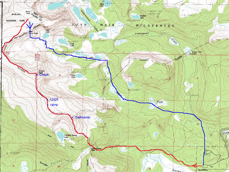
|
|
|
Re: Cirque Peak via Cottonwood Pass, May 17 & 18
|
Joined: Aug 2012
Posts: 671
|
|
OP
Joined: Aug 2012
Posts: 671 |
Thanks for the info Bob. I want to go back to try the green route.
Due to the difficulty all of us were having, we only did the yellow and blue routes to get off the mountain as quickly as possible.
I am hoping my difficulty was due to lack of sleep and acclimation and not an indicator of my fitness level (I've been dealing a bad cold or allergies for 6 weeks now and haven't been able to train).
|
|
|
Re: Cirque Peak via Cottonwood Pass, May 17 & 18
|
Joined: Oct 2010
Posts: 453 Likes: 1
|
|
Joined: Oct 2010
Posts: 453 Likes: 1 |
I've been fine over 14k ft with one day to acclimate before and I've also had headaches at 8k ft. I've also done 3 14ers over 3 days only to get AMS on the fifth day while lower at camp. AMS is a fickle mistress and one of the banes of my trips. For me, it's always been very hard to know when it'll rear its ugly head. Thanks for the info Bob. I want to go back to try the green route.
Due to the difficulty all of us were having, we only did the yellow and blue routes to get off the mountain as quickly as possible.
I am hoping my difficulty was due to lack of sleep and acclimation and not an indicator of my fitness level (I've been dealing a bad cold or allergies for 6 weeks now and haven't been able to train).
|
|
|
Re: Cirque Peak via Cottonwood Pass, May 17 & 18
|
Joined: Aug 2012
Posts: 671
|
|
OP
Joined: Aug 2012
Posts: 671 |
I've been fine over 14k ft with one day to acclimate before and I've also had headaches at 8k ft. I've also done 3 14ers over 3 days only to get AMS on the fifth day while lower at camp. AMS is a fickle mistress and one of the banes of my trips. For me, it's always been very hard to know when it'll rear its ugly head.
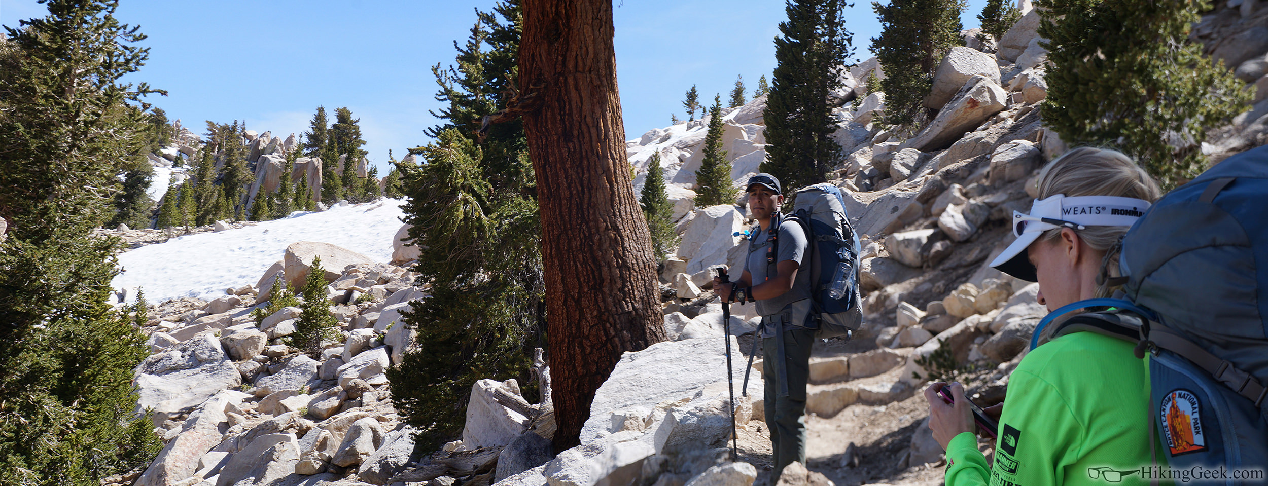
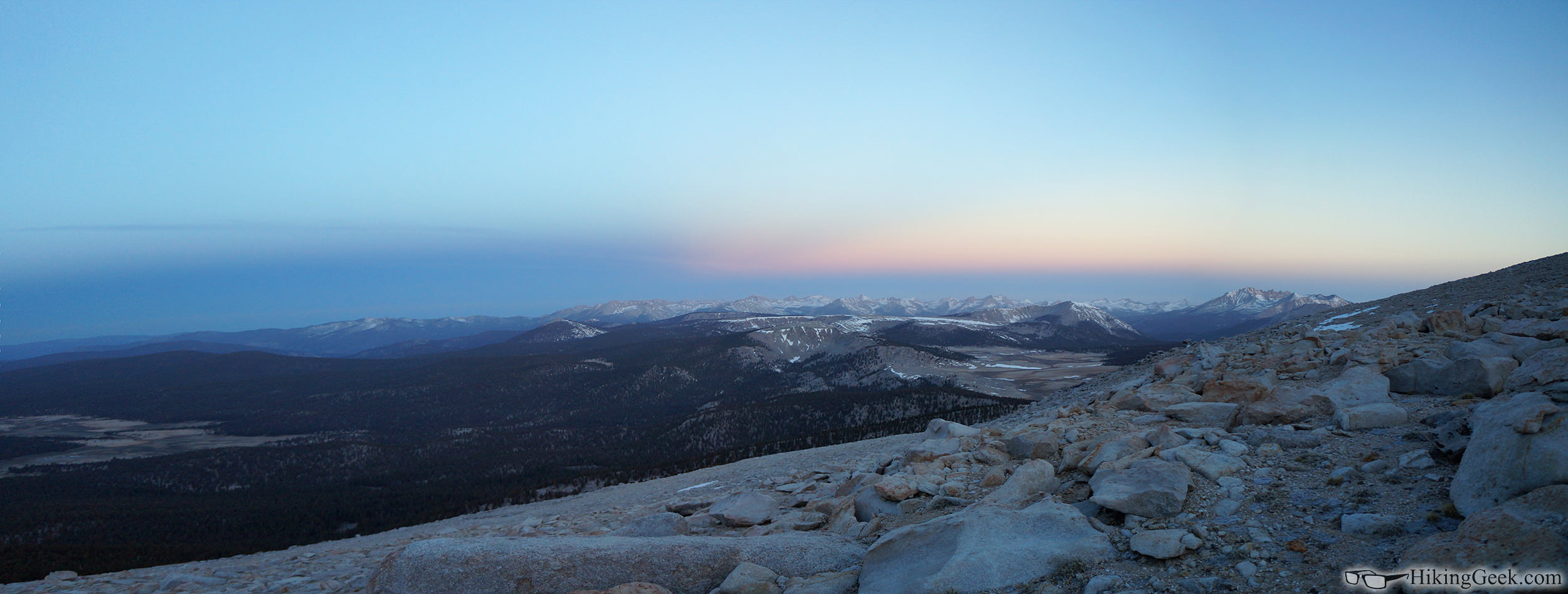
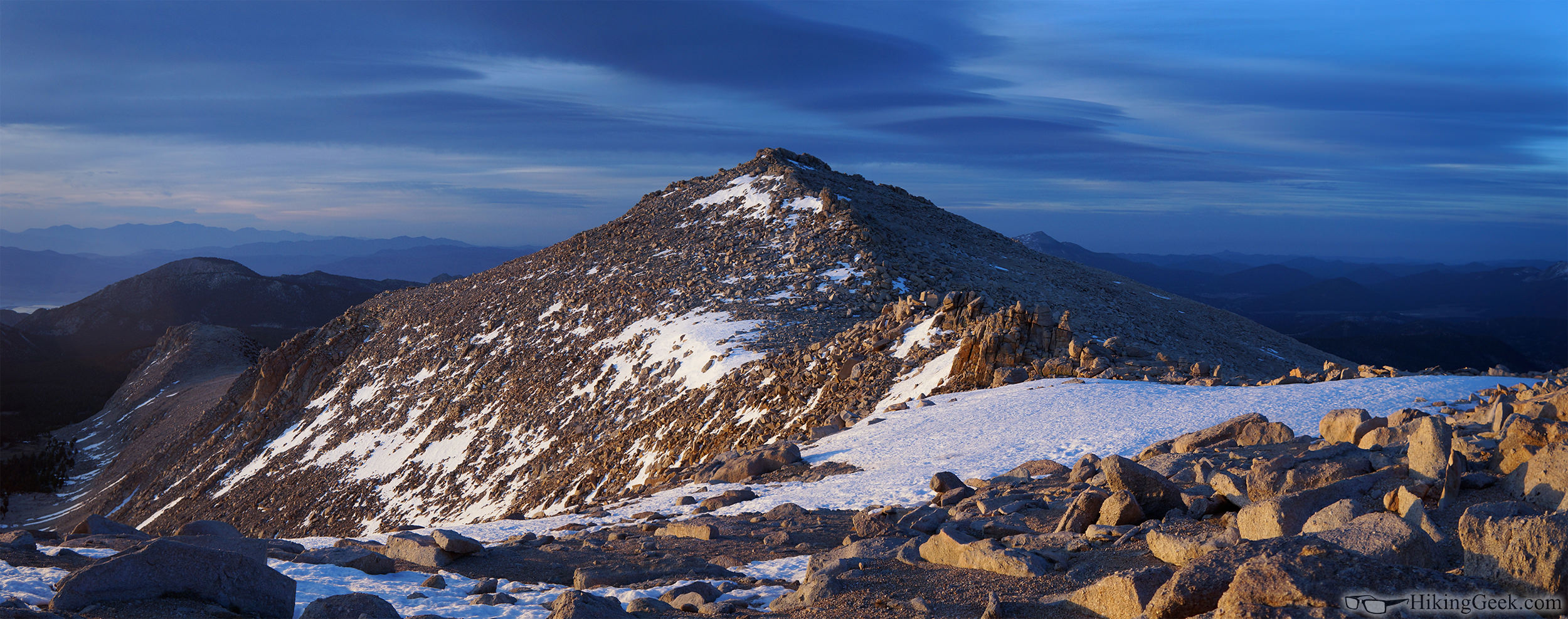
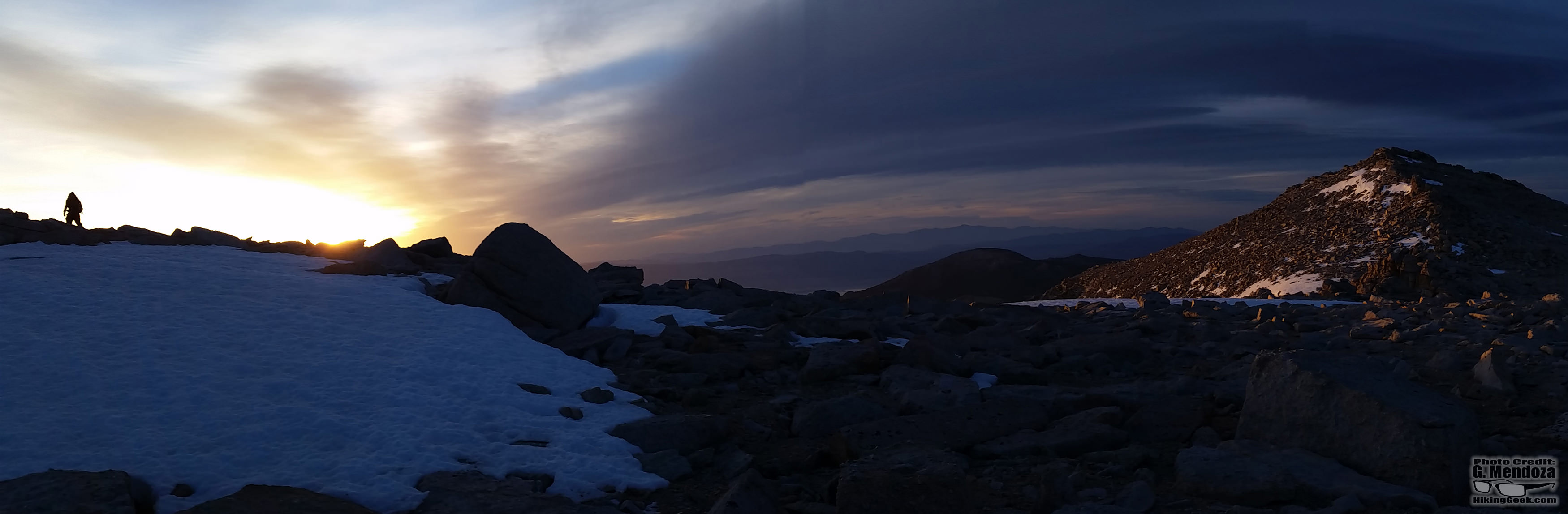
Two hikers had previously summited Whitney with AMS problems. One did it with no acclimation as a day hike. The other two (myself included) are prone to the headaches. By the end of the trip, all of us had headaches, with the two that hiked Whitney with no symptoms stopping at Chicken Spring Lake. I am really interested in what forum members will have to say about our situation; more on this later... Here are a few of my favorite pics from the hike. 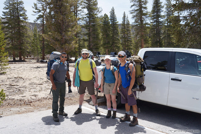     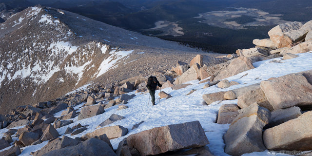 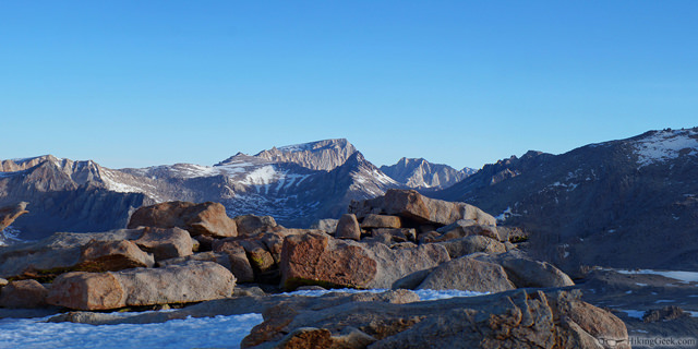 The rest can be seen on my website. Cirque Peak via Cottonwood Pass Trip Report, May 17-18 2014 The trip report will be posted on this page also. I am having issues with my web server, so the page may load slowly.
|
|
|
Re: Cirque Peak via Cottonwood Pass, May 17 & 18
|
Joined: Oct 2010
Posts: 453 Likes: 1
|
|
Joined: Oct 2010
Posts: 453 Likes: 1 |
Really, really beautiful pictures dude, especially the panoramas. Wallpaper worthy.
As for the AMS, looking at the pictures, it could be weather related. My unscientific theory that I've asked about before on here. Low pressure system coming in may affect sensitive people like me and you. Lack of oxygen is only part of the issue at altitude. The other part is the low pressure.
|
|
|
Re: Cirque Peak via Cottonwood Pass, May 17 & 18
|
Joined: Aug 2012
Posts: 671
|
|
OP
Joined: Aug 2012
Posts: 671 |
Really, really beautiful pictures dude, especially the panoramas. Wallpaper worthy.
Thanks! Taking pictures is an important part of the 'experience' for me.
As for the AMS, looking at the pictures, it could be weather related... The other part is the low pressure.
I had not heard that before, but it would apply to our situation. How could you tell there was low pressure by looking at the pictures? Clouds? something else? I am working on a separate post for the AMS issues.
|
|
|
Re: Cirque Peak via Cottonwood Pass, May 17 & 18
|
Joined: Aug 2012
Posts: 671
|
|
OP
Joined: Aug 2012
Posts: 671 |
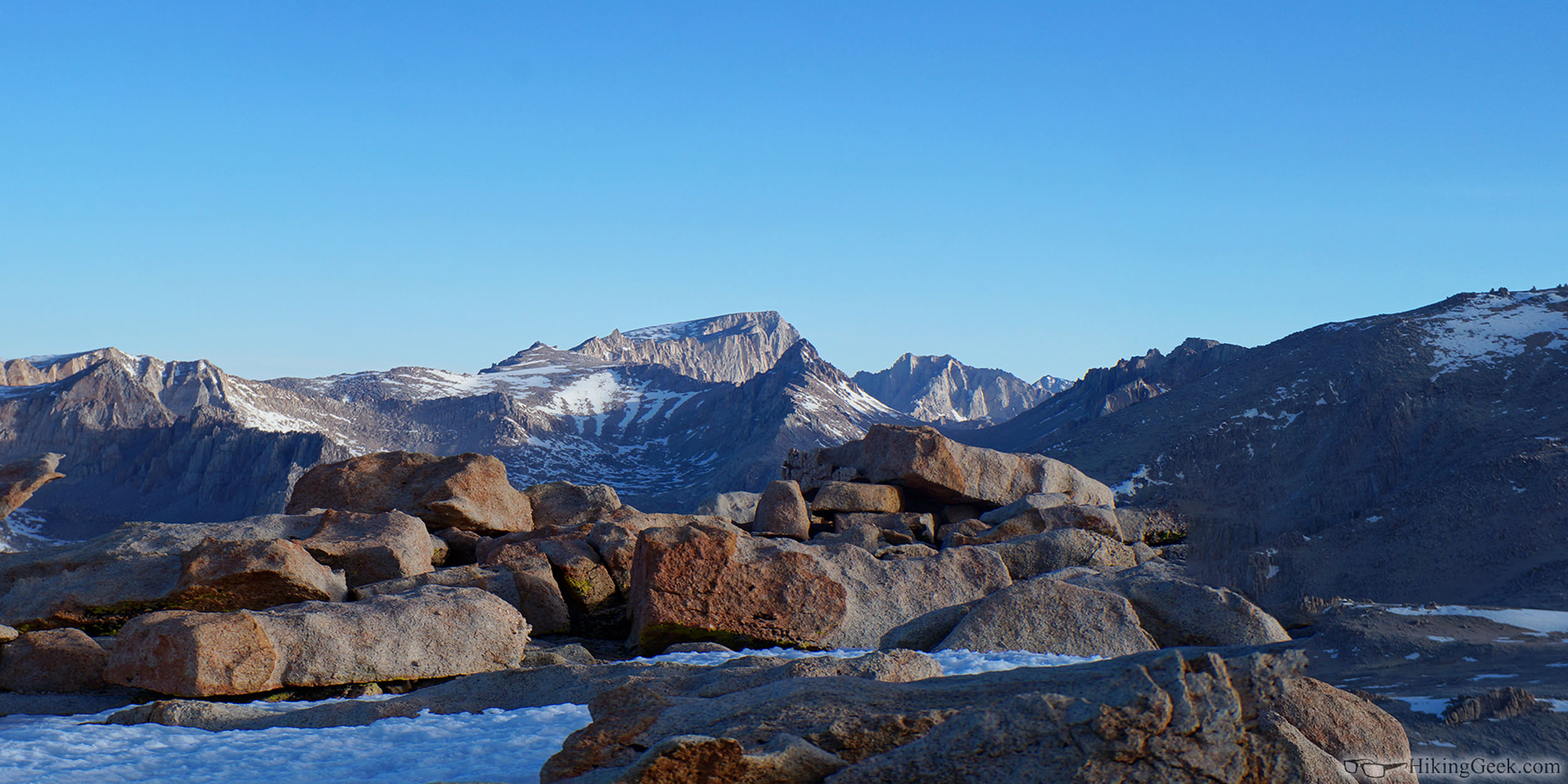
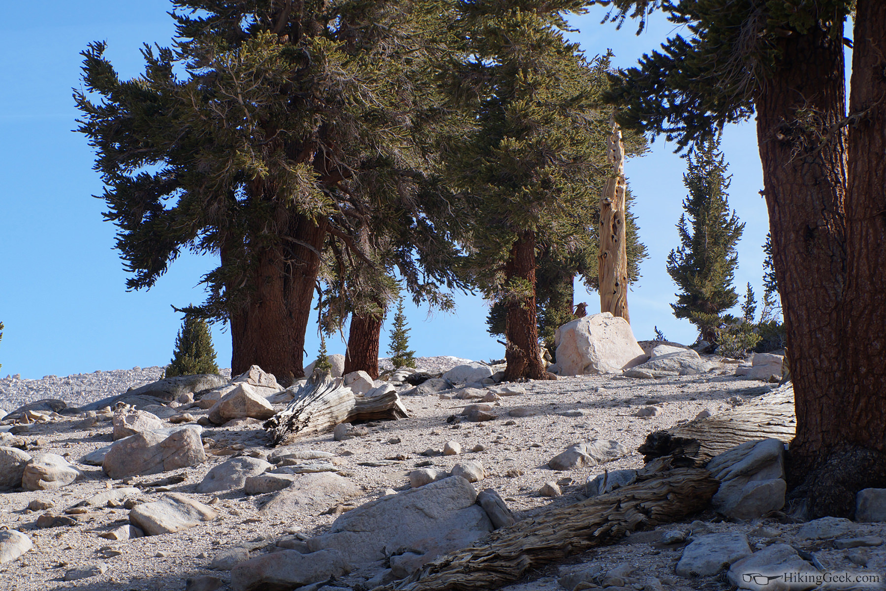
Thanks for the info regarding the cross country route to Cirque wbtravis! Here's the view: 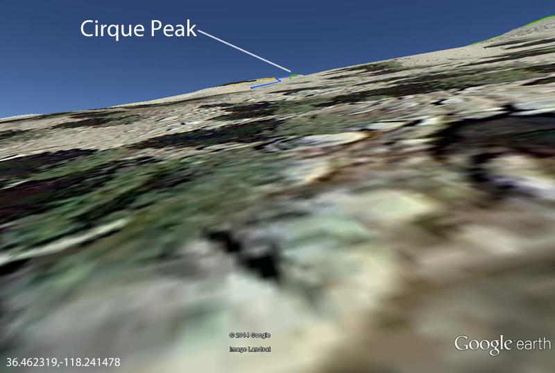 Does that seem right? This is what it looks like where we jumped off of the trail (36.462319,-118.241478): You can see Cirque Peak (covered in snow) in the center of the picture-  Next to the trail, there is a pile of trees- 
|
|
|
Re: Cirque Peak via Cottonwood Pass, May 17 & 18
|
Joined: Apr 2010
Posts: 659
|
|
Joined: Apr 2010
Posts: 659 |
OOOooooooooooooooh!!!!! Aaaaaaaaaaaaaaaaaahhhhh!
Beautiful pics!
|
|
|
Re: Cirque Peak via Cottonwood Pass, May 17 & 18
|
Joined: Aug 2012
Posts: 671
|
|
OP
Joined: Aug 2012
Posts: 671 |
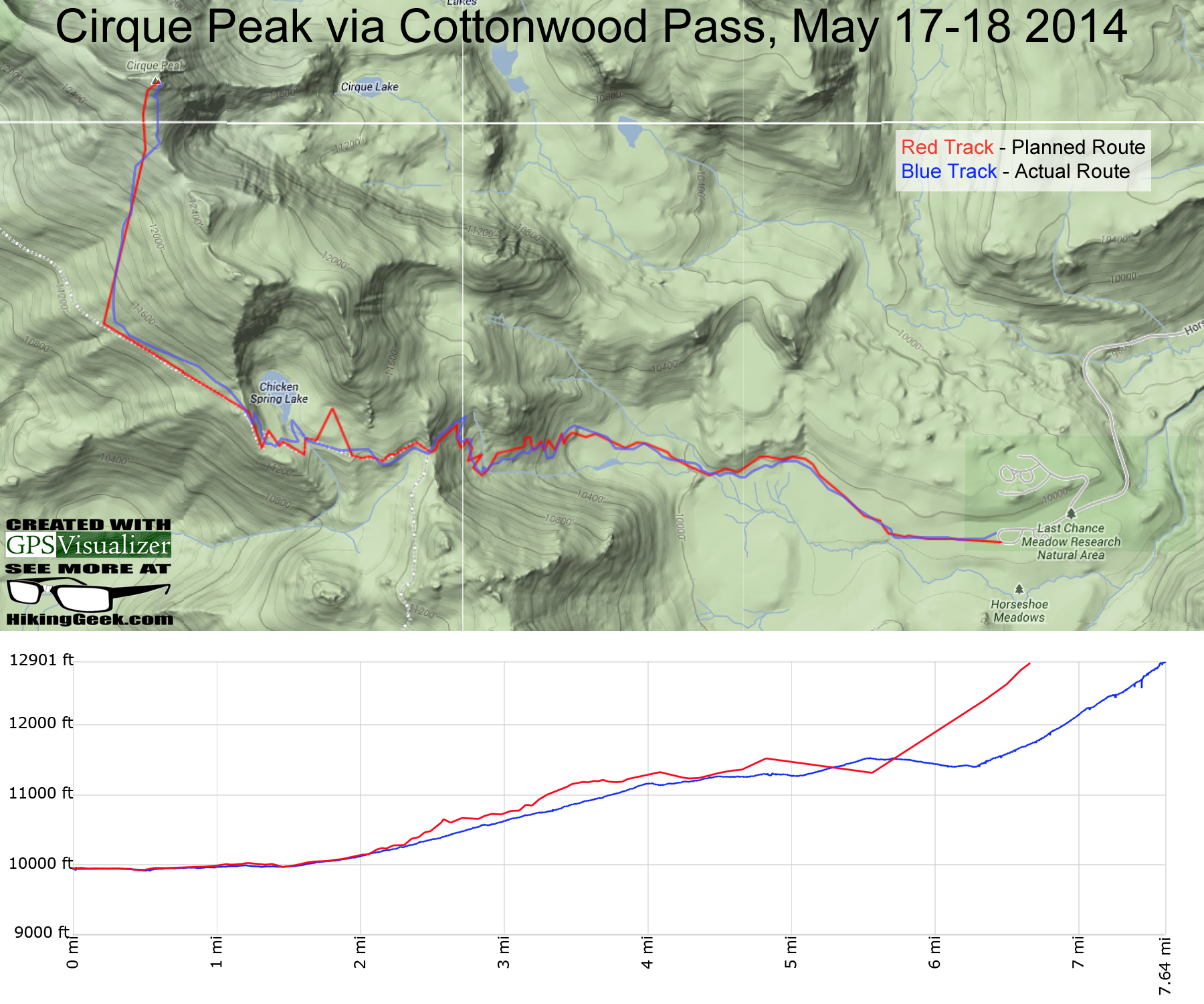
Thanks Akichow. Do you have any White Mtn Peak pictures? Something I've started doing is plotting my planned route/trail profile vs what my GPS records: 
|
|
|
Re: Cirque Peak via Cottonwood Pass, May 17 & 18
|
Joined: Apr 2010
Posts: 659
|
|
Joined: Apr 2010
Posts: 659 |
You bet! But taken with an older point and shoot, so photos lack vibrant color. Sunset at the Barcroft Gate area.  Flanks of White Mountain (summit approach)  Nearing the summit.  Summit view  On the White Mountain Trail, looking down at the research station and the road down to the Barcroft Gate.  Jeep road (when it has been graded). 
|
|
|
Re: Cirque Peak via Cottonwood Pass, May 17 & 18
|
Joined: Apr 2010
Posts: 659
|
|
Joined: Apr 2010
Posts: 659 |
If you are prioritizing summit and altitude, White may be your best choice.
If you are prioritizing summit and views, Dana is hard to beat.
And I second the comment about the 20 Lakes Loop Hike out of Saddlebag Lake. That is exactly where I fell in love with higher altitude Sierra hiking.
|
|
|
Re: Cirque Peak via Cottonwood Pass, May 17 & 18
|
Joined: Aug 2012
Posts: 671
|
|
OP
Joined: Aug 2012
Posts: 671 |
If you are prioritizing summit and altitude, White may be your best choice.
If you are prioritizing summit and views, Dana is hard to beat.
And I second the comment about the 20 Lakes Loop Hike out of Saddlebag Lake. That is exactly where I fell in love with higher altitude Sierra hiking. Thanks Akichow, I figured you'd have pics. What are your thoughts on doing Dana with micros and trekking poles if there's snow?
|
|
|
Re: Cirque Peak via Cottonwood Pass, May 17 & 18
|
Joined: Apr 2010
Posts: 659
|
|
Joined: Apr 2010
Posts: 659 |
I've only done it in summer so I don't have a perspective. Could be a lot of fun.... Dana tends to get scoured free of snow a little earlier than other places but still, this is what it looked like last Friday. And then another foot of snow fell. (Dana is the highest point just West of Mono Lake.)  This, while we are on the topic, was White Mountain last Friday. Comparatively much less snow. 
|
|
|
|
|