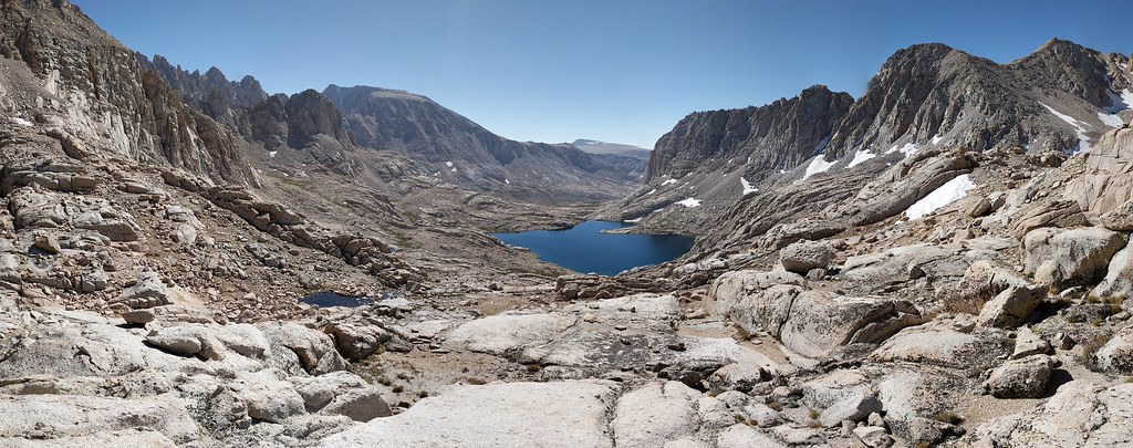
I awoke early on Saturday the 16th to watch the sunrise over Sky Blue Lake and the Miter Basin and found a layer of frost covering most of the gear that we had left out overnight, including our bear cans and the shelters. As the sun began to peek above the horizon the basin was awash with warm morning light and fish began to rise, with a few spectacular jumpers breaking the surface of the water. We brushed off as much frost as possible and for anything that was still frosty or damp we placed it in the path of the rising sun. As everything was drying out a bit we made coffee, ate some breakfast, treated a small volume of water for the hike and proceeded to pack up everything. We began the day by taking the standard route around Sky Blue Lake, north along the eastern shore and then west along the north shore until we reached the inlet stream. On our path around the lake we spotted several nice sized goldens hovering in the water column, just off the shore. At this point I was kicking myself for not bringing a fishing pole of some variety to try and tempt those beauties. It just adds another reason to the list of many to come back and spend more time in the Miter Basin. We followed the inlet stream up the hill, taking the path of least resistance to make it to our next goal. The route finding was pretty straight forward and offered plenty of views of where we had camped the the night before, as well as some of the better displays of Sierra Shooting Star along the stream I have seen.
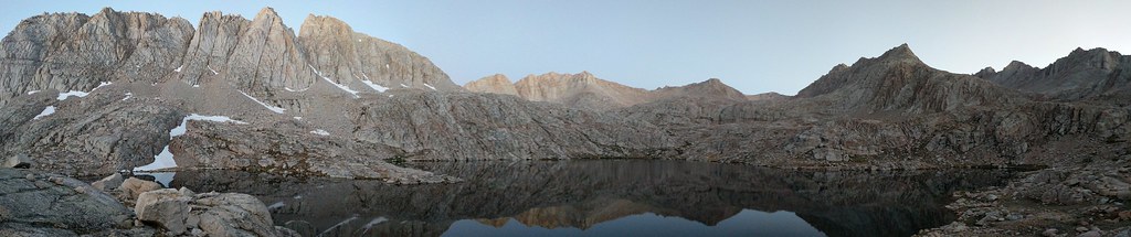
First light pano of the entire shore of Sky Blue Lake and surrounding peaks
Frosty Gear

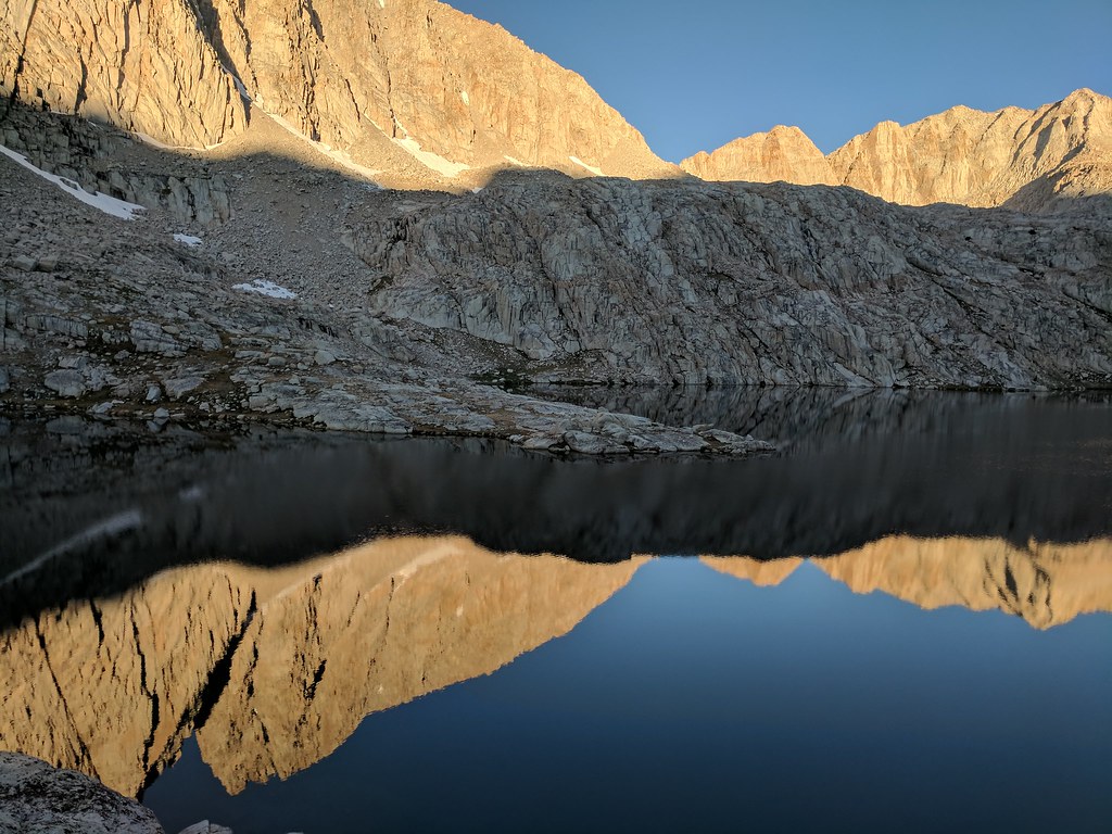
Morning Reflections
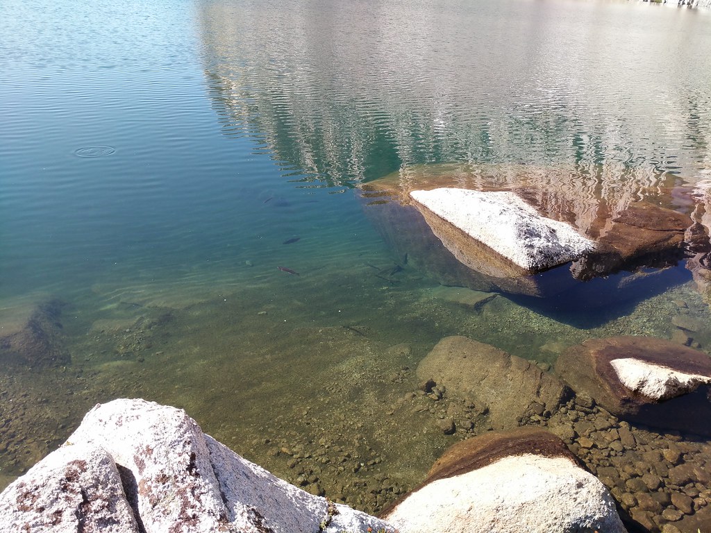
Good sized fish hovering in the water column
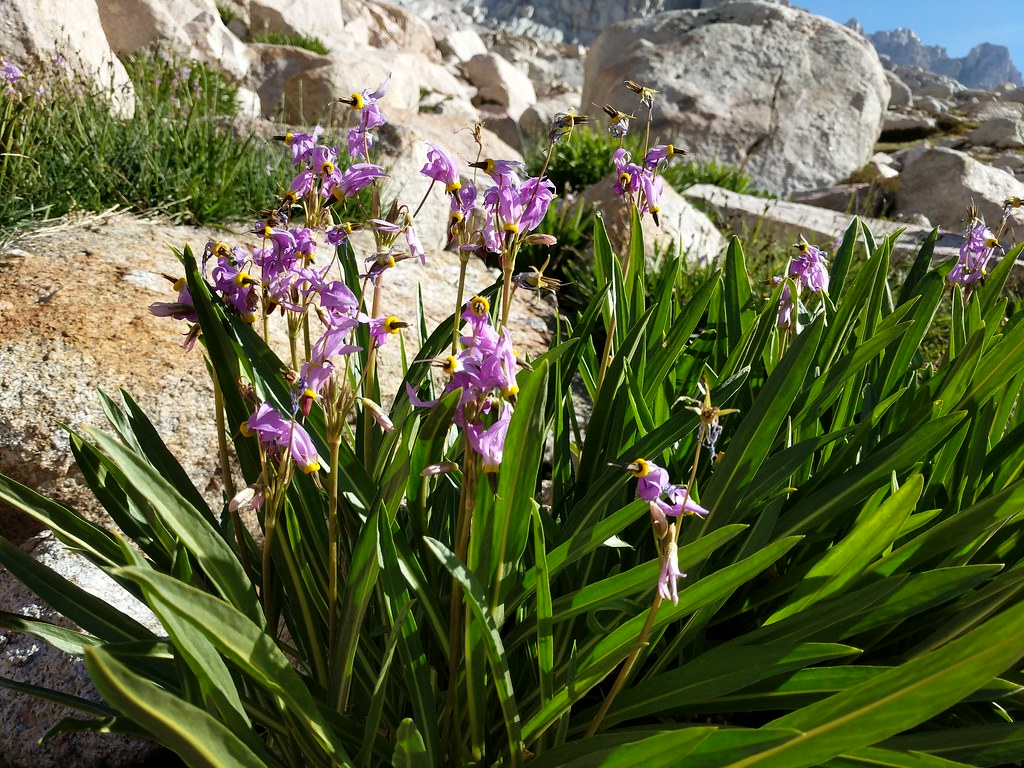
Sierra Shooting Star along the stream
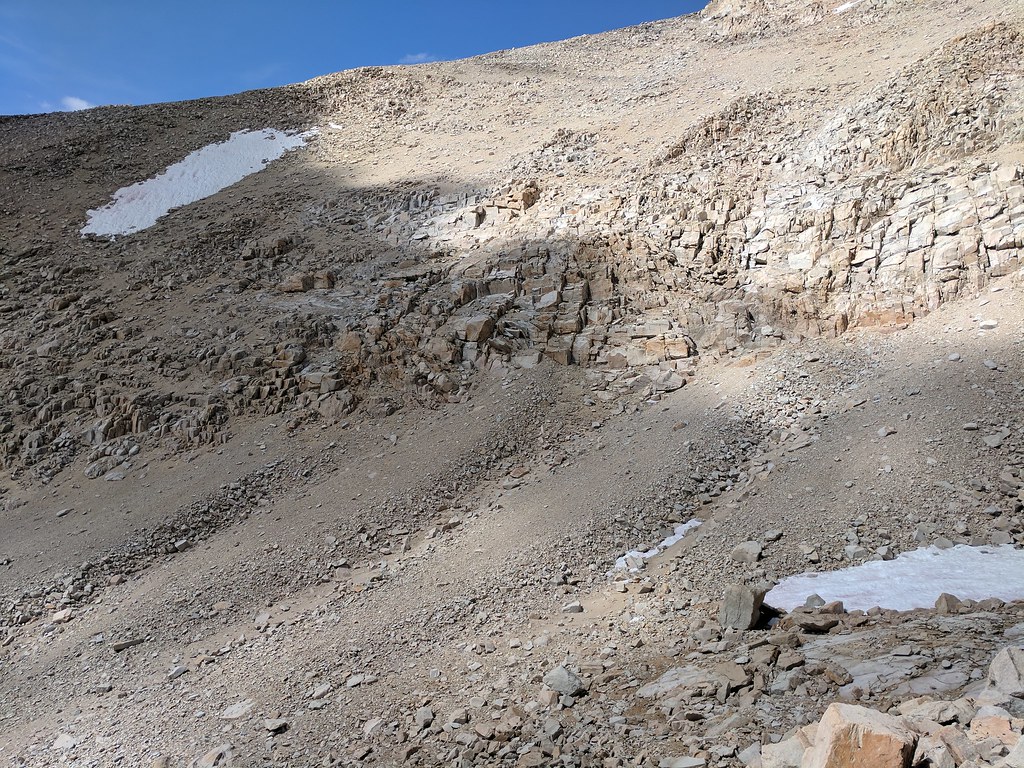
We continued making our way upwards to the next waypoint on our journey which was Lake 12129 (or 3697 depending on which map you consult) Again, the route finding in this section was quite tame. We decided to stay high on the ridgeline and only drop down when necessary. This worked out well, and we soon found ourselves above the notch that serves as the outlet for Lake 12129. At this point we had a decision to make on which route to take - west through the cliffs surrounding the lake or east and follow the use trail we spied across the lake. The route to the east looked mellower so that was the route we chose. We headed across the notch and the outlet stream then went up and to our left on a line we had sighted out before we started. The idea was to stay high and keep it class 2, avoiding the possible class 3-4 downclimb if you stay lower and near the water line. Things went to plan and we made the easy scramble, crossing a small snow patch then picking up the use trail we spied from the other side of the lake. As it was a use trail it petered in and out as it crossed through some larger boulders, but following the path of least resistance it always reappeared and we made quick work of that section. We tanked up on water at the far end of the lake, not knowing which route we were going to take from our next destination, Crabtree Pass. The section from the north side of Lake 12129 to Crabtree pass was pretty tame. The route finding was easy, simply following the path of least resistance to the saddle above which was the pass. There were a few snowfields to cross, but being mid-day they were fairly soft and easy to find good footing on.
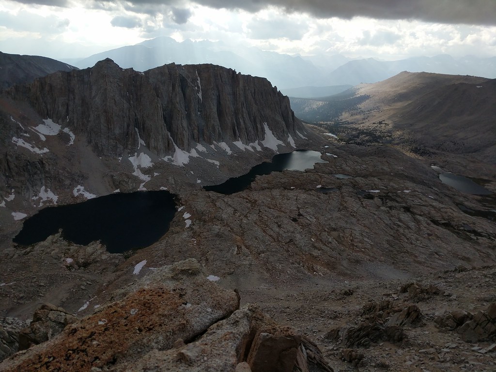
Looking back down to Sky Blue Lake and the expanse of the Miter Basin
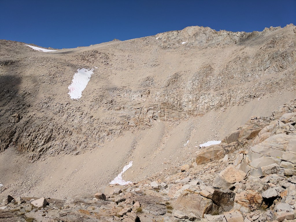
Looking up to Crabtree Pass
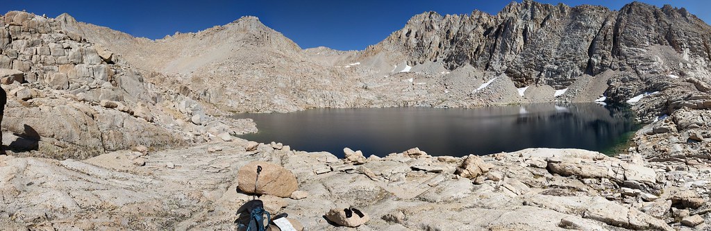
Crystal clear water of Lake 12120 as we were making our way down to the use trail

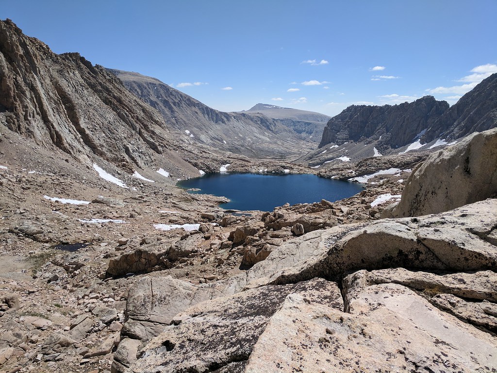
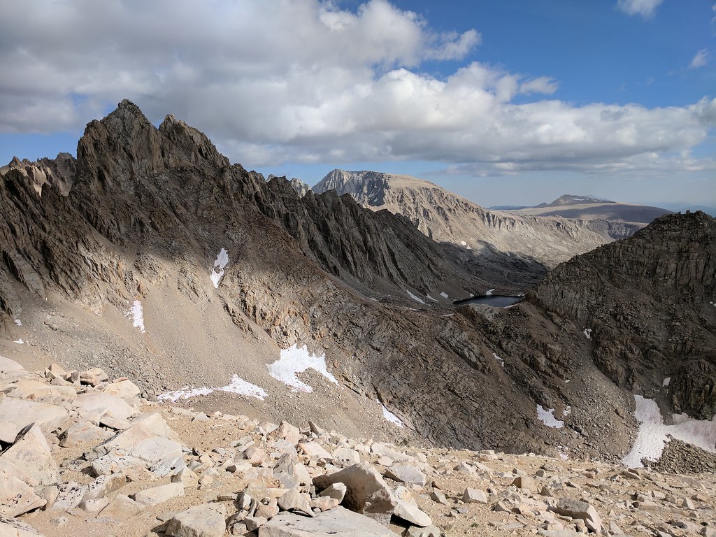
Once on top of Crabtree Pass we had some vistas to partake. Looking back down from whence we came we could see Lake 12129, a good swath of the Miter Basin, Cirque Peak, and most of the bulk of Mt. Langley, with only the actual summit obscured due to our location. Looking west from the high point in the middle of the saddle (which I had climbed from the south side, finding an easy way up) you could see Upper Crabtree Lake, the Dreaded Sand Hill, Discovery Pinnacle, the flank of Mt Chamberlin, and peak 12946. As we sat atop the pass we ate our lunch and came to a consensus of which way were were going to go about making our way up to Discovery Pinnacle from where we were currently. Before we left for the trip we knew there were pretty much two options to get to where we wanted to go. Both options were less than great, but doable. Option one was the most talked about that we had seen and that was to descend Crabtree Pass to upper Crabtree Lake, goto the west end of the lake, then trudge up the sand hill to Discovery Pinnacle. The other option was to try and stay level-ish with Crabtree Pass and then head around the cirque, up through the cliff bands, and then angle up the slope to make your way to Discovery Pinnacle. While we were ruminating a couple of fast packers came up and chatted for a minute. They had a similar goal, but from the look of things they were going to drop down to the lake and take the long way up. We watched them descend and when they made it to the large snow patch on the north side of Upper Crabtree Lake - one went through the patch, the other decided to go up, over and around.
Looking down to lake 12129 and Cirque Peak from the top of Crabtree Pass
Westward view from atop Crabtree Pass with Upper Crabtree Lake
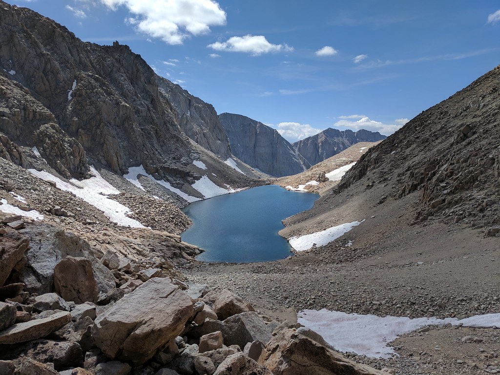
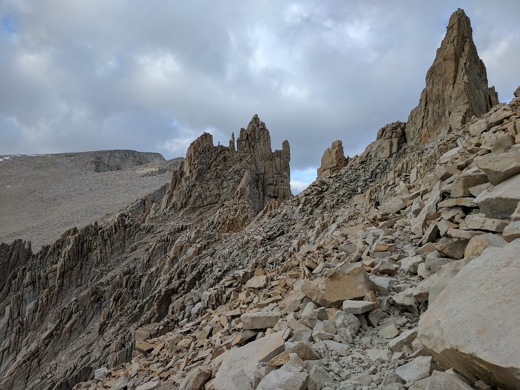
Looking across to the cliff bands and Discovery Pinnacle
We donned our packs and made our way towards our selected route, through the cliff bands and up. We tried hard to not give up too much elevation, ultimately only losing about 200’ of elevation from the pass until the point where we began to ascend through the cliff bands. It was a lot of boulder hopping, with some scree thrown in for giggles here and there until we reached our low point. Gotta love when the large refrigerator sized boulder your (much slimmer) hiking partner just skipped across shifts when you put your full weight on it, forcing some quick footwork to hop to stable ground and not get ones leg crushed. With that section done it was up and down what looked like small gravel bars from across the way, but ended up being small ridgelines, until we hit our desired start point where we would begin head up through the cliff bands. Once directly below the cliff bands the going looked much easier than it had from a distance, which usually ends up being the case most of the time. We made our way through the first cliff band heading mostly due west until we came to the bottom of the snow patch. From this point we changed directions and headed north east up the hill until we reached our next landmark, another patch of snow, where we once again changed directions and headed north west until right about 13200’ of elevation where we headed due west to the shoulder of the ridgeline the last of the steep stuff. We stopped for a few minutes at this point to catch our breath and orient ourselves towards our next landmark, Discovery Pinnacle. We were at the “easy” part of the sand hill, but still with the elevation, scree and sand it still took a while to transit to the ridgeline east of Discovery Pinnacle. Three hours after starting from Crabtree Pass we were finally on top of the ridgeline of Discovery Pinnacle, and we could see the Main Mt. Whitney Trail below. We quickly found a use path down to the main trail and slid down the hill to the main trail.
Closer to the cliff bands after losing a little bit of elevation
Finally through the cliff bands and looking back from where we started a couple of hours earlier
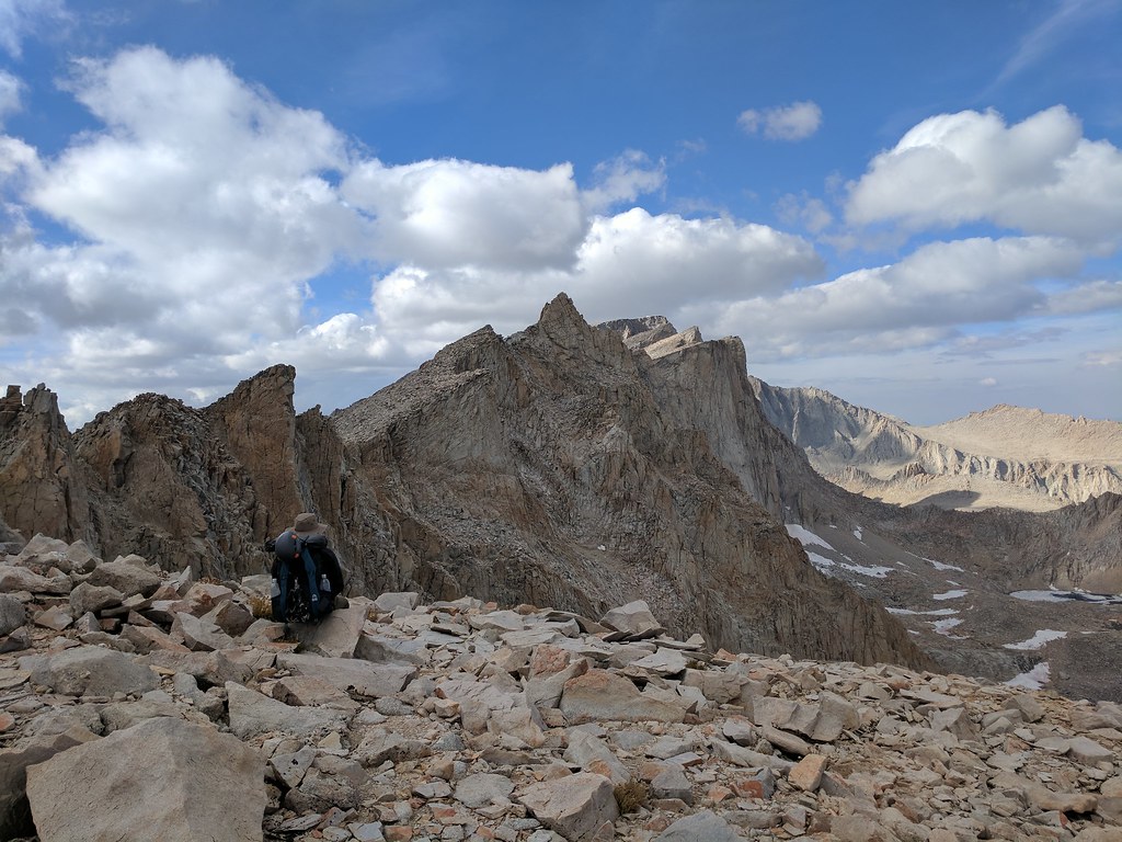
Resting on the ridge above the main trail looking to where we were headed
We joined the Main Trail just before Trail Crest. Hey look at this! A real trail! You forget how easy a groomed trail is to hike on until you’ve spent the majority of your day scrambling up the path of least resistance. It’s the small things sometimes. A hiker who had gotten a late start and was heading up solo joined up with us just after trail crest. He asked if we were heading to the summit today (which we were) and if so could he head up with us. We saw no problem with it so we continued on our merry way, our pair now a group of three. The hiker was planning to tag the summit then make his way back down and overnight at the sites just off the jmt below the junction with the main trail so we stopped at the junction so he could leave his pack there and have an easier hike up. At this point I was starting to drag a bit. No headaches, no nausea, just feeling a bit out of energy. Jose and our new addition would pull a bit ahead, and then stop and catch their breath, I would catch up, they would continue on, and so on and so forth. This pattern repeated itself all the way to the summit. Apparently the way Jose and our new friend took up to the last bit of the summit was optional route up which avoided the snow patch on the main trail and cut off some distance. As soon as I saw were were off the main trail and were following ducks I was silently cursing them. Soon enough though it was over and I popped up and there was the summit of Mt. Whitney - complete with the Smithsonian Hut, the large slabs on the peak adorned with a slew of benchmarks, and the views - oh my the views! Its funny how you can see something in a picture hundreds of time, but until you are there seeing it for yourself it finally clicks. I think it’s this experience that draws me back to the mountains, seeing things for myself, seeing all the nuances that the human eye picks up on that are lost in photographs.
Trail Crest

Hitchcock Lakes and Guitar Lake from the JMT junction
Mt Whitney and Mt Muir
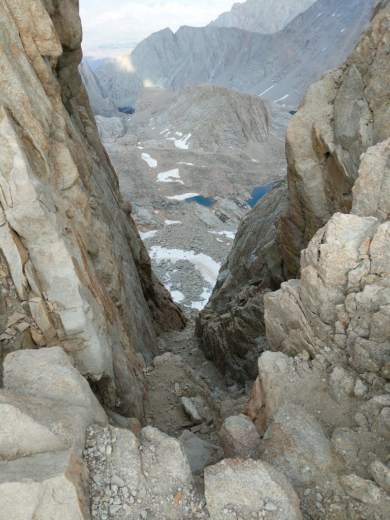
The second window
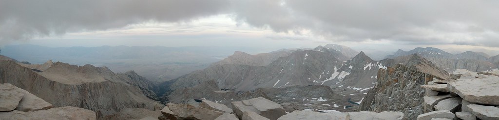
View east from the peak
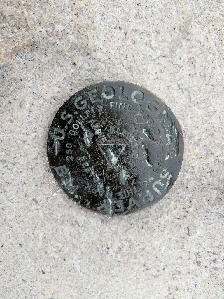
One of the many benchmarks at the summit
After taking in the vistas that present themselves at the top of the highest peak in the lower 48 and bidding farewell to our new friend that had accompanied us to the summit we had a decision to make. Continue down the Mountaineers Route as we had planned and try to make it to Icerberg Lake or stop and bivy at the summit. Some low clouds had begun to envelop the peak, but there was no call for any sort of weather at the summit in the latest forecast I had gotten from my inreach and with daylight fading quick with the final push to the summit having taken longer than we hand originally planned, and the prospect of descending the Mountaineers Route by headlamp sounding not so fun, we decided to pitch our abodes for the evening in the lee of a couple of rock shelters that had been constructed in the past by other hikers to shield themselves from the ever present summit winds and sleep at the summit. Since we had filled up on water at lake 12129 before Crabtree Pass we both had a little less than a liter of water each by the time we reached the summit. A little short, but there were small snow patches of recent snow that had fallen a few days prior that we could melt and use to supplement our water while we were at the summit. As darkness encroached we made our dinners and had a final cup of coffee before deciding to retire for the evening. With us on the summit was another pair that had came up the main trail a bit later in the day and like us were planning on descending the Mountaineers Route but decided it better to bivy in place and tackle the route down in the morning. Fortunately for us the weather was kind, with only light winds gusting here and there, and the clouds that and enveloped the summit finally dissipating around midnight. I laid out in my bivy with the top open with my face snuggled into my bag, looking at the stars that had finally started to shine when the clouds retreated. I’ve seen good displays of stars before on several backpacking trips, but never had the stars seemed so shine as bright as they did this night on the summit of Mt. Whitney.


