My plans for this climb began on January 6. A few climbers from the east coast had just attempted Mt. Whitney by the main trail, and one of them posted a trip report. A long-time member of the WPSMB (over 2,000 posts) weighed in with what I thought was a rather vicious rant, slamming them for not carrying enough ice axes and making several ridiculous claims about climbing the switchbacks in winter. Someone apparently agreed with me about the viciousness of the rant, since it soon disappeared.
The rant made these claims: The switchbacks are "unpassable" in winter and "well documented as such." The switchbacks would be "very technical" in winter. It would be a good idea to use "ropes and ice screws" on the switchbacks in winter. And finally, a climber without an axe in winter is about as dumb as a skydiver without a parachute.
I looked at those claims as a challenge. How much work would it take to go up there and prove them false? Should I even bother? Why not? I hadn't done anything harder than a moderate hike since Bear Creek Spire in September, so I was way overdue for something more ambitious.
When I saw that we were in the middle of a multi-week spell of perfect weather, I started organizing gear and tried to line up a partner. When the perfect weather looked like it might end, I decided I had to get organized and go. Besides, I had never been on Whitney in January, and a January ascent should be worth a few extra style points.
Getting organized was quite a chore. I hadn't used my 20-year-old four-season tent since at least 2003, so I had to find all the parts and remember how to set it up. I dug out the six-pound pack I took up Denali in 1995, made sure everything for my "winter kitchen" still worked, and packed more crap than I thought I would need, "just in case." I figured it wouldn't take much to bait RichardP into a Whitney trip, but I was wrong. Other prospects had excuses of their own. The weather window was closing, so I left Reno Wednesday afternoon, four hours later than I had intended.
I slept in my truck in Alabama Hills Wednesday night. I had breakfast at the Mt. Whitney Restaurant, wrote myself a permit, and got last minute beta from Doug before driving up Whitney Portal Road. I parked at the first switchback after the "ROAD CLOSED" sign. I generally prefer skis to snowshoes, but snowshoes are much lighter on my pack. The skis stayed behind. I started hiking up the road at 9:15 AM.
It was mostly firm snow and clear pavement to Whitney Portal. I made good time to the store, and then headed up the old trail shortcut. That's where things started getting tough. The pack must have weighed 60 pounds, and it really hurt my hips and shoulders. It was steeper now, and the trail wasn't very well packed. I broke through just often enough to waste tons of energy, but not often enough to concede that it was time for snowshoes. I finally got them out just before joining the main trail. There were boot, snowshoe, and ski tracks everywhere. The tracks more or less followed the trail, cutting many of the switchbacks along the way.
I followed the tracks to a point just beyond Lone Pine Lake, where the trail goes up some switchbacks on the right towards Bighorn Park. I headed left. The slope became steeper, and the snow became harder. I found myself on some very hard packed snow where I had no business going with just the crampon-style snowshoe bindings. There was no way to drop my heavy pack and switch to crampons without falling, so I pressed on, barely making it. A fall wouldn't have been serious, but I sure was glad I didn't have to climb back up after getting all bruised up.
Shortly after that, I was in some trees, looking down on Bighorn Park and Outpost Camp. I had never been this way before, the route toward Consultation Lake looked too steep for snowshoes, and it appeared to be quite a distance to the next good campsite. It was almost 3:00, and I was really sick of carrying all that weight. I dropped my pack and started digging a tent pad and building snow walls. It was a great camp except that the snow under the tent was sugary and just wouldn't form a solid platform. I had a two-man tent, so there was room for all my stuff (except for the pointy metal things) inside. I climbed into my sleeping bag, sorted gear, melted snow, and ate dinner.
I didn't sleep well. The snow under my pad was lumpy, and my sore hips made sleeping on either side painful. I finally started making breakfast and getting dressed around 6:20 AM. It was my first backpacking trip since 2009, and I wasn't very efficient. I didn't start for the summit until 7:42.
I used crampons and ski poles, with an old 55cm X-15 axe strapped on my pack. I left the snowshoes behind. Fortunately, the weather was perfect. The snow was firm enough that I rarely sank in deeper than my ankles and never deeper than the tops of my boots. I made good time to Trail Camp, took a break, and walked directly up to the Cables.
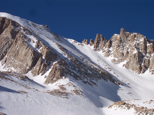
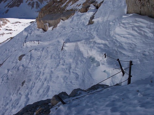
This was the beginning of the "very technical" "unpassable" switchbacks where I would supposedly need "ropes and ice screws." How technical can a trail with snow on it be? I just walked across using crampons and ski poles, with my axe still on my pack. I took a photo from the other side at 9:42, two hours after leaving camp. I more or less followed the switchbacks up to Trail Crest. Sometimes I took shortcuts, sometimes I climbed straight up the snow when I couldn't see the trail, and sometimes I just walked on the trail. Strangely, this "unpassable" route had obvious signs of other climbers all the way up to Trail Crest. Drat! I won't be able to claim the first winter ascent of this "very technical" route. As I expected, following the trail was a real pain in the butt, but it was still just a trail with snow on it. There was no ice where I could have placed an ice screw, even if I had been dumb enough to bring one. I arrived at Trail Crest around 11:40 with my ice axe still on my pack. I probably wasted 45-60 minutes going up the switchbacks instead of the chute, but it was worth it, knowing that Richard and Gary (bulldog34) were probably following my SPOT tracks.
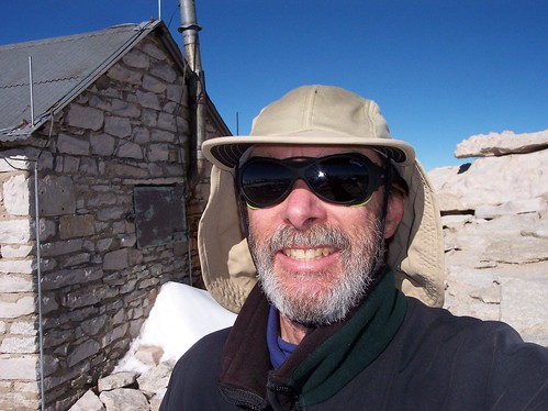
I took off my crampons, strapped them onto my pack, and headed for the summit. The west side can be really windy and cold, but the weather was perfect. I'm a real wimp about cold hands, but I made it to the summit and back to Trail Crest without gloves. The warm weather reminded me of the time I met a woman skiing topless near Lake Tahoe in January.
There were mixed conditions between Trail Crest and the summit. There was hard snow, soft snow, and exposed rock and dirt. I made the round trip without using crampons or axe, but there were a several places where kicking steps into the hard snow got pretty dicey. I got to the summit at 1:42, took a 15-minute break, and headed back down.
I took another break at Trail Crest. I put on more clothes and finally got out my ice axe for the descent in the shade. I only descended about 20 feet before I decided I didn't need the axe after all. I wouldn't try a trip like this without one, but an ice axe isn't nearly as essential as a parachute is for skydiving. I put the axe away and put on even more clothes when I got to the bottom of the chute. I followed my sometimes-sketchy crampon tracks back to camp, arriving around 4:50. I had definitely had enough fun for one day. I made a feeble attempt at leveling the snow under my sleeping pad and then climbed into the tent. I sorted gear, melted snow, ate dinner, and then slept poorly, just as I had the night before.
There was no reason to rush on Saturday morning, so I didn't start down until 9:15. I soon met five guys filling their water bottles from the stream. They had mid-weight boots, snowshoes, no crampons, and no ice axes. They were trying to day hike Mt. Whitney. I told them that they had no chance without crampons and that they didn't have enough time anyway. One of them muttered something about this being their third attempt without proper equipment or enough time. I just shook my head and left.
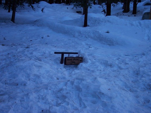
Walking straight down the softening snow with snowshoes is hard on the quads, but it made for a fast descent. I took the old trail shortcut again and was back at Whitney Portal in what seemed like no time. I made a substantial deposit at the "Human Waste Disposal Site" and continued down the road wearing snowshoes. I took them off when the snow finally petered out. I was back at the truck at 11:45. What a relief it was to put that pack down for the last time!
I drove into Lone Pine, ate a burger at McDonalds, and then dropped by the Visitor Center to report on conditions. I stopped at the Hostel, couldn't find Doug, and then headed home. I was back in Reno before 6:00. I was really glad that someone annoyed me enough to motivate me to do this. It was a great trip!
I only took a few photos. I'll post them as soon as I get time.
Some folks were asking about my spot link. It's
here, but there are many weeks when there won't be anything worth viewing. BTW, I have a buddy in Reno who has a mortgage, an ex-wife who is always trying to screw him over, a daughter in college, and therefore a need for a paycheck. He regularly receives my SPOT "custom" message as a reminder that I'm on a summit while he is stuck at work. Somehow, this makes carrying a SPOT and buying batteries for it worthwhile.
Bob