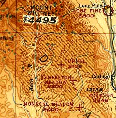
Tunnel Meadows Airport, Tunnel Meadows, CA
36.38 North / 118.26 West (Southeast of Fresno, CA)
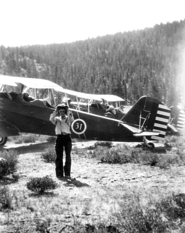
A 1931 photo of Pat Decano at in front of 2 Army Air Corps biplanes
which brought Col. "Hap" Arnold from March Field to Tunnel Meadows.
This extremely high-elevation backcountry strip
was located just south of Mt. Whitney, the highest point in the 48 United
States.
According to Pat Decano, "The airfield was created by my uncle, Leonard
Shellenbarger, at the request of a Dr. Shook in 1931. Dr. Shook was a friend of Bert Johnson, a cattleman, and he wanted to fly
in so he could fish there. He drug the field with a Fresno scraper pulled by a mule and was paid
$40 by Dr. Shook for the job. The Fresno scraper was packed in on a mule.
In 1931, then Col. 'Hap' Arnold and a buddy flew in from March Air Force Base to fish.
When they were ready to leave in the afternoon, my grandfather said that
they could not make it out. Arnold's plane crashed and my son has the cigar-sized box that was made from
scraps of the plane. It is olive drab painted aluminum.
My grandfather, Everett Shellenbarger, was the ranger there at the
time."
However, the Tunnel Meadows airfield was not yet depicted at all on
the August 1943 Mt. Whitney Sectional Chart (according to Chris Kennedy)
nor was it listed among active airfields in the 1945 AAF Airfield
Directory (courtesy of Scott Murdock)
The earliest aeronautical chart depiction of the Tunnel Meadows Airport
which has been located
was on the August 1945 Mt. Whitney World Aeronautical Chart (courtesy of
Chris Kennedy). It depicted Tunnel Meadows as an auxiliary airfield, at an elevation of
9,100'.
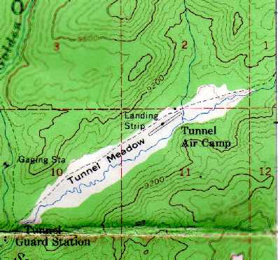
The 1955 USGS topo map (courtesy of Ted Sarbin) depicted the "Tunnel
Air Camp" as having a single runway.
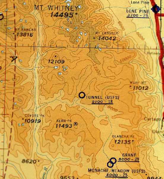
The last aeronautical chart depiction which has been located of the
Tunnel Meadows Airport was on the May 1957 Mt. Whitney Sectional Chart
(courtesy of Chris Kennedy). It depicted "Tunnel (USFS)" as having only an 1,800' unpaved
runway. Tunnel Meadows Airport was evidently no longer charted at some point between
1957-59, as it was no longer depicted at all on the March 1959 Mt. Whitney
Sectional Chart (according to Chris Kennedy)
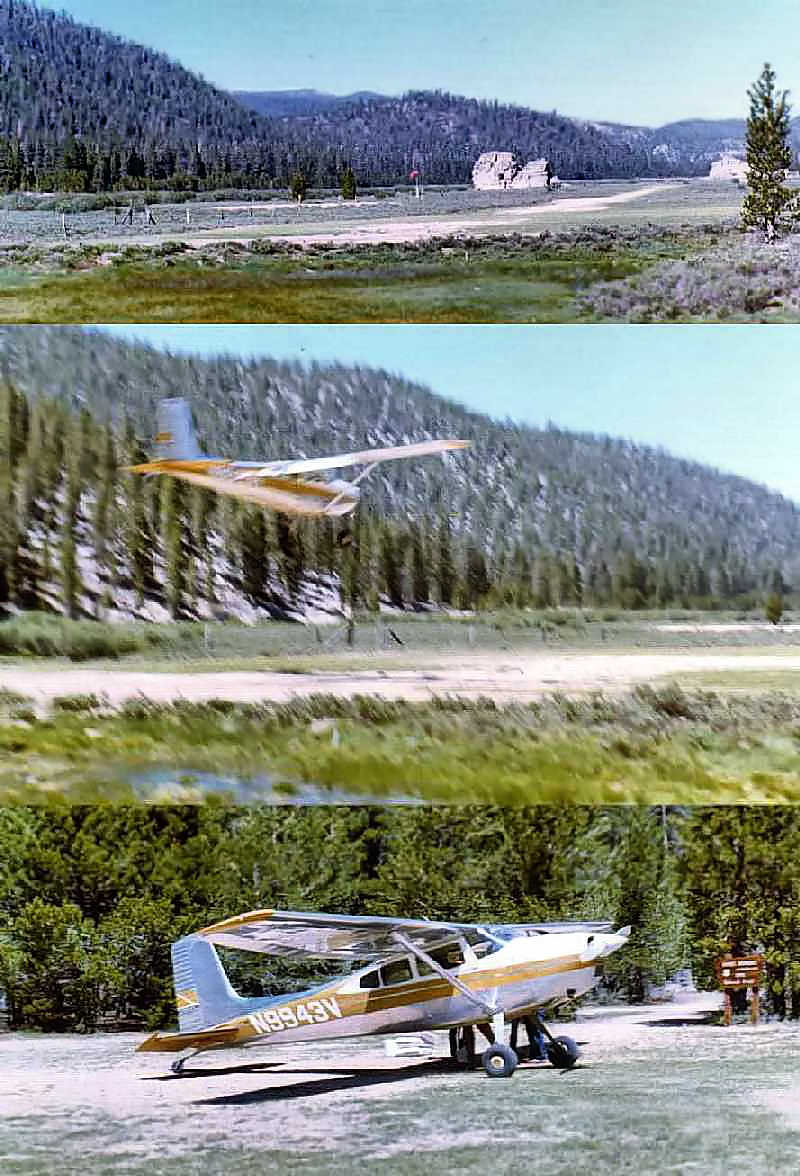
A series of photos by Ted Sarbin of a Cessna 180 landing at Tunnel
Meadows in 1972.
Ted Sarbin recalled, "It was around 1,800' long. I
flew in there twice, both times as a passenger of Bob White's flying
service. I had flown to Lone Pine but I didn't have the skill or a suitable
plane for Tunnel Meadows. There were a number of accidents there.
There was a single-wire (the other half of the circuit was ground) party
line Forest Service magneto-crank phone. Cranking
long-short-short would get Bob White to answer in Lone Pine and
come and pick us up. If one were landing to the west, a go around was possible, the other
direction was marginal."
Ted continued, "When it was operating, Bob White had guides, pack
horses for rent, and tents, tables and refrigerators (no electricity, they were used as
ice boxes). Also, there was a tractor for moving planes and taking the passengers'
gear to their campsite."
Ted continued, "An interesting anecdote I heard from an FAA
Operations Inspector: The FAA made a movie, later transferred to VHS, on mountain flying.
In it, a pilot in a Bonanza tries to land at Tunnel Meadows but
changes his mind when he sees the field so he lands at Lone Pine. There
he encounters a cheerful, friendly older flight instructor who
gives him some mountain flying dual instruction and then he lands
at Tunnel Meadows. I've seen the film and it is well done; both interesting and
instructive.
The problem was that pilots would see the film and then show up at Lone
Pine expecting to find that instructor. Of
course, the instructor was an actor and the real airport manager,
Bob White, was in the business of flying people in and out of Tunnel Meadows
and not especially interested in helping pilots to fly in and out
themselves."
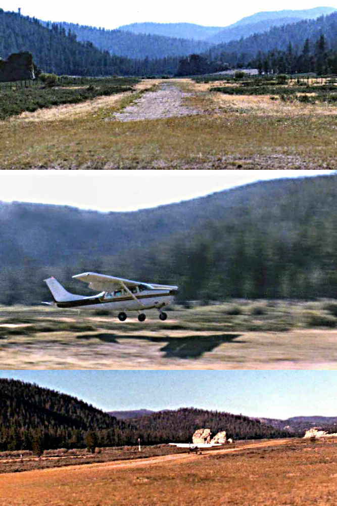
A series of photos by Ted Sarbin of a Cessna 206 landing at Tunnel Meadows in 1985.
According to Ted Sarbin, "The airport was closed when the Wilderness
areas was established."
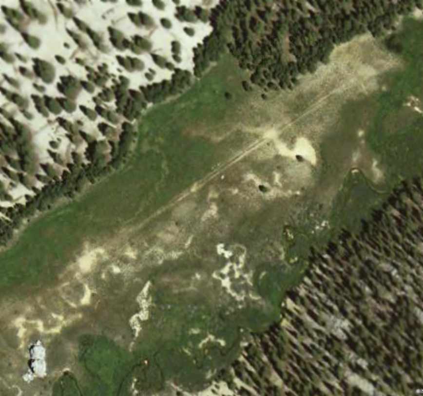
A circa 2001-2005 aerial photo showed the outline of Tunnel Meadows' runway to still remain recognizable.
Simon Hickey reported in 2009, "I'm a flight instructor with the UK
Royal Air Force and I can confirm that Tunnel Meadows, at
the height of summer can be quite challenging for the
less-experienced guys. Especially in a C-130. Done
it several times [made a low approach]. We regularly exercise at
China Lake and Inyokern training up crews prior to their going to
Afghanistan.
There are a few high altitude airstrips in Afghanistan so somewhere like
Tunnel Meadows gives crews exposure to the reduced performance. Going
in on night vision goggles was 'interesting'"


