Here it is – the "official” trip report.
I've written this for multiple audiences – online hiking forum members, family, friends and other acquaintances. All with divergent interests in my experience. So there will undoubtedly be some redundancy (some things will be new for some but repeat stuff for others) and some lack of interest in some areas for most of you. So please bear with that.
Where I cite elevations and distances – it should be no surprise that that there are varied figures for the same things online, although they are all, of course, generally in the same ball park.
You will find with the associated pictures that there are many more for the first part of the hike north of the Colorado River then there are for south of it. The first part is more spectacular than the last part, you tend to take more pictures for perceived new things at the start anyway, and – as you'll find out – I was much more concerned for my own well being with scant attraction to picture taking during the hike up from the river.
First a very general two paragraphs about the hike for those with no other interest beyond the simple fact that I completed a big hike. Then I'll get into the details – both expanding on the themes in the general opening as well as getting into many other things. (Connoisseurs of the real me will want to read it all!

)
On Wednesday, October 3, 2012 I successfully hiked in one day from the North Rim of the Grand Canyon to it's South Rim via the North Kaibab Trail going down and the Bright Angel Trail going up. This followed over a year in planning and about half a year of physical training. The hike started at an elevation of 8,241 feet, descending 14 1/2 miles and 5,761 feet in elevation loss to the bottom of the canyon at the Colorado River at 2,480 feet above sea level. From there the trail ascended 9.1 miles up 4,380 feet in elevation gain to the South Rim at an altitude of 6,860 feet.
That was 23.6 miles of hiking, with gains and losses in elevation as indicated. Unlike climbing a mountain, where the "up” is while you're fresh, this hike involved the "up” after the significant expenditure of energy going down. I started the hike at 5:30 AM in darkness and finished it in 13 hours at 6:30 PM as twilight was just ending. This hike was the HARDEST THING I'VE EVER DONE IN MY LIFE! (Including my 2004 day hike of Mt. Whitney.) Unlike any hike I'd ever done before, I had serious and credible reservations that I'd be able to finish it at one point. Or, if I could, under what late and/or embarrassing conditions that would apply. I had to dig down into mental and physical reserves deeper than I'd ever had to before, wondering if I even had those reserves. I'm darn' proud of the fact that I both met the challenge of somehow finishing the hike and this problem it gave me as well as the fact that, by doing that, the overall hike had been successful and that I, at age 67, had done something very few can claim they've done!
Now for the "blow by blow” . . .
The grand adventure started on Tuesday morning at 7 AM from my home in Summerlin in Las Vegas. Google Maps told me 276 miles and 5 hours and 19 minutes to the Grand Canyon Lodge (where I slept overnight before the hike) on the North Rim. (Google Maps also reports 288 miles and 5 hours and 3 minutes to the South Rim. Reason # 147 to live in fabulous Las Vegas – both rims essentially equal in accessibility!) As it turned out – driving at a little over the speed limit (like most people I suppose) it was only 4 hours and 28 minutes of driving discounting a 55 minute stop. At least Google had the distance essentially correct.
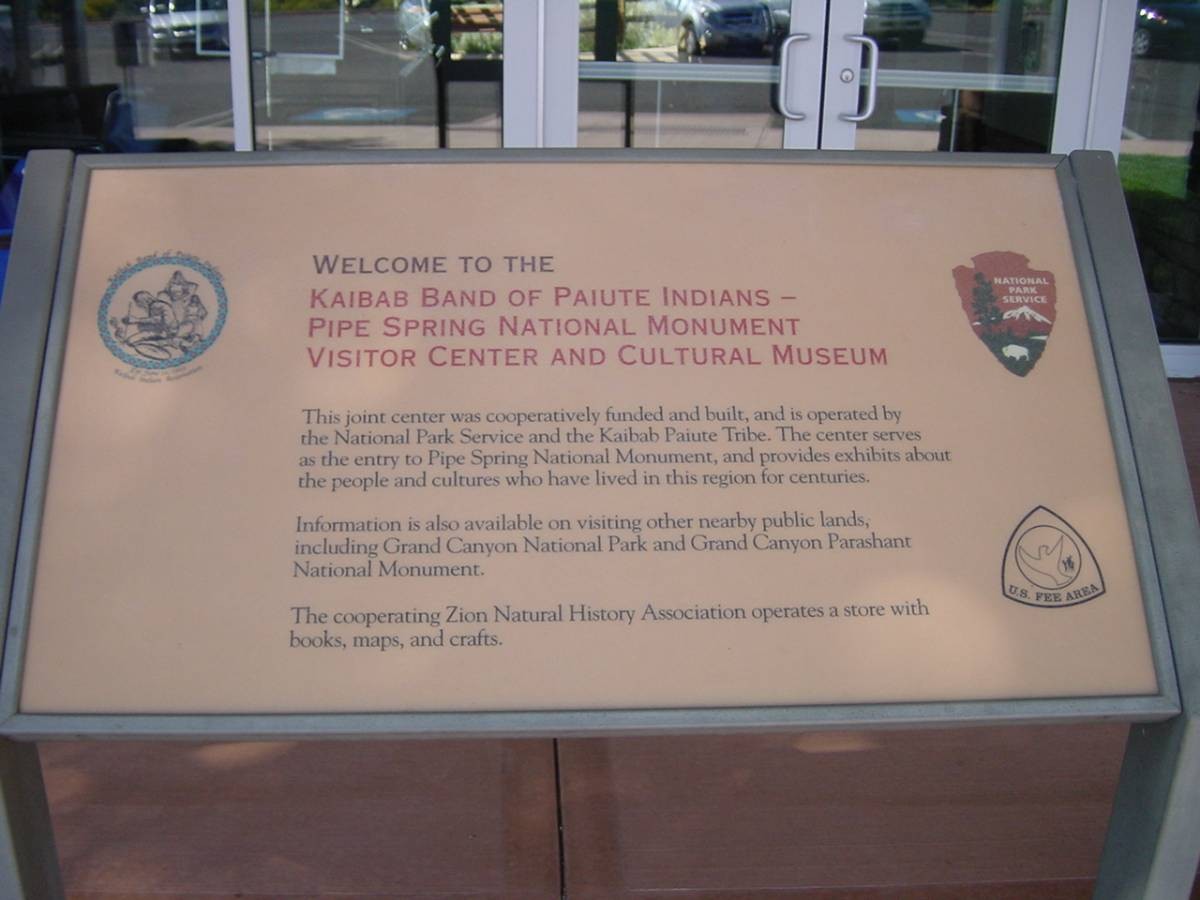
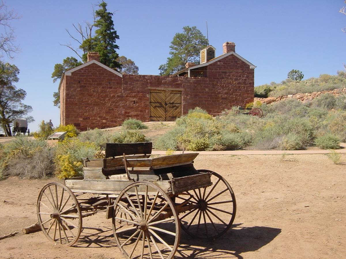
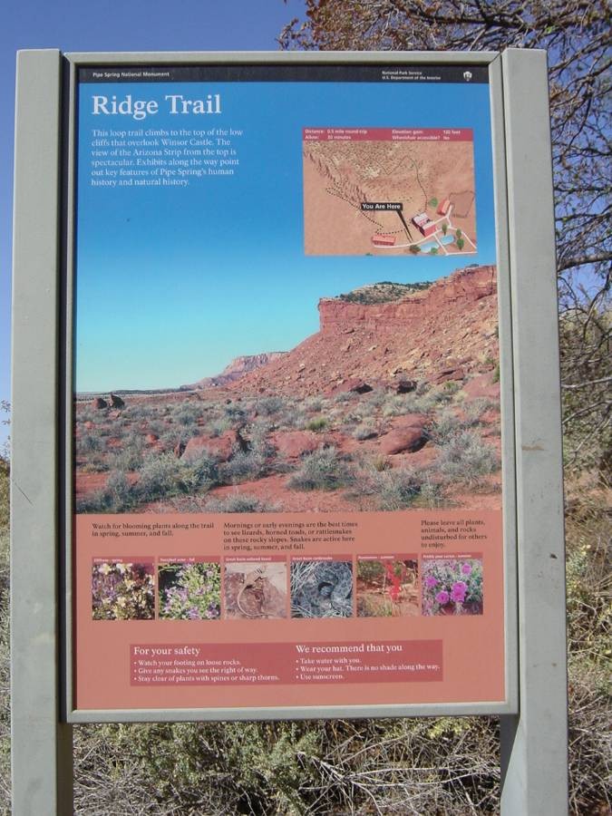
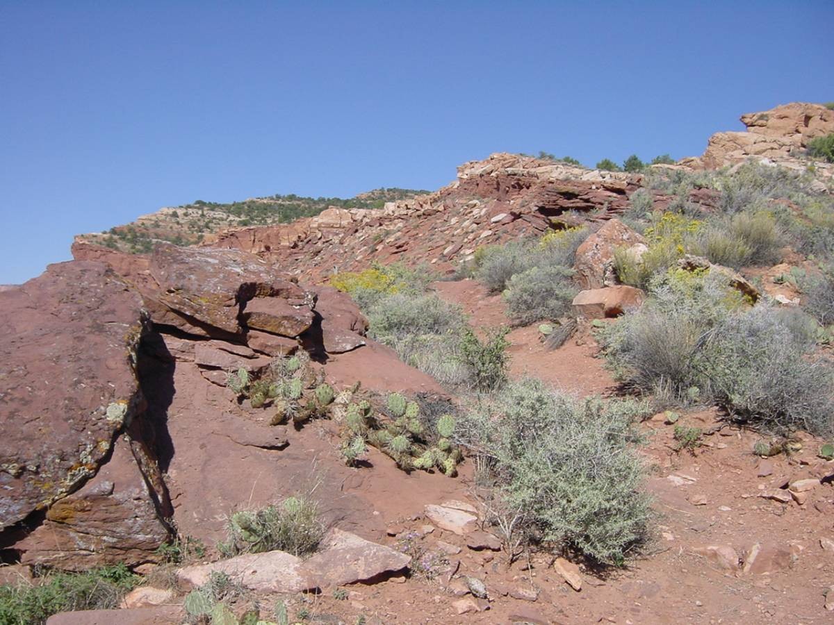
En route took me through the beautiful Virgin River Gorge in northwestern Arizona, in to Utah for a brief loop before turning south back into Arizona, crossing into that state passing through the twin cities of Hilldale, Utah and Colorado City, Arizona. That locale has many Mormons and gained notoriety through Warren Jeffs and his concubine of under aged women. Shortly after here I stopped for that 55 minutes at Pipe Springs National Monument. I work in as many National Park Service venues as I can in my travels and this was an easy one, directly on my route. This site has primarily an historical attraction to it. I took a gander at what was there – hiked a half mile loop trail with nice views and reciprocated a horse walking up to me by petting it's snout. One nice view was my destination a long ways off – the Kaibab Plateau extending from the north rim of the canyon, an obvious long wall appearing on the far horizon. (I learned that this whole section of Arizona is called the "Arizona Strip” – that area of Arizona cut off by the canyon.) (And back in Utah, in Hurricane, if you've ever passed through it en route to Zion National Park it was interesting that the road south to Arizona ascended dramatically from the town with a great view back towards it.)

(Pipe Spring National Monument welcome sign)

(Pipe Spring NM Winsor Castle)

(Pipe Spring NM Ridge Trail start)
(Pipe Spring NM view from trail)
After Pipe Spring the route went through Fredonia to Jacob Lake, where a turn to the last individual route number gave you some 40 to 45 miles left to the North Rim. Jacob Lake is more just a crossroads than a place with any population. And that last road south is the one that is closed seasonally over the late fall, winter, and early spring months. On that last road there were significantly more curves and elevation gains than in the earlier part of the drive. One section had denuded tree trunks, the result I later learned of a fire. But shorty after that there was quite a fall foliage scene show – deep forest greens contrasting with brilliant yellows and oranges. The National Park entry fee gate came up about 12 miles north of the rim and I was delayed about 6 minutes in the line. Free entry for me, as I – like everyone should do once they're of age to do it – showed them my senior pass. ($ 10 fee for lifetime free admittance to ANY National Park Service venue as well as others. One of America's sweetheart deals!)
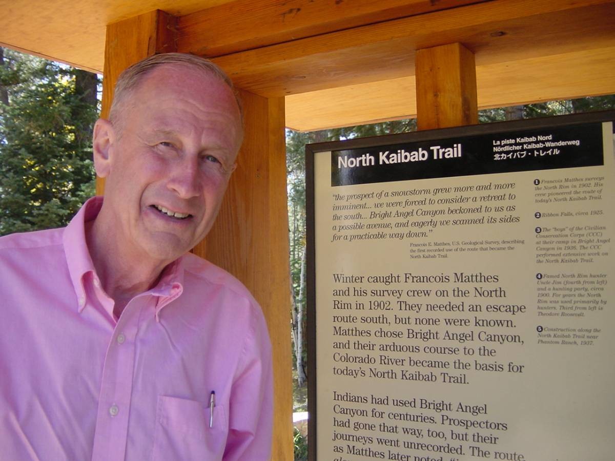
So I was then shortly THERE – on the North Rim for my first time ever. I first stopped at the North Kaibab Trail trailhead and adjacent parking lot to familiarize myself with where I'd be starting the hike the next morning – it's 2 miles north of the Grand Canyon Lodge. I noted the trail start in a forested area going downhill slightly. And I especially noted that the lot was basically full except for only one spot which I'd grabbed. I knew a last minute decision I had to make was to drive my own car there the next morning or avail myself of the free shuttle there from the hotel the next morning, and leave my car parked at the hotel. My immediate thought was that, hopefully, the most patronage of the lot would be during these daytime hours but not as heavy at 6:00 AM when I and other hard core hikers would be beginning a hike – there were assumedly more tourists and short distance hikers than early riser hikers, thus explaining the full lot. Nonetheless, early space availability remained a concern.

(Your hero at N. Kaibab Trail trailhead)

(And the START of N. Kaibab Trail)
The Grand Canyon Lodge is the ONLY hotel facility on the North Rim, and reservations are recommended up to a year in advance (which I had done). (The next closest lodging is called the Kaibab Lodge about 20 miles north.) I parked in the large general lot and entered the place to register. I also inquired about the need for taking the 5:30 AM shuttle. The gal at the registration desk didn't really know how full the lot would be in the morning and recommended I reserve for the free 5:30 AM shuttle – I did that when she assured me there would be no slap on my wrist if I changed my mind and didn't show up for it. I then asked about the parking lot status in the early morning across the lobby at the mule rides concession desk. The lady there didn't know but said she'd ask her supervisor who would know for sure, since she was in that area in the early morning every day. It was left that I'd check back in an hour or so.
(View from Lodge on North Rim)
In the middle of all this, it was suggested by someone that I check at the concierge desk of the Lodge Dining Room (also right across the lobby floor) regarding dinner reservations. All should know by now I'm a restaurant junkie, and with all my detailed advance planning this place had projected itself to me as a casual place not really needing a reservation, so I hadn't done that. So it came as a complete shock when I asked at the host stand about all this and was told that they were fully booked for the evening from their 4:45 PM opening to 9:00 PM! Horrors – I had to be in bed by no later than 8:00 PM to wake up for my planned early hike start! The only other food outlet was a deli with sandwiches and pizza, and that was NOT wanted for a "night before” enjoyable meal. But then – the host noted that, oh my goodness – there was ONE opening at 5:30 PM! SERENDIPITY STRIKES AGAIN! Good sign! I booked it and left to settle into my room.
I returned after doing that and first asked at the mule concession desk about the results from the lady's supervisor. It was good news – she said there had been and should be tomorrow quite a few spaces open in the trailhead parking lot. So – to cover myself just in case there wouldn't be, and also just to get a slightly earlier start than I'd planned – I planned on getting up at 4:00 AM instead of 4:15 AM with the idea of starting my hike at 5:30 AM instead of 6:00 AM. I reasoned that I'd get to the trailhead around 5:15 AM at the latest and that if it was full I would have enough time to drive back to the hotel and still catch the 5:30 AM shuttle. All along the idea of using my own car was the preferred way to go for the flexibility it would give me, and the earlier start now planned to ensure myself of shuttle availability in case the lot was full would work out fine – because I sort of wanted to start earlier than planned anyway. Despite all my careful planning for the hike (estimating 13 1/2 hours for it and 13 hours being an optimistic estimate) it was still a big unknown for me in terms of how it would actually work out, so an extra half hour earlier start was attractive.
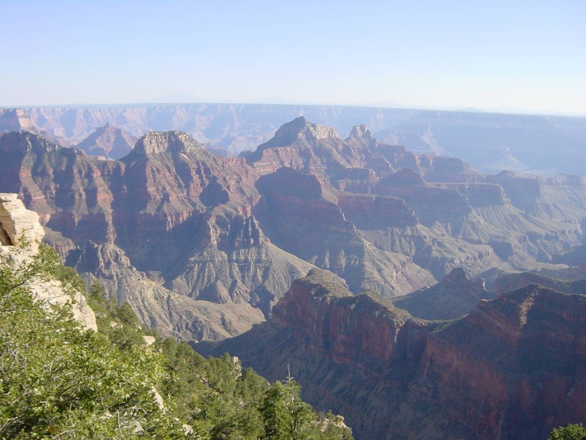
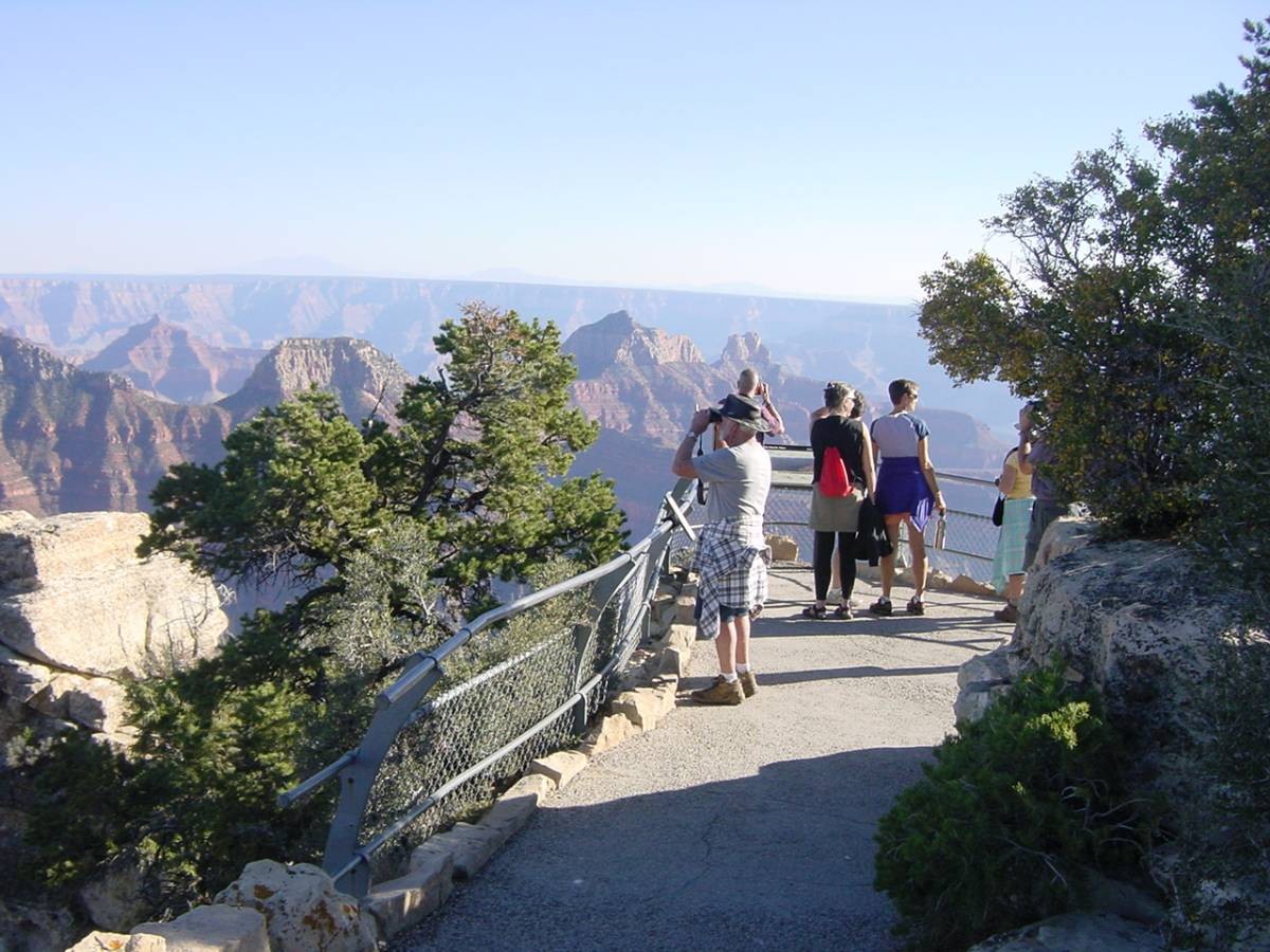
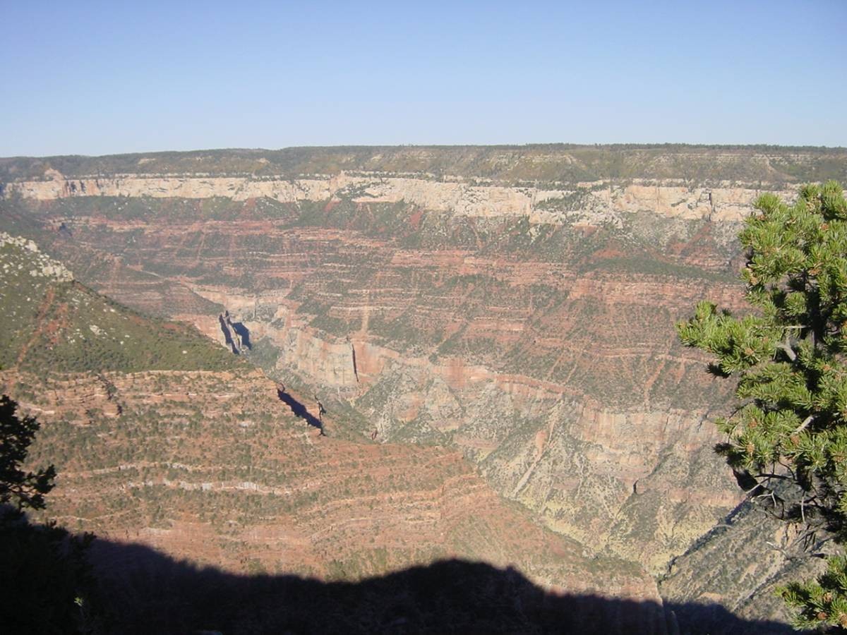
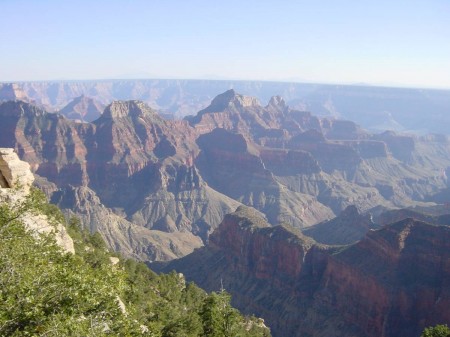
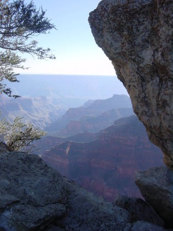
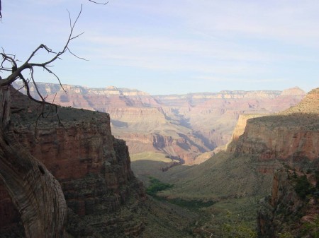
I then had my first real look at the canyon. The lodge has a beautiful lounge and observation room just off the lobby directly on the rim, and also outside terraces on either side of it. Besides exploring this, I took the 1/2 mile round trip hike to what is called Bright Angel Point overlooking the canyon. Heartily recommended. One word – albeit overused – describes the views into the canyon from the North Rim – AWESOME! I shortly realized that even if my hike the next day turned out to be a failure that the overall drive and trip would still have been worthwhile just from the standpoint of my having finally gotten to see the canyon from the North Rim. I had been to the South Rim twice before (and would be there a third time the next day) and although it is a view of certain grandeur I had always felt that because of the huge size and scope of what you were looking at it was almost too much. In contrast, my perception was that the views here seemed to be more dramatic, more "up close”, more "personal. Your mileage may vary (YMMV) – I earnestly recommend you seeing the North Rim some day, despite it's remoteness to get to. A totally different perspective of things compared to the South Rim, and one I found superior. One thing I really liked that you don't have at the South Rim – looming over the horizontal flat line horizon of the other rim were some of Arizona's mountains, including it's highest . . . Humphrey's Peak some 64 miles away just north of Flagstaff.
(Approaching Bright Angel Point)

(At Bright Angel Point)

(I'll be down there tomorrow)
(Another North Rim view)
It should be noted that although I live at 3,200 feet elevation I still felt slightly light headed at times at this 8,241 feet of elevation. That soon passed. I'll stand on my earlier recommendation that anyone coming from sea level should probably give themselves at least a day here before their hike.
It was time for dinner! Large and tall dining room with windows affording great views. American contemporary food with southwestern influences. I went for "smoked salmon (layered with capers & onions & with dill aioli” and "sunset mushroom pasta (semolina corkscrew pasta sautéed with mushrooms, shallots, baby spinach, oven roasted tomatoes & tossed with garlic”. That pasta (for the carbs before the big hike!) also had some cheese in it – horrors! (I've been on a "kick” watching my saturated fat intake in preparation for a major physical soon – watching my cholesterol count.) The bread was very good, served with an extra virgin olive oil, balsamic vinaigrette, and garlic conglomeration. Liquid was 2 Lumberyard India Pale Ales (God bless our nation with it's great regional craft beers!) and a glass of Esperto pinot grigio. I rated the whole place one fork – very good (upper 10%). (Now you know why I don't hike as much as many of you – my foodie hobby gets my first salute!) (It should be noted regarding one service lapse, though not by my waitress "Maria” who took good care of me. Some guy who I'd overheard had been there 27 years bumped into my table quite jarringly once, than AGAIN – without so much as an apology. I blurted, "Sir, that's twice you've bumped into my table!” Now why did it take THAT from me to get his "I'm sorry.”?)
I walked to my room with a light buzz from the booze, exactly what I wanted to facilitate getting to sleep at 7:30 PM.
I had some trouble getting to sleep, and when I did I woke up quite a few times during the night. In other words – everything normal for a night before a big hike. You're excited, and full of anticipation.
4:00 AM finally came and I sprung up in relief that the night was over and it was time to start what I'd looked forward to for over a year!
My first surprise was reaching for my razor to shave – and finding I'd forgotten it! Oh well, NBD (no big deal). That would be only one extra day of growth on my face, as I wasn't planning on packing it or any other toiletries in my pack ( to save weight) for my overnight stay on the South Rim (after finishing my hike and before the shuttle bus trip back to the North Rim the next day).
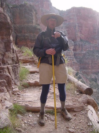
Speaking of my pack – here was what I wore and what was in the pack. (Anyone EXCEPT hikers can skip this paragraph.) On me – wool hiking socks, navy blue long johns (underwear), shorts, long sleeve navy shirt (wicking moisture well), New Balance trail runner footwear (with insoles), Marmot outer jacket (which was taken off later in the hike when the temperature rose), straw hat. Stuffed in pockets were 3 pages of notes, a small portable alarm clock, keys, wallet, change, a comb, a pen. Looped around my sternum strap was a digital camera. And one other item not in my pack described in the next paragraph. In my back pack – a parka with hood for inclement or colder weather, nylon wind pants (ditto), some toilet paper, moleskin, a map, my headlamp (worn for the first half hour of the hike), 4 20 oz. Gatorades, 5 Cliff bars, my reading glasses, a small plastic capsule with some pills . . . and that was basically it. Except for, also, 3 things unique to the fact that I'd be staying overnight on the South Rim – a pair of slacks, a long sleeved shirt, and fresh underwear to replace smelly hiking clothes. I just wore my hiking socks and trail runners along with those – and said the heck with a belt for the slacks. (Eschewed a nail file, deodorant, toothbrush, toothpaste, mouthwash, shaving lather, razor blade, hair spray – one morning without wouldn't kill me and that saved weight.) Although my pack had 20 pounds of stuff in it for training leading up to the hike it weighed only about 16 or 17 pounds for the hike with this assortment of things in it.
The one other item I took with me on the hike (non-hikers can join in now) was my poor man's version of a trekking pole. When I hiked Whitney I started without one but wound up using a sturdy enough but still light weight tree branch of appropriate length found off the trail – I found it especially helpful going downhill (as have others). Since then I'd done that on any moderately lengthy hike. But for this hike, thinking of what I might have to substitute for looking off the trail for something, I ingeniously (or some might say sadly) thought of the yellow pole on a mop I had, which could be unscrewed out of the mop end! Hey! It wasn't stylish or "cool” but from a pragmatic standpoint it worked like a charm! ("Stylish” and "cool” fall at the BOTTOM of criteria dictating any decisions I ever make. NOT important or substantive life heavy weights for me.) I'm aware genuine trekking poles are definitely better (among other things having the springy shock absorbing effect that a tree branch or mop pole won't!), but since I don't really hike that much to justify that expense the tree branch (or mop pole!) route is the way I've gone.
Sooo . . .. I got to the trailhead at about 5:15 AM, as planned. I fumbled around in the car and out of it ensuring all my gear was with me. When I closed the car door I wondered in my early morning fog why the interior dome light was still on. Then it dawned on me (no pun intended!) that I'd manually turned it on while I was in the car and had forgotten to turn it off. Whoa – one last dead car battery to worry about some 36 hours later the next day when the trans-canyon shuttle would be dropping me off here after the trip from the South Rim.
Now it was TIME! AT the trailhead at 5:30 AM for THE START OF THE HIKE!
It was dark, no twilight yet at all. The temperature was in the high 30's with a moderate wind, and my fingers were frosty – actually wondered if gloves would have been a good idea. I was ALONE. I'm 67, with 24 miles and lots of unknowns ahead of me – and I wondered, AM I FREAKIN' NUTS?!
And that question was maintained in my head when I found that my headlight – although giving great definition of the trail – did not give good depth perception when it came to rocks and ledges on the ground while walking downhill. I found that anything more than a tentative gait ahead would leave me slipping and misjudging steps and with the potential to leave me sitting on my keister (or worse). So, it was an initially slow pace until twilight hit, but it at least still gave me a head start with respect to what I'd originally planned (leaving at 6:00 AM). (I didn't have that problem on my Whitney day hike, where my first 2 1/2 hours were in darkness – I think because of the forced slower pace going uphill, the ground being marginally closer to you, perhaps not as rocky.)
My sense of isolation in the universe was relieved fairly shortly about 10 minutes in to the hike when I was startled by a flashlight's beam behind me hitting ahead of me all of a sudden. It was another male hiker. And just another minute after that about 5 or 6 folks with headlights came up from behind me, some of them women. All of them passed me – they were braver than me to go that fast in the dark with only headlights. Perhaps they were more familiar with the trail than I. But psychologically this was a boost – I WASN'T crazy after all! (Either that or ALL of us WERE!)
Which logically brings up several other observations. One, there are LOTS of people on the trail (the whole 24 miles of it) -- one reason being this WAS one of the limited times in the year when it was practical to do the whole trail (summer is impossible with hellish temperatures within the canyon). Two, despite the National Park Service's stern warning about hiking to the river and back in one day, or going rim to rim in one day – LOTS of people are doing it. It's likely that the big majority of hikers are not doing rim to rim, but the number who told me they were was surprising, as was the number who were doing rim to river to rim. From all the talk with fellow hikers, observation # 3 comes up – the camaraderie is (always has been) terrific. The hiking community is FULL of very nice people, on average much higher in that "niceness” than other segments of the general population.
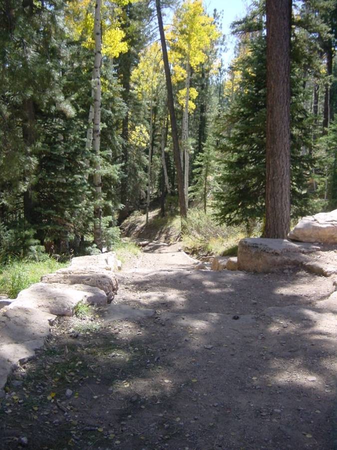
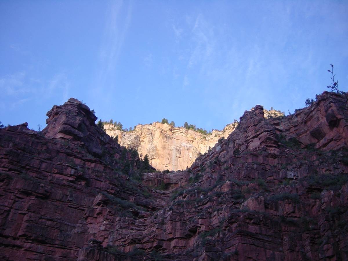
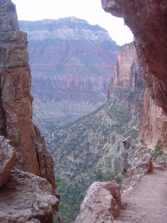
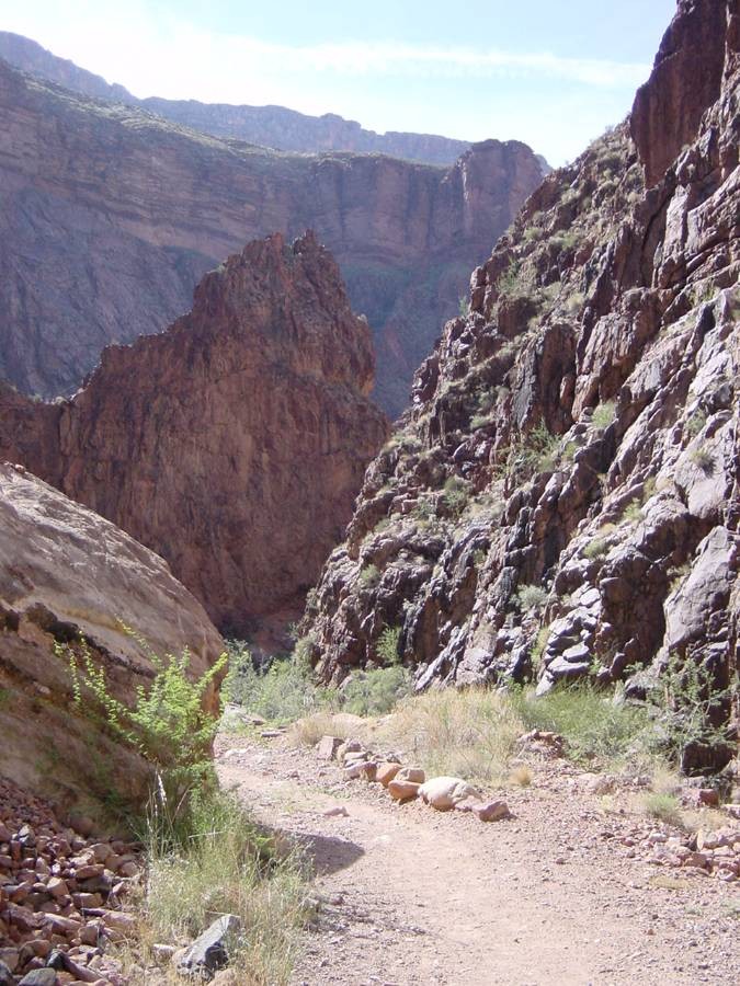
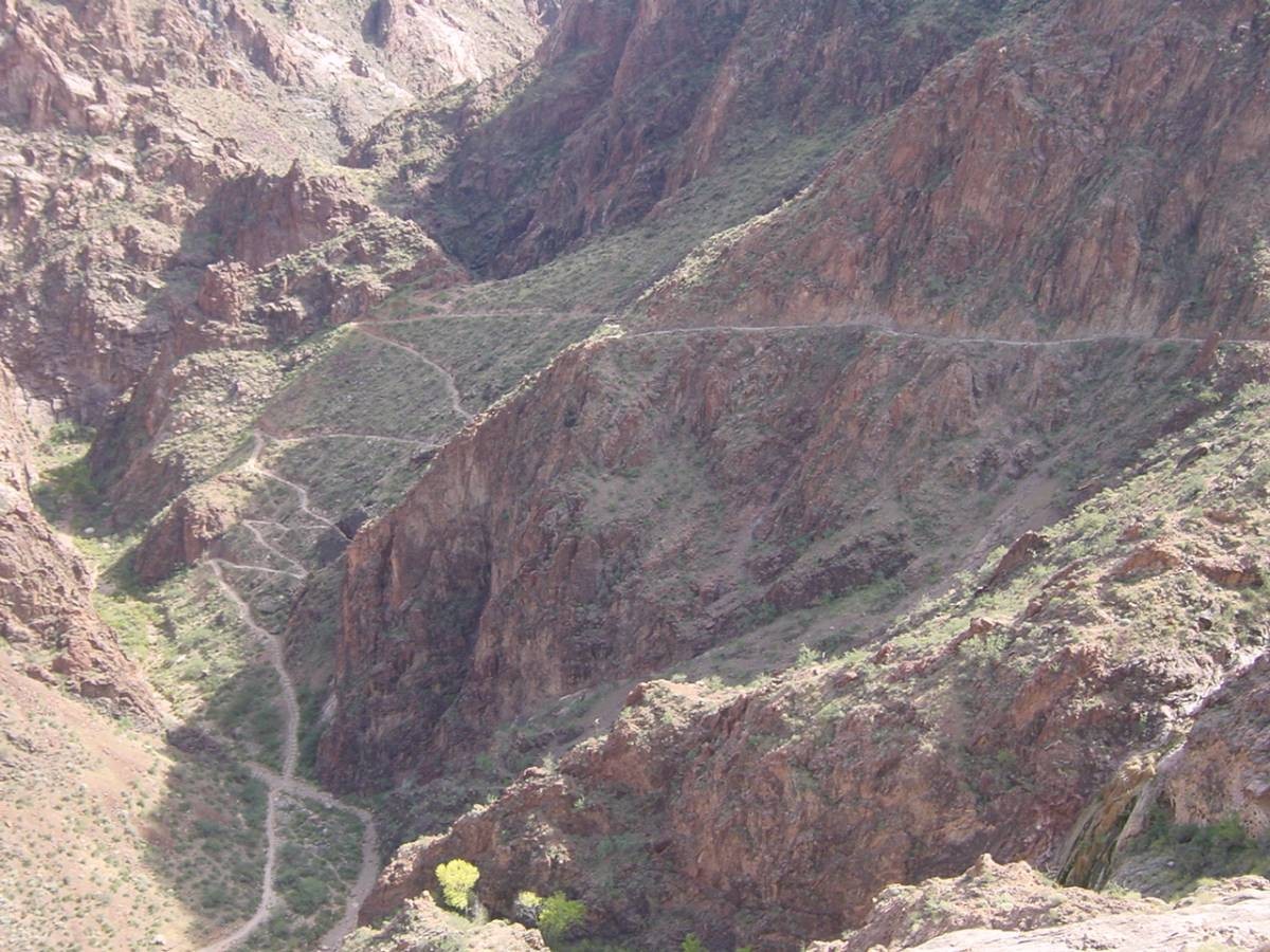
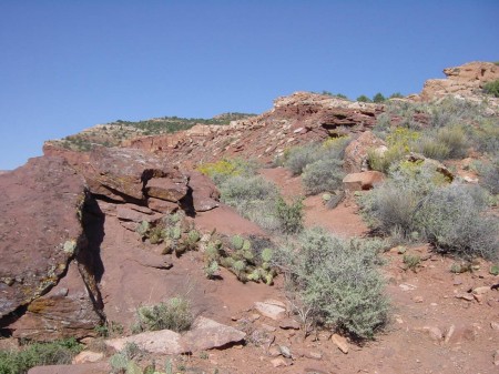
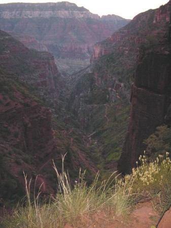
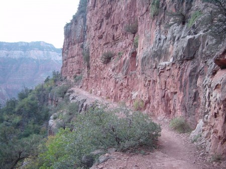
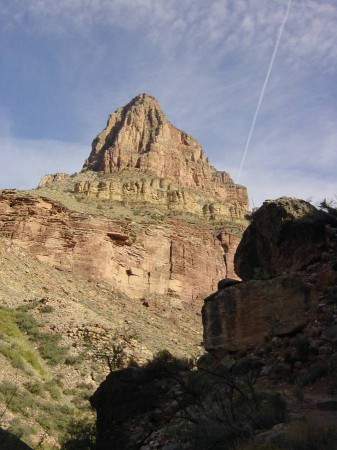
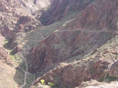
As twilight began to come up, transitioning to daylight, the beauty and ruggedness of the North Kaibab Trail began to reveal itself. One of the most "fun” trails I've ever been on – spectacular. There are a lot of scary pictures of parts of it but, as I thought would be the case, it's not so bad walking it in person. There IS significant exposure potential for a long fall in many places but you'd have to have a REAL bad stumble or be exceptionally careless for that to happen. On the other had, if you ARE quite afraid of heights I wouldn't recommend you hit this trail.
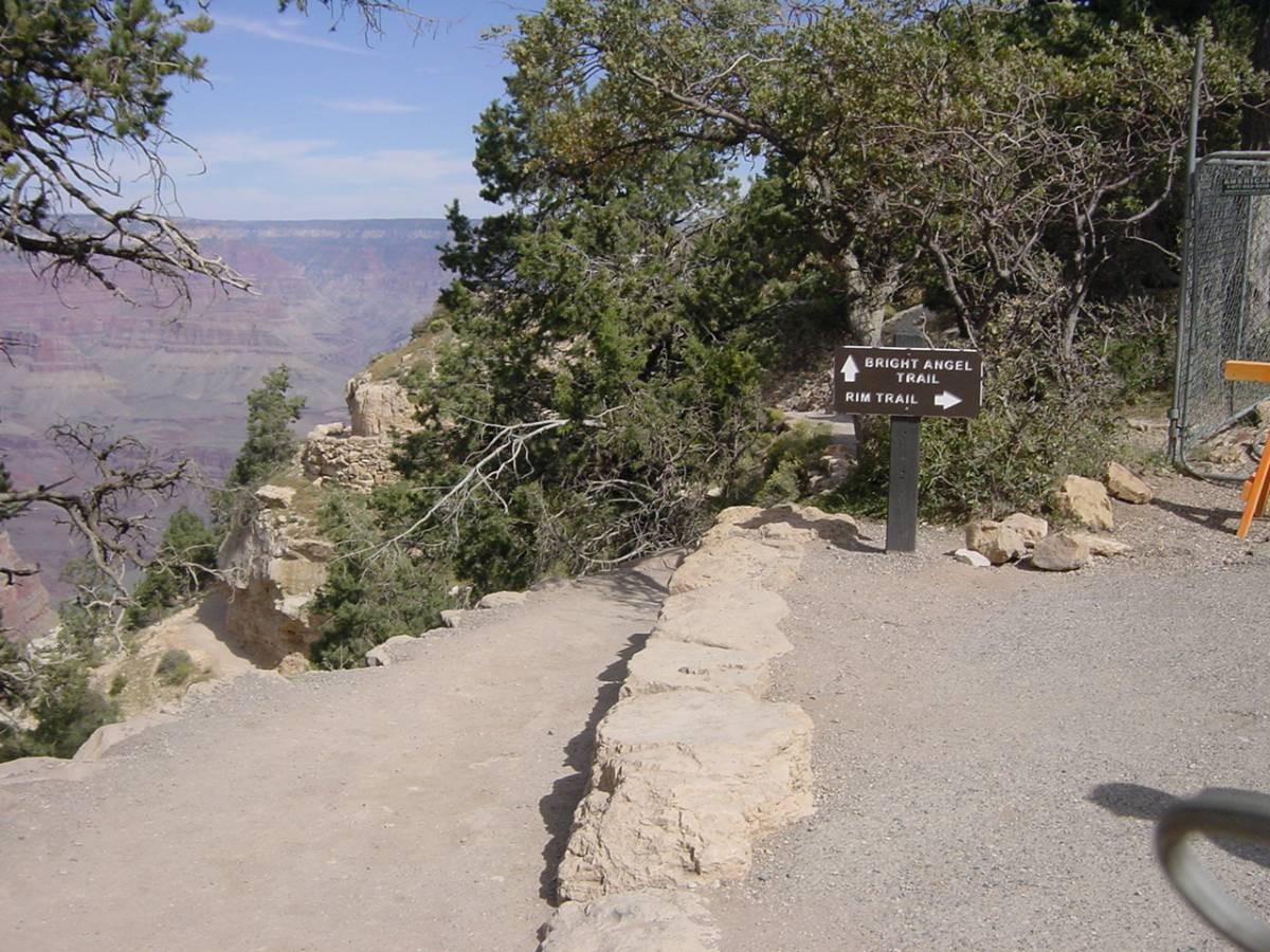
It is relentlessly downhill, with only a very few upgrade sections. And it is especially steep in it's first half, over the first 6 miles or so. It then lessens in it's rapid descent in elevation over the second half, although still losing it. The Grand Canyon name applies to the overall canyon and the prime canyon shaped by the Colorado River. But that overall canyon contains scores of sub-canyons emptying out into other sub-canyons or the river. That first especially steep section of the North Kaibab Trail is in what is called Roaring Springs Canyon. Roaring Springs Canyon empties (there are streams and/or creeks in these canyons) in to what is called Bright Angel Canyon which takes you to the Colorado River (I know, it's a little confusing – that and Bright Angel Point both being north of the river when the Bright Angel Trail (going up out of the canyon) is on the south side of the river).
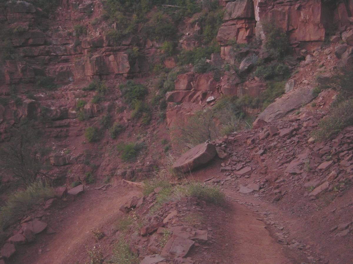
While I'm on this trail description bent I'll throw in another observation – the overall North Kaibab/Bright Angel 24 mile trail system is WELL defined. I can't think of HOW you'd lose track of where you were going. It is better defined and marked than the Mount Whitney Main Trail. The latter loses points in comparison because of it's sometimes hard to follow stretch above Mirror Lake. And it otherwise is destined to be marginally harder to follow give it's more alpine rocky nature to begin with. Also, although the trail is easy to follow, it is not, for the most part, a smooth path – it is generally very rocky, with plenty of large stones to meander around and over. And – lots and lots of ledges/steps to climb up. And – lots and lots of flat large stones set on edge protruding vertically up to a foot above the trail and crossing it. To step over. I presume they're for controlling and channeling water drainage from rainfall?
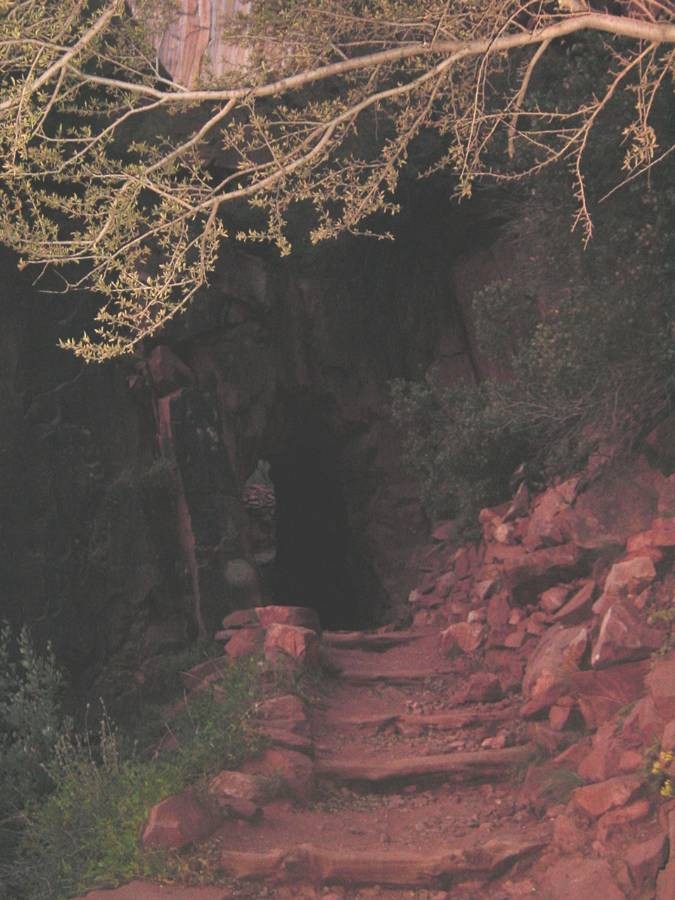
Back to the hike! The first significant named point on the North Kaibab Trail is the Supai Tunnel, 1.7 miles down from the trailhead. I wonder if all hikers find, like I do, that the start of any hike seems to go somewhat slow (not literally but in one's perception) and then the miles start going by faster (again, at least in perception) once you get on "cruise control”. That was my impression here, because I waited anxiously for that tunnel as the first "milestone”. I'm not sure if it's a natural tunnel or was man made for the tunnel. It's just about the same size as the tunnel Steve showed in a picture in his current trip report – maybe 8 feet tall and about 8 or 10 feet long.

(Looking up & back to Supai Tunnel)
(Trail visible in Roaring Springs Canyon)
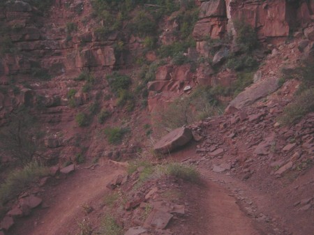
(Going DOWN, one of many switchbacks)

(Sun has hit the North Rim)

(Many bridges and another good view of trail)
(Good idea to favor the right!)

(It really IS a GRAND Canyon!)
(Uh, this would be your hero again)
OR
(Hide the women! Hide the children!)
The next named point was Roaring Springs, 3 miles into the hike and 3,000 feet down already. I had read there was a 1/4 mile off shoot trail to see it up close, but I decided against doing it . Sounded like just a spring to me, you could hear it anyway – and I thought I'd leave any optional side trail hike for Ribbon Falls, which seemed like it would be a little longer of an off hike yet a more spectacular thing to see. As it turned out, don't know about the spring or not but there was certainly a big waterfall , viewable from the main trail – so that was "close enough” for me.
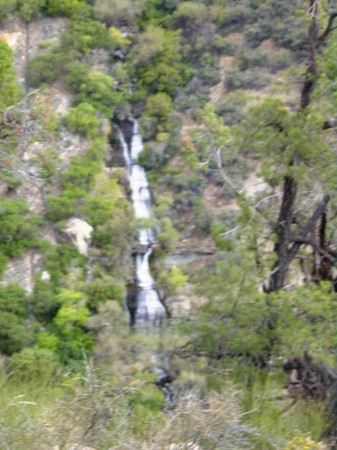
(An out of focus Roaring Springs-Falls)
Just .7 of a mile after this was what is called the Pumphouse Residence (where a ranger or some other custodian type person lived and often put out lemonade for hikers). Then another 1.4 miles to Cottonwood Campground.
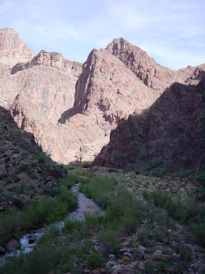
I found that the entire North Kaibab Trail sort of worked out to two segments – the trailhead to this point where most of the heavy descent of the Roaring Spring Canyon took place, and where you had finished roughly half of it (6.8 miles). And the next half to the river (through Bright Angel Canyon) , where the descent was still ongoing but much less pronounced.

(Transitioning in to Bright Angel Canyon)
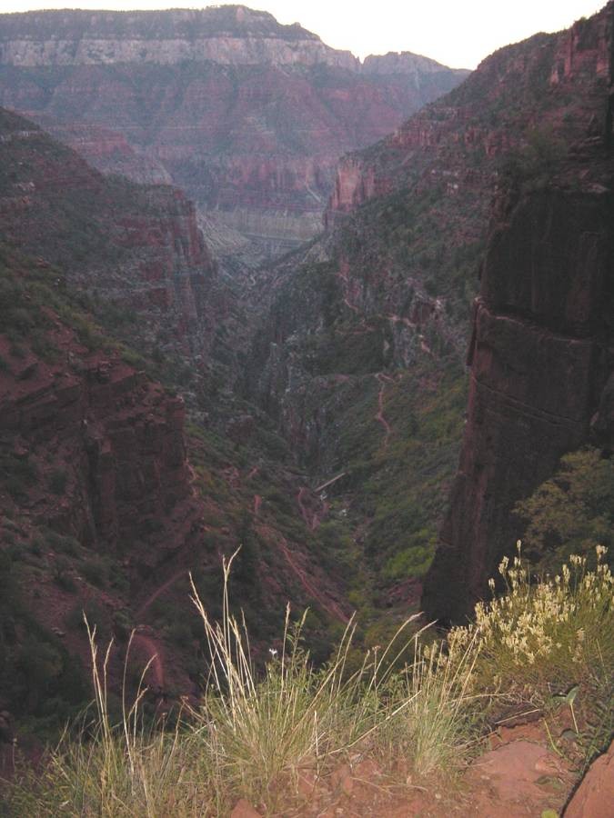
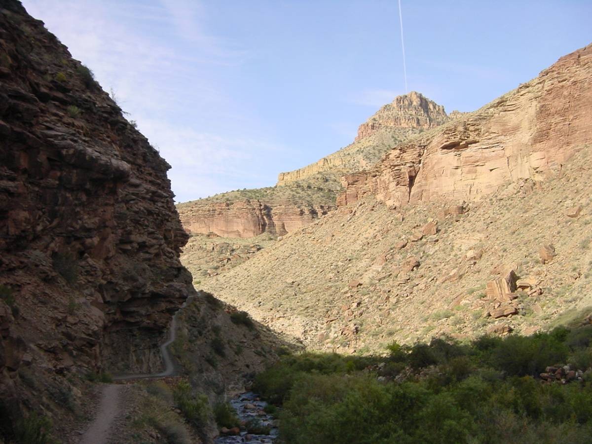
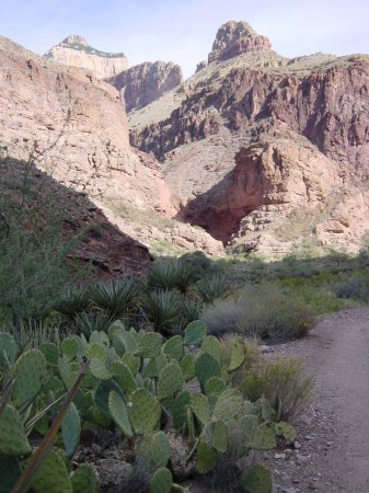
And I found that this second half sort of worked out in to two segments by itself also. Cottonwood Campground was the last "named” place before the end of the whole segment at Bright Angel Campground on the north side of the Colorado River. That was a 7.2 mile long segment in the hike with no intermediately named "milestone” points! But it seemed to break up in to the two segments I mentioned – the first part being a sort of open area between two canyon walls and the second part being a MUCH narrower section between steep (if not vertical) canyon walls. The latter area is called "The Box”.
In this first segment (before "The Box”) I kept plugging along. I tried to check what time it was but found that my clock had gone haywire and had to be reset, so I'd have to wait to find another hiker with a watch to reset my own time.
(One of many peaks)

(Gradually descending Bright Angel Canyon, South Rim in distance)
I got down to the side trail to Ribbon Falls and asked a guy how long the trail was to it. I had read online about 1.6 miles round trip. The fellow told me about 1/4 mile one way (big difference!) and showed me the trail, all of it mostly visible from the point I was at. The falls were hidden behind a sub canyon on the other side of the stream going down Bright Angel Canyon (the main sub-canyon I was now hiking down). But I was also told I could see the falls from the trail I was on just a little way further (I had asked specifically if you could see them). So I made the decision to NOT take the side trip. I reasoned that if I could see them from the main trail that would be at least something, if not as spectacular as being more up close. I also thought that even up close it would only be a marginal add on with respect to all the limitless beauty and grandeur I was enjoying already just being on the main trail. And most importantly, for my first time here, I though it would be best to conserve all my energy just for the main goal of doing 24 miles rim to rim in a day at my age. (As you will see, this was a wise decision!)
Shortly down the trail from here Ribbon Falls WAS visible. From the distance I was away, it basically came across no better or less impressive than what Roaring Springs had been.

(Zooming in on Ribbon Falls)
(The obligatory cacti shot)
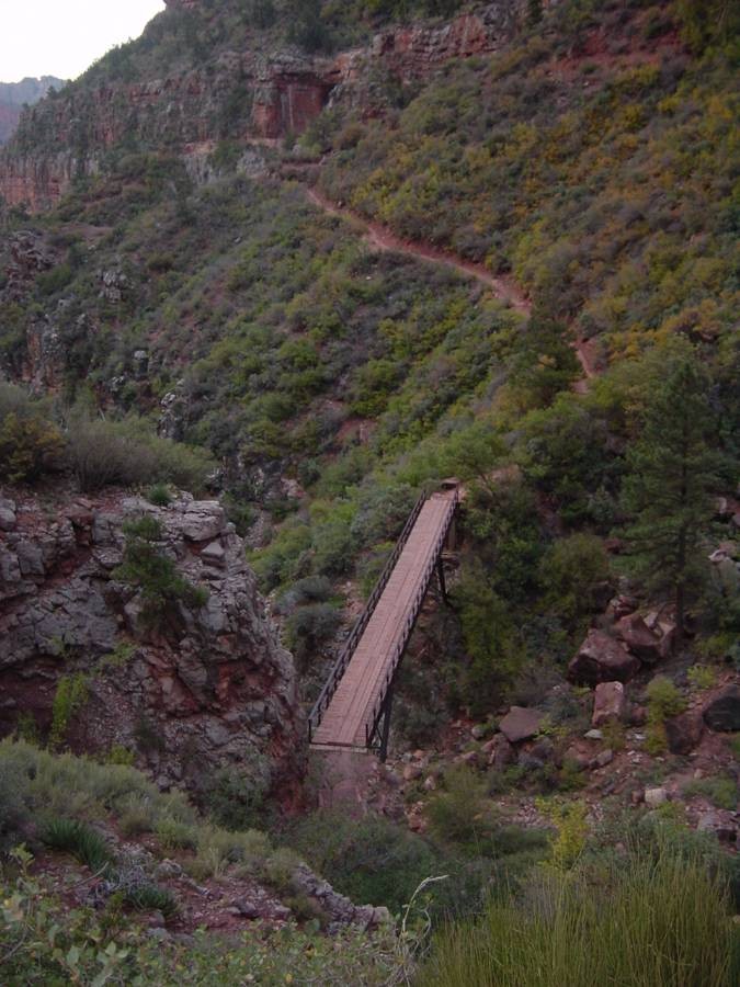
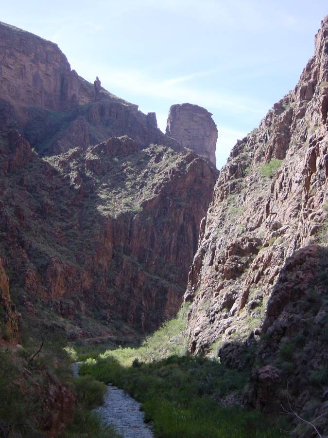
When I got to "The Box” section I found two things. One, a VERY spectacular part of the hike. (Remember? Narrow canyon! Steep and vertical walls! (Also, more distant sharp peaks and buttes on top of the walls!)) Two – it was a mentally challenging section. The canyon walls followed the curve of the creek (Guess! You're right – Bright Angel Creek!) and boy, there were lots of curves. So you'd be hiking from bend to bend, just wondering WHEN you'd come to the last of them. There were lots of footbridges in this section crossing back and forth over the creek, from one side of the canyon to the other.

(We've entered The Box)

(I TOLD you it was narrow!)

(One new rock formation after another)

(Still in The Box)
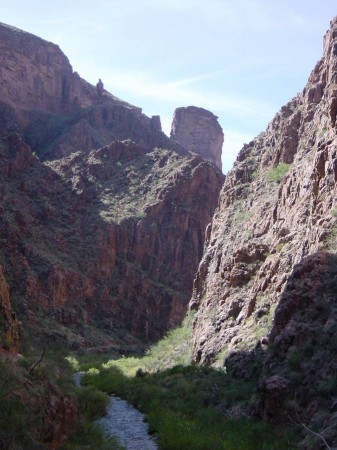
(The Box still, endless bends, crazier rocks)
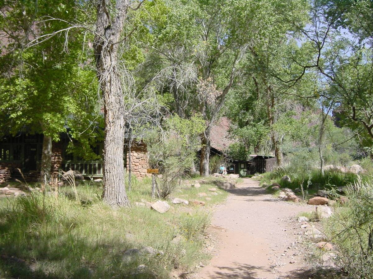
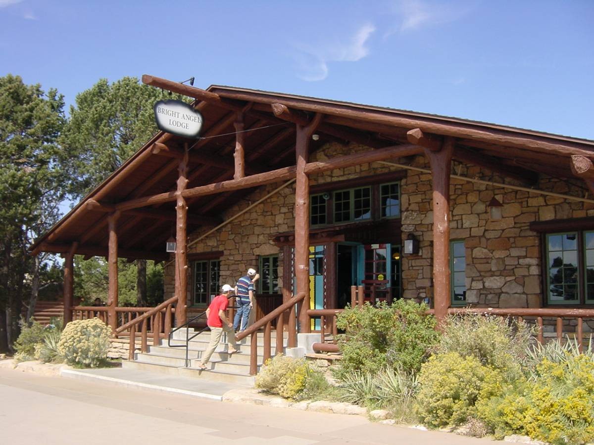
Your goal at this point was that next "named” point at Bright Angel Campground. Just before that on it's northern side is Phantom Ranch. Phantom Ranch is the resort operated by Xanterra, the corporation that also manages the hotels and lodges on the South Rim. It's paid lodging for folks who want to hike down to it and stay a night or more. Got it's own restaurant. It's very rustic, as you'd expect – not high fallutin at all. Sort of primitive in a way. I'm sure no TV –there was no TV at the Grand Canyon Lodge OR the Bright Angel Lodge where I stayed on the South Rim after the hike.

(Out of The Box! Phantom Ranch!)
I finally DID – of course – round the last bend in the creek in "The Box” and found myself walking through the Phantom Ranch grounds. I stopped briefly to enter a rest room and splash water over my face. Then past the campground on my right, looking for the bridge on my right that led to the correct bridge over the Colorado to the Bright Angel Trail on the south side of the river. I could see activity and building across the creek, and knew I'd already passed one bridge – I knew there were two bridges crossing from my (east) side to the other (west) side. I was worried that I might have gone too far and passed both bridges, so I stopped and hollered over to a lady on the other side to ensure there was a bridge ahead of me – and she responded, yes, there was one just ahead.
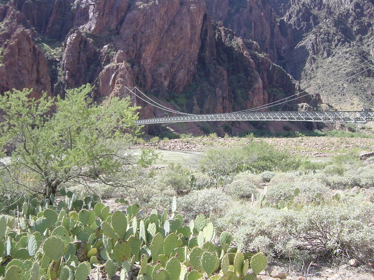
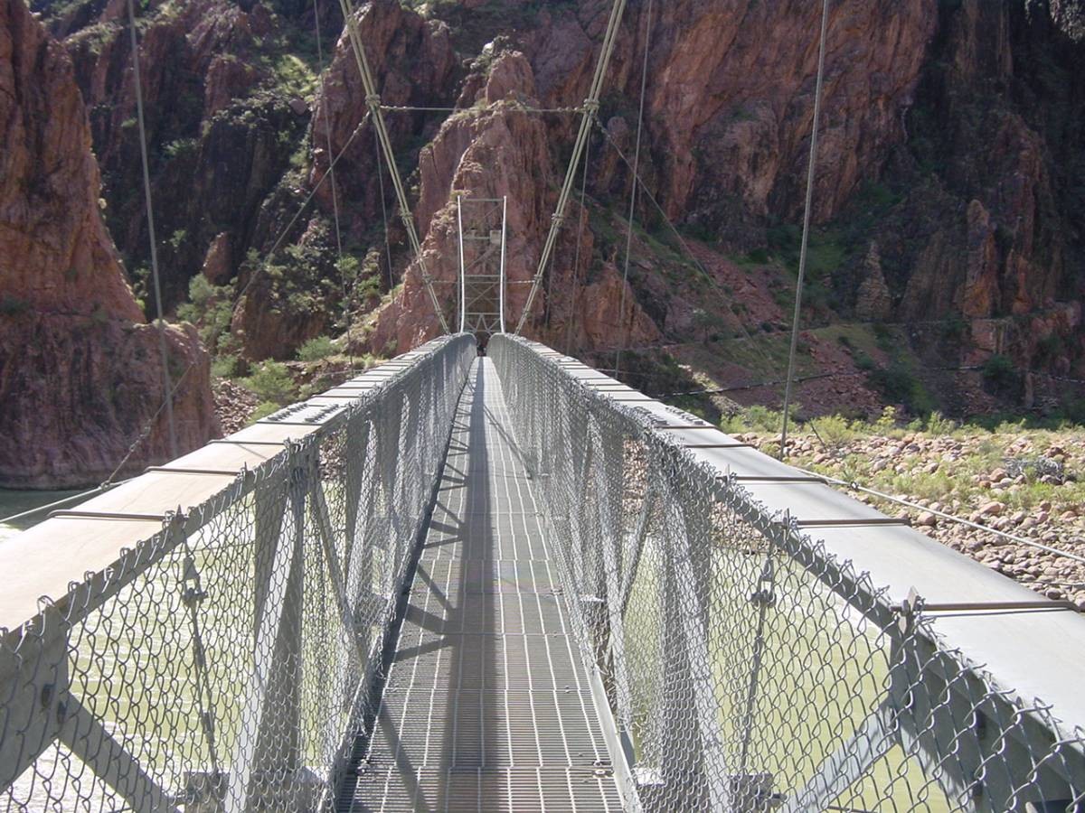
I crossed that and it was just another 300 feet or so to the bridge – that I could see -- across the Colorado River.
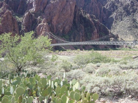
(Silver Bridge across the Colorado River)
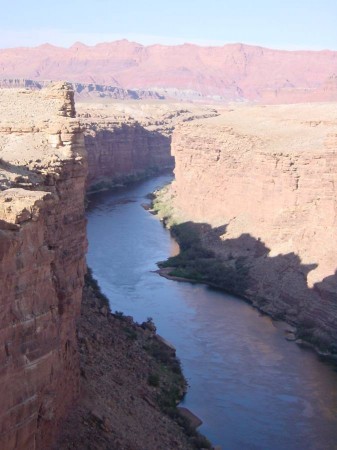
I crossed the silver suspension bridge. I was at the bottom of the Grand Canyon with the Colorado River below me. The river was churning along pretty rapidly.
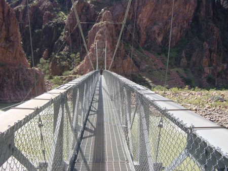
(About to cross over to the South side)
When I reached the other (south) side I finally checked my time (I had had the clock reset earlier when I'd talked with the gentleman by Ribbon Falls).
It was just a little after 12 noon, and I thought – I'm crunching it! I'm doing EXCELLENT! At this rate I'll finish significantly ahead of my best estimated finish time!
Wrong. So, so, so wrong! Read on!
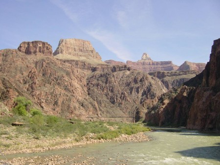
(Bottom of the Grand Canyon, looking east, only other bridge)
I knew the uphill part would be – let's say "fun”? Heh heh. I already had planned to break up the long uphill slog into manageable mental segments keyed to those named stops on the trail. So my first goal was to do the 1.5 miles along the south shore of the Colorado River to what was called "River Resthouse”. My research/notes showed me that my starting elevation at 2,420 feet wound up being the same after this 1 1/2 miles. So I thought I'd have a nice leisurely level walk. Uh uh. First of all, some sections with thick dense sand, slowing you down and playing with your energy. Second, worse – the trail went up about 300 feet before losing it. That 300 feet was a good estimate because I later at home found an online elevation graph for the trail showing that, yes indeed, there was about 300 feet to gain and loss here.
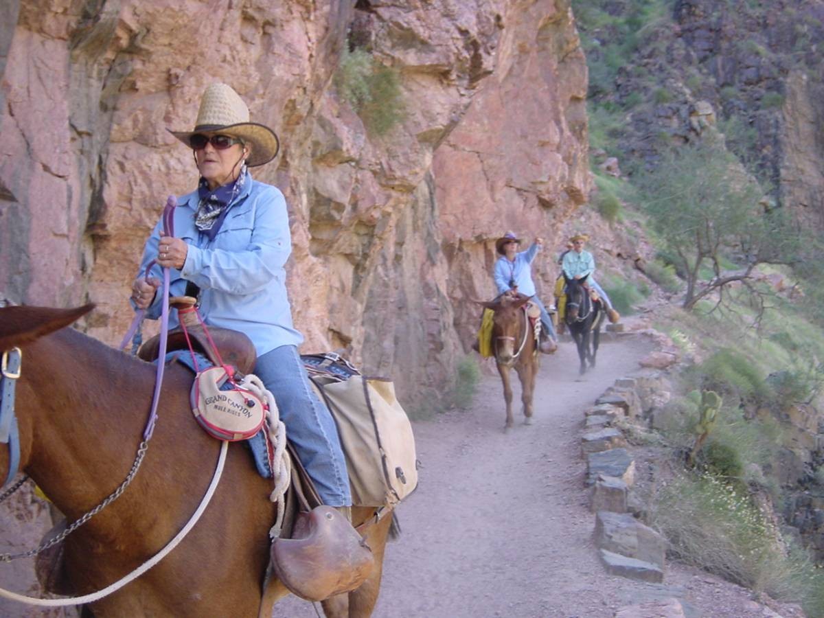
But I was still truckin' along fairly speedily. Only highlight – river rafters with folks going downstream. And at one bend in the trail running into a 20's gal mooning them as they yelled! (At least she hadn't actually dropped her drawers.) Ah, this is what we hikers STRIVE for – a real wilderness experience! LOL! (She seemed a little startled and embarrassed when she saw me walking up.) Oh – this was also the only time in the whole hike where I encountered a mule train. Actually, two of them. Or were they horses? (I did NOT major in animal husbandry!)
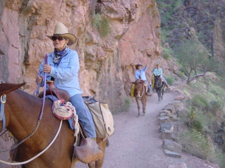
(Turns out they ARE mules, not horses!)
At the end of this segment, having descended back closer to the river, I saw a house ahead of me and a hiker leaving it walking on a trail to the west. I first thought it was a continuation of the segment and that I wasn't at the end but the trail turned left and uphill and I could see there was a stream between me and the house, so I realized that THAT was "River Resthouse” and that I was now entering the next segment.
Which would be a big one – 3.2 miles to "Indian Garden”, rising 1,320 feet to 3,800 feet above sea level.
I kept going, and going. Things DEFINITELY – for the first time in the hike – started going continually uphill. And the sun's full force finally came out in terms of angle of attack and getting towards the higher temperatures of the day. It was in the 80's for sure.
I got about 3/4 of a mile into this segment and then IT HIT ME.
Whenever I'm on a hike and hit a stretch where I'm quite fatigued I – and I think most hikers do this – just keep plugging along, if even at a slightly slower pace. If you quit and rest you often lose your resolve to endure and tough things out, and that is certainly part of hiking. So that is what I intended to do.
BUT I COULDN'T! MY TANK WAS ABSOLUTELY EMPTY! I WAS PUSHING EVERY BUTTON IN MY BODY BUT STILL GASPING AND GETTING NOWHERE!
So I had to stop and – for the first time in my hike – SIT DOWN!
I was flabbergasted. This had NEVER happened to me in any hike. It hit me, the signs were too acute to ignore – am I going to be able to finish this hike? And, if so, under what late and or weird embarrassing circumstances? I was somewhat ashamed and puzzled at my situation. I'm in good shape to begin with, I'd trained half a year – never on my Mt. Whitney day hike had I EVER questioned if I'd succeed. And yet here I was with good reason to entertain if I'd be able to do that here. Realize – at this point I had about 7 1/2 miles and 4,000 feet of elevation gain ahead to finish the hike and yet I was totally tanked! Can I finish at all? If so, how? Pressure – as the National Park Service puts on it's signs, "Going down is optional, getting up is MANDATORY”. Pressure – do I have to ask for help, and embarrass myself and spend some possible money for that help? Pressure – I've got a niece waiting for an "I'm OK” call from Uncle Bob later . . . am I going to be so stinking late, if I can finish at all, that she's going to have to call search and rescue per instructions to her to call after a certain time if I don't call her? Pressure – I've GOT to finish, somehow, but HOW?
I'm sure that part of my state of mind at this point was needlessly over worrying and being somewhat panicked – it was such an unexpected and new situation for me to find myself so wiped out yet realizing how much LEFT there was to the hike. I was in my own private hell.
I eventually got up, realizing I had to keep moving forward, however slowly it might be. I started playing mental games . . . if I can do just one mile an hour, where will it leave me? Well after sunset at the finish, not preferable, but I do have my headlamp.
I must have stopped at least 5 or 6 more times in that 3.2 miles. It went SLOW. It was undoubtedly the hardest 3.2 miles I've ever hiked.
(Bright Angel Trail, between the river & Indian Garden)
Finally, after what seemed like an inordinate amount of time, I reached Indian Gardens. I had had plenty of time to think about my predicament and potential courses of action on the long 3.2 mile long slog.
First thing that hit me. I had hiked non-stop (except for water on my face and pictures) since the start of the hike up to the point of my hitting my wall. ISN'T IT ABOUT TIME TO TAKE AN EXTENDED BREAK? You think? DUH!
I realized – hang the time it takes, I NEED the rejuvenation only a 30 minute rest will give me. And I did take 30 minutes to simply sit down, put up my feet, relax, talk with others, and drink water. I found the 4 20 ox. Gatorades I'd brought with me to not – as I sort of expected – to be enough hydration. But I knew there were plentiful water sources on the trail (basically all "named” trail stops except that "River Resthouse”). But I probably hadn't actually drunk enough up to this point – I'd only had 3 Gatorades. So I consumed LOTS of water here, and loaded up my empty Gatorade bottles with more. The water was cool and pleasant to drink. I also realized that I'd only eaten two Cliff bars for the whole day to this point – no breakfast (which I typically never have), just some 450 calories in 2 Cliff bars. While I tend towards not eating that much on the trail, I could see that whatever the case I'd undoubtedly erred in this department too. So I ate another half a Cliff bar. Only a half, because I learned something else when I started eating it – I've subconsciously hated Cliff bars the entire time I've ever eaten them! I CONSCIOUSLY realized it NOW. To me they're mealy, granular, and most of all – DRY.
I talked openly with my fellow hikers here, admitting my concern with actually being able to finish and my surprise at it all. Did I say hikers are nice people? I got plenty of concern wondering if and how I could be helped – I said I wasn't really at that point yet. I also got lots of astonishment that I'd started at the North Rim and was reaching for the South Rim in the same day at my age, so that was a nice ego boost.
The next segment wasn't much better in terms of generating optimism – another 1.9 miles and 948 feet of elevation gain to 3 Mile Rest House (3 miles to the rim from there). But after my half hour rest I begrudgingly put on the pack again and went forward slowly, taking frequent stops. That whole segment went very slowly too, and truth be told, seemed to be only marginally better in terms of the way I felt – I still was very worried at my capacity to finish the hike on my own.
(Higher up on the Bright Angel Trail, North Rim in distance)
At 3 Mile Rest House I took another extended break of about 15 minutes. I engaged in more conversation with others, still expressing my concerns, still getting offers of help, still getting amazement about what I was doing. I found out another guy liked Cliff Bars and we negotiated a trade of the two I had left for two Nature Valley granola bars. A girl gave me some crackers and another girl gave me some cookies. And a third girl slipped in an IV line . . .
So I started the first of the two last segments. It would be 1 1/2 miles to 1 1/2 Mile Rest House and another 981 feet in elevation. I had mused that if I could just do it in a hour that would be terrific. It appeared that if I could do both of the two last 1 & 1/2 mile segments in an hour each that I would actually finish just before twilight ended despite what I'd gone through, and I'd be able to finish without using my headlamp.
Just a minute or two into starting off again I realized something profoundly – I felt BETTER! (Kicking in – finally – of previous rests, food, and drink?) The whole segment went much better. My pacing was more what it should be, slow, methodical, deliberate, the tortoise beating the hare (actually passing some who had left before me).
I immediately checked my clock arriving at 1 1/2 Mile Resthouse – I'd done the segment in 55 minutes, beating the hour.
Another 5 minutes or so of rest. I met a 64 year old guy who was actually moving slower than me, so that boosted me.
I started the last 1 1/2 mile stretch, which would go the final 1,131 feet in elevation to the FINISH. A minute or two into THIS and I STILL felt just fine. And at that point I realized two things concurrently and – I'm not ashamed at all to admit this – I started crying. This lasted only 5 to 10 seconds, but it was an euphoric release of emotion I didn't expect. What I realized was that, one, I'd somehow reached within me to get out of that personal hell I was in, somehow finding a way to solve the perceived problem of wondering how I was going to finish the hike, if indeed I could finish it. I certainly reached deep down into reserves of physical and mental determination that I'd never tapped before. Back in the planning posts on the other forum, I'd raised a question regarding if I – or any of us – could accomplish a major goal like this without training, even if – doing that – it would be much harder. Well, there is no question in my mind that I would have NEVER been able to finish this hike without my training. The second thing I concurrently realized was simply the more overarching thing beyond the fact of meeting the "can I finish?” challenge I'd had – I HAD DONE IT! I HAD HIKED ACROSS THE GRAND CANYON IN ONE DAY AT AGE 67! And I was just pumped up beyond belief being so proud of myself. I have a history of accomplishing anything I set out to do and I'd sustained it!
"Sweet” was nearing the end of the trail, and seeing the lights in the windows of the Bright Angel Lodge just above and not far away on the rim. I immediately checked my clock upon exiting at the trailhead and it was 6:30 PM. Twilight was just ending, no headlight had been needed. Especially if you remember from the planning posts in the other forum, I had estimated my time for the hike would be 13 1/2 hours and also had an optimistic estimate that it would be 13 hours. And, despite all my troubles, having left at 5:30 AM my finish time meant that I'd actually finished in that optimistic 13 hours! Between the 30 minute break at Indian Garden, the 15 minute break at 3 Mile Resthouse, countless other sit down mini-breaks from Indian Garden on up, and stops for many pictures, I'm guessing that at least an hour and a half of that 13 hours can be accounted for by those activities – so given that, maybe I really did OK despite all my problems?
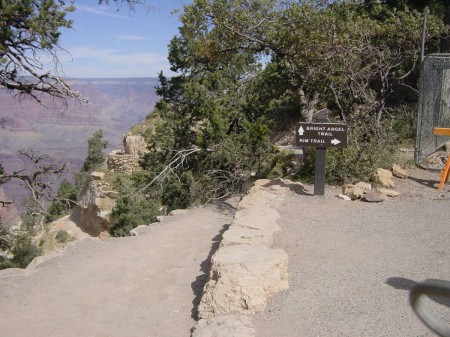
(Bright Angel Trailhead, where I finished!)
I have a little more to say about the problems I faced on this hike, but I'll finish the chronological narrative and finish my report with my overall and final "lessons learned” – and have some recommendations and exhortations for you too.
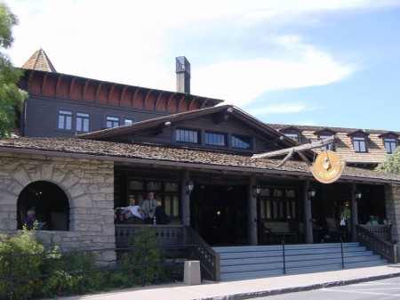
It was a little surreal to leave the trail and see – all of a sudden – hordes of tourists walking the sidewalk along the rim! I joined civilization quickly though, and walked to the east to the main lobby of the Bright Angel Lodge. Checked in, had nicely been assigned a room very close to the main lobby, settled in to my room, showered, cleaned things, called the El Tovar to cancel a dinner reservation, called my lovely niece in Massachusetts to assure her her Uncle was safe and had stood up for truth, justice, and the American way again (!), left a message for a friend from Florida who had checked in to a different hotel on the South Rim that night (we had hoped to have a reunion) . . . and called the front desk to tell them that although it didn't matter too much to me with only a one night stay that I thought they might like to know for their other guests that my room had a SLOW drain in the bathroom sink AND seemed to be infested with ants in the vicinity of the desk I was sitting at at the moment! (For rates hovering around $ 100, neither the Grand Canyon Lodge nor this Bright Angel Lodge seemed to me to have much more to offer than any Motel 6 room I've ever been in – I assume the prices were driven by location.)

(Sleep venue after the hike)
I had canceled El Tovar dinner because the online menu looked more interesting to me for dinner at the Arizona Room (Southwestern) within the Bright Angel Lodge, thus being more convenient for me as well. I planned to hit El Tovar for lunch the next day. I had checked on seating briefly at the Arizona Room before checking out my room and found that no reservations were taken, but that my planned time to come in (9:00 PM) should give me no problem. And it didn't. "En” – from Indonesia – waited on me (prompting a chat with her about Indonesian cuisine before I left the place!). My "victory” meal consisted of a house salad with a raspberry vinaigrette dressing, tortilla chips with a salsa, "grilled southwest chicken breast topped with avocado salsa”, and "lime cilantro rice”. On the phone with my niece, I had said, "Erika (for after all, that IS her name!), I'll probably be having one, two, three, four, or five India Pale Ales at dinner.” But it worked out to 2 Grand Canyon sunset amber beers and a glass of sauvignon blanc. Food was fair, location and view factored in – I call the place "good” and award it a check mark (70 to 90 % percentile).
Leaving the place, I had a nice conversation with an employee when I exited – she had been informed by the hostess that I'd done rim to rim that day, and she had some hiking experience in the canyon. We obviously had good grounds to talk! Incidentally, I found out that the employees (National Park Service, resorts, concessions) here (meaning – the entire South Rim) AND on the North Rim all live in employer sponsored housing for the most part, with most of them renting although I was told there are a few ownership possibilities. But these housing areas are not in nearby villages or towns – there just aren't any reasonably close to where the work is that are large enough to sustain the number of employees. So, it seems to be ideal for those who like a "small town”, outdoors oriented, and somewhat insular atmosphere. I could never do it – I need a big place for the quantity and diversity of restaurants it offers to me. As such, serious existential questions are raised for me about these employees – what do they do if they want to go out and eat Thai?!
Can you believe sleep was a lot of fun?!
The next morning, I called my friend directly at the hotel – he had not returned my call. Caught him – he informed me his cell account was not working in the area and he'd never gotten my message from the night before. I briefly outlined my hike to him – he had wondered how I had done, and expressed astonishment at it all. But we found out that our plans for the day didn't quite mesh, and we weren't able to meet.
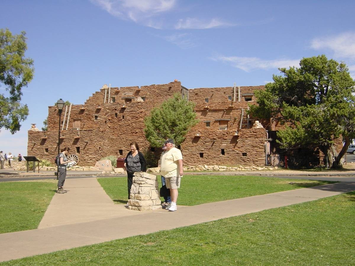
I walked to the Bright Angel Trail trailhead to get a picture of it that I hadn't been able to do in darkness the night before. Walked to the El Tovar (sort of the oldest and most venerable hotel there) for my lunch. American Contemporary, a modest "Santa Fe sandwich” (with "roasted green chili hummus, grilled eggplant, avocado, grilled red onions, tomato, cucumber, roasted red peppers” . . . all on 12-grain bread), a fresh fruit salad, a dill pickle, and some lemonade. Just fair, but a nice interior and canyon view left me assigning "good” again.
(Lunch here the next day)

(Hopi House at El Tovar)
Had to be back in the Bright Angel lobby to register by 1:00 PM for the 1:30 PM Trans-Canyon shuttle. (I had been able to check my backpack, straw hat, and high priced trekking pole earlier so that I didn't have to walk around with them before the shuttle arrived.) I had reserved about two months earlier for this, cost $ 85. Goes 220 miles around the eastern end of the canyon back to the North Rim. The vehicle used turned out to be three of them – three SUV's, basically, mine seating 12 in 4 rows of 3 each. I grabbed a left window position. Our driver"Rich” was a real nice guy – good natured and funny jabs at me about my "trekking pole”, he'd hiked on the south island of New Zealand, knew much about local stuff and the route we'd be traveling. And other fellow passengers – all of us hikers – were great to talk with also.
My immediate two companions to my right were a young couple from Orange County who had left their car on the South Rim – they were going to do what I'd done the next day, hike from the north to the south. Just when you are full of yourself for some reason you always find someone who leaves you humbled! Besides TRAIL RUNNERS I'd seen yesterday right about in the middle of the whole 24 miles (I hadn't told you about that yet – surprise!), the male half of this couple had done rim to rim several times . . . AND rim to rim to rim – in 23 hours! (His wife had not done anything in the Grand Canyon yet, but my humble opinion is that she had a qualified escort!)
The whole route back to the North Rim looks sort of like a reverse "C” on a map, with a downward extension from the top of the "C” in the upper left (Jacob Lake to the rim). The whole ride generally very scenic (what road in the West ISN'T?). On the eastern part of that reverse "C”, going from south to north, I noted what was called Echo Cliffs. Then at Marble Canyon, Arizona, the driver stopped to let us get out to walk across the Navajo Bridge if we wanted to. (I wanted to.) This crosses the Colorado River well upstream from the Grand Canyon National Park itself. Per Wikipedia: "Apart from the Glen Canyon Bridge a few miles upstream at Page, Arizona it is the only roadway crossing of the river and the Grand Canyon for nearly 600 miles (970 km)”. And: "The bridge is 834 feet (254 m) in length, with a maximum height of 467 feet (142 m) from the canyon floor.” Just past here were what is called Vermillion Cliffs – a name accurately describing the colors. There is actually a "Vermillion Cliffs National Monument” encompassing these cliffs and I wondered if – technically – I had visited it to enter into that running journal of National Park Service venues I'd been to. But when I got home Googling showed that the monument actually is under the purview of the BLM (Bureau of Land Management).
(You highly astute readers will have noted from the above paragraph that not only did I do a rim to rim generating a long trip report I ALSO did TWO rim to rims in TWO days!)
(Marble Canyon from Navajo Bridge, the Colorado, Vermillion Cliffs)
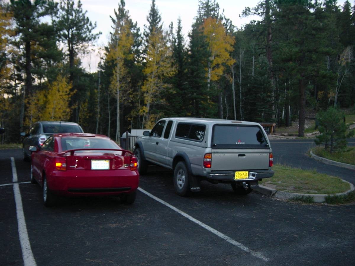
We arrived back at the North Rim on schedule (6:00 PM). Mule deer were roaming the meadows immediately north of the rim. I was let out at the North Kaibab Trail parking lot 2 miles north of the rim, where I of course had left my car parked and started my hike. One lady wished me good luck on my drive back to Vegas. Car still there! Car unbroken in to! Car starts! I traded my hiking shoes and socks for regular shoes and socks and started the drive back home to Las Vegas. (Which ALSO – like the trip TO here – took about 4 and a half hours, actually a minute less than the time arriving here.) Twilight then darkness in the beginning of the drive had me staying cautious after the physically tiring last 2 days. And "Rich” had warned me about the mule deer crossing the roads. I actually had to slow down drastically at one point when 3 of them were on the right shoulder just ahead of me.
(My red chariot awaits at N. Kaibab Trail parking lot)
Had an extended stop in Hurricane for gas, a fight against all the bugs that had hit my windshield, and a microwaved burrito with orange juice. One last "highlight” to the trip? Never fails to impress me descending into Las Vegas on I-15 from the northeast, with the carpet of lights and Strip casinos and Stratosphere (tallest building west of the Mississippi) projecting as a "never never land”. Reason # 181 for living in Las Vegas – ALL entrances in to Las Vegas (except one) are particularly visually dramatic.
And just like that – the adventure was done.
My initial post in this forum had stated that "the rim to rim hike is harder” (in comparison to the day hike of Mt. Whitney). Now – with a week of reflection and hindsight behind me as I conclude and get ready to post this report – I know that the more accurate statement to make is that "my rim to rim hike was harder than my Mt. Whitney hike”. Meaning – maybe when all votes are in Whitney STILL is the harder. All that reflection and hindsight tells me that I undoubtedly made life a lot tougher for me than it needed to be on my rim to rim. I can see now that I made a big mistake with regard to both total caloric intake and the timing of it, going way too far into the hike without enough fuel in me. I think I also made a big mistake with regard to taking breaks – it was admirable to have my zeal and march some 17 miles with no break whatsoever, but that by definition left my technique and approach just wrong. That half hour break at Indian Garden should have been much sooner. (At Whitney I'd taken an extended break with a meal at Trail Camp going up – and had a 55 minute break at the summit.) I might never have had the problem I had if I'd been smarter about my food and rest breaks.
Only other factor would be this – like we've all read, the uniqueness of rim to rim is that unlike mountains, you're going down first and up second. All the considerable energy you're spending going down almost 15 miles and 6,000 feet in elevation means that unlike a mountain – you're starting UP with that energy gone from you instead of starting FRESH. I was surprised at the impact of this and surmise you will be too the first time you go for this hike. To that end, I think a third mistake I probably made was to not completely make the psychological transition necessary from that going down to going up. The 'bat out of hell” approach getting me down so quickly needed to be SEVERELY compromised with the reality of a COMPLETELY different approach and mind set going up. And I probably didn't do that. I think back to that first stretch up from the river before my realization I was tanked – and I feel like I still had that "bat out of hell” mentality.
Which was more relevant? My failure regarding food and breaks – that I could control? Or the raw fact of "down first, up last” – that couldn't be controlled except, perhaps, for your mind set and pacing? I don't know for sure – it would have been interesting how I would have fared if I'd behaved better regarding the former, and then I'd have a more clear idea of the relevance of the latter.
But I do know this. In the final analysis, I DID IT! Now it's YOUR turn if you haven't already. Really, I'm obviously biased, but I think this has got to be one of America's iconic day hikes! What's more American than ice cream and the Grand Canyon? (And you can't hike ice cream!) I exhort you to make this hike – it's just a gas, and – like Mt. Whitney was for me – truly a life milestone and life influencing event. And I really am interested in how others will do with this hike. In particular, Steve, who I know hasn't done it yet. And SuperWoman, errr, I mean MooseTracks – Laura, do I recall correctly you haven't done this yet? If so, I really look forward to seeing how much worse you can make me look with your superior conditioning and experience on this hike! (I know time is not the objective, and is irrelevant to the importance of what any individual gets out of the hike – but it's still nonetheless interesting. And we've got to get you out of the Sierra anyway and show you the rest of the world! (insert BIG FRIENDLY SMILE!)).
Anyone – feel free to offer corrections to anything I've stated that is factually incorrect. And feel free to constructively critique my hike, offer suggestions, make other comments, talk about your past rim to rim hike, ask me further questions. I TOLD you I wrote long reports – hope you have found it all interesting, and maybe even gotten a few laughs.
(Meanwhile, got to start getting my ambition back to decide what major thing I want to do at age 70. Tentatively the Mountaineer's Route on Whitney.)