On Saturday, July 11, 2015 I dayhiked Split Mountain via the Red Lake trail. Temperatures were mild and the day started out clear, but clouds rolled in as the day elapsed.
It's an adventure just getting to the trailhead - I took the "shortcut" way that goes by an old mining operation to a rocky dirt road that tests one's vehicle's suspension and ground clearance. My Subaru Forester had no problem with it. I got to the trailhead close to 1 AM and slept in my car for 5 hours. A 540 wake-up time put me on the trail at 640.
The Red Lake trail actually starts on the north side of the parking area - though the trailhead sign is on the south side. My research led me to believe that the south side start would be quite a bushwhack for the first bit as it runs along the Red Mountain Creek. I followed the trail as shown on the USGS 7.5' topo.
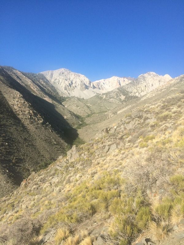
The first couple miles are in the desert zone, but as the trail heads southwest and nears the Red Mountain Creek, the vegetation becomes thicker and the views are phenomenal. Near the creek and 3100m pond there are some neat vegetation "tunnels" that you walk through. Surprisingly, there were no mosquitoes.
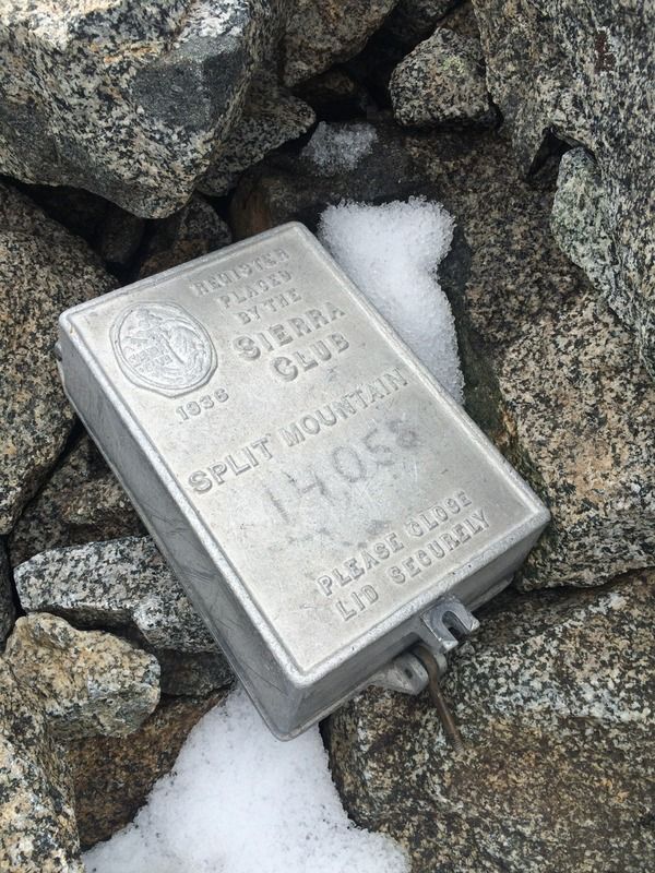
I reached Red Lake in 3 hours and it took another 4h40m to reach the summit. I tried to stay more hydrated and eat more on the way up than my last dayhike up Langley 3 weeks prior, but above 12000 feet my appetite dwindled and I was feeling pretty fatigued up the last 1000 feet to the summit - this was slow going. Coming from sea level (San Diego), plus a 6 hour drive and 5 hours of sleep, make mountaineering at the 14k level a bit more challenging. So does my lack of proper nutritioning during the hike. By this time, the afternoon clouds had rolled in, though there were still some good views from the top. I forced down half a banana, signed a loose slip in the overflowing register box, and headed back down. A light drizzle began.
Descending was very slow - I was in a zombie state and being extra careful descending the loose boulders - I'd already knocked my ankles a few times and didn't want to twist or break anything. I went too far down the north slope and passed the ridge I was supposed to descend; a 15 minute penalty. It took 4 slow hours to reach Red Lake on the descent. At this rate, hiking in the dark was inevitable. I stopped and chatted with some fellows camping that I met while ascending (they had summitted a couple hours before me). They gave me a lifesaving bowl of soup which renewed my energy.
The light drizzle turned to rain and I switched my down jacket for a hooded synthetic. The rain wasn't too bad, but the narrow trail weaves through waist-high bushes, causing my pants and shoes to get soaked. Luckily it was warm out and I was moving enough to keep warm. Feeling good, I maintained a fast pace but around 9450ft (2880m) the GPS file I had shows the trail forks and meets up a short while later. I took the wrong fork and couldn't find the trail after it dead-ended in some thick bushes. The trail is sometimes hard to find in the vegetation around this area, so I bushwhacked a bit as the last light of the day faded. I donned my headlamp and after a half hour of getting nowhere, I returned to the fork and found the right way down. The last 3 miles went smoothly, but felt really long.
This 17 hour dayhike was as long as my first time up Whitney.
Timesheet:
0639: Start
0732: Cross small north creek at 7480ft (2280m)
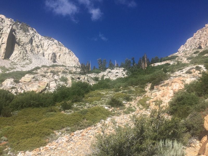
0827: Cross creek at 9000ft (2750m)
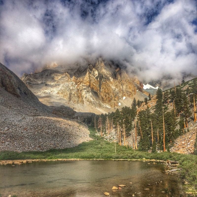
0918: Pond at 3100m
0941: Red Lake (take a 15 minute food break)
1040: 11200ft (3400m)
1140: Moraine around 12000ft (3660m)
1211: Gain ridge
1243: Top out on ridge
1418: Summit!
1441: Depart summit
1551: Reach "ridge" - had to go back and find the correct one
1646: Depart ridge
1654: Moraine around 12100ft (3690m)
1749: 11400ft (3470m)
1843: Red Lake
1928: Depart Red Lake
2330: Back to car!
View up the Red Mountain Creek
Around 9000ft (2750m)
Pond at 3100m
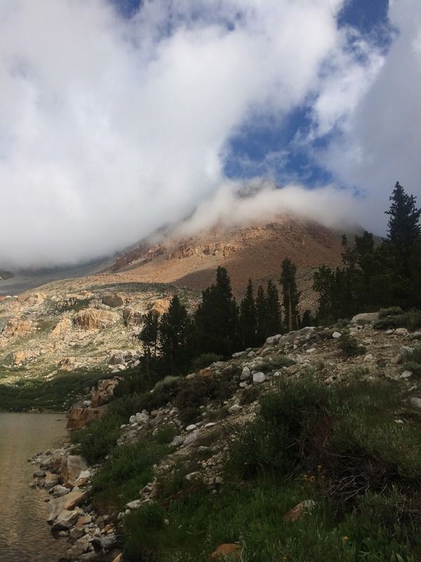
Panorama above pond, Split Mtn in clouds, Mt Tinemaha on very right

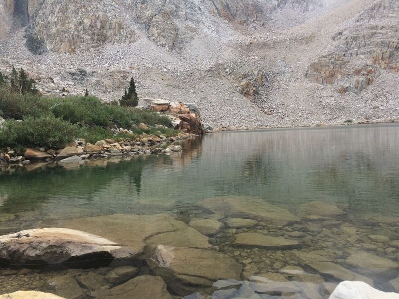
Red Lake facing west
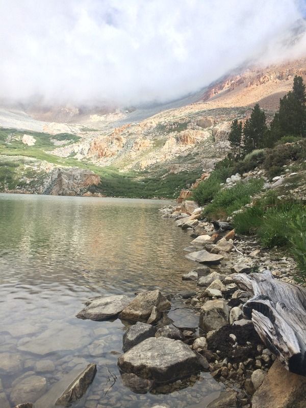
Red Lake facing south
Unnamed peak directly north of Red Lake
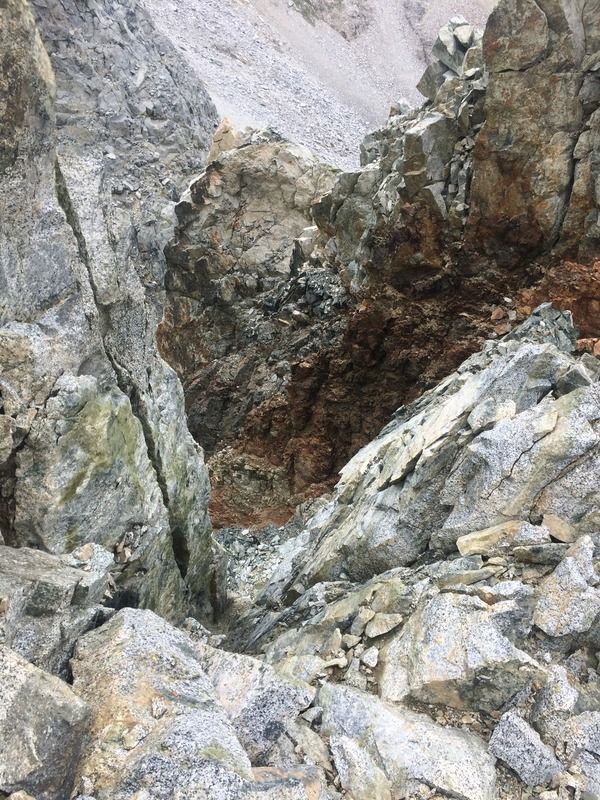
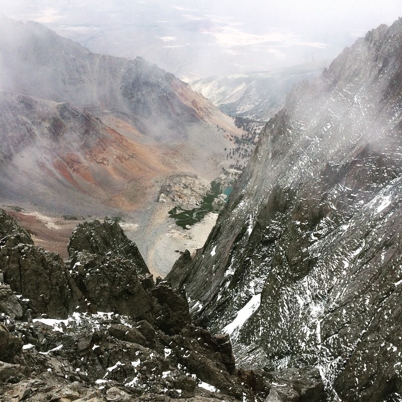
Looking down from the ridge
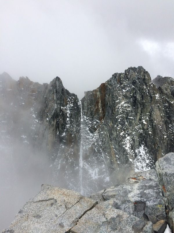
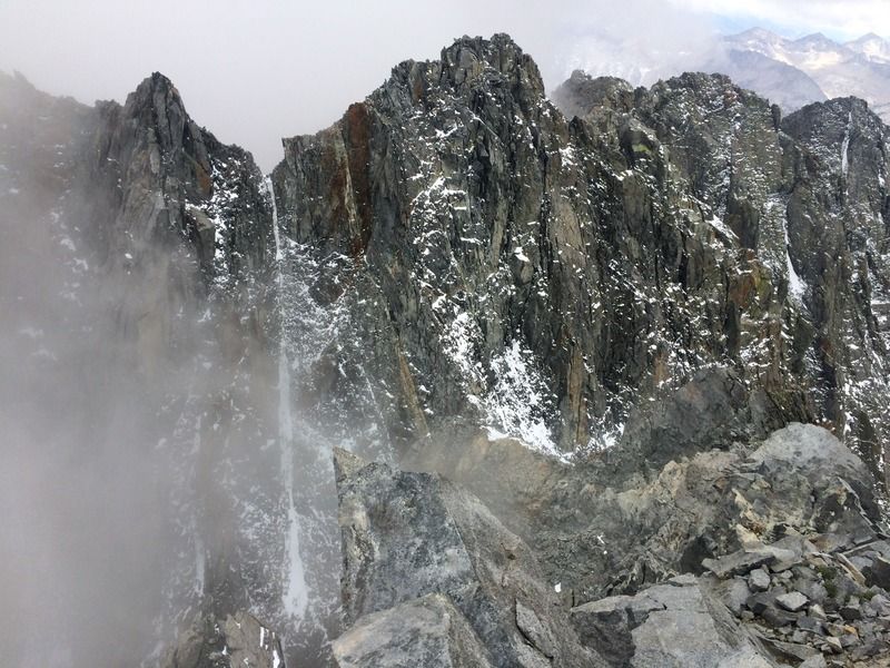
Amazing 2000+ ft ice couloir along one of Split's east ridges.
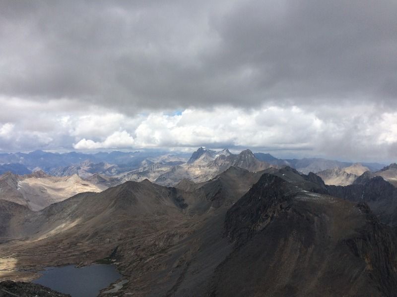
Stunning views to the northwest
View south - I want to climb this in the spring
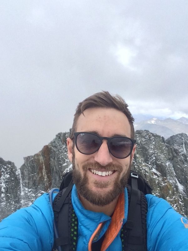
Summit selfie
Full register box
View down the creek from the summit
Cheers!