As submitted at HAZ about my trip.
Relevant pictures here:
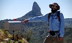
http://imgur.com/a/CeiUPWith Kilimanjaro coming in a few short weeks I really needed to get some more mental prep work done. Whitney is something that is great at being a test of your mental mettle.
On the journey out we stayed in Anaheim for a couple days prior to visit some friends. I really didn’t think much about it until the drive to Lone Pine when I was thinking about the ocean. And now the first doubts started to creep in. I had been scouring the various message boards and groups to get as much info about the trail conditions for several weeks. With the record snow in the Sierra’s now melting, that alone had planted the seed of doubt into my mind.
I started up the trail around 1:30AM. Instantly I had to backtrack as I left my camera back in the car. I snatched that and started to head back up again. A few minutes later I noticed that my backside was wet. My Camelbak was leaking. It was a good thing I was dropped off at the trailhead otherwise I might have packed it in. (Ok, not really) Turns out, I think at least, the connection with the tube and bladder came loose. All I know is that it didn’t present any issues for the rest of the day.
With the amount of snow the mountains received this winter the stream crossings were going to be their own mini games. The first crossing was crazy! It was pretty unsettling starting across a stream and not being able to see the bottom, nor the other side, due to the darkness. The really creepy part is the sound. It sounds angry, powerful, and downright hateful. One mistake and it is ready to send you rushing down, down, down.
I was shocked that I passed two separate groups on their way down. I made small talk with the first group, about trail conditions and the alpine start; but the second group was an Asian collection who didn’t say much.
The log bridge crossing was hairy. One of the logs broke and is angled weirdly, necessitating a leap. The water underneath the logs (just barely) is rushing by in a low rumble as well.
I had read that the snow abruptly starts right past Lone Pine lake and that was spot on. The sign stating that you need a permit to proceed was buried. I grew up on the east coast, in the lake effect snow belt of upstate NY, but was still in awe. The snow, at times, caused the trail to disappear into the night. It made for quite an ordeal in trying to follow it. There is quite a well trodden path in the snow but it can easily be missed in a few spots that transition from dirt to snow.
The waterfall by Outpost Camp was monstrous. The sound literally shook the ground as you ascended around it. I was making decent time at this point. I took the approach of just going but not overly fast. I wanted to try to maintain a decent clip but able to breath and talk.
Approaching Trailside Meadow the trail is submerged under ankle deep water for the majority of it, with some points being at mid-calf. Thankfully the gore-tex boots I have, along with the gaiters, kept my feet dry throughout this trip.
Much of the route past this point is directly over snowfields. This presented a whole new set of issues. The day before I read a triplog about how a guy fell through into waist deep water. Well, with that vision in my mind I stumbled upon the first of many cavities in the snow fields that harbored raging water. Now, not only would a spill into one of these end your summit attempt it very well could end you. If you were sucked down under the snow I can’t imagine any sort of positive outcome to that situation.
I reached Trail Camp a little before sunrise. I strapped on my crampons, pulled out my axe, and started weaving my way up the chute. The sunrise was breathtaking; just like the climb. The snow was crisp and firm making the traction easy to be had. Oxygen was the rare commodity and I fell into a routine of a few steps followed by a rest period and a few breaths. The chute took forever and a day. I managed to catch up to a couple groups, who had mercilessly been sending chunks of snow down on me throughout, right near the top. We chatted a bit about the conditions and then parted ways.
From Trail Crest to the summit the trail is basically clear. I really had to mentally force myself through this section. The altitude hit me like a ton of bricks. It wasn’t in a headache or nausea kind of way; just in a way that sapped all energy and desire to continue. This is what I came for, although I didn’t want to deal with it. I just focused on the summit hut. I went when I could, I stopped when I had to. It was slow going, but eventually I reached the base of the plateau. Typically, the main trail sweeps around the western side of the plateau but with the snow the chosen way was climbing the boulder field of the southern face (I hope my sense of direction is accurate).
The summit hut had its door blown off this winter. Inside, from the ground to the roof, was snow. I am pretty amazed that a couple people were able to survive in there, overnight, a few weeks back.
I made it back down to Trail Crest and had a decision to make; either glissade down the chute or plunge step. I decided to plunge step to play it safe. It is remarkable how fast the descent is compared to the ascent.
Upon reaching Trail Camp I ran out of water. I had brought up a full Camelbak of 100oz. I pulled up the lake and got out my filter. Turns out (and I should have tested this beforehand) that my filter was busted. So I was left with either no water or drinking unfiltered water. I chose the unfiltered water approach on the assumption that I could make 6 miles before my intestines exploded. With all the water out there I figured my odds were good. Going on a day and a half later and my stomach still doesn’t hate me.
Just below Trail Camp I bumped into a solo SAR member from Inyo County SAR. We chatted for a good amount of time about what I saw, how far I made it, my gear, etc. Apparently with all of the tragedies that have already transpired this year on Whitney they are out trying to do preventative work.
The stream crossings that were troublesome in the early morning hours were downright terrifying during the midday melt period. Thankfully I made it through them all but I am not so sure it isn’t just dumb luck.
Overall, my 4th ascent of Whitney was my most challenging to date. The conditions out there were no joke, but more importantly, the mental aspect of it was tough. It is really easy to keep going when it is a new peak, trail, etc; but when it is something you’ve seen before, it can become easy to throw in the towel when the going gets tough. The lessons and experience garnered from this adventure will last me a lifetime.