|
0 members (),
77
guests, and
397
robots. |
|
Key:
Admin,
Global Mod,
Mod
|
|
 Last 3.7 mi of Whitney Portal Rd closed to trailhead
|
Joined: Apr 2023
Posts: 2
|
OP

Joined: Apr 2023
Posts: 2 |
https://www.instagram.com/p/Cro3DzJJrvq/Word-of-mouth is this segment will be closed until July when they can clear the rockfall.
|
|
|
Re: Last 3.7 mi of Whitney Portal Rd closed to trailhead
|
Joined: Jul 2022
Posts: 18 Likes: 7
|
|
Joined: Jul 2022
Posts: 18 Likes: 7 |
Where are you receiving this word of mouth?
I just watched a video posted from the road this morning indicating all but one large boulder has been cleared from the road.
|
|
|
Re: Last 3.7 mi of Whitney Portal Rd closed to trailhead
|
Joined: Apr 2023
Posts: 2
|
|
OP
Joined: Apr 2023
Posts: 2 |
Someone who works at the Portal Store. Where did you see the video?
|
|
|
Re: Last 3.7 mi of Whitney Portal Rd closed to trailhead
|
Joined: Jul 2022
Posts: 18 Likes: 7
|
|
Joined: Jul 2022
Posts: 18 Likes: 7 |
It's posted on the Mt. Whitney Facebook group. There's apparently two large boulders that need to be blasted first but everything else looks good. I don't care much for FB but that particular group does provide a lot of useful up-to-date information.
I'd also take anything that comes from the Whitney Store employees with a grain of salt unless it's coming from Sharon, Doug or Doug Jr. There's a lady who works up at the Portal who currently works down at the hostel, she's completely clueless and quite rude, with the personality of a rock (speaking of rocks!). If it was coming from her, that'd definitely explain the misinformation.
|
|
|
Re: Last 3.7 mi of Whitney Portal Rd closed to trailhead
|
Joined: May 2022
Posts: 21 Likes: 7
|
|
Joined: May 2022
Posts: 21 Likes: 7 |
I talked to the road clearing foreman from Inyo County on my way down from a successful main trail summit. He was inquiring about the road conditions further up and stated that they were beginning to clear the road that day (4.25.23). Indeed heavy equipment was moving up the portal road as I was coming down. I asked about duration and he said that there is no time limit for them. Yes there are large rocks but nothing removing the handrail and rolling over the edge wont take care of. They had a solid crew then and more on the way, I doubt the "word of mouth" duration will hold up. The major concern is lack of parking at the physical portal. The trailhead is a huge avi debris field and the main parking lot is a river. Snow is cleared by the FS and not the Inyo rock dudes. Their work cannot start until the road is cleared first. That 3.5mi is not too bad, a good warmup for the crazy conditions on the mountain, especially the main trail this time of year
Last edited by 805_backpacker; 05/02/23 01:25 PM.
|
|
1 member likes this:
OverPack |
|
|
Re: Last 3.7 mi of Whitney Portal Rd closed to trailhead
|
Joined: May 2023
Posts: 1
|
|
Joined: May 2023
Posts: 1 |
Thanks for the careful update/status!
I was getting anxious to take a drive up from SoCal, but now learn that I have to wait before roads and parking lots are cleared. I'm sure that's a real big job.
Appreciate your letting everyone know.
|
|
|
Re: Last 3.7 mi of Whitney Portal Rd closed to trailhead
|
Joined: Sep 2009
Posts: 8,538 Likes: 107
|
|
Joined: Sep 2009
Posts: 8,538 Likes: 107 |
I talked to the road clearing foreman from Inyo County on my way down from a successful main trail summit. That's a really early Main Trail summit trip! Can you post a little report? Congratulations!
|
|
|
Re: Last 3.7 mi of Whitney Portal Rd closed to trailhead
|
Joined: May 2022
Posts: 21 Likes: 7
|
|
Joined: May 2022
Posts: 21 Likes: 7 |
Sure. We parked on WP road below the switchbacks on the night of 4.22 after spending the day in Bishop. We (me and one friend) hiked into WP campground that night up the road and stopped at the first site when we hit snow on the road, which happened to be the very first set of spots. We set up camp there and drank a couple beers. 5am 4.23 we set off for Trail Camp. Trailhead until about northfork crossing is just and avi debris field. This was initially to be a test trip for new gear as we have a permit for 5.22.23, but we agreed that if the weather was good we would keep pushing up the mountain. We in fact had perfectly clear skies the duration of the trip, which was remarkable. This was our first real mountaineering excursion, first with rope, etc. Early morning conditions were sublime, snow good and frozen. But around 10am, postholing became an issue, especially in the rocky areas of the "trail". Keep in mind there was no trail, any anyone going from outpost on up will probably be following our tracks.
Took us a full 12hrs to make Trail Camp. Exhausting slogs, particularly before and after outpost camp. Essentially a "chute 2.0" immediately after outpost camp. A ginormous snow bowl in which we chose to walk a gradual ascending traverse. Gorgeous conditions at trail camp that first night, but obviously no liquid water anywhere. Melting snow made for slow mornings. Was so hot during the climbs I ate a lot of snow to just keep cool and moisture in my mouth. Tastiest I've ever had! Left for summit 530am 4.24 (late start). Chute conditions were good, nice ice crust, but just a long grind. Took shortcut at very top and climbed over a small 4ft serac and ate a snack in a window pocket. West side of mountain on main trail was very sketchy in about 8 spots. There was lots of bare dirt in the initial stretches, before you get onto the main western slope behind the needles. These 8 spots were where snow steeply covered the trail and sloped straight down a couple hundred feet to boulders below. FYI, we stayed roped up the duration of the western side. These 8 places took me straight to Puckerville, but methodical tempo and constant verbal communication got us through. Those two things are VERY IMPORTANT.
Once you exit onto the main western slopes, its all snow and boulder. The last 500 vert ft to the summit is a snow and ice dome where roping was beneficial. Any ice could lead to a long and gnarly slide. Got to summit about noon and stayed 30min while we made water. Made good time descending until we got back to pucker city sections. Changing snow conditions meant reevaluation of every section, even through we were through there just hours before. Partner switched to lead and was better for our pace and communication. Good learning experience (I had more confidence on initial crossing, he kept us methodical going back in a rush). My partner was getting really tired from post holing and we didn't get to the chute until 330pm. Half was in the shade already. The steepest part was in the sun, but we made the erroneous choice of taking the shaded part thinking it was still soft enough for us to break through the surface crust. Dead wrong. Things got out of hand and I had to self arrest (not roped up at this point). During the slide, could not hammer in axe due to ice. If it did go in, immediately ripped out of my hands due to thick ice. Used my leash to pull axe back into grip and rolled on my back. I have a Kelty external frame, and leaned back as hard as possible to use external frame termination points at the bottom as two additional spikes to aid in arrest. This, coupled with my axe in the glissade position allowed me to stop. My estimate was a 200ft slide. Fully convinced only my external frame pack allowed me to self arrest as I wasnt carrying sleeping pads for the summit push.
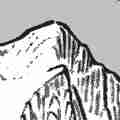
Conditions around the cables were abominable. Zero run out. Adeneline played a huge role in this series of events, and not sure others of less physical stature or strength (6ft, 185 lean) or gear would have been successful. A perspective altering experience, listed here as a cautionary tale to other overly adventurous hikers. Please see the recent picture postings in Trip Reports - there is trecherous snow and ice everywhere on this route. If reading this gives you pause, you will for sure have issues on the mountain if you are not in the right head space. Made it back to TC at 6pm, exhausted. Couldnt eat. Winds howled all night, but awoke to clear skies. Slept in to allow for more plunge stepping conditions around chute 2.0 and Whitney zone areas. Left TC about 730am. Used a whole large gas bottle making water for 3 days. Ran into very sketchy downhill conditions around chute 2.0 near the waterfall area of outpost. Stayed roped up throughout this area luckily, my friend lost a crampon on an icy downhill portion of the bowl and I had him on a very taught rope, moving inches at a time. Ultimately descended just south of the waterfall near where the MWMT actually is.
Terrible post holing all the way to WP store, atrocious post holing up to the crotch. Made it to portal store at 1130 and ran into Doug (?) walking up the road, talked for 20 min about conditions. Got back to truck at 1230 and devoured a beer and the best meal I've ever had at The Grill in LP. Needless to say, we are NOT going again on 5.22. We think the conditions will be even worse (post holing, constant on and off of crampons, runoff becoming ice, delays from other hikers, lack of parking, etc.). This was my first time making the summit after two previous failed attempts, and I used every ounce of luck I had in my bag that week, I will not push my luck again like that in a year with conditions like these.
All this being said, the MWMT is NOT the easier or safer route up the mountain at this time of year. Do not attempt without a harness, rope, axe, helmet, crampons, gore tex, etc. Microspikes are NOT AN OPTION. Poles instead of an axe is NOT AN OPTION (need both IMO). Please reach out with any other questions, I'd be happy to answer them.
|
|
|
Re: Last 3.7 mi of Whitney Portal Rd closed to trailhead
|
Joined: Dec 2022
Posts: 19
|
|
Joined: Dec 2022
Posts: 19 |
Great trip report! It sounds like it was a real character-building adventure.
Your mishap in the chute underscores the necessity of a leash. An ice axe without a leash is just an expensive toy that a hiker loses while falling to his death.
Anyway. Three cheers for old Kelty frame packs!
|
|
|
Re: Last 3.7 mi of Whitney Portal Rd closed to trailhead
|
Joined: Sep 2018
Posts: 50 Likes: 2
|
|
Joined: Sep 2018
Posts: 50 Likes: 2 |
Your mishap in the chute underscores the necessity of a leash. An ice axe without a leash is just an expensive toy that a hiker loses while falling to his death. The owner of "International Alpine Guides" (one of the Sierra guiding services) told a horrific tale of someone getting impailed by a leashed ice axe. From my rememberance, the ice axe stayed embedded in the climber until a helicopter got the climber to a hospital. This is why I believe guiding services do not like leashes. That being said, I am too mindless not to have a leash. I am extremely likely just to mindlessely drop it on a steep slope and watch it rocket down the mountain. So its skewering for me.
|
|
|
Re: Last 3.7 mi of Whitney Portal Rd closed to trailhead
|
Joined: Apr 2013
Posts: 50 Likes: 6
|
|
Joined: Apr 2013
Posts: 50 Likes: 6 |
Thanks for the great trip report 805! I'm going to be in town next week. I have no illusions of attempting the summit this time of year, but with multiple summits in prior years and quite a bit of general Sierra backcountry experience, I was at least thinking about making a run at Lone Pine Lake or something. Now I'm not so sure. How crazy is that stretch from the Portal up to LPL? Is that first couple miles or so full crampon/ice axe territory like the rest of the trail you described? Any other advice for that section if we decide to give it a go? Would love to tackle it, but I'm also wise enough to solicit the advice of my betters. 
|
|
|
Re: Last 3.7 mi of Whitney Portal Rd closed to trailhead
|
Joined: Dec 2022
Posts: 19
|
|
Joined: Dec 2022
Posts: 19 |
You wrote: "So it is skewering for me."
You are very wise!
Did you know R. J. Secor lost his ice axe during an accident, as he glissaded down Mount Baldy? With no way to self-arrest, he suffered major injuries; the accident put an end to his climbing career.
An ice axe is a serious tool, and, like many tools, it can be mishandled to the detriment of the user. Yvon Chouinard, in "Climbing Ice" stressed that, when used as a walking stick, the pick of the axe should always be aimed forward (in the direction you are moving). Otherwise, if you stumbled and fell on the thing "it could interfere with your digestion."
|
|
|
Re: Last 3.7 mi of Whitney Portal Rd closed to trailhead
|
Joined: Sep 2018
Posts: 50 Likes: 2
|
|
Joined: Sep 2018
Posts: 50 Likes: 2 |
Extreme leashed ice axe "skewering" usually occurs during out of control tumbling down the mountain at high velocities. It takes a lot of force to drive an ice axe through your body like a shish kabob.
Another thing, I am kind of amazed how sharp the spike on my new ice axe (Petzl) was. I damaged stuff accidently while just transporting it. Now its nice and dull. I heard that "hair splitting" sharpness is not really necessary for the spike so haven't sharpened it. I also have the usual protectors (top and bottom) corded together to reduce likelyhood of loss but they are less necessary now.
|
|
|
Re: Last 3.7 mi of Whitney Portal Rd closed to trailhead
|
Joined: May 2022
Posts: 21 Likes: 7
|
|
Joined: May 2022
Posts: 21 Likes: 7 |
Not too crazy, in that section at all, we had bad post holing coming down through there around 11am. Other than that the lake is doable. Should be a solid trail going up the creek from the portal store. Main areas of concern we all in the Whitney Zone.
|
|
|
|
|