As for the other topic, I don' think everyone reaizes that the faint change in shading that Wagga is talking about is a STRAIGHT line,and when it does change it is angular, not like a contour line
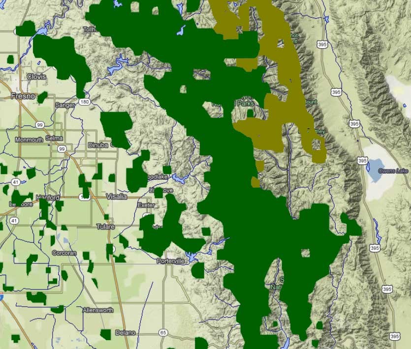
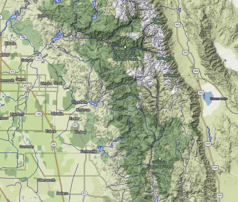
Harvey, the vegetation layers I'm talking about are straight lines that roughly follow contours. In the screen shots below I've captured the "Forest cover" and "Tundra cover" layers for the Whitney area. The "tundra layer" highlites the very tallest region but it does not follow contour lines. What you see is that the layers are drawn as vector data with straight lines. When I turn off the vector layers in the next image, these boundaries appear smoother, especially when blended with terrain shading in steep areas. Compare the green "forest cover" in the flat valley and the straight lines still look like straight lines.
These specific layers, and other datasets, are not used at all map resolutions. As you zoom in to higher resolution, the tundra data disappears and is replaced by different shading. At the zoomed-in level the vector layer (lines and polygons) is converted to raster data (pixels), which is the green shading Wagga is describing. The quality control of the data and the color schemes vary at different resolutions. The dark green area Wagga is referring to should have been white to be consistent with the lower resolution dataset, but the two datasets probably came from different sources. This seems to be an issue in other areas of Google maps as well. Remember, this is free stuff and the layer data is coming from multiple sources.
That's my guess on what's up with the dark green shading. If I'm wrong, it won't be the first time, but it makes sense and seems reasonable to me.